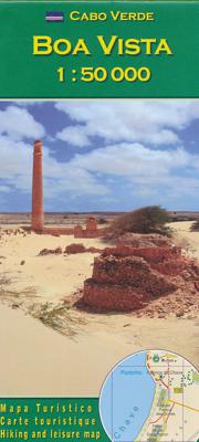
Wandelkaart Boa Vista - Kaapverdische Eilanden | AB Karten-Verlag | AB Kartenverlag

0
Topografische wandelkaart voor de Kaapverdische Eiland Boa Vista. Met hoogtelijnenafstand van 50 meter. Legenda en tekst in het Duits, Engels, Italiaans en Portugees. Met stranden en duikplaatsen.   De kaart bevat wandelingen en/of routeverbindingen op deze drie eilanden. Met een gedetailleerde weergave van het landschap. Rijk geïllustreerde infor...

Verkopers met dit product

Verkoper
Bezorging
Prijs
DeZwerver.nl logo
DeZwerver.nl
2,95
12,95

Anderen bekeken ook

Wandelkaart Santiago - Kaapverdische Eilanden | AB Kartenverlag
Santiago Island in the Cape Verde archipelago on a detailed, GPS compatible map at 1:50,000 from AB Kartenverlag, highlighting 33 hiking and mountain bike routes and including small plans of Praia, Tarrafal and Cidade Velha.    The map is double-sided with a very generous overlap between the sides. Contours with relief shading and spot heights present the topography. The map shows the network of local roads, tracks and footpaths. Symbols indicate locations of viewpoints, diving sites and medical facilities.   33 selected walks, from one to five hours long, are highlighted on the map and listed in a table with details of the terrain, altitude, degree of difficulty and suitability as mountain bike routes. Map legend and all the accompanying text include English.   Also included are small plans of Praia, Tarrafal and Cidade Velha, indicating main facilities.
17,95
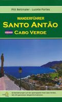
Wandelkaart Santo Antão - Santa Antao | AB Kartenverlag
1:40,000 Hiking and walking map of Santo Antao (San Antao, Sint-Antonius) in the Cape Verde Islands. A detailed topographical map with an English keysheet and routes, roads and places of interest shown on the map.    Includes a detailed 1:10,000 map of Cidade do Porto Novo and a number of colour photos on the reverse, showing local places of interest, relating to numbered routes described on the map. The descriptions show the average time of the route, the quality of the track (following a description they give), the ascent and total descent.
18,95
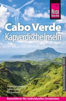
Reisgids Cabo Verde Kapverdische Inseln - Kaapverdische Eilanden | Reise Know-How Verlag
Uitstekende - meest uitgebreide - reisgids van de Kaapverdische Eilanden. Hoge kwaliteit, veel kaartjes en praktische informatie. Duits, 612 (!) bladzijden. Cabo Verde ist nicht nur reich an faszinierenden Landschaften, Bergen und Schluchten, Wüsten und grünen Tälern, weiten Stränden und kleinen Buchten, sondern besitzt auch einen großen kulturellen Reichtum. Ein Reichtum, der aus den Begegnungen rund um den Atlantischen Ozean entstanden ist und eine neue kreolische Kultur hervorgebracht hat: so stark wie das Meer und so vielfältig wie die Landschaften. Jede der kapverdischen Inseln für sich ist ein authentisches und unverwechselbares Reiseziel.   Das steckt in unserem Reiseführer Cabo Verde / Kapverdische Inseln:   - Übersichtsseiten mit Beschreibungen aller Inseln: Sal: Sonne, Sand und Salz, Boa Vista: Sahara im Atlantik, Maio: Einsamkeit und viel Ruhe, Santiago: Hauptinsel des Archipels, Fogo: die Vulkaninsel, Brava: die kleineste Insel, São Vicente: Insel der Kontraste, Santo…
28,95
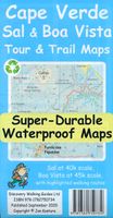
Wandelkaart Tour & Trail Cape Verde: Sal & Boa Vista | Discovery Walking Guides
Scheur- en watervaste wandelkaart van de Kaapverdische eilanden Sal & Boa Vista met hoogtelijnen en graden. or your best adventures, use the best maps. Water-proof, split-proof, tear-proof, adventure-proof. Sal and Boa Vista Tour & Trail Super-Durable Maps are simply the toughest, most accurate, easy to read, easy to use maps of these two islands that you can buy at any price.   A large 840mm by 690mm double sided map sheet has Sal at 1:40,000 scale on the cover side, with Boa Vista at 1:45,000 scale on the reverse. There are also street plans of Espargos, Santa Maria (Sal) and Sal Rei (Boa Vista) at 1:10,000 scale. Our special concertina map fold makes our map easy to open and easy to refold to its 230mm by 120mm pocket size.   Our legendary 'Tour & Trail' level of detail ranges from major roads to secondary roads to minor roads to streets and narrow country roads, plus dirt roads, tracks and walking trails. Altitude shading each 100 metres is designed to clearly show the altitude ra…
16,95

Klanten-reviews van Wandelkaart Boa Vista - Kaapverdische Eilanden | AB Karten-Verlag | AB Kartenverlag

Er zijn nog geen beoordelingen voor dit productBen jij de eerste die een review plaatst?

Meer over Wandelkaart Boa Vista - Kaapverdische Eilanden | AB Karten-Verlag | AB Kartenverlag

Productomschrijving

Topografische wandelkaart voor de Kaapverdische Eiland Boa Vista. Met hoogtelijnenafstand van 50 meter. Legenda en tekst in het Duits, Engels, Italiaans en Portugees. Met stranden en duikplaatsen.   De kaart bevat wandelingen en/of routeverbindingen op deze drie eilanden. Met een gedetailleerde weergave van het landschap. Rijk geïllustreerde informatie op de achterkant. Meertalige legenda.    

Productinformatie

    Verken gerelateerde categorieën

    Webshop.nl maakt gebruik van cookies. Ga je verder op onze website, ga dan akkoord met het plaatsen van cookies en de verwerking van deze data door ons en vermelde partners.