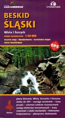
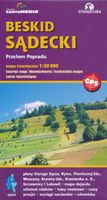
Wandelkaart Beskid Slaski - Wista en Szczyrk - Beskiden | Sygnatura

0
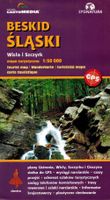
De kaart beslaat de hele Silezische Beskiden, van Bielsko-Biała tot Zwardoń en van de Shelter bij Tułem tot Kotlina Żywiecka.   Vertaling van Google Translate:    De legende bevat ongeveer 90 karakters, beschreven in 5 talen (PL, GB, D, SK, F). Zeer levendige, kleurrijke schaduwen en contourlijnen om de 20 m geven het terrein duidelijk weer. De ka...

Verkopers met dit product

Verkoper
Bezorging
Prijs
DeZwerver.nl logo
DeZwerver.nl
niet bekend
9,95

Anderen bekeken ook

Wandelkaart Tatry Zachodnie | Sygnatura
Goede wandelkaart van het grote westelijke deel van het Tatra gebergte, zowel aan de Poolse als aan de SLowaakse kant. Wandelpaden, campings, hutten, alles staat er op.  Western Tatra Mountains in Poland and Slovakia at 1:25,000 on a contoured and GPS compatible map from CartoMedia highlighting waymarked hiking trails, mountain huts and campsites, places of interest, etc, Coverage extends from Zakopane westwards to Habovka. On the reverse are panels with an overview of the waymarked hiking trails for planning longer routes, a road map showing access to this part of the Tatra Mountains from both sides of the border, a directory of local mountain huts and other useful tourist information, etc.   Maps in the Cartomedia hiking series present topography is by contours at 20m intervals, enhanced by relief shading and, where appropriate, graphic relief for exposed rocky areas. Waymarked hiking trails indicate approximate walking times in both directions and possible danger points. Most title…
9,95
Nieuw
Wandelkaart 8.1 Mt. Taygetos - Peloponnesos | Anavasi
Uitstekende topografische kaarten van een deel van Griekenland: zonder meer hele goede kaarten voor wandeltochten in een onbekend stuk Griekenland! Ze zijn gedrukt op scheurvast en watervast papier op een schaal van 1:25.000 met een UTM grid voor GPS gebruikers. Op de meeste kaarten is geven de hoogtelijnen een interval van 20m. aan. Met schaduwkleuren, punten met hoogtemeters, bronnen, riviertjes en landgebruik geven ze de topografie van het land goed weer. Lokale voetpaden, herbergen en berghutten zijn duidelijk weergegeven. De wegen zijn in gradaties getekend: verhard en onverhard, groot en klein, met afstanden en benzinepompen. Toeristische bezienswaardigheden als kloosters, grotten, kerken etc staan ingetekend. Achterop de kaart worden suggesties gegeven voor wandelroutes met wandeltijd in uren. This is not just a hiking map, this is a hiking guide AND 1: 25 000 map.   Taygetos extends as 70 km of magnificent massif anchoring the southern tip of Greece. From a dense network of ch…
25,95
Nieuw
Wandelkaart 11 Sierra y Cañones de Guara, Canyons National Park | Editorial Alpina
Zeer gedetailleerde wandelkaart van een klein gebied. Met ingetekende wandelroutes en andere informatie. Spaanstalig, maar uitstekende kaart. Coordinaten zijn weergegeven, dus GPS compatible met UTM grid.    Op de topografische wandelkaart worden o.a. berghutten, campings aangeduid en hoogtelijnen, ingetekende wandelroutes en de GR paden (doorgaande langeafstandswandelpaden). De kaart is inclusief een Spaanstalig boekje met extra informatie over aanwezige voorzieningen en enkele routes.   Gebied: Huesca, Urriales, Bárcabo, Alquézar, Buera, Adahuesca, Salas Altas, Ibieca, Bastarás, Chibluco, Pedruel, Otín, Lúsera, Arguis, Lúsera, Nueno, Igriés, Loporzano, Chibluco, Bara, Nocito, Used, Tozal de Guara, Tozal de la Cabeza A topographic tourist map and hiking guide with details of tourist attractions, hiking & sporting activities as well as transport information. An excellent folded map & booklet. Sierra de Guara in an extensive and very popular series of walking maps from Editorial Alpina…
19,95
Wandelkaart A15 Sarrabus da Costa Rei a Porto Corallo | Abies
Sarrabus is a territory that is not known by everybody yet. Here lies its charm and this has made possible to keep this environmental area out of big building speculations and also out of history. In fact it preserves little traces of the past, and paradoxically the remains from the prehistoric age are more meaningful than those back to more recent times. We can find traces from the most remote past not far from the State Road SS125, that from Muravera goes to Costa Rei, by visiting the nuraghe Murtas, the nuraghe S’Aqua Secis and the megalithic complexes of Scalas and Cuili Piras. They are about ten menhirs, almost fully intact, arranged in groups and fixed in the ground in the original orthostatic position. They have been put in relation with the position of the sun and the moon, at dawn and at sunset. In fact they were used as a very precise astronomic calendar but also for religious purposes since they represented both the masculine divinity and the fertility according to the wors…
12,95
Nieuw
Wandelkaart Outdoorkarte Madeira - Funchal - Porto Santo | Kümmerly & Frey
Hele goede wandelkaart met alle noodzakelijke topografische details van Madeira met ingetekende routes. De kaart is geplastificeerd, met kleine plattegrond van Funchal. Madeira at 1:40.000 on a contoured, GPS compatible outdoor map from Kümmerly + Frey printed on sturdy waterproof and tear-resistant synthetic paper. The map is double-sided on a more convenient size sheet and includes a street plan of central Funchal, plus coverage of the nearby Islas Desertas and Porto Santo at 1;70,000.   The map divides Madeira east/west with a very generous overlap between the sides. Topography is shown by contours at 20m intervals, enhanced by relief shading and spot heights, plus colouring and/or graphics to indicate different types of terrain and vegetation.. Waymarked hiking trails and footpaths are highlighted by overprint which indicates narrow steep sections. The map also shows cycle routes plus a selection of mountain bike and horse riding trails.   A wide range of symbols indicate various …
13,50
Nieuw
Wandelkaart 17 Banff - Egypt Lake | Gem Trek Maps
Mooie, gedetailleerde kaart uit de serie van Gem Trek Hiking map-guides. Helder kleurgebruik en met de beste / mooiste wandelroutes, hikes en interessante plaatsen erop aangegeven. Gem Trek’s 1:50,000-scale BANFF–EGYPT LAKE MAP covers the most popular hiking trails in the immediate area of the town of Banff in more detail than our Banff & Mount Assiniboine Map.   The Banff–Egypt Lake Map features detailed cartography, accurate hiking trails with distances, and details such as side trips and backcountry campgrounds. For road travellers, it includes viewpoints, picnic areas, and campgrounds.   On the back of the map are trail descriptions of 17 recommended day hikes and four classic multi-day trips, all referenced to the map on the front. Also on the back is a list of trails recommended for early season, birdwatching, wildflowers, waterfalls, expansive views, awe-inspiring scenery, alpine meadows and rainy days. Included are contact numbers for visitor centres and backcountry booki…
17,95
Wandelkaart NS504 Upper and Lower Dolpa - Dolpo | Himalayan Maphouse
Goede duidelijk leesbare  map voor trekkings in Dolpo. Van Juphal en Jejargaon in het westen tot Kagbeni in Mustang aan de oostkant van de kaart. De trekkingroutes staat goed ingetekend. Shey Phoksundo National Park staat er ook geheel op.  Large area centred on Dho Tarap, lying between the Upper and Lower Dolpa regions, in the Nepa Maps series which provides extensive coverage of trekking areas of Nepal on detailed contoured maps with trekking routes and hiking trails, huts and camp sites, local places of interest and other tourist information.   Cartography is based on the country’s topographic survey, with contours usually at 40m or 50m intervals, enhanced by relief shading, colouring and graphics to show various features of the terrain, including glaciers, forested or cultivated areas, etc. Numerous peaks, with additional spot heights, plus names of glaciers and mountain ranges are prominently shown. The network of rivers, streams and lakes is shown in great detail, with many smal…
12,95
Wandelkaart Suva Planina - Servië | Geokarta
One side topographic marked with footpaths, ski trails, ski lifts, camp sites, picnic sites, mountain huts, also notable features in the landscape. Other side further information, additional words and pics of notable features, mountain huts etc. Suva Mountains with the Gorges of the Jelašnicka River on a detailed contoured map at 1:55,000, plus extensive information on the tourist facilities in the area with colour photos of mountain shelters, notes on fauna and flora, etc. The map has contours at 20m intervals with relief shading and colouring for woodlands. Different levels of protection zones are marked and areas where hunting is allowed are indicated. An overprint highlights waymarked hiking trails including the 130km long-distance trail across the Niš range. Also marked are different types of tourist accommodation including campsites and hunting lodges, paragliding sites, skiing areas, etc. The map has latitude and longitude lines at intervals of 5’. Map legend includes English. …
13,95
Wandelkaart 69 Serra de Tramuntana + GR-221 | Editorial Alpina
Kaartenset van 4 kaarten op stevig papier voor de hele Serra de Tramuntana met de GR221. Zeer gedetailleerde wandelkaart van een klein gebied. Met ingetekende wandelroutes en andere informatie. Spaanstalig, maar uitstekende kaart. Coordinaten zijn weergegeven, dus GPS compatible met UTM grid.    Op de topografische wandelkaart worden o.a. berghutten, campings aangeduid en hoogtelijnen, ingetekende wandelroutes en de GR paden (doorgaande langeafstandswandelpaden). De kaart is inclusief een Spaanstalig boekje met extra informatie over aanwezige voorzieningen en enkele routes.   Gebied: Andratx, Sóller, Estellencs, Banyalbufar, Lluc, Orient, Sa Calobra, Pollenca, Alcúdia, Deià, Valldemossa, Peguera, Puig Major, Puig Roig, Tomir, Puig de n'Ali, Puig de Galatzó.   Mallorca’s Serra de Tramuntana mountains presented by Editorial Alpina at 1:25,000 on a set of four light, contoured and GPS compatible maps with an overprint for local hiking trails, GR221 long-distance route, sites for various …
28,95
Nieuw
Wandelkaart Trekking map Drakensbergen - Zuid Afrika | TerraQuest
Geplastificeerde trekking-kaart. Relatief zeer gedetailleerd. Het Ukhahlamba Park ligt op de grens van Zuid-Afrika en Lesotho met de hoogste berg en het meest interessante gebied van de Draak. Met wandelroutes, toeristische info, GPS coordinaten in WGS-84. Hiking map of the Drakensberg in the Ukhahlamba Park, on the South Africa and Lesotho border. Waterproof and tear resistant map published by Terraquest. The map is double-sided and covers the park in two overlapping sections. Coverage extends north-west to include the Royal Natal National Park. The map covers the entire Ukhahlamba Park - the highest in the Drakensberg area.   The map is distinguished by its topographical accuracy (contour) and the detailed content focused on tourism (symbols show locations of hotels, mountain refuges and campsites, bivouac and picnic places, restaurants, car parks and petrol stations, medical facilities, viewpoints, etc...) The map shows rural roads and footpaths, and highlights trekking trails indi…
18,50

Klanten-reviews van Wandelkaart Beskid Slaski - Wista en Szczyrk - Beskiden | Sygnatura

Er zijn nog geen beoordelingen voor dit productBen jij de eerste die een review plaatst?

Meer over Wandelkaart Beskid Slaski - Wista en Szczyrk - Beskiden | Sygnatura

Productomschrijving

De kaart beslaat de hele Silezische Beskiden, van Bielsko-Biała tot Zwardoń en van de Shelter bij Tułem tot Kotlina Żywiecka.   Vertaling van Google Translate:    De legende bevat ongeveer 90 karakters, beschreven in 5 talen (PL, GB, D, SK, F). Zeer levendige, kleurrijke schaduwen en contourlijnen om de 20 m geven het terrein duidelijk weer. De karakteristieke kenmerken van de kaart zijn: een dicht netwerk van paden en wegen, overzichtelijke accommodaties en toeristische, paard- en skiroutes, maar ook fiets- en skiroutes, overzichtelijke skiliften en kabelbanen, zorgvuldig berekende passeertijden, GPS-raster, gedetailleerde gebouwen duidelijk zichtbaar, zelfs in bossen.   De gids op de achterkant van de kaart is zeer gevarieerd en kleurrijk. Naast geografische informatie over het gebergte is er gedetailleerde informatie over alle PTTK-schuilplaatsen met hun foto's. Ook andere accommodaties in de bergen werden niet vergeten. Er is: een schema van paden met plastic schaduw, dekking voor mobiele telefoons, plattegronden van Ustroń, Jaszowiec, Wisła, Malinka, Szczyrk en Cieszyn, panorama's, toegangskaart, toeristische gids, beschrijving van interessante routes, treindienstregelingen.   De kaart bevat een complete set informatie voor een toerist te voet, maar ook voor degenen die skiën, paardrijden of fietsen. Het is ideaal voor mensen die met de auto reizen, maar ook met de bus (naam van de haltes!). De kaart kan met succes worden gebruikt door toeristische elites, maar ook door gewone toeristen. Het is een zeer vriendelijke kaart.   Beskid Slaski at 1:50,000 on a contoured and GPS compatible map from CartoMedia highlighting waymarked hiking trails, mountain huts and campsites, places of interest, etc, plus indexed street plans of local towns and resorts: Wisla with Malinka, Ustron with Jaszowiec, Szczyrk, Cieszyn and Zywiec.   Maps in the Cartomedia hiking series present topography is by contours at 20m intervals, enhanced by relief shading and, where appropriate, graphic relief for exposed rocky areas. Waymarked hiking trails indicate approximate walking times in both directions and possible danger points. Most titles also show cross-country and alpine ski routes and mountain bike trails. Symbols mark various types of tourist accommodation including mountain huts and campsites, mountain rescue and medical facilities, places of interest, etc. Road network indicates scenic routes, petrol stations and border crossings for motorized traffic. The maps have latitude and longitude lines at 1’ intervals. Map legends include English.   On the reverse most titles carry additional tourist information, including directories of accommodation and other relevant tourist facilities, street plans, etc.
Verken gerelateerde categorieën

Webshop.nl maakt gebruik van cookies. Ga je verder op onze website, ga dan akkoord met het plaatsen van cookies en de verwerking van deze data door ons en vermelde partners.