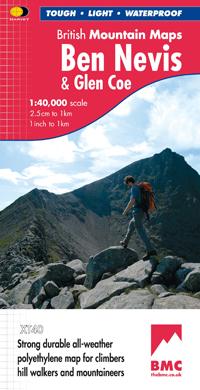
Wandelkaart Ben Nevis & Glen Coe | Harvey Maps

0
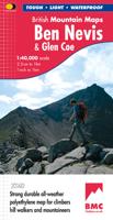
"This excellent Ben Nevis and Glen Coe map provides all the details needed for safe navigation on these iconic mountains". Cameron McNeish, outdoor writer and broadcaster.   Detailed map for hillwalkers and climbers of Ben Nevis and Glen Coe at 1:40,000 scale.   Section on navigation on Ben Nevis and detailed 1:15,000 enlargement of the summit wit...

Verkopers met dit product

Verkoper
Bezorging
Prijs
DeZwerver.nl logo
DeZwerver.nl
2,95
29,95

Anderen bekeken ook

Nieuw
Wandelkaart Ben Nevis | Harvey Maps
HARVEY launch innovative new series: Ultramap XT40. 16 titles featuring in Trail magazine through spring 2016. 40 years experience have gone into HARVEY's most creative new series. The Ultramap covers a large area yet is small enough to slip in a pocket. Actual size 73mm x 152mm. The Ultramap is fully detailed genuine original HARVEY mapping. The Ultramap is tough and 100% waterproof. Use it without a map case, whatever the weather! To provide the biggest area on the smallest lightest sheet, the Ultramap is printed double sided. The ingenious folding pattern allows you to open the Ultramap directly to any part, and either side, of the sheet. The two sides are aligned, so when you reach the edge of the Ultramap sheet you simply flip it over without re-folding. There's an overlap as well, so you can map read continuously. The magic scale of 1:40,000 enables the Ultramap to provide all the detail you would expect to find on a large scale walking map, including rights of way and boundarie…
19,50
Wandelkaart Ben Nevis | Harvey Maps
Een bijzonder mooie en handige kaart van dit prachtige bergachtige gebied. Op waterafstotend papier met veel details. HARVEY Superwalker map at 1:25,000 scale Detailed map of Ben Nevis for walkers and climbers This map for hillwalkers covers Fort William through Glen Nevis to Loch Treig. From the Grey Corries south to Kinlochleven. Ben Nevis, the Aonachs and the Mamores are among the 20 Munros and 4 Corbetts. Clear and easy to read with all the detail needed for ascending Britain's highest mountain. Enlargement of Ben Nevis summit showing the safety bearings in case of a descent in bad weather. As used by the Lochaber Mountain Rescue Team.
24,95
Nieuw
Wandelkaart Schiehallion / Ben Lawers & Glen Lyon | Harvey Maps
"I've spent most of my climbing career searching for new crags and bouldering areas and until Harvey Maps came along it was a process of trial and error. Their attention to detail is unmatched and they have led me successfully to all sorts of new adventures." Kevin Howett, Development Officer for the Mountaineering Council of Scotland and Author of 'Rock Climbing in Scotland' and SMC's 'Highland Outcrops' Guide.   Detailed map of 42 challenging Perthshire hills on one sheet at 1:40,000 scale.   Map extension covers Ben Chonzie.   Includes 27 Munros, 15 Corbetts and 4 Grahams   Schiehallion, Ben Lawers & Glen Lyon is the current new publication in this highly successful and innovative British Mountain Map Series. There are over 42 challenging Perthshire hills on this one sheet including 27 Munros and 15 Corbetts. Climbing Crags are highlighted & named. Climbing Crag route diagrams are also shown. Again this map is printed on polyethylene which is durable, tearproof & 100% waterproof. T…
29,95
Nieuw
Wandelkaart Skye The Cuillin | Harvey Maps
New Revised Edition and Format. More than a map, an essential piece of equipment this new generation HARVEY Superwalker is designed to be the most practical tool for navigation outdoors. The format gives more mapping on the sheet without making the map heavy and bulky. The fold has been developed to allow you to open directly to any part and either side of the sheet easily. No more struggling in the wind. The Superwalker XT25 is based on original HARVEY mapping with all the information a walker would expect on a map at 1:25,000 scale. Walls and fences on farmland are now shown. The clarity of the mapping has been improved to enable more people to read it without their glasses. The map is uncluttered by information irrelevant to the walker. The precise contouring and delicate hill shading give an immediate picture of the ground. Experience the satisfaction of fine navigation with the Superwalker XT25, now printed on our 100% waterproof and almost indestructible paper, whatever the weat…
24,95
Nieuw
Wandelgids Ben Nevis and Glen Coe | Cicerone
Uitstekende wandelgids van Ben Nevis en Glen Coe. Goed beschreven met veel praktische informatie om de route te kunnen lopen, inclusief redelijke kaarten. This guidebook details 100 walking routes around Ben Nevis and Glen Coe, centred in 10 areas including Fort William and Glen Nevis, the Aonachs, the Mamores, Kinlochleven, Glen Coe, Glen Etive, Black Mount and Ben Cruachan. Routes are graded according to difficulty, and range between short, easy strolls and long, challenging walks with overnight bothy stays. The region's 44 Munro summits are covered, including 2 easy scrambles and the formidable traverse of Aonach Eagach's iconic jagged ridge.    Alongside step-by-step route descriptions and mapping, the guide presents practical advice on transport, access, safety and where to stay plus background information on the area's fascinating geology.     Many of the routes reflect the author's belief that the best rewards often lie off the popular tourist trails. Yet the highlights are all…
20,95
Nieuw
Wandelkaart Ben Lawers & Schiehallion | Harvey Maps
Harvey Maps for hillwalkers showing the hills from Loch Tay to Glen Lyon. This detailed walking map includes Ben Lawers and the Tarmachan Ridge. The Superwalker XT25 is based on original HARVEY Maps with all the information a walker would expect on a map at 1:25,000 scale. 16 Munros & 6 Corbetts all on one sheet. The format gives more mapping on the sheet without making the map heavy and bulky. The fold has been developed to allow you to open directly to any part, and either side of the sheet easily no more struggling in the wind! The clarity of the mapping has been improved to enable more people to read it without their glasses. The map is uncluttered by information irrelevant to the walker. The precise contouring and delicate hill shading give an immediate picture of the ground. Less than half the weight of a laminated map and GPS compatible. Experience the satisfaction of fine navigation with the Superwalker XT25 now printed on our 100% waterproof and almost indestructible paper, w…
24,95
Nieuw
Wandelkaart Knoydart / Kintail & Glen Affric | Harvey Maps
"Clarity is the hallmark of this map. It covers magnificently honed peaks set above western seas and lochs, inviting exploration of one of Scotland's superlative and remote mountain regions", the late Irvine Butterfield, author of The High Mountains.   Detailed map of ‘Britain's last wilderness’ at 1:40,000 scale.   Includes Kintail and Glen Affric.   Detailed crag information for climbers.   Includes 43 Munros, 21 Corbetts and 7 Grahams.   Knoydart & Kintail, seventh in this highly successful & innovative British Mountain Map series, is a long awaited title. It is the only detailed map to cover this famous wilderness area on one sheet. This all weather map for climbers, hillwalkers, mountaineers & mountain bikers includes 43 Munros & 21 Corbetts. It is printed on polyethylene which is durable, tearproof & 100% waterproof. Colour shading is used for easy identification of hills & valleys & the map weighs less than half the weight of a laminated map. There is also an extension covering…
29,95
Nieuw
Wandelkaart Ben Alder | Harvey Maps
Superwalker is designed to be the most practical tool for navigation outdoors. The Superwalker XT25 is based on original HARVEY mapping with all the information a walker would expect on a map at 1:25,000 scale. Includes 23 Munros, 4 Corbetts and 3 Grahams all on one sheet. Also includes Creag Meagaidh National Nature Reserve. The format gives more mapping on the sheet without making the map heavy and bulky. The fold has been developed to allow you to open directly to any part, and either side of the sheet easily no more struggling in the wind. The clarity of the mapping has been improved to enable more people to read it without their glasses. The map is uncluttered by information irrelevant to the walker. The precise contouring and delicate hill shading give an immediate picture of the ground. Less than half the weight of a laminated map. GPS compatible. Experience the satisfaction of fine navigation with the Superwalker XT25 now printed on our 100% waterproof and almost indestructibl…
24,95

Klanten-reviews van Wandelkaart Ben Nevis & Glen Coe | Harvey Maps

Er zijn nog geen beoordelingen voor dit productBen jij de eerste die een review plaatst?

Meer over Wandelkaart Ben Nevis & Glen Coe | Harvey Maps

Productomschrijving

"This excellent Ben Nevis and Glen Coe map provides all the details needed for safe navigation on these iconic mountains". Cameron McNeish, outdoor writer and broadcaster.   Detailed map for hillwalkers and climbers of Ben Nevis and Glen Coe at 1:40,000 scale.   Section on navigation on Ben Nevis and detailed 1:15,000 enlargement of the summit with bad visibility descent route.   The map area includes 44 Munros, 14 Corbetts and 9 Grahams.     Serious map for serious mountains. The latest addition to the British Mountain Map series is a real heavyweight. Ben Nevis/Glencoe is the first Scottish title in this highly successful & innovative range. The map at 1:40000 has 43 Munros & 14 Corbetts on one sheet & is printed on polyethylene which is durable, tearproof & 100% waterproof. There is also colour shading for easy identification of hills and valleys & weighs less than half the weight of a laminated map. The reverse of the map has an enlargement of Ben Nevis summit, a Geological map, navigation advice & useful local phone numbers & websites.

Verken gerelateerde categorieën

Webshop.nl maakt gebruik van cookies. Ga je verder op onze website, ga dan akkoord met het plaatsen van cookies en de verwerking van deze data door ons en vermelde partners.