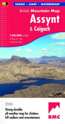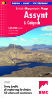
Wandelkaart Assynt & Coigach | Harvey Maps

0
"This is a fabulous map for a fabulous area; for the first time it shows crags, bouldering areas and clear details in what could seem a maze of rock and water. It must surely set the standard for all future maps." John Mackenzie, the Earl of Cromartie.   Detailed map for hillwalkers and climbers of the spectacular peaks of Assynt at 1:40,000 scale...

Verkopers met dit product

Verkoper
Bezorging
Prijs
DeZwerver.nl logo
DeZwerver.nl
2,95
29,95

Anderen bekeken ook

Nieuw
Wandelkaart Suilven / Stac Pollaidh / Lochinver | Harvey Maps
Detailed map for runners and walkers of Suilven and the surrounding area at the magic scale of 1:40,000. Covers a large area yet is handily compact. Pocket perfect! This is a fantastic and beautiful area, with Suilven at its centre. The map includes the two Munros of Ben More Assynt and Conival, as well as other famous mountains such as Cul Mor, Cul Beag, Canisp and Stac Pollaidh. Coverage is extended to the north with an inset of Quinag. The map shows 2 Munros, 8 Corbetts and 3 Grahams. Fully detailed genuine HARVEY mapping Use without a map case: tough and 100% waterproof Opens directly to either side of the sheet
19,50
Wandelkaart 337 Kalymnos | Terrain maps
Gedetailleerde wegenkaart en wandelkaart met alle kleine wegen, wandelpaden, hoogtelijnen en toeristische informatie aangegeven. Alle tekst is tweetalig in Engels en Grieks en de waterproof kaart is geschikt voor gebruik met GPS. This is a great map because: It is the only map featuring the climbing crags of Kalymnos completely and accurately. Fabulous cliffs and impeccable organization have made Kalymnos the No 1 rock climbing destination worldwide. This is the first map of Kalymnos to accurately feature all climbing crags on the island, with no omissions or errors, including crags equipped through May of 2009! There are two more maps of Kalymnos in the market, but if you can compare them with the SKAI map of Kalymnos – you will immediately see how far ahead our map is. One of those maps features a few of the climbing crags with symbols on the back side. The other features climbing crags on the actual map but with several errors, inconsistencies and considerable omissions.  It is w…
11,95
Nieuw
Wandelkaart Schiehallion / Ben Lawers & Glen Lyon | Harvey Maps
"I've spent most of my climbing career searching for new crags and bouldering areas and until Harvey Maps came along it was a process of trial and error. Their attention to detail is unmatched and they have led me successfully to all sorts of new adventures." Kevin Howett, Development Officer for the Mountaineering Council of Scotland and Author of 'Rock Climbing in Scotland' and SMC's 'Highland Outcrops' Guide.   Detailed map of 42 challenging Perthshire hills on one sheet at 1:40,000 scale.   Map extension covers Ben Chonzie.   Includes 27 Munros, 15 Corbetts and 4 Grahams   Schiehallion, Ben Lawers & Glen Lyon is the current new publication in this highly successful and innovative British Mountain Map Series. There are over 42 challenging Perthshire hills on this one sheet including 27 Munros and 15 Corbetts. Climbing Crags are highlighted & named. Climbing Crag route diagrams are also shown. Again this map is printed on polyethylene which is durable, tearproof & 100% waterproof. T…
29,95
Nieuw
Wandelkaart Torridon & Fisherfield | Harvey Maps
"HARVEY British Mountain Maps are a joy to use. The detail and accuracy make them my first choice when I am researching a route or just out on the hills for fun". Peter Macfarlane, outdoor writer and photographer.   Detailed map of the giants of Torridon and the remote hills of Fisherfield on one sheet at 1:40,000 scale.   Summit enlargements of Beinn Alligin, Beinn Eighe, Liathach and An Teallach.   Includes 18 Munros, 12 Corbetts and 9 Grahams.     The giants of Torridon and the remote hills of Fisherfields on one sheet. The map area includes 18 Munros and 12 Corbetts. There are also 1:15000 enlargements of An Teallach, Beinn Alligin, Beinn Eighe and Liathach on the reverse. Climbing crags are highlighted and climbing crag route diagrams are also included. Harvey British Mountain maps are a joy to use. The detail and accuracy make them my first choice when I am researching a route or out on the hills.
29,95
Nieuw
Wandelkaart 311 Naxos | Terrain maps
Erg goede wandelkaart van naxos, weerbestendig en volledig. Bezienswaardigheden, campings en andere praktische zaken staan op de kaart aangegeven. GPS toepasbaar. This map is great because: • It is waterproof and rip-proof. You can fold and unfold it a thousand times, fold it in irregular ways, dunk it in the sea or leave it out in the rain. This map is indestructible! • It is the first time the island’s entire coastline is mapped. Cartography was done with TERRAIN’s specially equipped and staffed cartographic vessel. This means that you can locate all beaches of the island, down to the tiniest cove! In fact, the special features of every single beach are recorded: whether it is sandy or pebbled, whether it features natural tree shade, water, a beach bar or organized water sports, whether the seabed in front of the beach is sandy or rocky (so that you will know where to anchor). • It indicates the boundaries of NATURA 2000 areas so that you will know which parts of the island are of s…
11,95
Nieuw
Wandelkaart - Wegenkaart - landkaart 308 Tinos | Terrain maps
Gedetailleerde wegenkaart en wandelkaart met alle kleine wegen, wandelpaden, hoogtelijnen en toeristische informatie aangegeven. Alle tekst is tweetalig in Engels en Grieks en de waterproof kaart is geschikt voor gebruik met GPS. This is a great map of Tinos because:   •    It is waterproof and rip-proof. You can fold and unfold it a thousand times, fold it in irregular ways, dunk it in the sea or leave it out in the rain. This map is indestructible!    •    It is the first time the island’s entire coastline is mapped. Cartography was done with TERRAIN’s specially equipped and staffed cartographic vessel. This means that you can locate all beaches of the island, down to the tiniest cove! In fact, the special features of every single beach are recorded: whether it is sandy or pebbled, whether it features natural tree shade, water, a beach bar or organized water sports, whether the seabed in front of the beach is sandy or rocky (so that you will know where to anchor).    •    It feature…
12,50
Nieuw
Wandelkaart - Fietskaart - Wegenkaart - landkaart 448 Western Crete - Kreta West | Terrain maps
Gedetailleerde wegenkaart en wandelkaart met alle kleine wegen, wandelpaden, hoogtelijnen en toeristische informatie aangegeven. Alle tekst is tweetalig in Engels en Grieks en de waterproof kaart is geschikt voor gebruik met GPS. Terrain’s map of Western Crete provides travelers with everything they need:    Scale of 100.000, which attributes all the information with clarity and in detail.  Map data processed within a GIS environment, resulting in great accuracy.  Double coordinate system, WGS 84 and ΕΓΣΑ 87, completely compatible with GPS.  It is printed on Polyart material, making it totally waterproof and rip-proof. You can fold it and unfold it a hundred times, fold it in irregular ways, dunk it in the sea or leave it out in the rain. This map is indestructible!  Clear symbols, easily readable fonts, rich colors and excellent arrangement of every element make the map extremely friendly to the user.  Unique wealth of information. Every village, every road (including their dis…
12,50
Nieuw
Wandelkaart - Fietskaart - Wegenkaart - landkaart 449 Central Crete - Kreta centraal | Terrain maps
Gedetailleerde wegenkaart en wandelkaart met alle kleine wegen, wandelpaden, hoogtelijnen en toeristische informatie aangegeven. Alle tekst is tweetalig in Engels en Grieks en de waterproof kaart is geschikt voor gebruik met GPS. Terrain’s map of Central Crete provides travelers with everything they need:  Scale of 100.000, which attributes all the information with clarity and in detail.  Map data processed within a GIS environment, resulting in great accuracy.  Double coordinate system, WGS 84 and ΕΓΣΑ 87, completely compatible with GPS.  It is printed on Polyart material, making it totally waterproof and rip-proof. You can fold it and unfold it a hundred times, fold it in irregular ways, dunk it in the sea or leave it out in the rain. This map is indestructible!  Clear symbols, easily readable fonts, rich colors and excellent arrangement of every element make the map extremely friendly to the user.  Unique wealth of information. Every village, every road (including their dista…
12,50
Wandelkaart 313 Santorini | Terrain maps
Gedetailleerde wegenkaart en wandelkaart met alle kleine wegen, wandelpaden, hoogtelijnen en toeristische informatie aangegeven. Alle tekst is tweetalig in Engels en Grieks en de waterproof kaart is geschikt voor gebruik met GPS.   This is a detailled map of Santorini. Features: It is waterproof and rip-proof. You can fold and unfold it a thousand times, fold it in irregular ways, dunk it in the sea or leave it out in the rain. This map is indestructible!  It indicates the boundaries of NATURA 2000 areas so that you will know which parts of the island are of special environmental interest and beauty – thus you can enjoy traveling through them, but also take care to protect them.  The length of all trails is measured in kilometers, so you can estimate the duration of your hike no matter which trail / road combination you follow.  It features detailed descriptions of 2 trails on the back, including their total length in kilometers and the duration of the hike, and the wineries of Sa…
11,95

Klanten-reviews van Wandelkaart Assynt & Coigach | Harvey Maps

Er zijn nog geen beoordelingen voor dit productBen jij de eerste die een review plaatst?

Meer over Wandelkaart Assynt & Coigach | Harvey Maps

Productomschrijving

"This is a fabulous map for a fabulous area; for the first time it shows crags, bouldering areas and clear details in what could seem a maze of rock and water. It must surely set the standard for all future maps." John Mackenzie, the Earl of Cromartie.   Detailed map for hillwalkers and climbers of the spectacular peaks of Assynt at 1:40,000 scale.   Includes Quinag, Suilven, Stac Pollaidh, Cul Mor and Ben More Assynt.   Enlargements at 1:15,000 scale of Stac Pollaidh, Suilven and Quinag on the reverse.   Climbing crags are highlighted and a climbing route on Stac Pollaidh is included.   The map area includes 2 Munros, 9 Corbetts and 6 Grahams.

Verken gerelateerde categorieën

Webshop.nl maakt gebruik van cookies. Ga je verder op onze website, ga dan akkoord met het plaatsen van cookies en de verwerking van deze data door ons en vermelde partners.