webshop.nl
Categorieën
  Sluiten

Meer Harvey Maps

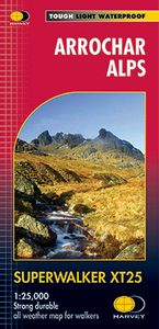
Wandelkaart Arrochar Alps | Harvey Maps

0
Includes Beinn Ime, Ben Vorlich and the Cobbler (Ben Arthur). Detailed map for hillwalkers of the western part of the Loch Lomond and Trossachs National Park at the popular scale of 1:25,000. Includes 5 Munros, 10 Corbetts and 13 Grahams. Tough, light, durable and 100% waterproof Genuine, original, HARVEY mapping Opens directly to either side of th...

Webshops met dit product

Webshop
Bezorging
Prijs

Anderen bekeken ook

Wandelkaart Arrochar Alps | Harvey Maps
Covers a large area yet is handily compact. Pocket perfect!   Includes Beinn Ime, Ben Vorlich and the Cobbler (Ben Arthur).   Detailed map for hillwalkers of the western part of the Loch Lomond and Trossachs National Park at the magic scale of 1:40,000.   Includes 5 Munros, 10 Corbetts and 13 Grahams.   The Arrochar Alps are a group of mountains located around the head of Loch Long, Loch Fyne, and Loch Goil, near the villages of Arrochar and Lochgoilhead, on the Cowal Peninsula in Argyll and Bute, Scotland. The mountains are especially popular with hillwalkers, due to their proximity and accessibility from Glasgow.   The Ultramap is fully detailed, genuine, original HARVEY mapping. To provide the biggest area on the smallest, lightest sheet, the Ultramap is printed double sided. The ingenious folding pattern allows you to open the Ultramap directly to any part, and either side, of the sheet. The two sides are aligned, so when you reach the edge of the Ultramap sheet you simply flip it …
19,50
Wandelkaart Loch Lomond & The Trossachs | Harvey Maps
Detailed Superwalker map for walkers of Loch Lomond & the Trossachs National Park at 1:25,000 scale. Includes Scotland?s most southerly Munro, Ben Lomond and an inset map for access to Ben Vorlich from Loch Earn. Ideal for The Great Trossachs Forest, Loch Katrine, Ben Ledi & Queen Elizabeth Forest Park. Includes 7 Munros, 7 Corbetts and 6 Grahams. Tough, light, durable and 100% waterproof Genuine, original, HARVEY mapping Opens directly to either side of the sheet Easy to re-fold
24,95
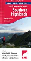
Wandelkaart Southern Highlands | Harvey Maps
"I've researched Scottish Guidebooks using HARVEY maps. They are the clearest, and the most accurate. They don't fall to pieces in the rain and the geology bits are pure bonus". Ronald Turnbull, author of Walking Loch Lomond and The Trossachs.   Detailed map of the Southern Highlands at 1:40,000 scale.   Map extensions of Ben Cruachan and Ben Vorlich.   This map shows 63 hills over 2,000 feet, including 25 Munros, 24 Corbetts and 14 Grahams.     This map covers an area dense with popular hills close to Central Scotland and easily accessed from the motorways. There are 63 popular hills over 2000', climbing crags are highlighted & named and the map covers most of Loch Lomond National Park. Printed on polyethylene the map is durable, tearproof and 100% waterproof. We use colour shading for easy identification of hills and valleys and the map is less than half the weight of a laminated map.
29,95
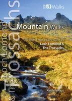
Wandelgids Mountain Walks in Loch Lomond and the Trossachs | Northern
One of four books in the popular Loch Lomond and The Trossachs: Top 10 Walks series. Handy, pocket-sized, full colour walking guides written by experts. The perfect impulse buy. The other titles in the series are: Lochside Walks, Hill Walks and Easy Summits and Pub Walks. This attractive and cleverly structured guide gives walkers ten of the finest short circular mountain walks in the Loch Lomond and The Trossachs National Park in a popular pocketable format. With clear information, an overview and introduction for each walk, expertly written numbered directions, large scale Ordnance Survey maps, superb eye-grabbing panoramic photographs, and interpretation of points of interest along the way, these guides set a new standard in clarity and ease-of-use. Featured walks include: Ben Lomond & Ptarmigan Ridge, Ben Donich, The Cobbler, Beinn Ime and Beinn Narnain, Ben Vorlich, An Caisteal & Beinn a¿ Chroin, Cruach Ardrain and Beinn Tulaichean, Beinn Odhar and Meall Buidhe, Stob Binnein, Ben …
10,95

Klanten-reviews van Wandelkaart Arrochar Alps | Harvey Maps

Er zijn nog geen beoordelingen voor dit productBen jij de eerste die een review plaatst?

Meer over Wandelkaart Arrochar Alps | Harvey Maps

Productomschrijving

Includes Beinn Ime, Ben Vorlich and the Cobbler (Ben Arthur). Detailed map for hillwalkers of the western part of the Loch Lomond and Trossachs National Park at the popular scale of 1:25,000. Includes 5 Munros, 10 Corbetts and 13 Grahams. Tough, light, durable and 100% waterproof Genuine, original, HARVEY mapping Opens directly to either side of the sheet Easy to re-fold

Productspecificaties

Artikelnummer(s)
Brand
Harvey Maps
Webshop.nl maakt gebruik van cookies. Ga je verder op onze website, ga dan akkoord met het plaatsen van cookies en de verwerking van deze data door ons en vermelde partners.