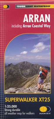
Wandelkaart Arran including Arran Coastal Way | Harvey Maps

0
Een bijzonder handige kaart van dit gebied. Op waterafstotend papier met veel details.    Features the renowned Goat Fell, A'Chir ridge, Beinn Bharrain, Glen Sannox & Glen Rosa. Detailed map for hillwalkers of the whole island at the popular 1:25,000 scale. The 100km (62 miles) Arran Coastal Way is also shown. The route links the coastline of the ...

Verkopers met dit product

Verkoper
Bezorging
Prijs
DeZwerver.nl logo
DeZwerver.nl
2,95
24,95

Anderen bekeken ook

Wandelkaart Arran including Arran Coastal Way | Harvey Maps
Een bijzonder handige kaart van dit gebied. Op waterafstotend papier met veel details.    Features the renowned Goat Fell, A'Chir ridge, Beinn Bharrain, Glen Sannox & Glen Rosa. Detailed map for hillwalkers of the whole island at the popular 1:25,000 scale. The 100km (62 miles) Arran Coastal Way is also shown. The route links the coastline of the island with the villages and the stunning scenery Arran has to offer. Includes Gaelic-English glossary and information on local archaeological and historical sites. Landscape and wildlife information from the National Trust for Scotland Includes 4 Corbetts and 1 Graham.   Tough, light, durable and 100% waterproof Genuine, original, HARVEY mapping Opens directly to either side of the sheet Easy to re-fold  
24,95
Wandelkaart Arran | Harvey Maps
Covers a large area yet is handily compact. Pocket perfect!   Features the renowned Goat Fell, A'Chir ridge, Beinn Bharrain, Glen Sannox & Glen Rosa.   Detailed map for runners and walkers of the whole island at the magic 1:40,000 scale.   The 100km (62 miles) Arran Coastal Way is also shown. The route links the coastline of the island with the villages and the stunning scenery Arran has to offer.   Includes Gaelic-English glossary and information on local archaeological and historical sites.   Includes 4 Corbetts and 1 Graham.
20,95
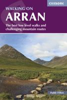
Wandelgids Walking on Arran | Cicerone
Uitstekende wandelgids voor dit uitdagende wandelgebied in Schotland. Dagtochten. The 45 walking routes in this Isle of Arran guidebook range from easy 3km (2 miles) nature trails to long arduous mountain routes with scrambles (up to 32km) providing thorough coverage of Arran, including the ascent of Goatfell and nearby Holy Isle. Most routes are 10km to 15km long but many give opportunities to create longer cross island walks. This guidebook presents a selection of 45 day walks on the popular and accessible Isle of Arran. The routes are between 2 miles (3km) and 20 miles (32km) in length, from easy waymarked forest trails to more arduous mountain walks, exposed ridge routes and scrambles. There are linear and circular walks to choose from, and opportunities to link routes together and create longer walks across the length and breadth of the island. With highlights including Goatfell, Beinn Tarsuinn, the Sannox Horseshoe, Glen Rosa and the Cock of Arran, there's something here to suit…
23,95
Wandelkaart Anglesey Coastal Path | Harvey Maps
Een bijzonder handige kaart van dit lange-afstands-wandelpad. Op waterafstotend papier met veel details. Het enige dat je eigenlijk een beetje mist is een overzicht. Verder uitstekend en voldoende voor de route. Entire route on one map   The 200km (125 mile) long Anglesey Coastal Path is a long distance route that follows much of the island's coastline and comprises one section of the Wales Coast Path. The path primarily caters for walkers however, cyclists and horse riders can also enjoy certain sections.   The path falls within a designated Area of Outstanding Natural Beauty which covers 95% of the coast. It passes through landscape that includes a mixture of farmland, coastal heath, dunes, salt-marsh, foreshore, cliffs and a few small pockets of woodland.   Tough, light, durable and 100% waterproof Includes Rights of Way Genuine original HARVEY mapping Route clearly marked
25,95
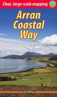
Wandelgids The Arran Coastal Way | Rucksack Readers
The Arran Coastal Way is perhaps Scotland's finest circular long-distance trail, running 65 miles (105 km) around the Isle of Arran in a memorable week-long hike from Brodick. It's accessible from near Glasgow by the Ardrossan ferry. Famous as`Scotland in miniature', Arran is rich in scenery, castles, caves and standing stones. The walking is varied, from mountain paths to deserted beaches, from minor road-walking to boulder-hopping, and in places it is refreshingly rugged. Arran's wildlife is uniquely approachable, and its residents welcoming. Our second edition was thoroughly updated during 2017 with many route changes and extra options. This guidebook contains all you need to plan and enjoy the Arran Coastal Way, including:   detailed description of the route walked anticlockwise, updated for 2021 background on geology, pre-history and history whisky-making, wildlife and habitats boat trip to the Holy Isle Foreword by wilderness walker Cameron McNeish clear mapping of the …
22,50
Wandelkaart East Highland Way | Harvey Maps
Mooie, duidelijke kaart van de East highland Way in Engeland. Geplastificeerd met veel extra informatie en uitsnedes van de route.  East Highland Way is an exciting new unofficial long distance route between Fort William and Aviemore. Pioneered by Kevin Langan, this 82 mile trail forms a new link between the northern end of the West Highland Way and the southern end of the Speyside Way. It also joins with the Great Glen Way at Fort William. It is a tranquil route which takes in a varied and wild landscape and includes the ancient Caledonian Forests of Inshriach, loch-side trails and mountain wilderness. Access to accommodation has been carefully considered wherever possible, making this route accessible to walkers of all abilities. The map is arranged in panels so that at any one time you only have to have the part you need open. It is supplied folded in a plastic pocket. The map shows the detail you need for navigation. There is a full key and scale bar.   Information on planning you…
25,95
Wandelkaart St Oswald's Way | Harvey Maps
Mooie, duidelijke kaart van de St Oswald's Way Noord-Engeland. Geplastificeerd met veel extra informatie en uitsnedes van de route.   From Holy Island to Heavenfield, the 97 mile St Oswald's Way links some of the places associated with St Oswaldwho was the King of Northumbria in the early 7th century. The route runs through the Northumbria National Park following the stunning Northumberland Coast before heading inland across beautiful countryside to Heavenfield. It links with St Cuthbert's Way in the north and Hadrian's Wall Path in the south. Along the way you will encounter rolling farmland, villages, vast sandy beaches and fascinating history.   The HARVEY series of Long Distance Route maps is an established success. Now the advanced technology used in the creation of our best-selling British Mountain Maps is also applied to the route maps.   These maps are a leap forward in technical excellence. They are tough, durable, light and 100% waterproof - virtually indestructible in norma…
25,95
Wandelkaart Northumberland Coast Path and Berwickshire Coastal Path | Harvey Maps
Mooie, duidelijke kaart van de Northumberland Coast Path en het vervolg daarop de Berwickshire Coastal Path in Noord-Engeland en Schotland. Geplastificeerd met veel extra informatie en uitsnedes van de route.    The Northumberland Coast Path stretches for 103km (64m) from Cresswell in the south to Berwick-upon-Tweed in the north. The Berwickshire Coastal Path stretches for 48km (28m) and continues this route from Berwick-upon-Tweed to Cockburnspath. These routes are part of the North Sea Trail and offer some of the finest coastal walking in the country with rugged coastline, stunning cliff scenery and panoramic views.   XT40 - These maps are a leap forward in technical excellence. They are tough, durable, light and 100% waterproof - virtually indestructible in normal use.   They are light to carry, and compact - not the great bulky package you get with a laminated map.   The map is detailed, with the routes clearly marked. It also contains general information, useful telephone numbers…
25,95
Wandelkaart Cleveland Way | Harvey Maps
Mooie, duidelijke kaart van de Cleveland Way in Noord-Engeland. Geplastificeerd met veel extra informatie en uitsnedes van de route.    Leap forward in technical excellence. Tough, light and 100% waterproof Compact and light - the map itself weighs just 60gms - a third of the weight of a laminated map, and much less bulky. And you can fold or refold it time and again, or stuff it in your back pocket and it won't fall to pieces. Shows the entire route on one sheet.   174km (109 miles) from Helmsley across the North York Moors National Park to Saltburn and along the coast via Scarborough ending at Filey.   Information on finding accommodation, camping, food. Directions to the start. Also Ranger Service contact numbers and enlargements of towns/villages showing facilities available and tips on weather and clothing.   Detailed mapping, full legend. National Grid - can be used with GPS. 1:40,000 scale. Waterproof. Supplied in clear plastic pocket
25,95
Wandelkaart North Downs Way | Harvey Maps
Mooie, duidelijke kaart van de North Downs Way in Engeland. Geplastificeerd met veel extra informatie en uitsnedes van de route.    XT40 - Leap forward in technical excellence. Tough, light and 100% waterproof   Compact and light - the map itself weighs just 60gms - a third of the weight of a laminated map, and much less bulky. And you can fold or refold it time and again, or stuff it in your back pocket and it won't fall to pieces.   Revised edition and format Shows the entire route on one XT40 map sheet.   The Way is 246km (156 miles). This map covers the whole route from Farnham in the west to Dover on the south east coast.   Information on finding accommodation, camping, food. Directions to the start and end points. Shows facilities available and includes tips on weather and clothing.     Detailed mapping, full legend. National Grid - can be used with GPS. 1:40,000 scale. Waterproof. Supplied in clear plastic pocket.
25,50

Klanten-reviews van Wandelkaart Arran including Arran Coastal Way | Harvey Maps

Er zijn nog geen beoordelingen voor dit productBen jij de eerste die een review plaatst?

Meer over Wandelkaart Arran including Arran Coastal Way | Harvey Maps

Productomschrijving

Een bijzonder handige kaart van dit gebied. Op waterafstotend papier met veel details.    Features the renowned Goat Fell, A'Chir ridge, Beinn Bharrain, Glen Sannox & Glen Rosa. Detailed map for hillwalkers of the whole island at the popular 1:25,000 scale. The 100km (62 miles) Arran Coastal Way is also shown. The route links the coastline of the island with the villages and the stunning scenery Arran has to offer. Includes Gaelic-English glossary and information on local archaeological and historical sites. Landscape and wildlife information from the National Trust for Scotland Includes 4 Corbetts and 1 Graham.   Tough, light, durable and 100% waterproof Genuine, original, HARVEY mapping Opens directly to either side of the sheet Easy to re-fold


Productinformatie

    Verken gerelateerde categorieën

    Webshop.nl maakt gebruik van cookies. Ga je verder op onze website, ga dan akkoord met het plaatsen van cookies en de verwerking van deze data door ons en vermelde partners.