webshop.nl
Categorieën
  Sluiten

Meer Harvey Maps

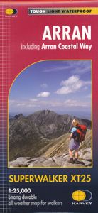
Wandelkaart Arran including Arran Coastal Way | Harvey Maps

0
Een bijzonder handige kaart van dit gebied. Op waterafstotend papier met veel details.    Features the renowned Goat Fell, A'Chir ridge, Beinn Bharrain, Glen Sannox & Glen Rosa. Detailed map for hillwalkers of the whole island at the popular 1:25,000 scale. The 100km (62 miles) Arran Coastal Way is also shown. The route links the coastline of the i...

Webshops met dit product

Webshop
Bezorging
Prijs

Anderen bekeken ook

Wandelkaart Arran including Arran Coastal Way | Harvey Maps
Een bijzonder handige kaart van dit gebied. Op waterafstotend papier met veel details.    Features the renowned Goat Fell, A'Chir ridge, Beinn Bharrain, Glen Sannox & Glen Rosa. Detailed map for hillwalkers of the whole island at the popular 1:25,000 scale. The 100km (62 miles) Arran Coastal Way is also shown. The route links the coastline of the island with the villages and the stunning scenery Arran has to offer. Includes Gaelic-English glossary and information on local archaeological and historical sites. Landscape and wildlife information from the National Trust for Scotland Includes 4 Corbetts and 1 Graham.   Tough, light, durable and 100% waterproof Genuine, original, HARVEY mapping Opens directly to either side of the sheet Easy to re-fold
24,95
Wandelkaart Arran | Harvey Maps
Covers a large area yet is handily compact. Pocket perfect!   Features the renowned Goat Fell, A'Chir ridge, Beinn Bharrain, Glen Sannox & Glen Rosa.   Detailed map for runners and walkers of the whole island at the magic 1:40,000 scale.   The 100km (62 miles) Arran Coastal Way is also shown. The route links the coastline of the island with the villages and the stunning scenery Arran has to offer.   Includes Gaelic-English glossary and information on local archaeological and historical sites.   Includes 4 Corbetts and 1 Graham.
19,50
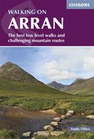
Wandelgids Walking on Arran | Cicerone
Uitstekende wandelgids voor dit uitdagende wandelgebied in Schotland. Dagtochten. The 45 walking routes in this Isle of Arran guidebook range from easy 3km (2 miles) nature trails to long arduous mountain routes with scrambles (up to 32km) providing thorough coverage of Arran, including the ascent of Goatfell and nearby Holy Isle. Most routes are 10km to 15km long but many give opportunities to create longer cross island walks. This guidebook presents a selection of 45 day walks on the popular and accessible Isle of Arran. The routes are between 2 miles (3km) and 20 miles (32km) in length, from easy waymarked forest trails to more arduous mountain walks, exposed ridge routes and scrambles. There are linear and circular walks to choose from, and opportunities to link routes together and create longer walks across the length and breadth of the island. With highlights including Goatfell, Beinn Tarsuinn, the Sannox Horseshoe, Glen Rosa and the Cock of Arran, there's something here to suit …
23,95
Wandelgids Walking The Munros Vol 1 Southern, Central and Western High
Uitstekende wandelgids van het zuiden, midden en westen van de Schotse Hooglanden. Goed beschreven met veel praktische informatie om de route te kunnen lopen, inclusief redelijke kaarten. Guidebook to walking the Munros in southern, central and western Highlands. Describes 69 challenging routes across 139 of the iconic 3000ft+ mountains covering areas such as Glencoe, Bridge of Orchy and Mull. Includes routes up Ben More, Ben Alder, Ben Lomond and Ben Nevis, the highest mountain in the British Isles. Volume 1 of two guidebooks.   Seasons The guide is intended for summer hillwalkers (usually April/May to October in Scotland). In winter conditions the routes become more serious mountaineering expeditions requiring appropriate skills, equipment and experience.   Centres Arrochar, Crianlarich, Killin, Pitlochry, Tyndrum, Glencoe, Fort William, Spean Bridge, Dalwhinnie, Braemar, Glenshee   Difficulty Most of the Munros are straightforward walks but some involve ridge walking, scr…
20,95
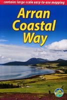
Wandelgids The Arran Coastal Way | Rucksack Readers
The Arran Coastal Way is perhaps Scotland's finest circular long-distance trail, running 65 miles (105 km) around the Isle of Arran in a memorable week-long hike from Brodick. It's accessible from near Glasgow by the Ardrossan ferry. Famous as`Scotland in miniature', Arran is rich in scenery, castles, caves and standing stones. The walking is varied, from mountain paths to deserted beaches, from minor road-walking to boulder-hopping, and in places it is refreshingly rugged. Arran's wildlife is uniquely approachable, and its residents welcoming. Our second edition was thoroughly updated during 2017 with many route changes and extra options. This guidebook contains all you need to plan and enjoy the Arran Coastal Way, including:   detailed description of the route walked anticlockwise, updated for 2021 background on geology, pre-history and history whisky-making, wildlife and habitats boat trip to the Holy Isle Foreword by wilderness walker Cameron McNeish clear mapping of the e…
22,50

Klanten-reviews van Wandelkaart Arran including Arran Coastal Way | Harvey Maps

Er zijn nog geen beoordelingen voor dit productBen jij de eerste die een review plaatst?

Meer over Wandelkaart Arran including Arran Coastal Way | Harvey Maps

Productomschrijving

Een bijzonder handige kaart van dit gebied. Op waterafstotend papier met veel details.    Features the renowned Goat Fell, A'Chir ridge, Beinn Bharrain, Glen Sannox & Glen Rosa. Detailed map for hillwalkers of the whole island at the popular 1:25,000 scale. The 100km (62 miles) Arran Coastal Way is also shown. The route links the coastline of the island with the villages and the stunning scenery Arran has to offer. Includes Gaelic-English glossary and information on local archaeological and historical sites. Landscape and wildlife information from the National Trust for Scotland Includes 4 Corbetts and 1 Graham.   Tough, light, durable and 100% waterproof Genuine, original, HARVEY mapping Opens directly to either side of the sheet Easy to re-fold

Productspecificaties

Artikelnummer(s)
Brand
Harvey Maps
Webshop.nl maakt gebruik van cookies. Ga je verder op onze website, ga dan akkoord met het plaatsen van cookies en de verwerking van deze data door ons en vermelde partners.