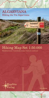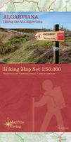
Wandelkaart Algarviana - Hiking the Via Algarviana | MapSite Verlag

0
Wandelkaartset van 6 kaarten van de Via Algarviana.  The Via Algarviana (GR13) is a long distance trail in Portugal, running 300 km from Alcoutim at the Spanish border across the entire length of the Algarve to Cape St. Vincent at the Atlantic Ocean. A scale of 1:50.000, accurate relief presentation, 25-m contours, UTM-grid and -projection (for GP...

Verkopers met dit product

Verkoper
Bezorging
Prijs
DeZwerver.nl logo
DeZwerver.nl
2,95
18,95

Anderen bekeken ook

Wandelkaart Algarviana - Hiking the Via Algarviana | MapSite Verlag
Wandelkaartset van 6 kaarten van de Via Algarviana.  The Via Algarviana (GR13) is a long distance trail in Portugal, running 300 km from Alcoutim at the Spanish border across the entire length of the Algarve to Cape St. Vincent at the Atlantic Ocean. A scale of 1:50.000, accurate relief presentation, 25-m contours, UTM-grid and -projection (for GPS-usage) location information about accomodation, amenity and attracttion etc makes this set of maps to the ideal companion of those, who walk the via Algarviana.
18,95
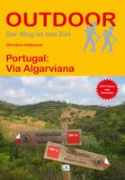
Wandelgids - Pelgrimsroute 298 Via Algarviana - Algarve | Conrad Stein Verlag
Conrad Stein wandelgids - Langeafstands wandelgids door de Algarve in 14 goed gemarkeerde dagetappes tot 300 km in delen door het binnenland van Portugal. De gids bevat een uitgebreide routebeschrijving, informatie over accomodatie, eenvoudige kaartjes en praktische informatie.   Deze gids bevat kleine kaartjes die u samen met de markeringen van A naar B brengen.    Bei der Algarve denken wohl viele zuerst an weite Sandstrände und beeindruckende Steilküsten. Nicht weniger faszinierend ist allerdings das Hinterland der Region, das man bei einer Wanderung auf der Via Algarviana von Alcoutim zum Cabo de São Vicente kennenlernen kann. Über 300 km führt der Weg auf alten Hirtenpfaden und Waldwegen durch eine abwechslungsreiche Landschaft mit idyllischen Flusstälern und Gebirgszügen, Korkeichenwäldern und ursprünglichen Dörfern.    Das Buch beschreibt den Weg in 14 Etappen und informiert genau über Unterkünfte, Nahverkehr, Einkaufsmöglichkeiten und Wasserstellen. Ausführliche Reise-Info…
17,50
Reisgids Algarve | Michael Müller Verlag
Uitstekende, diepgaande reisgids over dit deel van het land. Met veel achtergrondinformatie en ook praktische zaken als overnachtingen en eet- en drinkgelegenheden. Thematische hoofdstukken over geschiedenis, geologie etc. Let op: Duits! Anders reisen und dabei das Besondere entdecken: Mit den aktuellen Tipps aus den Michael-Müller-Reiseführern gestalten Sie Ihre Reise individuell, nachhaltig und sicher.   Sonnendurchflutete Weite, markante Natur, quirlig und einsam zugleich, der Garten Portugals: die Algarve. Auch "Kalifornien Europas" genannt, hat der südwestlichste Zipfel Kontinentaleuropas Individualisten im Wohnmobil, Aussteigern mit VW-Bus, Kultur- und Geschichtsinteressierten sowie Golfern, Surfern und anderen sportlich Ambitionierten gleichermaßen viel zu bieten. Mit dem Algarve-Reiseführer von Michael Müller in der elften Auflage entdecken Sie diesen bezaubernden Landstrich ganz nach Ihren Interessen. 264 Seiten mit 95 Farbfotos, 36 Karten, eine herausnehmbare Faltkarte im Ma…
21,95
Wandelgids Walking in the Algarve | Cicerone
Uitstekende wandelgids van de Algarve. Goed beschreven met veel praktische informatie om de routes te kunnen lopen, inclusief redelijke kaarten. This guidebook describes 33 walks in the beautiful Algarve in southern Portugal. Boasting good weather, easy access, stunning scenery and some great hiking trails, the region is a perfect destination for a walking holiday. It is best known for its spectacular coastline: the coastal trails presented here afford ample opportunity to admire the plunging sinkholes, striking sea-cliffs and rock-hugged beaches. However, the interior is every bit as beautiful and other walks explore the forested slopes of Monchique and the tranquil countryside between the mountains and coast.   The routes range from 3.5 to 17km and cover the sun-kissed south coast, the rugged Vicentina Coast, the Monchique mountains and traditional villages of the eastern Algarve. Many can be accessed by public transport and details, along with tips on refreshment opportunities on r…
23,95
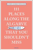
Reisgids 111 places in Along the Algarve You Shouldn't Miss | Emons
- The ultimate insider's guide to the Algarve - Features interesting and unusual places not found in traditional travel guides - Part of the international 111 Places/111 Shops series with over 300 titles and 1.8 million copies in print worldwide - Appeals to both the local market (more than 440,000 people call the Algarve home) and the tourist market (more than 60 million people visit Portugal every year!) - Fully illustrated with 111 full-page color photographs The Algarve is different. On the coast of the former Kingdom of the Algarve the wind blows stronger, the summer is hotter, the cabbages grow bigger, the fruit ripens quicker and the grilled Sardines taste better than anywhere else in the country. The people are enthrallingly candid, sometimes defiantly stubborn or plaintively silent, but mostly they like to laugh out loud, and are nevertheless entirely conscious of tradition. A trip to the Algarve will take you to a different time zone, away from the constant bustle of middle-…
18,50
Wegenkaart - landkaart 593 Zuid Portugal - Algarve | Michelin
Zoals je van Michelin mag verwachten zijn het onmisbare overzichtskaarten van een uitstekende kwaliteit: een duidelijk en goed leesbaar kaartbeeld.  Vrijwel alle berijdbare wegen staan er op ingetekend, in kleur verschillend voor grote en kleine wegen. Andere weginformatie omvat bijvoorbeeld kilometer-afstanden, tolwegen, helling-aanduiding, winterafsluitingen, tankstations maar ook de bekende groene routes: de mooiste wegen om te rijden.   Daarnaast geeft de kaart toeristische informatie met symbolen weer: bezienswaardigheden als kastelen, kloosters, musea, maar ook campings (niet allemaal overigens). De kaart is voorzien van een 4-talige legenda.   Toch hebben de makers door een beperkt gebruik van symbolen geen drukke kaart gemaakt. De kracht zit hem dan ook in de combinatie van meer dan voldoende informatie en goede leesbaarheid.    Part of the orange regional series from Michelin, this Portugal South - Algarve map shows this part of Portugal in excellent detail. Primary & seconda…
11,95
Wandelkaart Parque Natural do Sudoeste Alentejano e Costa Vicentina | Adventure MAPS
Prachtige tweezijdige topografische kaart van een groot deel van de zuidwest kust van Portugal, een westelijk stuk van de Alrgarve en de Ruta Vicentina. Veel details op topografisch gebied, ingetekende wandelroutes maar ook toeristische informatie als stranden, campings en jeugdherbergen Schaal: 1:50.000 Legenda en aanvullende informatie over PT, EN, ES, FR en DE Magnetisch kompas opgenomen  Paths, GR(Long Distance Path) and PR(Short Distance Path) includes GR11-E9 (Rota Vicentina) and GR13-E4 ( Via Algarviana)     Toeristische bezienswaardigheden in de omgeving van de symboliek (monumenten, mooie vergezichten, picknickplaatsen, musea en toeristische kantoren) Klimmen, surfen, duiken, paragliding en de stranden Offset contouren van 10 m Gauss rooster met afdelingen van 1 Km Coördinaten WGS84 (compatibel met GPS) Vertegenwoordiging van magnetische declinatie Afmetingen: 66cmx80cm Printing: Duplex Plaatsen op de kaart Aljezur | Almograve | Barão de S.João | Bensafrim | Borde…
23,50
Fotoboek Great Hiking Trails of the World | Rizzoli International
FOREWORD INDIES Book of the Year Awards -- 2017 GOLD Winner for Nature A hiker's dream bucket list is embodied in this lavishly illustrated celebration of more than eighty of the world's most iconic trails. Celebrating the most important, popular, and diverse hiking trails in the world, this book invites readers to take a walking tour through the planet's natural wonders. Divided into six sections, the book groups trails by theme: pilgrimages, historic hikes, mountain hikes, wilderness trails, trails through diverse environments, and long-distance trails. From Mount Kenya to subarctic hikes in Scandinavia, and from exotic hikes in the Himalayas to more familiar trails in the United States and Canada, this book invites readers to explore the history, environment, and cultures of the world on foot. Each featured trail has its own section, with a map and photo gallery focusing on what makes it one of the most magnificent hiking trails anywhere in the world. Included are detailed descr…
42,95
Wandelkaart Dilijan National Park - Hiking Topo Map Armenia | Cartisan
Detailed topographical map of Dilijan National Park and the surrounding area, highlighting available hiking routes including the long-distance Transcaucasian Trail and Janapar Trail, as well as the official national park trail network and many more regional attractions. Attractions: Dilijan city, Parz Lake, Gosh Lake, Aghjka Berd fortress, Mantash fortress. Monasteries: Haghartsin, Goshavank, Aghavnavank, Jukhtakvank, Matosavank Villages: Gosh, Kalavan, Hovk, Khachardzan. 5 % of each map sold is used to maintaine the local trail network
16,95

Klanten-reviews van Wandelkaart Algarviana - Hiking the Via Algarviana | MapSite Verlag

Er zijn nog geen beoordelingen voor dit productBen jij de eerste die een review plaatst?

Meer over Wandelkaart Algarviana - Hiking the Via Algarviana | MapSite Verlag

Productomschrijving

Wandelkaartset van 6 kaarten van de Via Algarviana. 

The Via Algarviana (GR13) is a long distance trail in Portugal, running 300 km from Alcoutim at the Spanish border across the entire length of the Algarve to Cape St. Vincent at the Atlantic Ocean.

A scale of 1:50.000, accurate relief presentation, 25-m contours, UTM-grid and -projection (for GPS-usage) location information about accomodation, amenity and attracttion etc makes this set of maps to the ideal companion of those, who walk the via Algarviana.

Productinformatie

    Verken gerelateerde categorieën

    Webshop.nl maakt gebruik van cookies. Ga je verder op onze website, ga dan akkoord met het plaatsen van cookies en de verwerking van deze data door ons en vermelde partners.