webshop.nl
Categorieën
  Sluiten

Meer Abies

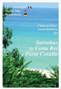
Wandelkaart A15 Sarrabus da Costa Rei a Porto Corallo | Abies

0
Sarrabus is a territory that is not known by everybody yet. Here lies its charm and this has made possible to keep this environmental area out of big building speculations and also out of history. In fact it preserves little traces of the past, and paradoxically the remains from the prehistoric age are more meaningful than those back to more recent...

Webshops met dit product

Webshop
Bezorging
Prijs

Anderen bekeken ook

Wandelkaart A15 Sarrabus da Costa Rei a Porto Corallo | Abies
Sarrabus is a territory that is not known by everybody yet. Here lies its charm and this has made possible to keep this environmental area out of big building speculations and also out of history. In fact it preserves little traces of the past, and paradoxically the remains from the prehistoric age are more meaningful than those back to more recent times. We can find traces from the most remote past not far from the State Road SS125, that from Muravera goes to Costa Rei, by visiting the nuraghe Murtas, the nuraghe S’Aqua Secis and the megalithic complexes of Scalas and Cuili Piras. They are about ten menhirs, almost fully intact, arranged in groups and fixed in the ground in the original orthostatic position. They have been put in relation with the position of the sun and the moon, at dawn and at sunset. In fact they were used as a very precise astronomic calendar but also for religious purposes since they represented both the masculine divinity and the fertility according to the worsh…
12,95
Wandelkaart Tour & Trail Costa de Sol - Axarquia | Discovery Walking G
Goede wandelkaart van de omgeving Nerja - Competa in het binnenland. For better adventures, use the best map. Costa del Sol (Axarquia) Tour & Trail Super-Durable Map comes with a 2 year adventurous use wear and tear guarantee against splitting or falling apart, see Discovery Walking Guides website for details. From 1 April 2020 a free Custom Map digital edition for Garmin users is available to download from the Discovery Walking Guides website.   Our large 1:40,000 scale, combined with splitting the region into West and East sections with a generous overlap, produces double sided map whose total size is 840mm by 700mm that folds to a pocketable 240mm by 120mm. Costa del Sol (Axarquia) covers the region from Ventas de Zafarraya in the North-West to Almunecar in the South-East; approx 3 42'W to 4 08'W and 36 43'N to 36 58'N. You get the most detailed map of the region that is produced including our 'Tour & Trail' level of detail ranging from major roads to secondary roads to minor roa…
15,95
Fietskaart 10 Cycling guides North York Moors | Goldeneye
Scheur- en watervast foetskaart van de North York Moors  met ingetekende fietsroutes.   Our maps are double-sided, printed on an A2 sheet with a concertina fold. This allows for easy folding and folding, and an ease of access to the mapping. The material is rain and tear-resistant. Our early maps were designed at the scale of 2 miles to 1 inch/1:126,720. The later designs along with digitalisation are 1: 100,000. We were encouraged by the Cycle Touring Club to convert our cartography toward the cycle market (to replace the out-of-print Bartholomew series). As time and the series progressed we have added more data: The National Cycle Network routes, Regional Routes, and Traffic-Free Family Routes, as and when they are developed. These routes are in addition to the Circular Routes Goldeneye Commissioned at the outset of our publishing schedule. We are also adding to new editions; bike shops, cycle hire, and tea rooms, along with the tourist attractions already featured. Our plan is to ma…
14,95
Wandelkaart A06 Siniscola | Abies
Siniscola area at 1:25,000 in a series of contoured maps from Ed. Abies. Overprint highlights campsites and agriturismo accommodation, climbing sites, wild sheep and bird watching sites and archaeological remains. This title has no UTM grid. Main series at 1:60,000 (Nos. 1 to 12) The maps have contours at 100m intervals and colouring for woodlands and maquis shrubland. Local trails are highlighted, with additional overprint for selected hiking, mountain bike and kayaking routes listed on the reverse of the maps with brief notes and grading for the degree of difficulty. All the maps have a UTM grid for GPS users. Very extensive range of symbols highlight numerous places of interest and tourist facilities, including campsites and caravan parks, beaches, sport and recreational sites, archaeological remains and nuraghi, etc. The maps also indicate places where typical local products can be purchased. On the reverse each title has descriptions of its main places of interest, beaches, etc.…
12,95
Wandelkaart 304 Sifnos | Terrain maps
Erg goede wandelkaart van Sifnos, weerbestendig en volledig. Bezienswaardigheden, campings en andere praktische zaken staan op de kaart aangegeven. GPS toepasbaar. This is a great map of Sifnos because: It is waterproof and rip-proof. You can fold and unfold it a thousand times, fold it in irregular ways, dunk it in the sea or leave it out in the rain. This map is indestructible!  It features more trails than any other map of Sifnos on the market. For example, take a look at the area between Apollonia and Kastro, which is where most visitors choose to hike. The trail from Plakoto and the chapel of Aghia Anastasia to Kastro, the trail ascending to Exambela and the branch leading to Apollonia, the trail to Kato Petali, the trail from Aghios Loukas to Kastro and so many more, appear on a map of Sifnos for the first time – in fact, the length of all trails is measured in kilometers so you can estimate the duration of your hike. Also, unlike other hiking maps, SKAI maps do not depict any …
11,95
Fietskaart 01 Cycling guides Cornwall | Goldeneye
Our maps are double-sided, printed on an A2 sheet with a concertina fold. This allows for easy folding and folding, and an ease of access to the mapping. The material is rain and tear-resistant. Our early maps were designed at the scale of 2 miles to 1 inch/1:126,720. The later designs along with digitalisation are 1: 100,000. We were encouraged by the Cycle Touring Club to convert our cartography toward the cycle market (to replace the out-of-print Bartholomew series). As time and the series progressed we have added more data: The National Cycle Network routes, Regional Routes, and Traffic-Free Family Routes, as and when they are developed. These routes are in addition to the Circular Routes Goldeneye Commissioned at the outset of our publishing schedule. We are also adding to new editions; bike shops, cycle hire, and tea rooms, along with the tourist attractions already featured. Our plan is to make available digital versions for cell phones and tablets and to update, on an annual ba…
15,95
Wandelkaart 304 Sifnos | Terrain maps
Erg goede wandelkaart van Sifnos, weerbestendig en volledig. Bezienswaardigheden, campings en andere praktische zaken staan op de kaart aangegeven. GPS toepasbaar. This is a great map of Sifnos because: It is waterproof and rip-proof. You can fold and unfold it a thousand times, fold it in irregular ways, dunk it in the sea or leave it out in the rain. This map is indestructible!  It features more trails than any other map of Sifnos on the market. For example, take a look at the area between Apollonia and Kastro, which is where most visitors choose to hike. The trail from Plakoto and the chapel of Aghia Anastasia to Kastro, the trail ascending to Exambela and the branch leading to Apollonia, the trail to Kato Petali, the trail from Aghios Loukas to Kastro and so many more, appear on a map of Sifnos for the first time – in fact, the length of all trails is measured in kilometers so you can estimate the duration of your hike. Also, unlike other hiking maps, SKAI maps do not depict any …
11,95

Klanten-reviews van Wandelkaart A15 Sarrabus da Costa Rei a Porto Corallo | Abies

Er zijn nog geen beoordelingen voor dit productBen jij de eerste die een review plaatst?

Meer over Wandelkaart A15 Sarrabus da Costa Rei a Porto Corallo | Abies

Productomschrijving

Sarrabus is a territory that is not known by everybody yet. Here lies its charm and this has made possible to keep this environmental area out of big building speculations and also out of history. In fact it preserves little traces of the past, and paradoxically the remains from the prehistoric age are more meaningful than those back to more recent times. We can find traces from the most remote past not far from the State Road SS125, that from Muravera goes to Costa Rei, by visiting the nuraghe Murtas, the nuraghe S’Aqua Secis and the megalithic complexes of Scalas and Cuili Piras. They are about ten menhirs, almost fully intact, arranged in groups and fixed in the ground in the original orthostatic position. They have been put in relation with the position of the sun and the moon, at dawn and at sunset. In fact they were used as a very precise astronomic calendar but also for religious purposes since they represented both the masculine divinity and the fertility according to the worship of the proto-Sardinian populations. At  200 meters of distance from the beach of Costa Rei  we can also visit the complex of Piscina Rei, back to 5000 years ago. Its peculiarity is the presence of a block of granite that was used with the function of an altar for sacrifices, since it has a cavity apt to contain liquids. Going back to the north, to St. Vito, adjacent to the State Road  and well indicated by signs, we can see the nuraghe Asoru, characterized by a trilobate structure. There are many more remains from the Proto-Sardinian age but their value has  not been exploited yet , neither they have been arranged in a such a way so as to be reached easily by visitors. The remains from the Roman and the medieval ages are on the contrary just a few, since these territories were abandoned because of the continuous Islamic and piratical raids. This is witnessed by some sentinel towers that were built between the 14th and 17th cent., that is, from north to south, the tower of Monti Ferru, the tower Salinas, the one of the Ten Horses and that of Porto Corallo. The coast of Sardinia on a series of contoured, GPS compatible maps at 1:60,000 from Ed. Abies with extensive tourist information including special recreational routes, plus additional coverage at more detailed scales of selected popular areas. Main series at 1:60,000 (Nos. 1 to 12) The maps have contours at 100m intervals and colouring for woodlands and maquis shrubland. Local trails are highlighted, with additional overprint for selected hiking, mountain bike and kayaking routes listed on the reverse of the maps with brief notes and grading for the degree of difficulty. All the maps have a UTM grid for GPS users. Very extensive range of symbols highlight numerous places of interest and tourist facilities, including campsites and caravan parks, beaches, sport and recreational sites, archaeological remains and nuraghi, etc. The maps also indicate places where typical local products can be purchased. On the reverse each title has descriptions of its main places of interest, beaches, etc. More detailed maps at 1:25,000/1:30,000 (Nos. 3A to 12A) Contour interval is 25m, plus colouring for vegetation. Local trails are marked but unless indicated in the individual description, special routes are not included. Tourist overprint is also less extensive than on the 1:60,000 maps. Most titles have GPS coordinates. On the reverse are extensive notes describing the area. For more details see individual descriptions.  Map legend and additional text on all the maps includes English.
Productspecificaties

Artikelnummer(s)
Brand
Abies
Webshop.nl maakt gebruik van cookies. Ga je verder op onze website, ga dan akkoord met het plaatsen van cookies en de verwerking van deze data door ons en vermelde partners.