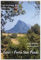
Wandelkaart A03 Loiri - Porto San Paolo | Abies

0
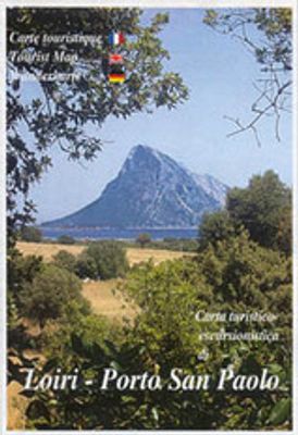
Mooie wandelkaart van het noord oostelijk deel van Sardinië, onder Olbia. The Commune of Loiri - Porto San Paolo has a very particular conformation. Its area, in fact, stretches in a very distinctive way between coast and hinterland. The village of Loiri has developed around a small enclosure of shepherds even if this area was continuously inhabit...

Verkopers met dit product

Webshop
Bezorging
Prijs
DeZwerver.nl logo
DeZwerver.nl
niet bekend
12,95

Anderen bekeken ook

Wandelkaart A15 Sarrabus da Costa Rei a Porto Corallo | Abies
Sarrabus is a territory that is not known by everybody yet. Here lies its charm and this has made possible to keep this environmental area out of big building speculations and also out of history. In fact it preserves little traces of the past, and paradoxically the remains from the prehistoric age are more meaningful than those back to more recent times. We can find traces from the most remote past not far from the State Road SS125, that from Muravera goes to Costa Rei, by visiting the nuraghe Murtas, the nuraghe S’Aqua Secis and the megalithic complexes of Scalas and Cuili Piras. They are about ten menhirs, almost fully intact, arranged in groups and fixed in the ground in the original orthostatic position. They have been put in relation with the position of the sun and the moon, at dawn and at sunset. In fact they were used as a very precise astronomic calendar but also for religious purposes since they represented both the masculine divinity and the fertility according to the wors…
12,95
Fietskaart 01 Cycling guides Cornwall | Goldeneye
Our maps are double-sided, printed on an A2 sheet with a concertina fold. This allows for easy folding and folding, and an ease of access to the mapping. The material is rain and tear-resistant. Our early maps were designed at the scale of 2 miles to 1 inch/1:126,720. The later designs along with digitalisation are 1: 100,000. We were encouraged by the Cycle Touring Club to convert our cartography toward the cycle market (to replace the out-of-print Bartholomew series). As time and the series progressed we have added more data: The National Cycle Network routes, Regional Routes, and Traffic-Free Family Routes, as and when they are developed. These routes are in addition to the Circular Routes Goldeneye Commissioned at the outset of our publishing schedule. We are also adding to new editions; bike shops, cycle hire, and tea rooms, along with the tourist attractions already featured. Our plan is to make available digital versions for cell phones and tablets and to update, on an annual b…
15,95
Fietskaart Cycling guides Exmoor - North Devon | Goldeneye
Scheur- en watervast foetskaart van Exmoor en Noord Devon met ingetekende fietsroutes.   Our maps are double-sided, printed on an A2 sheet with a concertina fold. This allows for easy folding and folding, and an ease of access to the mapping. The material is rain and tear-resistant. Our early maps were designed at the scale of 2 miles to 1 inch/1:126,720. The later designs along with digitalisation are 1: 100,000. We were encouraged by the Cycle Touring Club to convert our cartography toward the cycle market (to replace the out-of-print Bartholomew series). As time and the series progressed we have added more data: The National Cycle Network routes, Regional Routes, and Traffic-Free Family Routes, as and when they are developed. These routes are in addition to the Circular Routes Goldeneye Commissioned at the outset of our publishing schedule. We are also adding to new editions; bike shops, cycle hire, and tea rooms, along with the tourist attractions already featured. Our plan is to …
12,95
Natuurgids - Reisgids Crossbill Guides Southern Morocco - Zuid Marokko | KNNV Uitgeverij
Zeer gedegen natuurgids van het betreffende gebied. Unieke gids met streekinformatie, plekken waar je echt  moet zijn, routes en veel achtergrondinformatie over het landschap, de ecologie, ontstaansgeschiedenis en de flora en fauna. De routes en plekken die beschreven worden in de gids zijn zo gekozen dat je een heel compleet beeld krijgt van het gebied: landschappelijk, flora en fauna ... alle toppers van de streek zijn goed te vinden. Echt een aanrader voor elke natuurliefhebbers die zich wat meer in het gebied wil verdiepen.   This nature travel guidebook to Southern Morocco contains routes and background info on landscape, flora and fauna.   Landscape history Ecosystems Geology Flora and Fauna Where to watch birds Finding mammals, reptiles, butterflies, dragonflies and wildflowers 25 detailed routes with tips for finding wildlife and 29 site descriptions   Region covered by this Crossbill Guide The Crossbill Guide Southern Morocco covers the part of Morocco that lies ro…
29,95
Wandelkaart A06 Siniscola | Abies
Siniscola area at 1:25,000 in a series of contoured maps from Ed. Abies. Overprint highlights campsites and agriturismo accommodation, climbing sites, wild sheep and bird watching sites and archaeological remains. This title has no UTM grid. Main series at 1:60,000 (Nos. 1 to 12) The maps have contours at 100m intervals and colouring for woodlands and maquis shrubland. Local trails are highlighted, with additional overprint for selected hiking, mountain bike and kayaking routes listed on the reverse of the maps with brief notes and grading for the degree of difficulty. All the maps have a UTM grid for GPS users. Very extensive range of symbols highlight numerous places of interest and tourist facilities, including campsites and caravan parks, beaches, sport and recreational sites, archaeological remains and nuraghi, etc. The maps also indicate places where typical local products can be purchased. On the reverse each title has descriptions of its main places of interest, beaches, etc…
12,95
Wandelgids National Parks: Pembrokeshire | Northern Eye Books
This superbly-written and good looking book will take you on ten short circular walks to the very best stretches of coast, pubs, tea shops, and viewpoints that the beautiful Pembrokeshire coast, in West Wales, has to offer.   Defining the south-westernmost tip of Wales, Pembrokeshire’s coastline is arguably the most beautiful and varied in the British Isles. Virtually all of it lies within the Pembrokeshire Coast National Park. Relative isolation has left it largely untouched by modern development and most of its length is a wild frontier where the endless confrontation between sea and land is played out. Long stretches of coast face the fury of Atlantic storms and weakness and faults in the high cliffs are eroded into caves, coves and inlets. However, the harder rock, some of which is 700 million years old, resists the onslaught and stands out in rugged promontories and headlands.   Elsewhere, sheltered landings and harbours, fine beaches and secluded bays reveal other aspects of thi…
10,95
Fietskaart 09 Cycling guides Norfolk | Goldeneye
Norfolk is the fourth largest county in England and one of the most rural. It is also one of the flattest and our circular routes have been chosen to explore the quiet lanes linking the isolated and picturesque villages and places of interest. This is ideal cycling territory and fortunately, the Norfolk County Council (and its District Councils) are seriously committed in providing and developing cycling routes and in promoting a cycling culture that is sustainable and family friendly. Some of their routes are illustrated, hitherto.   The County has been described as flat (rather gentle undulations) and does not in fact rise much over 300 feet, but it offers great scenic interest; the dark forests of Breckland, the rolling chalk lands of the northwest, the unique watery patch of the Broads, and a coastline of great variety. Ancient churches and picturesque villages are there in abundance, the latter often decorated with the attractive signs designed by Harry Carter in the 1950’s.   Re…
14,95
Wandelgids Walk! Costa del Sol: Axarquia | Discovery Walking Guides
Goede wandelgids van een uitermate geschikt wandelgebied aan de Costa del Sol: het binnenland boven Nerja rond Competa en andere bergdorpen. De beschrijvingen zijn prima, zo ook de praktische informatie en de kaarten. We celebrate a Costa del Sol that does not correspond to the cliches, a Costa del Sol that is all right rather than all wrong, a playground of green valleys and gilded mountain tops, a hidden idyll unknown to most visitors, a haven for dedicated walkers and adventurous tourists alike, a place in which every nook is graced with some gratifying discovery and every outing is a great adventure. The majority of walks are aimed at the adventurous leisure walker, people who will on the whole have some experience of hiking in mountains, are happy to invest a certain amount of effort for a corresponding reward. Covering the best preserved stretch of coastline, the prettiest villages, and most spectacular mountains, Walk! Costa del Sol explores the Axarquia region east of Malaga, …
18,50
Wegenkaart - landkaart Cordillera Cantabrica - Asturias y provincias limitrofes | Adrados Ediciones
Gedetailleerde wegenkaart an de Cordillera Cantabrica met hoogtelijnen, hoogte verschillen in kleur en schaduw en UTM coördinaten. Met plaatsnamen index! Cordillera Cantabrica on a detailed road map from the Oviedo based Adrados Ediciones, presenting this mountainous region with contours at 100m intervals, altitude coluring, relief shading and UTM coordinates. Since the publishers specialize in detailed hiking maps, including the best coverage of the Picos de Europa, the map includes an exceptionally large number of names of peaks, passes, etc. Symbols highlight best rock and ice climbing areas, huts and refuges, campsites, mountain rescue posts and information centres. Along the coast numerous beaches are named. Road network includes small country roads and tracks. Local railway lines are shown, although not very easy to see on the base map filled with so much information. The map has a 10km UTM grid. Map legend is in Spanish only. On the reverse is a panorama drawing of the area, lo…
14,95
Wandelgids Coast to Coast Walk - van Ierse Zee tot Noordzee | Aurum Press
Goede gids over dit inmiddels beroemde pad. Kaartmateriaal is perfect, alsmede achtergrondinformatie. Praktische info wat minder, maar die is op de ramblerssite op internet te vinden! The Coast to Coast Walk is unique among Britain's long-distance footpaths in that it was the invention of one man, the legendary Alfred Wainwright, and enjoys no official status like, for example, the National trails in England and Wales. Nevertheless, it has become one of Britain's most popular long-distance walks, which is hardly surprising as it traverses some of the finest walking territory in the country. Starting at St Bees on the Cumbrian coast, the route runs for 192 miles (307 km) to Robin Hood's Bay on the North Sea and lies, for the most part, within the boundaries of three of Britain's loveliest National Parks - the Lake District, the Yorkshire Dales and the North York Moors. As well as the main route there are also alternatives available at several points. Martin Wainwright's description of …
20,95

Klanten-reviews van Wandelkaart A03 Loiri - Porto San Paolo | Abies

Er zijn nog geen beoordelingen voor dit productBen jij de eerste die een review plaatst?

Meer over Wandelkaart A03 Loiri - Porto San Paolo | Abies

Productomschrijving

Mooie wandelkaart van het noord oostelijk deel van Sardinië, onder Olbia.

The Commune of Loiri - Porto San Paolo has a very particular conformation. Its area, in fact, stretches in a very distinctive way between coast and hinterland. The village of Loiri has developed around a small enclosure of shepherds even if this area was continuously inhabited during the Nuraghe period and in the Punic-Roman age. On the mountain of Loiri, at a height of 500m. it is still possible to catch a glimpse of some ruins that go back to the Nuraghe period… The landscape of the coast is as impressive as the one of the hinterland: a series of deep long creeks with beaches of white sand and pine-woods behind the dunes, an ever transparent green emerald-coloured sea. The grand massive structure of the Tavolara island dominates this landscape, with its mountain of snow-white rock emerging out of the sea at a height of almost 600 meters…

Verken gerelateerde categorieën

Webshop.nl maakt gebruik van cookies. Ga je verder op onze website, ga dan akkoord met het plaatsen van cookies en de verwerking van deze data door ons en vermelde partners.