Wandelkaart 6.11 Mt. Olympus | Anavasi
Snel naar
- Prijzen
PrijzenProductomschrijving
Snel naar
PrijzenProductomschrijving
Uitstekende topografische kaarten van een deel van Griekenland: zonder meer hele goede kaarten voor wandeltochten in een onbekend stuk Griekenland! Ze zijn gedrukt op scheurvast en watervast papier op een schaal van
1:25.000 met een UTM grid voor GPS gebruikers.
Op de meeste kaarten is geven de hoogtelijnen een interval van 20m. aan. Met schaduwkleuren, punten met hoogtemeters, bronnen, riviertjes en landgebruik geven ze de topografie van het land goed weer.
Lokale voetpaden, herbergen en berghutten zijn duidelijk weergegeven. De wegen zijn in gradaties getekend: verhard en onverhard, groot en klein, met afstanden en benzinepompen.
Toeristische bezienswaardigheden als kloosters, grotten, kerken etc staan ingetekend. Achterop de kaart worden suggesties gegeven voor wandelroutes met wandeltijd in uren.
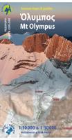
Hiking map to mount Olympus in a scale 1:30 000 and summit Mitikas in a scale of 1:10 000 Mount Olympus is the highest mountain in Greece with an altitude of 2917m, and in ancient times it was considered worthy to be the house of the Gods. Olympus (or Olibos, Olympe, Olympos, Olimbos, Olymp) is a rock tower shaped by wind and rain directly of the seashore, its unique geography is perhaps the reason for the diversified and endemic flora. Inspired by its unique nature, we made a unique map for mount Olympus. A map like no other: one side covers the whole mountain in scale 1:30 000 giving an overview of all the paths crossing the mountain and all access points. The other side is a 1:10 000 close-up to the summits and advanced refuges. This new and updated edition is by far the most comprehensive map of the renowed mythic mountain. It covers the entire massif in great detail (20m contours, all the paths, springs, refuges etc). On the reverse side there are detailed information about the footpaths with their waymarking and the course of E4 and O2 and info about all the refuges. On this new edition of Olympus map find suggested mountain ski routes by Lazaros Botellis.