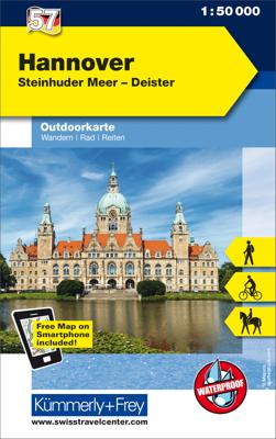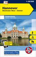
Wandelkaart 57 Outdoorkarte Hannover | Kümmerly & Frey

0
Wandelkaart met ingetekende routes.   The Kümmerly+Frey outdoor maps help your with your planning. And once your have arrived at your holiday destination they double up as silent tour guides: attractive map image, comprehensive regional coverage (a map for each holiday region), contents featuring interesting tourist information such as important w...

Verkopers met dit product

Webshop
Bezorging
Prijs
DeZwerver.nl logo
DeZwerver.nl
2,95
13,50

Anderen bekeken ook

Nieuw
Wandelkaart 50 Outdoorkarte Hochspessart | Kümmerly & Frey
Wandelkaart met ingetekende routes.   The Kümmerly+Frey outdoor maps help your with your planning. And once your have arrived at your holiday destination they double up as silent tour guides: attractive map image, comprehensive regional coverage (a map for each holiday region), contents featuring interesting tourist information such as important walking paths, mountain huts and tourist attractions. Scale: 1:50 000. Water and rip-proof map.   Dorpen: Hösbach, Aschaffenburg, Weibersbrunn, Geiersberg, Main, Rothenfels, Heimbuchenthal, Obernburg, Klingenberg, Schollbrunn, Marktheidenfeld, Wertheim, Miltenberg, Bronnbach
13,50
Nieuw
Wandelkaart 60 Outdoorkarte Hohe Mark, Münsterland West | Kümmerly & Frey
Wandelkaart met ingetekende routes.   The Kümmerly+Frey outdoor maps help your with your planning. And once your have arrived at your holiday destination they double up as silent tour guides: attractive map image, comprehensive regional coverage (a map for each holiday region), contents featuring interesting tourist information such as important walking paths, mountain huts and tourist attractions. Scale: 1:50 000. Water and rip-proof map.   Dorpen:Ahaus, Vreden, Legden, Altenberge, Baumberge, Coesfeld, Gescher, Münster, Dülmen, Borken, Rasefeld, Haltern am See, Lippe, Lüdingshausen, Dortmund-Ems-Kanal, Marl, Dorsten, Recklingshausen, Lünen
13,50
Wandelkaart 11 Outdoorkarte Fehmarn - Holsteinische Küste | Kümmerly & Frey
Hele goede wandelkaart met alle noodzakelijke topografische details, hoogtelijnen, ingetekende wandelroutes en hutten, mountainbikeroutes en fietsroutes - de kaart is geplastificeerd.   De vakantie-kaarten van Kümmerly + Frey zijn de ideale hulp bij het voorbereiden van uw vakantie. En ter plekke overtreffen ze elke plaatselijke gids: aantrekkelijke, beeldende kaarten, uitgebreide regionale dekking (een kaart voor elke regio) en informatieve toeristische inhoud, zoals belangrijk wandelpaden, berghutten en monumenten.   Dorpen, Bergen en dalen: Neustadt in Holstein, Scharbeutz, Timmendorfer Strand, Fehmarn, Fehmarnsund, Oldenburg, Heiligenhafen, Lütjenburg, Plön, Eutin, Malente, Gromitz, Dahme, Holsteinische Schweiz
13,50
Nieuw
Wandelkaart 1 Outdoorkarte AT Bregenzerwald | Kümmerly & Frey
Hele goede wandelkaart met alle noodzakelijke topografische details, hoogtelijnen, ingetekende wandelroutes en hutten, mountainbikeroutes en fietsroutes - de kaart is geplastificeerd.   De vakantie-kaarten van Kümmerly + Frey zijn de ideale hulp bij het voorbereiden van uw vakantie. En ter plekke  overtreffen ze elke plaatselijke gids: aantrekkelijke, beeldende kaarten, uitgebreide regionale dekking (een kaart voor elke regio) en informatieve toeristische inhoud, zoals belangrijk wandelpaden, berghutten en monumenten.   Dorpen, Bergen en dalen: Hard, Bregenz, Balderschwang, Müselbach, Lustenau, Dornbir, Schwarzenberg, Bregenzerwald, Schönenbach, Hohenems, Götzis, Bregenzerach, Schoppernau, Hoher Freschen, Rankweil, Feldkirch, Furkajoch, Fontanella, Nenzing, Rote Wand
13,50
Wandelkaart - Topografische kaart 179 OS Explorer Map Gloucester, Cheltenham, Stroud | Ordnance Survey
The essential map for outdoor activities in Gloucester, Cheltenham and Stroud. The OS Explorer Map is the Ordnance Survey's most detailed folding map and is recommended for anyone enjoying outdoor activities including walking, horse riding and off-road cycling. This map now comes with a digital version which you can download to your smartphone or tablet.Providing complete GB coverage, the OS Explorer map series details information essential in the great outdoors, including youth hostels, pubs and visitor information. Rights of way, fences, permissive paths and bridleways are clearly shown, ensuring you have the best information to get the most out of your time in the countryside. FeaturesCotswold Way Severn Way Gloucestershire Way Macmillan Way Wysis WayCotswold Way (National Trail) GloucesterCheltenhamGloucester Stroud1:25 000 scale (4 cm to 1 km - 2.5 inches to 1 mile) Met zijn 4cm voor 1 km (2 ½ cm voor 1 mijl) schaal, is de OS Explorer kaartenserie de ideale en meest gedetailleerd…
19,50
Wandelkaart - Topografische kaart 181 OS Explorer Map Chiltern Hills North | Ordnance Survey
The essential map for outdoor activities in Chiltern Hills North. The OS Explorer Map is the Ordnance Survey's most detailed folding map and is recommended for anyone enjoying outdoor activities including walking, horse riding and off-road cycling. This map now comes with a digital version which you can download to your smartphone or tablet.Providing complete GB coverage, the OS Explorer map series details information essential in the great outdoors, including youth hostels, pubs and visitor information. Rights of way, fences, permissive paths and bridleways are clearly shown, ensuring you have the best information to get the most out of your time in the countryside. FeaturesIcknield Way RidgewayNorth Buckinghamshire Way Icknield Way PathSwan's Way Two Ridges Link Aylesbury RingSouth Bucks Way Chess Valley Walk Chiltern Link Thame Valley WalkGrand Union Canal Walk Midshires Way Bledlow Circular Ride Hertfordshire Way Chiltern WayRidgeway (National Trail) Bedfordshire Buckinghamshire H…
19,50
Wandelkaart Tour & Trail Lanzarote | Discovery Walking Guides
De Lanzarote Tour & Trail Super-Durable wandelkaart (4de editie) beslaat dit grote eiland op een schaal van 1: 40.000 wat resulteert in de meest gedetailleerde en sterkste kaart van Lanzarote die u kunt kopen.   For your best adventures, use the best map. Water-proof, split-proof, tear-proof, adventure-proof. Lanzarote Tour & Trail Super-Durable Map is simply the toughest, most accurate, easy to read, easy to use multipurpose map that you can get. A large 960mm by 694mm double sided map sheet covers Lanzarote and its neighbouring island La Graciosa at 1:40,000 scale. A generous overlap and an extra mini-map reduce the need of turning the map in use. Whether you plan to walk, or discover the island by car or the bus, this is the map for you. New for the 6th edition is a summary of Lanzarote bus system, with overview of bus lines and actual bus routes highlighted in the map. Also new is a summary and a mini-guide to main tourist attractions of Lanzarote, with tips for a successful…
18,95
Wandelkaart 15 Lausanne - Vallée de Joux | Kümmerly & Frey
Zeer duidelijke wandelkaart van een deel van Zwitserland. Deze kaart - gemaakt op scheur en watervast papier - is bedoeld voor de gewone en gemiddelde bergwandelaar. Ook voor huttentochten is deze zeker geschikt. Slechts voor de gevorderde wandelaar die glesjers gaat overschrijden zijn de 25.000 topografische kaarten aan te raden. Op deze 1:60.000 kaarten staan de wandelroutes in 3 soorten weergegeven: Wanderweg, Bergweg en Alpine route. De routes staan goed ingetekend en werken prima naast de vele markingen in het veld. Hoogteverschillen, overnachtingsmogelijkheden, bus routes en gps-informatie ontbreken allemaal niet op deze landkaarten.   The maps have contours at 50m or 25m intervals according to the terrain, enhanced by graphic relief and shading. An overprint distinguishes between sign-posted hiking paths, mountain path where proper walking shoes are necessary, and alpine paths requiring special equipment.   Mountain huts are marked, plus various types of accommodation: campsite…
22,50
Nieuw
Wandelkaart G1 Samos | Freytag & Berndt
Introducing the Samos Hiking and Leisure Map – your essential guide to exploring the stunning landscapes of Samos Island.   Discover detailed information on hiking trails across Samos, allowing you to plan your adventures with ease and learn about key attractions along the way.   Samos beckons hikers with its captivating diversity – from towering peaks like Mount Kerkis and deep gorges such as Kakoperato Gorge, to remote forests waiting to be explored. This Mediterranean hiking paradise boasts picturesque villages, hidden monasteries, ancient city walls, and medieval fortresses.   Key Features of the Samos Hiking and Leisure Map:   Scale 1:35,000 Extensive network of hiking trails Tourist information highlights Includes the Rother App for digital map access Waterproof and tear-resistant Dimensions: 99 x 61 cm Explore confidently with the linked free version of the Rother App, offering a digital map of Samos' complete hiking network and sample tours (free registration required).   Desi…
14,95
Reisgids Japan | Marco Polo
Handige en overzichtelijke, kleine reisgids voor een eerste kennismaking met de vakantiebestemming. Globale uitklapkaart achterin, makkelijk binnenzakformaat. Let Marco Polo Japan guide you around this beautiful country. Explore Japan with this handy, pocket-sized, authoritative guide, packed with Insider Tips. Discover boutique hotels, authentic restaurants, the country's trendiest places, and get tips on shopping and what to do on a limited budget. There are plenty of ideas for travel with kids, and a summary of all the festivals and events that take place in Japan. Let Marco Polo show you all this exotic country has to offer.From the sprawling metropolis of Tokyo to the tropical beaches of Okinawa, Marco Polo Japan introduces you to this unique travel destination. Discover the many highlights of Japan including Mount Fuji at sunrise, the famous Geisha District and the Hiroshima Peace Memorial Park as well as temples and shrines, bustling harbour towns and traditional, landscaped ga…
13,95

Klanten-reviews van Wandelkaart 57 Outdoorkarte Hannover | Kümmerly & Frey

Er zijn nog geen beoordelingen voor dit productBen jij de eerste die een review plaatst?

Meer over Wandelkaart 57 Outdoorkarte Hannover | Kümmerly & Frey

Productomschrijving

Wandelkaart met ingetekende routes.   The Kümmerly+Frey outdoor maps help your with your planning. And once your have arrived at your holiday destination they double up as silent tour guides: attractive map image, comprehensive regional coverage (a map for each holiday region), contents featuring interesting tourist information such as important walking paths, mountain huts and tourist attractions. Scale: 1:50 000. Water and rip-proof map.   Dorpen: Nienburg, Stolzenau, Neustadt, Weser, Steinhuder Meer, Leine, Wunstorf, Garbsen, Langenhagen, Hannover, Mittellandkanal, Stadthagen, Barsinghausen, Pattensen, Springe, Hessisch Oldendorf, Bückeburg

Verken gerelateerde categorieën

Webshop.nl maakt gebruik van cookies. Ga je verder op onze website, ga dan akkoord met het plaatsen van cookies en de verwerking van deze data door ons en vermelde partners.