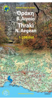
Wandelkaart 5 Thraki-Aegan Noord anavasi - Thraki Aegan North | Anavasi

0
The Thraki-North Aegean map guides us to areas of Greece with a rich history and important ecosystems. On the one side, Eastern Macedonia & Thrace where Ancient, Byzantine and Ottoman monuments coexist with the virgin forests of the Rhodope mountains, precious wetlands and the birds of prey sanctuary of Dadia. On the other side, the islands of the...

Verkopers met dit product

Webshop
Bezorging
Prijs
DeZwerver.nl logo
DeZwerver.nl
niet bekend
11,95

Anderen bekeken ook

Reisgids Northern Greece - Noord Griekenland | Bradt Travel Guides
Voor vele landen net zo goed, zo niet beter dan de Planet. Beduidend soberder uitgevoerd, maar ook met veel informatie voor backpackers en met veel kaartmateriaal. Een aanrader! This new guide to Northern Greece, written by Greece expert and long-time travel writer Dana Facaros, is the only guide available to the region and includes the areas of Epirus, Thessaly, Macedonia and Thrace, complete with their five dramatically beautiful national parks, the country's highest peaks and mountain lakes, rushing rivers and the world's deepest gorge, and (this is Greece, after all) long sandy beaches. Sections on background and practical information are followed by an easy-to-follow breakdown of the area offering detailed coverage in 12 chapters, from Greece's second city, Thessaloníki, to Chalkidikí, Central Macedonia, Eastern Macedonia, Thrace, Western Macedonia, Epirus (including Ioánnina), Thessaly and Magnesía, the Pelion Peninsula and the Islands, plus a short chapter on Athens, the gatewa…
22,50
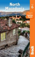
Reisgids North Macedonia - Noord-Macedonië | Bradt Travel Guides
Voor vele landen net zo goed, zo niet beter dan de Planet. Beduidend soberder uitgevoerd, maar ook met veel informatie voor backpackers en met veel kaartmateriaal. Een aanrader! Engelstalig Bradt's North Macedonia remains the only standalone English-language guidebook to this increasingly popular destination available outside the country. Originally written by Thammy Evans, a political analyst who lived there for five years, this new edition has been thoroughly updated and restructured to make it even easier to use by Philip Briggs, arguably the world's most experienced guidebook writer.   Coverage of national parks has been increased and hiking information has been fully integrated to make it more accessible to casual users. Introductions to many points of interest have been expanded to give more of an overview of what the attractions are and there are several new and redrawn maps.   Of all the new countries formed following the break-up of Yugoslavia in 1991, North Macedonia was the…
24,95
Nieuw
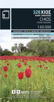
Wandelkaart 328 Chios - Hios | Terrain maps
Gedetailleerde wegenkaart en wandelkaart met alle kleine wegen, wandelpaden, hoogtelijnen en toeristische informatie aangegeven. Alle tekst is tweetalig in Engels en Grieks en de waterproof kaart is geschikt voor gebruik met GPS. THIS IS THE BEST MAP OF CHIOS, BECAUSE: • It is the only GIS map of Chios made with data collected 100% through field survey. • All major trails of Chios are shown, with distances measured in kilometers, so that you can estimate the duration of your hike. On the reverse side you‘ll find detailed descriptions of 3 of the island’s best hikes. These are also distinctly labeled on the map, so you can easily locate them. • It includes a map of the neighboring island of Inousses, showing all beaches. • It includes a detailed town plan of the island’s capital, in the scale of 1:4.000, with all sites of interest clearly indicated. • It shows more roads and hiking trails than any other map of Chios, with scenic routes marked in green. • It is printed on Polyart plasti…
11,95
Wegenkaart - landkaart North America - Noord Amerika | National Geographic
• Waterproof • Tear-Resistant • Reference Map   Expertly researched and designed, National Geographic's North America Flags & Facts Map is the authoritative map of North America by which other reference maps are measured. The map side includeds a political map showing countries, cities and other landmarks and a physical map shows the landforms such as mountain ranges and rivers.   Clearly defined boundaries, major cities, and physical features Hundreds of place names carefully placed to maintain legibility in heavily populated areas Includes North America and adjacent regions within Asia and South America Detailed physical map of North America with mountain ranges, plains, lakes, and rivers Flags and facts with detailed information about cultural and physcial attributes Printed in the U.S.A. on extremely durable, waterproof, and tear-resistant material This Reference Map is printed on durable synthetic paper, making it waterproof, tear-resistant and tough — capable of withstanding the…
17,50
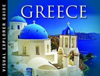
Fotoboek Greece - Griekenland | Amber Books
Presented in a landscape format and with captions explaining the story behind each entry, Greece is a stunning collection of images celebrating one of the world's most popular destinations. From antiquity to modernity, from the tallest mountains to the tiniest islands, from the Romans to the Venetians to the Ottomans, Greece is a beautiful photographic exploration of this fascinating country. Arranged by region, the book celebrates such classical highlights as Athens's Acropolis, the ruins at Mycenae in the Peloponnese, the Byzantine churches of Thessaloniki, and the ancient Temple at Delphi. It also explores the beauty of the islands of the Aegean and the Ionian Sea, the Zagori mountains in the northwest of the country, and the hydrothermal craters on Nisyros.
13,95
Nieuw
Wandelkaart 6 Mount Athos | Orama
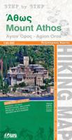
  Wandelkaart  van dit bijzondere stukje Griekenland: de berg Athos.   Mount Athos - Agion Oros (Greece) 1:60,000 Hiking Map, waterproof, GPS compatible, ORAMA Mount Athos is a mountain and peninsula in Macedonia, Greece. A World Heritage Site, it is home to 20 Eastern Orthodox monasteries and forms a self-governed monastic state within the sovereignty of Greece. Today, Greeks commonly refer to Mount Athos as the "Holy Mountain" ( Agion Oros).   This is a double sided, very detailed, topographic hiking map of the peninsula at 1:60,000. Relief colouring with spot heights and contours (20 m interval) indicate the terrain. Symbols mark churches, monasteries, archaeological sites, campsites, beaches, etc.   Reverse side features a simplified map of the southern end of the peninsula with hiking routes highlighted and described (in Greek and English).   Added is an index of villages. Place names are in both Greek and Latin script, multilingual legend includes English, printed on synthetic p…
10,25
Nieuw
Stadsplattegrond Hanoi & North Vietnam - Noord Vietnam | ITMB
Overzichtelijke stadsplattegrond met register, schaal 1:15700 en een kaart van  Noord Vietnam op schaal 1:920.000. Double-sided map with north Vietnam on one side and a street plan of Hanoi on the reverse. The road map at 1:920,000 shows the area’s road and rail networks and local airports. National parks, nature reserves, beaches and numerous places of interest are highlighted. Provincial boundaries are marked and names of administrative regions prominently shown. Topography is indicated by altitude colouring. Latitude and longitude lines are drawn at 30’ intervals. On the reverse is a street plan of Hanoi at 1:15,700 annotated with numerous places of interest, accommodation, and various facilities. An enlargement shows the Old Town at 1:10,000, and a further inset covers the city’s suburbs area at 1:920,000. Both the road map and the street plan are indexed. All place names are shown in the Roman alphabet but with scrupulous transliteration, since the map was prepared by a company w…
13,95
Reisverhaal Athos - the holy mountain | TPP
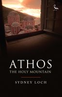
“It calls for a writer more able at words to picture the sheer beauty of the Mountain. To convey the altering feeling of morning, or high noon; of afternoon, and deep midnight; of the golden scores of stars puncturing the sky.”   Athos, the Holy Mountain of Greece, is one of the most mysterious places in the world. A rugged pyramid that rises up from the Aegean Sea, the mountain is wreathed in myth, legend and ancient traditions that, to this day, remain largely hidden from view. The heart of Athos started to beat at the dawn of Christianity and its community lays claim to being the oldest democracy in the world. An entirely autonomous region of the Hellenic Republic, it is home to twenty Eastern Orthodox monasteries that cling to its rocky flanks. No women are allowed to set foot upon the peninsula and the monks who inhabit this isolated place still use the Julian calendar, living on 'Byzantine Time', where each day starts at sunset. While living in the mountain's shadow, in Ouranopo…
16,95
Nieuw
Wandelkaart North York Moors | Harvey Maps
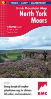
"I’ve enjoyed and endured tough and challenging walks throughout the North York Moors, and this tough, durable, detailed map is the ideal companion and guide." Paddy Dillon, outdoor writer.   Detailed map of the North York Moors on one sheet at 1:40,000 scale.   Includes the popular North Yorkshire Moors Railway and the Lyke Wake Walk.     North York Moors on one sheet: This map covers around 560 square miles of country - the only detailed map to cover this whole area on one sheet. It also includes the popular North Yorkshire Moors Railway and the Lyke Wake Walk. There are also map extensions to Guisborough and east towards Scarborough. Being part of the British Mountain Map series this map is printed on polyethylene - light, durable, tearproof and 100% waterproof. Colour shading is used for easy identification of hills and valleys.
29,95
Nieuw
Reisgids Experience Greece | Lonely Planet
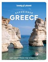
This latest edition of Lonely Planet's ExperienceGreece travel guide reveals exciting new ways to explore this iconic country with all the tools you need to create your own unique trip.   Discover amazing local experiences from hiking ancient trails up the thickly forested slopes of Mt Olympus, to swimming in the crystal waters that lap Naxos island's beaches, and touring volcanic vineyards to taste crisp asyrtiko white wines on Santorini.   Build a one-of-a-kind trip with Lonely Planet's ExperienceGreece travel guide:   Our Experience guidebook format is led by local experts who provide in-the-know tips so you can plan the ultimate 1-2 week adventure Easy-to-use regional and activity based itineraries help you get off-the-beaten-track and tailor a trip to your interests Insider scoop on the best festivals, secret hangouts, hidden locations, tantalising local food scene and photo-worthy views Vibrantphotography and maps including a pull out map of Athens Connect with local traditions …
26,50

Klanten-reviews van Wandelkaart 5 Thraki-Aegan Noord anavasi - Thraki Aegan North | Anavasi

Er zijn nog geen beoordelingen voor dit productBen jij de eerste die een review plaatst?

Meer over Wandelkaart 5 Thraki-Aegan Noord anavasi - Thraki Aegan North | Anavasi

Productomschrijving

The Thraki-North Aegean map guides us to areas of Greece with a rich history and important ecosystems. On the one side, Eastern Macedonia & Thrace where Ancient, Byzantine and Ottoman monuments coexist with the virgin forests of the Rhodope mountains, precious wetlands and the birds of prey sanctuary of Dadia. On the other side, the islands of the North Aegean, Thassos, Samothraki, Limnos, Lesvos, Chios and the smaller Ai Stratis and Psara complete the wonderful mosaic of nature and culture, as this NE edge of Greece has been through time a bridge between East and the West.  

Verken gerelateerde categorieën

Webshop.nl maakt gebruik van cookies. Ga je verder op onze website, ga dan akkoord met het plaatsen van cookies en de verwerking van deze data door ons en vermelde partners.