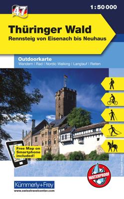
Wandelkaart 47 Outdoorkarte Thüringer Wald | Kümmerly & Frey

0
Wandelkaart met ingetekende routes.   The Kümmerly+Frey outdoor maps help your with your planning. And once your have arrived at your holiday destination they double up as silent tour guides: attractive map image, comprehensive regional coverage (a map for each holiday region), contents featuring interesting tourist information such as important w...

Verkopers met dit product

Verkoper
Bezorging
Prijs
DeZwerver.nl logo
DeZwerver.nl
2,95
13,50

Anderen bekeken ook

Nieuw
Wandelkaart 45 Outdoorkarte Teutoburger Wald | Kümmerly & Frey
Wandelkaart met ingetekende routes.   The Kümmerly+Frey outdoor maps help your with your planning. And once your have arrived at your holiday destination they double up as silent tour guides: attractive map image, comprehensive regional coverage (a map for each holiday region), contents featuring interesting tourist information such as important walking paths, mountain huts and tourist attractions. Scale: 1:50 000. Water and rip-proof map.   Dorpen: Ibbenbüren, Lotte, Osnabrück, Melle, Bad Iburg, Ladbergen, Dissen, Borgholzhausen, Werther, Versmold, Ostbeven, Herford, Bad Sulzfluen, Bielefeld, Gütersloh, Detmold, Externsteine, Schlangen, Paderbord, Bad Driburg
13,50
Nieuw
Wandelkaart 18 Outdoorkarte Elbsandsteingebirge | Kümmerly & Frey
Wandelkaart met ingetekende routes.   The Kümmerly+Frey outdoor maps help your with your planning. And once your have arrived at your holiday destination they double up as silent tour guides: attractive map image, comprehensive regional coverage (a map for each holiday region), contents featuring interesting tourist information such as important walking paths, mountain huts and tourist attractions. Scale: 1:50 000. Water and rip-proof map.   Dorpen en steden op de kaart Stolpen, Neustadt in Sachsen, Steinigtwolmsdorf, Lohmen, Bastei, Hohnstein, Sebnitz, Pirna, Elbe, Lilienstein, Könogstein, Berggießhübel, Bad Gottleuba, Rosenthal, Decin, Schmilka, Großer Winterberg, Kirnitzsch, Ruzova
13,50
Nieuw
Wandelkaart 58 Outdoorkarte Porta Westfalica | Kümmerly & Frey
Wandelkaart met ingetekende routes.   The Kümmerly+Frey outdoor maps help your with your planning. And once your have arrived at your holiday destination they double up as silent tour guides: attractive map image, comprehensive regional coverage (a map for each holiday region), contents featuring interesting tourist information such as important walking paths, mountain huts and tourist attractions. Scale: 1:50 000. Water and rip-proof map.   Dorpen: Bad Essen, Espelkamp, Petershagen, Minden, Bückeburg, Wiehengebirge, Bad Oeynhausen, Porta Westfalica, Löhne, Melle Bünde, Vlotho, Rinteln, Hameln, Herford, Bad Salzfluen, Lemgo, Oerlingshausen, Detmold, Bad Pyrmont
13,50
Nieuw
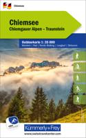
Wandelkaart 7 Outdoorkarte Chiemsee | Kümmerly & Frey
Wandelkaart met ingetekende routes.   The Kümmerly+Frey outdoor maps help your with your planning. And once your have arrived at your holiday destination they double up as silent tour guides: attractive map image, comprehensive regional coverage (a map for each holiday region), contents featuring interesting tourist information such as important walking paths, mountain huts and tourist attractions. Scale: 1:35 000. Water and rip-proof map.   Dorpen: Bad Endorf, Seebruck, Traunreut, Chiemsee, Herrenchiemsee, Traunstein, Prien, Bernau, Grassau, Siegsdorf, Ruhpolding, Kampenwand, Aschau, Schleching, Reitr im Winkel, Schwendt
13,50
Nieuw
Wandelkaart 6 Outdoorkarte Wendelstein / Rosenheim | Kümmerly & Frey
Wandelkaart met ingetekende routes.   The Kümmerly+Frey outdoor maps help your with your planning. And once your have arrived at your holiday destination they double up as silent tour guides: attractive map image, comprehensive regional coverage (a map for each holiday region), contents featuring interesting tourist information such as important walking paths, mountain huts and tourist attractions. Scale: 1:50 000. Water and rip-proof map.   Dorpen: Bruckmühl, Bad Aibling, Rosenheim, Simssee, Kolbermoor, Miesbach, Bad Freihbach, Nußdorf, Schliersee, Wendelstgein, Bayrischzell, Mangfallgebirge, Kiefersfelden, Kufstein
13,95
Wandelkaart 36 Outdoorkarte Fichtelgebirge | Kümmerly & Frey
Wandelkaart met ingetekende routes.   The Kümmerly+Frey outdoor maps help your with your planning. And once your have arrived at your holiday destination they double up as silent tour guides: attractive map image, comprehensive regional coverage (a map for each holiday region), contents featuring interesting tourist information such as important walking paths, mountain huts and tourist attractions. Scale: 1:50 000. Water and rip-proof map.   Dorpen en steden op de kaart Wüstenselbitz, Schwarzenberg, Münchberg, Selb, Stammbach, Gefrees, Marktleuthen, Bad Berneck, Schneeberg, Wunsiedel, Goldkronach, Makrtredwitz, Warmensteinach, Fichtelbergm Brand, Weidenberg, Kulmain
13,95
Nieuw
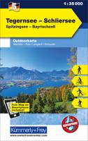
Wandelkaart 5 Outdoorkarte Tegernsee - Schliersee | Kümmerly & Frey
Wandelkaart met ingetekende routes.   The Kümmerly+Frey outdoor maps help your with your planning. And once your have arrived at your holiday destination they double up as silent tour guides: attractive map image, comprehensive regional coverage (a map for each holiday region), contents featuring interesting tourist information such as important walking paths, mountain huts and tourist attractions. Scale: 1:50 000. Water and rip-proof map.   Dorpen: Holzkirhcne, Wyarn, Bruckmühl, Bad Aibling, Miesbach, Mangfall, Schliersee, Tergensee, Gmund, Bas Tölz, Bad Wiessee, Rottach-Egern, Wildbad Kreuth, Ursprungpass
13,50
Nieuw
Wandelkaart 49 Outdoorkarte Spessart Nord | Kümmerly & Frey
Wandelkaart met ingetekende routes.   The Kümmerly+Frey outdoor maps help your with your planning. And once your have arrived at your holiday destination they double up as silent tour guides: attractive map image, comprehensive regional coverage (a map for each holiday region), contents featuring interesting tourist information such as important walking paths, mountain huts and tourist attractions. Scale: 1:50 000. Water and rip-proof map.   Dorpen: Birstein, Schlüchtern, Steinau, Bad Soden-Salmünster, Wächtersbach, Gelnhausen, Bad Orb, Hohberg, Burgsinn, Fellen, Wiesen, Schöllkrippen, Frammersbach, Gemünden, Heigenbrücken
13,50
Nieuw
Wandelkaart 52 Outdoorkarte Schwarzwald - Zwarte Woud | Kümmerly & Frey
Wandelkaart met ingetekende routes.   The Kümmerly+Frey outdoor maps help your with your planning. And once your have arrived at your holiday destination they double up as silent tour guides: attractive map image, comprehensive regional coverage (a map for each holiday region), contents featuring interesting tourist information such as important walking paths, mountain huts and tourist attractions. Scale: 1:50 000. Water and rip-proof map.   Dorpen: Ettlingen, Malsch, Rastatt, Neuenbürg, Pforzheim, Bad Herrenalb, Gaggenau, Baden-Baden, Bad Wildbad, Bad Liebenzell, Murg, Enz, Forbach, Hornisgrinde, Enzklösterle, Neubulach, Simmersfeld, Altensteig
13,50
Nieuw
Wandelkaart 56 Outdoorkarte Fränkisches Weinland, Würzburg | Kümmerly & Frey
Wandelkaart met ingetekende routes.   The Kümmerly+Frey outdoor maps help your with your planning. And once your have arrived at your holiday destination they double up as silent tour guides: attractive map image, comprehensive regional coverage (a map for each holiday region), contents featuring interesting tourist information such as important walking paths, mountain huts and tourist attractions. Scale: 1:50 000. Water and rip-proof map.   Dorpen::Karlstadt, Schwanfeld, Main, Uettingen, Höchberg, Würzburg, Volkach, Marktbreit, Ochsenfurt, Tauberbischofsheim, Lauda-Königshofen, Bad Mergentheim, Weikersheim, Bad Windsheim
13,50

Klanten-reviews van Wandelkaart 47 Outdoorkarte Thüringer Wald | Kümmerly & Frey

Er zijn nog geen beoordelingen voor dit productBen jij de eerste die een review plaatst?

Meer over Wandelkaart 47 Outdoorkarte Thüringer Wald | Kümmerly & Frey

Productomschrijving

Wandelkaart met ingetekende routes.   The Kümmerly+Frey outdoor maps help your with your planning. And once your have arrived at your holiday destination they double up as silent tour guides: attractive map image, comprehensive regional coverage (a map for each holiday region), contents featuring interesting tourist information such as important walking paths, mountain huts and tourist attractions. Scale: 1:50 000. Water and rip-proof map.   Dorpen en steden op de kaart Eisenach, Waltershausen, Bad Salzungen, Großer Inselberg, Friedrichroda, Bad Liebenstein, Horch, Breitungen, Ohrdruf, Tambach-Dietharz, Schmalkalden, Grße Beerberg, Suhl, Zella-Mehlis, Ilmenzau, Gehren, Schmiedefeld, Adlersberg, Schleusingen, Königsee, Schwarza, Oberweißbach, Masserberg, Nauhaus, Lauscha, Steinach

Verken gerelateerde categorieën

Webshop.nl maakt gebruik van cookies. Ga je verder op onze website, ga dan akkoord met het plaatsen van cookies en de verwerking van deze data door ons en vermelde partners.