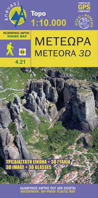
Wandelkaart 4.21 Meteora 3D | Anavasi

0
Wandelkaart van Meteora en directe omgeving. Op de achterzijde een 3D kaart waarbij het bijgeleverde brilletje tot z'n recht komt.   The hiking map of Meteora in scale 1:10 000 by Anavasi editions is a world first in the printed cartography with its the three-dimensional depiction. We provide the special glasses and we let wander back you back to ...

Verkopers met dit product

Verkoper
Bezorging
Prijs
DeZwerver.nl logo
DeZwerver.nl
2,95
9,95

Anderen bekeken ook

Wandelkaart 4.21 Meteora 3D | Anavasi
Wandelkaart van Meteora en directe omgeving. Op de achterzijde een 3D kaart waarbij het bijgeleverde brilletje tot z'n recht komt.   The hiking map of Meteora in scale 1:10 000 by Anavasi editions is a world first in the printed cartography with its the three-dimensional depiction. We provide the special glasses and we let wander back you back to Meteora even when you are no longer there.   A monument of World Natural and Cultural Heritage of UNESCO, Meteora is a unique landscape of rocky spines and the second largest monastic complex in Greece. With the new map, Anavasi editions invites you to discover the transcendental scenery of Meteora through hiking trails. The map is printed on waterproof "polyart" paper 
9,95
Wandelkaart 9.4 Corfu | Anavasi
Een nieuwe gedetailleerde wandelkaart voor Corfu met informatie over monumenten en stranden. De route van de Corfu Trail, een 220 km lange bewegwijzerde wandelroute langs de mooiste en authentieke plaatsen van het eiland, is op de kaart opgenomen. De kaarten van Anavasi zijn zeer gedetailleerd, beschikken over een helder kaartbeeld en zijn uitstekende kaarten voor diverse activiteiten. Ze beschikken over vele interessante punten voor wandelaars, fietsers of andere toeristen die het gebied bezichtigen. De wandelkaarten bevatten ook een uitzonderlijke reliefaanwijzing, verschillende vormen van gewassen en andere topografische details. A new detailed hiking map for Corfu by Anavasi editions with information on its monuments and beaches. The course of the Corfu Trail, a 220 km long waymarked hiking route passing by the most beautiful and authentic places of the island is recorded on the map. Printed on waterproof and rip-proof polyart paper.  
10,95
Wandelkaart 1.3 Mt. Penteli | Anavasi
Deze wandelkaart van berg Penteli door Anavasi nodigt u uit om één van de bergen nabij Athene te ontdekken via wandel- en fietspaden. Oude steengroeven, grotten en monumenten, en de beroemde 'lithagogische weg' zijn in de kaart opgenomen. De kaarten van Anavasi zijn zeer gedetailleerd, beschikken over een helder kaartbeeld en zijn uitstekende kaarten voor diverse activiteiten. Ze beschikken over vele interessante punten voor wandelaars, fietsers of andere toeristen die het gebied bezichtigen. De wandelkaarten bevatten ook een uitzonderlijke reliefaanwijzing, verschillende vormen van gewassen en andere topografische details.   The new hiking map of Mt Penteli [1.3] by Anavasi in a scale 1:16 000 invites you to discover one of the mountains that delimit the Athens plain through hiking and cycling trails. Old quarries, caves and monuments, including the famous "lithagogias road" from where the Parthenon marbles were transported to the Acropolis are recorded on the map The map is printed …
9,95
Wandelkaart 10.00 Aigina | Anavasi
Egina eiland ligt heel dicht bij Athene, maar het heeft veel verborgen en wilde kanten. De Anavasi Aigina kaart is de beste manier om deze te ontdekken. De stranden van Egina variëren van zandstranden tot wilde rotsachtige kusten. Maar naast de charmante landschappen en stranden is het een plek die rijk is aan geschiedenis. Deze kaart nodigt u uit om Aigina te ontdekken en rond te lopen in het prachtige landschap. Aan de achterkant van de kaart vindt u voorgestelde wandelroutes en korte beschrijvingen van de belangrijkste bezienswaardigheden. De kaarten van Anavasi zijn zeer gedetailleerd, beschikken over een helder kaartbeeld en zijn uitstekende kaarten voor diverse activiteiten. Ze beschikken over vele interessante punten voor wandelaars, fietsers of andere toeristen die het gebied bezichtigen. De wandelkaarten bevatten ook een uitzonderlijke reliefaanwijzing, verschillende vormen van gewassen en andere topografische details. Aigina island is very close to Athens but it has many hid…
9,95
Wandelkaart 1.1 Mt. Parnitha | Anavasi
Parnitha, de hoogste berg in Attika, is een natuurreservaat waar de Atheners in contact komen met de natuur. Het sparrenbos, de ravijnen, het vele kreupelhout, herten en vogels maken dit stukje natuur ontzettend bijzonder. Het is een ideale bestemming om te wandelen, klimmen, mountainbiken, of om zelfs een sneeuwpop te maken. De kaarten van Anavasi zijn zeer gedetailleerd, beschikken over een helder kaartbeeld en zijn uitstekende kaarten voor diverse activiteiten. Ze beschikken over vele interessante punten voor wandelaars, fietsers of andere toeristen die het gebied bezichtigen. De wandelkaarten bevatten ook een uitzonderlijke reliefaanwijzing, verschillende vormen van gewassen en andere topografische details.   A new (7th) edition of Mt Parnitha hiking map. Parnitha, the highest mountain in Attica, is a natural reserve where the Athenians come in contact with nature. The fir forest, the ravines and endless, scrubland, deers and birds are the manifestations of the wildlife we come lo…
11,95
Wandelkaart - Wegenkaart - landkaart 10.24 Santorini | Anavasi
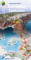
As you enter the caldera of Santorini by ferry sheer cliffs rise up dramatically, exposing richly coloured rock strata, crowned by the colored houses of the cliff-top settlements. Equally magnificent is the sunset from the heights of the caldera towards the sea and the remnants of prehistoric rounded island Strogyli, Thirasia, the New and Old Kameni. However, there is more than the visual excitement to discover and if you don’t take the time to walk the island you will have learnt little of Santorini.   The new Anavasi map will take hiking in every corner, beach and hill top of Santorini and Thirassia to discover landscapes with visible signs of the traditional rural culture, with orchards stonewalls, threshing floors, huts, chapels, inland villages with a well preserved medieval core (called Castelo), routes with wonderful vistas, lost beaches quiet even in the heart of summer.   On the reverse side of the map, there is a brief description of the 25 proposed hiking routes and a short…
10,95
Wandelkaart 10.44 Kythnos | Anavasi
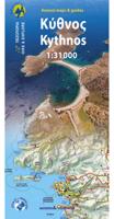
Het eiland Kithnos heeft twee charmante nederzettingen, Hora en Dryopida, wat zeker een bezoekje waard is. Ook heeft Kithnos prachtige stranden en een goed bewaard netwerk van paden.   De kaarten van Anavasi zijn zeer gedetailleerd, beschikken over een helder kaartbeeld en zijn uitstekende kaarten voor diverse activiteiten. Ze beschikken over vele interessante punten voor wandelaars, fietsers of andere toeristen die het gebied bezichtigen. De wandelkaarten bevatten ook een uitzonderlijke reliefaanwijzing, verschillende vormen van gewassen en andere topografische details.   Kythnos, the second in the series of the islands of the western Cyclades, after Kea, has two charming settlements, Hora and Dryopida, wonderful beaches and a well preserved network of trails, whose maintenance and waymarking has started. The new detailed map of Anavasi depicts as always with precision and detail roads and trails, while professor of archeology  Alexander Mazarakis Ainian and the great connoisseur of …
9,95
Wandelkaart 10.50 Karpathos | Anavasi
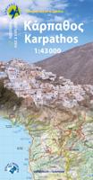
Zeer goede kaart van Karpathos. Topografische details zijn goed uitgewerkt, zeer leesbare kaart met ook nog eens alle toeristisch interessante punten. Karpathos, a mountainous island with rugged terrain and magnificent landscapes, is one of the most authentic places in Greece. It has endless sandy beaches in the south and secluded coves with emerald-blue waters in the north. The more developped south of the island is popular to surfers while the north still keeps folkways alive especially in the magical village of Olymbos, perched on a saddle between two mountains and two seas. Off the northern tip of Kárpathos, separated from it by a narrow channel is the uninhabited island of Sariá with old agricultural settlements and remains of medieval houses at Palatia. This new detailed map of Anavasi proposes 12 hiking trails in the north and 6 in the south and presents the major highlights of the island.
9,95
Wandelkaart - Wegenkaart - landkaart 10.51 Ikaria | Anavasi
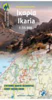
The new Anavasi map of Ikaria on a scale of 1:35.000 figures dozens of footpaths, the complete road network and all the beaches of the island, which is also well known for its summer feasts (panigiria) and the longevity of its inhabitants. The island was named after the mythical Icarus, the young man who flew too close to the sun and plunged into the sea, close to Ikaria.   Ikaria has a well-marked network of hiking trails. The island is indeed perfect for days of hiking pleasure with lots of vegetation, deep river valleys with plenty of hidden, refreshingly cold (and clean) water pools, relatively level top plateaus and a ridge line that climbs up to about 900-1000m above sea level with amazing views and nice beaches to end the walks. Printing on waterproof, rip-proof polyart paper
10,95
Wandelkaart 10.33 Chalki | Anavasi
 wandelkaart schaal 1:20.000 met hoogtelijnen, wandelpaden, toeristische informatie en UTM grid, de kaart is geschikt voor gebruik met GPS. A tiny island though very rich in monuments and ancient remains. More than 50 byzantine chappels, dozens of rock carved cisterns and old agricultural settlements and a well-preserved medieval caslte with a ruined medieval settlement at its foot. The new detailed map by ANAVASI will be your precious guide to discover all these little known remains, most of them accessible only by footpaths.
9,95

Klanten-reviews van Wandelkaart 4.21 Meteora 3D | Anavasi

Er zijn nog geen beoordelingen voor dit productBen jij de eerste die een review plaatst?

Meer over Wandelkaart 4.21 Meteora 3D | Anavasi

Productomschrijving

Wandelkaart van Meteora en directe omgeving. Op de achterzijde een 3D kaart waarbij het bijgeleverde brilletje tot z'n recht komt.   The hiking map of Meteora in scale 1:10 000 by Anavasi editions is a world first in the printed cartography with its the three-dimensional depiction. We provide the special glasses and we let wander back you back to Meteora even when you are no longer there.   A monument of World Natural and Cultural Heritage of UNESCO, Meteora is a unique landscape of rocky spines and the second largest monastic complex in Greece. With the new map, Anavasi editions invites you to discover the transcendental scenery of Meteora through hiking trails. The map is printed on waterproof "polyart" paper 

Productinformatie

    Verken gerelateerde categorieën

    Webshop.nl maakt gebruik van cookies. Ga je verder op onze website, ga dan akkoord met het plaatsen van cookies en de verwerking van deze data door ons en vermelde partners.