webshop.nl
Categorieën
  Sluiten

Meer Editorial Alpina
Meer Editorial Alpina in Literatuur boeken

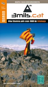
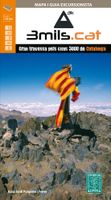
Wandelkaart 3mils.cat | Editorial Alpina

Gedetailleerde wandelkaart van een meerdaagse tocht in Catalonië, veel detail op topografisch niveau met hoogtelijnen, schaduwwerking, hutten, paden etc. Coördinaten zijn weergegeven, dus GPS compatible met UTM grid.  3mils.cat is a walk through a mountain to crown in a row on the road and all the peaks of 3000 meters of Catalonia , designed and do...
16,95

Webshops met dit product

Webshop
Bezorging
Prijs

Anderen bekeken ook

Wandelkaart 3mils.cat | Editorial Alpina
Gedetailleerde wandelkaart van een meerdaagse tocht in Catalonië, veel detail op topografisch niveau met hoogtelijnen, schaduwwerking, hutten, paden etc. Coördinaten zijn weergegeven, dus GPS compatible met UTM grid.  3mils.cat is a walk through a mountain to crown in a row on the road and all the peaks of 3000 meters of Catalonia , designed and documented by Jordi Puigneró i Ferrer.   The crossing has been designed to take in 10 stages of 6 hours on average every day, covering a total of about 125 km and an accumulated rise of about 10.000 meters.   Although it could be within days, this has not been thought through to compete but to enjoy. The route begins at the top of the Hill formally Molières or Mulleres and ends in Pic Rodó de Canalbona , crossing the beautiful valleys as Mollières, Besiberri and Boi , as well as sites of special protection such as the Parc Nacional d’Aigüestrotes-Sant MaMaurici and the Parc Natural de l’Alt Pirineu.   List of summits order of ascension:   • 1.-…
16,95
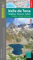
Wandelkaart 05 Valle de Tena | Editorial Alpina
Zeer gedetailleerde wandelkaart van een klein gebied. Met ingetekende wandelroutes en andere informatie. Spaanstalig, maar uitstekende kaart. Coordinaten zijn weergegeven, dus GPS compatible met UTM grid.    Op de topografische wandelkaart worden o.a. berghutten, campings aangeduid en hoogtelijnen, ingetekende wandelroutes en de GR paden (doorgaande langeafstandswandelpaden). De kaart is inclusief een Spaanstalig boekje met extra informatie over aanwezige voorzieningen en enkele routes.   Gebied: Panticosa, Sallent de Gallego, Formigal, Escarrilla, El Pueyo de Jaca, Saqués, Oz de Jaca, Búbal, Polituara, Piedrafita de jaca, Tramacastilla de Tena, Pic du Midi d'Ossau, Pico Balaitús, Pic de Cambalès, Grand Pic de Péterneille, Pico Tendenera, Pico da Sabocos, Pena de Puerto Rico, Pena Telera, Punta de la Espata, Pena Collarada, Pico Arriel, Pico as Ferreras   Hiking map and guidebook Scale: 1:40.000 Heights of the most interesting spots of the area Shady relief UTM grid with divisions…
16,95
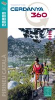
Wandelkaart Cerdanya 360 - territori | Editorial Alpina
Hiking Map and guide of the crossing of the 3 refuges of the Spanish publisher Alpina.   The crossing of the three shelters is a fantastic hike to discover unforgettable sites in the East Pyrenees. It allows to discover abundant wildlife, superb flowers, spectacular gorges, isolated lakes, beautiful forests and lifetime rivers. At the end of each step, you will experience one night's experience in a guarded refuge and resume forces for the next day. The total altitude of the crossing is more than 3,000 meters. For the more sports, the steps can be supplemented by the rise of the summits of the region: the peaks of Balandrau, Bastiments, Gra de Fajol, Gallinas, Torreneules and Puigmal, for a total altitude of more than 6,000 meters.   The regions of the Ripollès and Upper Conflent, east of the Pyrenees chain, offer a wild territory predominated by the high mountain. It is a very well preserved natural space with great biodiversity. It is in these isolated sites that the Ulldeter shelter…
16,95
Wandelkaart Cabo de Gata - Nijar | Editorial Alpina
Zeer gedetailleerde wandelkaart van een klein gebied. Met ingetekende wandelroutes en andere informatie. Spaanstalig, maar uitstekende kaart. Coordinaten zijn weergegeven, dus GPS compatible met UTM grid.    Op de topografische wandelkaart worden o.a. berghutten, campings aangeduid en hoogtelijnen, ingetekende wandelroutes en de GR paden (doorgaande langeafstandswandelpaden).  Cabo da Gata-Níjar Natural Park in an extensive and very popular series of walking maps from Editorial Alpina covering the Pyrenees, Catalonia and other selected hiking areas in Spain, including Picos de Europa, Sierra Nevada and parts of Andalucía, Majorca, etc. Scales vary from 1:50,000 to 1:10,000, with the majority of the titles at 1:25,000. The maps have contours, usually at 20m or 10m intervals, with additional hill shading and spot heights. An overprint highlights hiking trails, long-distance footpaths, campsites, mountain huts, refuges, etc. Many maps also show climbing sites, potholing caves, mountain bi…
16,95
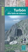
Wandelkaart 17 Turbón, Alto Valle de Isábena | Editorial Alpina
Zeer gedetailleerde wandelkaart van een klein gebied. Met ingetekende wandelroutes en andere informatie. Spaanstalig, maar uitstekende kaart. Coordinaten zijn weergegeven, dus GPS compatible met UTM grid.    Op de topografische wandelkaart worden o.a. berghutten, campings aangeduid en hoogtelijnen, ingetekende wandelroutes en de GR paden (doorgaande langeafstandswandelpaden). De kaart is inclusief een Spaanstalig boekje met extra informatie over aanwezige voorzieningen en enkele routes.   Gebied: Villanova, Liri, Chía, Seira, Gabas, Bisaurri, Arasán, Buyelgas, El Run, Urmella, Veri, Las Paules, Ardanué, Denuy, Ardanuy, Barbaruens, Calvera, Llert, Biescas, Bonansa, Egea, Campo, Castillo de El Turbón, Gallinero, Pic de Basibé, Pic de Menada, Cornadelo   A topographic tourist map and hiking guide with details of tourist attractions, hiking & sporting activities as well as transport information. An excellent folded map & booklet. Hiking map and guidebook -  Scale: 1:40.000 - Heights of…
16,95
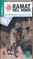
Wandelkaart Ramat del Nord | Editorial Alpina
Gedetailleerde wandelkaart van een meerdaagse tocht in de Spaanse Pyreneeen, veel detail op topografisch nivo met hoogtelijnen, schaduwwerking, hutten, paden etc.    Zeer gedetailleerde wandelkaart van een klein gebied. Met ingetekende wandelroutes en andere informatie. Spaanstalig, maar uitstekende kaart. Coordinaten zijn weergegeven, dus GPS compatible met UTM grid.    Op de topografische wandelkaart worden o.a. berghutten, campings aangeduid en hoogtelijnen, ingetekende wandelroutes en de GR paden (doorgaande langeafstandswandelpaden). De kaart is inclusief een Spaanstalig boekje met extra informatie over aanwezige voorzieningen en enkele routes.   Areu - Ginestarre - Ribera de Cardos - Estaron - Escal o - Espot - Jou - La Guingueta - Esterri d'Aneu - Slardu.   -wandelpaden ingetekend -schaal 1:50.000 (1 cm = 500 m) -hoogtelijnen -campings, berghutten, herberg, jeugherbergen -tankstations, parkeerplaatsen -locaties voor rotsklimmen, wandelen, lalnglaufen etc -GPS-compatible…
16,95

Klanten-reviews van Wandelkaart 3mils.cat | Editorial Alpina

Er zijn nog geen beoordelingen voor dit productBen jij de eerste die een review plaatst?

Meer over Wandelkaart 3mils.cat | Editorial Alpina

Productomschrijving

Gedetailleerde wandelkaart van een meerdaagse tocht in Catalonië, veel detail op topografisch niveau met hoogtelijnen, schaduwwerking, hutten, paden etc. Coördinaten zijn weergegeven, dus GPS compatible met UTM grid.  3mils.cat is a walk through a mountain to crown in a row on the road and all the peaks of 3000 meters of Catalonia , designed and documented by Jordi Puigneró i Ferrer.   The crossing has been designed to take in 10 stages of 6 hours on average every day, covering a total of about 125 km and an accumulated rise of about 10.000 meters.   Although it could be within days, this has not been thought through to compete but to enjoy. The route begins at the top of the Hill formally Molières or Mulleres and ends in Pic Rodó de Canalbona , crossing the beautiful valleys as Mollières, Besiberri and Boi , as well as sites of special protection such as the Parc Nacional d’Aigüestrotes-Sant MaMaurici and the Parc Natural de l’Alt Pirineu.   List of summits order of ascension:   • 1.- Tuc de Molières o Mulleres (3.010 m) • 2.- Pic de Comaloforno (3.029 m) • 3.- Besiberri Sud (3.024 m) • 4.- Besiberri Nord (3.008 m) • 5.- Punta Alta de Comalesbienes (3.014 m) • 6.- Pic de Sotllo (3.072 m) • 7.- Pic de Verdaguer (3.129 m) • 8.- Pica d’Estats (3.143 m) • 9.- Punta de Gabarró (3.114 m) • 10.- Pic Rodó de Canalbona (3.004 m)

Productspecificaties

Artikelnummer(s)
Brand
Editorial Alpina

Verken gerelateerde categorieën

Webshop.nl maakt gebruik van cookies. Ga je verder op onze website, ga dan akkoord met het plaatsen van cookies en de verwerking van deze data door ons en vermelde partners.