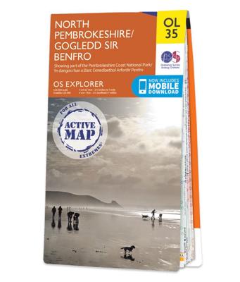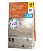
Wandelkaart 35 OS Explorer Map | Active North Pembrokeshire Active Map | Ordnance Survey

0
Een van de beste detailkaarten die er op de wereld gemaakt worden: zeer gedetailleerd, prachtig helder kleurgebruik, veel topografische aspecten en - zeer belangrijk - allerlei toeristische en recreatieve aspecten zijn ingetekend. De perfecte kaart voor vakantie en vrije tijd: wandelen, fietsen of gewoon de omgeving verkennen. Door de grootte van...

Verkopers met dit product

Verkoper
Bezorging
Prijs
DeZwerver.nl logo
DeZwerver.nl
2,95
25,95

Anderen bekeken ook

Wandelkaart 35 OS Explorer Map | Active North Pembrokeshire Active Map | Ordnance Survey
Een van de beste detailkaarten die er op de wereld gemaakt worden: zeer gedetailleerd, prachtig helder kleurgebruik, veel topografische aspecten en - zeer belangrijk - allerlei toeristische en recreatieve aspecten zijn ingetekend. De perfecte kaart voor vakantie en vrije tijd: wandelen, fietsen of gewoon de omgeving verkennen. Door de grootte van de kaart, voor- en achterzijde, bestrijkt het een behoorlijk groot gebied!   The OS Explorer map of North Pembrokeshire and the Pembrokeshire Coast National Park is a must-have when visiting the West coast of Wales.   With a variety of beaches with stretches of sand to small rocky coves, there's an abundance of beauty to explore.   Some must see places on Explorer OL35 are St Davids, Cardigan, Goodwick, and Fishguard, and the Pembrokeshire Coast Path.   Our explorer range comes in both weatherproof and standard options, meaning you'll never get caught out in a storm. Receive a free download of this map, making for a convenient companion.
25,95
Wandelkaart - Topografische kaart OL35 OS Explorer Map North Pembrokeshire | Ordnance Survey
Een van de beste detailkaarten die er op de wereld gemaakt worden: zeer gedetailleerd, prachtig helder kleurgebruik, veel topografische aspecten en - zeer belangrijk - allerlei toeristische en recreatieve aspecten zijn ingetekend. De perfecte kaart voor vakantie en vrije tijd: wandelen, fietsen of gewoon de omgeving verkennen. Door de grootte van de kaart, voor- en achterzijde, bestrijkt het een behoorlijk groot gebied! These highly detailed maps show all the administrative boundaries, settlements as small as isolated farms, road network down to unfenced roads and country tracks, and field boundaries (hedges and drystone walls) which make navigation across the countryside much easier. Steep gradients on roads are indicated. Various landmarks, eg. powerlines, archaeological sites, windmills, churches and lighthouses are shown, and additional graphics indicate natural terrain features such as cliffs, scree, mud and vegetation variations. Contour interval is 5 metres in the lower parts o…
19,50
Wandelgids Pembrokeshire | Northern Eye Books
OS Map Books: Wales Coast Path: Pembrokeshire Coast Path Map Atlas | Ordnance Survey ‘Explorer’ Large-scale 1:25,000 maps for the Pembrokeshire Coast in compact book format | Pocket Atlas | Walking Wales | UK Long-Distance Trails | Hiking | Adventure   One of seven handy Ordnance Survey Map Books covering the entire 870 mile/1400 kilometre-long, world-class Wales Coast Path — from Chester in the north to Chepstow in the south.   Enjoy enhanced, large scale (1:25,000) Ordnance Survey Explorer mapping in compact atlas format with all the detailed mapping you need to walk the Pembrokeshire Coast section of the Wales Coast Path.   Continuous, full colour OS mapping covering the Wales Coast Path between Cardigan and Amroth. Contains extracts from large scale Explorer maps OL 35 and OL 36. The enhanced OS 1:25,000 maps are accurate, up-to-date and reliable. Additional map symbols show tea shops, cafes, extra parking, and public toilets.   A brief introduction to Pembrokeshire Coast includes…
17,50
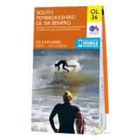
Wandelkaart 36 OS Explorer Map | Active South Pembrokeshire / De Sir Benfro | Ordnance Survey
Met zijn 4cm voor 1 km (2 ½ cm voor 1 mijl) schaal, is de OS Outdoor Leisure kaartenserie de ideale en meest gedetailleerde kaartenreeks voor mensen die graag outdoor-activiteiten zoals fietsen, wandelen, paardrijden, klimmen en watersporten.   Deze kaart is nog gedetailleerder dan de 'gewone' Landranger maps. Voor- en achterzijde bedrukt! Zeker op de moors en andere natuurgebieden van onschatbare waarden met echt alle aspecten van het landschap op de kaart ingetekend. Zeer goede detailkaart met topografische ondergrond. Hierop zijn toeristische symbolen van bezienswaardigheden ingetekend, daarnaast staan bijvoorbeeld campings en jeugdherbergen vermeld en - voor wandelaars het belangrijkst - alle right of way paden en Lange afstands Wandelpaden zijn er op te vinden. De ideale kaart voor het wandelen in Engeland, Wales of Schotland.   OS Explorer is the Ordnance Survey's most detailed map and is recommended for anyone enjoying outdoor activities such as walking, horse riding and off…
25,95
Wandelkaart - Topografische kaart OL36 OS Explorer Map South Pembrokeshire | Ordnance Survey
Met zijn 4cm voor 1 km (2 ½ cm voor 1 mijl) schaal, is de OS Outdoor Leisure kaartenserie de ideale en meest gedetailleerde kaartenreeks voor mensen die graag outdoor-activiteiten zoals fietsen, wandelen, paardrijden, klimmen en watersporten.   Deze kaart is nog gedetailleerder dan de 'gewone' Landranger maps. Voor- en achterzijde bedrukt! Zeker op de moors en andere natuurgebieden van onschatbare waarden met echt alle aspecten van het landschap op de kaart ingetekend. Zeer goede detailkaart met topografische ondergrond. Hierop zijn toeristische symbolen van bezienswaardigheden ingetekend, daarnaast staan bijvoorbeeld campings en jeugdherbergen vermeld en - voor wandelaars het belangrijkst - alle right of way paden en Lange afstands Wandelpaden zijn er op te vinden. De ideale kaart voor het wandelen in Engeland, Wales of Schotland.   These highly detailed maps show all the administrative boundaries, settlements as small as isolated farms, the road network down to unfenced roads and co…
19,50
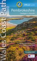
Wandelgids Wales Coast Path: Pembrokeshire | Northern Eye Books
Official Guide: Wales Coast Path: Pembrokeshire   One of seven Official Guides to the Wales Coast Path   The 186 mile/300km long Pembrokeshire section of the Wales Coast Path runs through some of Wales’ most varied and dramatic coastal scenery — high, rugged cliffs and long sandy bays, Pembroke Castle, St David’s cathedral and St Govan’s remote cliff-wrapped chapel, with several large offshore islands. Pembrokeshire is also Britain’s only coastal National Park.   This Official Guide splits the route into 14 convenient day sections, each of about 10-17 miles / 16-27 kilometres. It contains everything local and long-distance walkers need to enjoy the path and includes:   An overview of Pembrokeshire with dedicated history and wildlife sections Fourteen day-walk sections with detailed route descriptions and full, enhanced Ordnance Survey mapping Distance charts, section overviews, background information and interpretation of places of interest Stunning professional photographs throughout…
22,50
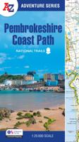
Wandelatlas Adventure Atlas Pembrokeshire Coast Path | A-Z Map Company
The A-Z Adventure Series of maps is the perfect companion for walkers, off-road cyclists, and anyone wishing to explore the great outdoors.   The Pembrokeshire Coast Path is a 186 mile (299 km) National Trail in south-west Wales. From Amroth in the south to St Dogmaels in the north and running mainly through the Pembrokeshire National Park, the route passes through some of the most scenic parts of Wales.   This official National Trail Map features detailed mapping at a scale of 1:25 000, providing complete coverage of the Pembrokeshire Coast Path. There is also a route planner included to show distances between places and the amenities available making it easy to plan your adventure. Additional features include:   Information Centres Hotels/B&Bs Youth Hostels Campsites (seasonal opening) Public Houses Shops Restaurants Cafes (seasonal opening) Petrol Stations Other walks available in the A-Z Adventure series include: Cotswold Way, Peddars Way and Norfolk Coast Path, Coast to Coast Pat…
17,95
Reisgids British Breaks Pembrokeshire | Rough Guides
Discover the best of Pembrokeshire with this compact, practical, entertaining Pocket Rough Guide. This slim, trim treasure trove of trustworthy travel information is ideal for travellers on short trips, and covers all the key sights such as St Davids Catherdral, Poppit Sands and the Pembrokeshire coastal path, restaurants, shops, cafes and bars, plus inspired ideas for day-trips, with honest independent recommendations from expert authors.   The Pocket Rough Guide Pembrokeshire covers: St Davids and Around, Haverfordwest and around, Pembroke and around, Tenby and around, Narbeth and around, Fishguard and around, Newport and around and further afield   Inside this travel guide you will find:   RECOMMENDATIONS FOR EVERY TYPE OF TRAVELLER  Experiences selected for every kind of trip to Pembrokeshire, from off-the-beaten-track adventures in Fishguard to family activities in child-friendly places, like Haverfordwest or or chilled-out breaks in popular tourist areas, like St Davids.   INCIS…
12,50
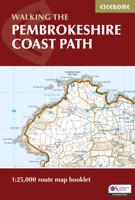
Wandelgids Walking the Pembrokeshire Coast Path map booklet | Cicerone
A booklet of all the mapping needed to walk the Pembrokeshire Coast Path National Trail between Amroth near Tenby and St Dogmaels by Cardigan. Covering 290km (180 miles) and over 10,500m of ascent, this trail takes around 2 weeks to complete. The full route is shown on 1:25,000 OS maps The map booklet can be used to walk the trail in either direction Sized to easily fit in a jacket pocket or rucksack The relevant extract from the OS Explorer map legend is includedHigh tide and military range closure alternate routes are providedAn accompanying Cicerone guidebook – Walking the Pembrokeshire Coast Path is also available, which includes a copy of this map booklet   Both native Lancastrians, Dennis and Jan Kelsall have long held a passion for countryside and hill walking. Since their first Cicerone title was published in 1995, they have written and illustrated around 35 guides covering some of Britain’s most popular walking areas and have become regular contributors to various outdoor ma…
15,95
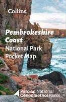
Wegenkaart - landkaart National Park Pocket Map Pembrokeshire Coast | Collins
Duidelijke pocket wandelkaart met belangrijke toeristische informatie, bezienswaardigheden, campeerplekken e.d. Handy little full colour map and guide of Pembrokeshire Coast National Park. Detailed mapping and visitor information to the National Park along with a selection of photographs. Map at a scale of 1:133,000 (2.1 miles to 1 inch or 1.33 km to 1cm).   This small map with additional text and photographs gives a great overview of the Pembrokeshire Coast National Park, and is the perfect companion for exploring this beautiful area of West Wales.   Clear, detailed mapping Key park, tourist and travel information Ideal for planning visits to the National Park Index to help locate and plan your trip
7,95

Klanten-reviews van Wandelkaart 35 OS Explorer Map | Active North Pembrokeshire Active Map | Ordnance Survey

Er zijn nog geen beoordelingen voor dit productBen jij de eerste die een review plaatst?

Meer over Wandelkaart 35 OS Explorer Map | Active North Pembrokeshire Active Map | Ordnance Survey

Productomschrijving

Een van de beste detailkaarten die er op de wereld gemaakt worden: zeer gedetailleerd, prachtig helder kleurgebruik, veel topografische aspecten en - zeer belangrijk - allerlei toeristische en recreatieve aspecten zijn ingetekend. De perfecte kaart voor vakantie en vrije tijd: wandelen, fietsen of gewoon de omgeving verkennen. Door de grootte van de kaart, voor- en achterzijde, bestrijkt het een behoorlijk groot gebied!   The OS Explorer map of North Pembrokeshire and the Pembrokeshire Coast National Park is a must-have when visiting the West coast of Wales.   With a variety of beaches with stretches of sand to small rocky coves, there's an abundance of beauty to explore.   Some must see places on Explorer OL35 are St Davids, Cardigan, Goodwick, and Fishguard, and the Pembrokeshire Coast Path.   Our explorer range comes in both weatherproof and standard options, meaning you'll never get caught out in a storm. Receive a free download of this map, making for a convenient companion.

Productinformatie

    Verken gerelateerde categorieën

    Webshop.nl maakt gebruik van cookies. Ga je verder op onze website, ga dan akkoord met het plaatsen van cookies en de verwerking van deze data door ons en vermelde partners.