webshop.nl
Categorieën
  Sluiten

Meer Terrain maps
Meer Terrain maps in Literatuur boeken

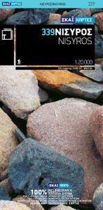
Wandelkaart 339 Nisyros | Terrain maps

0
Gedetailleerde wegenkaart en wandelkaart met alle kleine wegen, wandelpaden, hoogtelijnen en toeristische informatie aangegeven. Alle tekst is tweetalig in Engels en Grieks en de waterproof kaart is geschikt voor gebruik met GPS.   This is a great map because: For starters, it’s the only map of Nisyros! This is the first time Nisyros is mapped us...

Webshops met dit product

Webshop
Bezorging
Prijs

Anderen bekeken ook

Wandelkaart 339 Nisyros | Terrain maps
Gedetailleerde wegenkaart en wandelkaart met alle kleine wegen, wandelpaden, hoogtelijnen en toeristische informatie aangegeven. Alle tekst is tweetalig in Engels en Grieks en de waterproof kaart is geschikt voor gebruik met GPS.   This is a great map because: For starters, it’s the only map of Nisyros! This is the first time Nisyros is mapped using GIS technology, hence this is the first reliable map of the island.  It is waterproof and rip-proof. You can fold and unfold it a thousand times, fold it in irregular ways, dunk it in the sea or leave it out in the rain. This map is indestructible!  It is remarkably detailed, as the 1:20.000 scale makes everything crystal clear!  It is the first time the island’s entire coastline is mapped. Cartography was done with TERRAIN’s specially equipped and staffed cartographic vessel. This means that you can locate all beaches of the island, down to the tiniest cove! In fact, the special features of every single beach are recorded: whether it …
11,95
Wandelkaart 304 Sifnos | Terrain maps
Erg goede wandelkaart van Sifnos, weerbestendig en volledig. Bezienswaardigheden, campings en andere praktische zaken staan op de kaart aangegeven. GPS toepasbaar. This is a great map of Sifnos because: It is waterproof and rip-proof. You can fold and unfold it a thousand times, fold it in irregular ways, dunk it in the sea or leave it out in the rain. This map is indestructible!  It features more trails than any other map of Sifnos on the market. For example, take a look at the area between Apollonia and Kastro, which is where most visitors choose to hike. The trail from Plakoto and the chapel of Aghia Anastasia to Kastro, the trail ascending to Exambela and the branch leading to Apollonia, the trail to Kato Petali, the trail from Aghios Loukas to Kastro and so many more, appear on a map of Sifnos for the first time – in fact, the length of all trails is measured in kilometers so you can estimate the duration of your hike. Also, unlike other hiking maps, SKAI maps do not depict any …
11,95
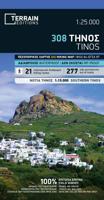
Wandelkaart - Wegenkaart - landkaart 308 Tinos | Terrain maps
Gedetailleerde wegenkaart en wandelkaart met alle kleine wegen, wandelpaden, hoogtelijnen en toeristische informatie aangegeven. Alle tekst is tweetalig in Engels en Grieks en de waterproof kaart is geschikt voor gebruik met GPS. This is a great map of Tinos because:   •    It is waterproof and rip-proof. You can fold and unfold it a thousand times, fold it in irregular ways, dunk it in the sea or leave it out in the rain. This map is indestructible!    •    It is the first time the island’s entire coastline is mapped. Cartography was done with TERRAIN’s specially equipped and staffed cartographic vessel. This means that you can locate all beaches of the island, down to the tiniest cove! In fact, the special features of every single beach are recorded: whether it is sandy or pebbled, whether it features natural tree shade, water, a beach bar or organized water sports, whether the seabed in front of the beach is sandy or rocky (so that you will know where to anchor).    •    It features…
12,50
Wandelkaart 315 Ios | Terrain maps
Gedetailleerde wegenkaart en wandelkaart met alle kleine wegen, wandelpaden, hoogtelijnen en toeristische informatie aangegeven. Alle tekst is tweetalig in Engels en Grieks en de waterproof kaart is geschikt voor gebruik met GPS. This is a great map because: It is the first GIS map of the island, meaning that this is the first time Ios is mapped with a topographic precision in proportion to the map scale.  It is waterproof and rip-proof. You can fold and unfold it a thousand times, fold it in irregular ways, dunk it in the sea or leave it out in the rain. This map is indestructible!  It is remarkably detailed, at a scale nearly twice as large as the competition’s, which makes everything crystal clear!  It is the first time the island’s entire coastline is mapped. Cartography was done with TERRAIN’s specially equipped and staffed cartographic vessel. This means that you can locate all beaches of the island, down to the tiniest cove! In fact, the special features of every single bea…
11,95
Wandelkaart 302 Kythnos | Terrain maps
Erg goede wandelkaart van Kythnos, weerbestendig en volledig. Bezienswaardigheden, campings en andere praktische zaken staan op de kaart aangegeven. GPS toepasbaar.   This is the best map of Kythnos because:   It is waterproof and rip-proof. You can fold and unfold it a thousand times, fold it in irregular ways, dunk it in the sea or leave it out in the rain. This map is indestructible!  It is the first GIS map of the island, meaning that this is the first time Kythnos is mapped with a topographic precision in proportion to the map scale.  It is remarkably detailed, at a scale twice as large as the competition’s, which makes everything crystal clear!  It is the first map depicting the island’s trails with total precision, their length measured in kilometers so you can estimate the duration of your hike, and detailed descriptions of Kythnos’ 13 best trails on the back.  It is the first time the island’s entire coastline is mapped. Cartography was done with TERRAIN’s specially equip…
11,95
Wandelkaart - Wegenkaart - landkaart 308 Tinos | Terrain maps
Gedetailleerde wegenkaart en wandelkaart met alle kleine wegen, wandelpaden, hoogtelijnen en toeristische informatie aangegeven. Alle tekst is tweetalig in Engels en Grieks en de waterproof kaart is geschikt voor gebruik met GPS. This is a great map of Tinos because:   •    It is waterproof and rip-proof. You can fold and unfold it a thousand times, fold it in irregular ways, dunk it in the sea or leave it out in the rain. This map is indestructible!    •    It is the first time the island’s entire coastline is mapped. Cartography was done with TERRAIN’s specially equipped and staffed cartographic vessel. This means that you can locate all beaches of the island, down to the tiniest cove! In fact, the special features of every single beach are recorded: whether it is sandy or pebbled, whether it features natural tree shade, water, a beach bar or organized water sports, whether the seabed in front of the beach is sandy or rocky (so that you will know where to anchor).    •    It features…
12,50
Wandelkaart 302 Kythnos | Terrain maps
Erg goede wandelkaart van Kythnos, weerbestendig en volledig. Bezienswaardigheden, campings en andere praktische zaken staan op de kaart aangegeven. GPS toepasbaar.   This is the best map of Kythnos because:   It is waterproof and rip-proof. You can fold and unfold it a thousand times, fold it in irregular ways, dunk it in the sea or leave it out in the rain. This map is indestructible!  It is the first GIS map of the island, meaning that this is the first time Kythnos is mapped with a topographic precision in proportion to the map scale.  It is remarkably detailed, at a scale twice as large as the competition’s, which makes everything crystal clear!  It is the first map depicting the island’s trails with total precision, their length measured in kilometers so you can estimate the duration of your hike, and detailed descriptions of Kythnos’ 13 best trails on the back.  It is the first time the island’s entire coastline is mapped. Cartography was done with TERRAIN’s specially equip…
11,95
Wandelkaart 307 Andros | Terrain maps
Gedetailleerde wegenkaart en wandelkaart met alle kleine wegen, wandelpaden, hoogtelijnen en toeristische informatie aangegeven. Alle tekst is tweetalig in Engels en Grieks en de waterproof kaart is geschikt voor gebruik met GPS. This is a great map because: It is waterproof and rip-proof. You can fold and unfold it a thousand times, fold it in irregular ways, dunk it in the sea or leave it out in the rain. This map is indestructible!  It is the first time the island’s entire coastline is mapped. Cartography was done with TERRAIN’s specially equipped and staffed cartographic vessel. This means that you can locate all beaches of the island, down to the tiniest cove! In fact, the special features of every single beach are recorded: whether it is sandy or pebbled, whether it features natural tree shade, water, a beach bar or organized water sports, whether the seabed in front of the beach is sandy or rocky (so that you will know where to anchor).  It indicates the boundaries of NATURA …
11,95

Klanten-reviews van Wandelkaart 339 Nisyros | Terrain maps

Er zijn nog geen beoordelingen voor dit productBen jij de eerste die een review plaatst?

Meer over Wandelkaart 339 Nisyros | Terrain maps

Productomschrijving

Gedetailleerde wegenkaart en wandelkaart met alle kleine wegen, wandelpaden, hoogtelijnen en toeristische informatie aangegeven. Alle tekst is tweetalig in Engels en Grieks en de waterproof kaart is geschikt voor gebruik met GPS.   This is a great map because: For starters, it’s the only map of Nisyros! This is the first time Nisyros is mapped using GIS technology, hence this is the first reliable map of the island.  It is waterproof and rip-proof. You can fold and unfold it a thousand times, fold it in irregular ways, dunk it in the sea or leave it out in the rain. This map is indestructible!  It is remarkably detailed, as the 1:20.000 scale makes everything crystal clear!  It is the first time the island’s entire coastline is mapped. Cartography was done with TERRAIN’s specially equipped and staffed cartographic vessel. This means that you can locate all beaches of the island, down to the tiniest cove! In fact, the special features of every single beach are recorded: whether it is sandy or pebbled, whether it features natural tree shade, water, a beach bar or organized water sports, whether the seabed in front of the beach is sandy or rocky (so that you will know where to anchor).  It features the most complete road network. The dirt road descending to Fontadiko beach and the dirt roads west of the port leading to the small beaches of Diakofto are just a few of the roads featured for the first time on a map of Nisyros.  It features the trails of Nisyros for the first time, with total precision since the cartographers of TERRAIN walk them one-by-one. The length of all trails is measured in kilometers so you can estimate the duration of your hike, plus the 11 most important trails are described in detail on the back of the map.  It features biking routes through the prettiest remote dirt roads of Nisyros, for mountain bike fans and a map of Mandraki including all pertinent and useful information.

Productspecificaties

Artikelnummer(s)
Brand
Terrain maps

Verken gerelateerde categorieën

Webshop.nl maakt gebruik van cookies. Ga je verder op onze website, ga dan akkoord met het plaatsen van cookies en de verwerking van deze data door ons en vermelde partners.