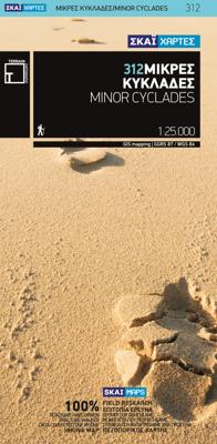
Wandelkaart 312 Minor Cyclades | Terrain maps

0
Gedetailleerde wegenkaart en wandelkaart met alle kleine wegen, wandelpaden, hoogtelijnen en toeristische informatie aangegeven. Alle tekst is tweetalig in Engels en Grieks en de waterproof kaart is geschikt voor gebruik met GPS. Why this is a great map: For one thing, it is the most accurate map of the Minor Cyclades! This is the first GIS preci...

Verkopers met dit product

Verkoper
Bezorging
Prijs
DeZwerver.nl logo
DeZwerver.nl
2,95
11,95

Anderen bekeken ook

Wandelkaart 312 Minor Cyclades | Terrain maps
Gedetailleerde wegenkaart en wandelkaart met alle kleine wegen, wandelpaden, hoogtelijnen en toeristische informatie aangegeven. Alle tekst is tweetalig in Engels en Grieks en de waterproof kaart is geschikt voor gebruik met GPS. Why this is a great map: For one thing, it is the most accurate map of the Minor Cyclades! This is the first GIS precision map on the market for the Minor Cyclades, namely Irakleia, Pano and Kato Koufonisi, Schinousa, Donousa and Keros.  It is waterproof and rip-proof. You can fold and unfold it a thousand times, fold it in irregular ways, dunk it in the sea or leave it out in the rain. This map is indestructible!  It is the first time the island’s entire coastline is mapped. Cartography was done with TERRAIN’s specially equipped and staffed cartographic vessel. This means that you can locate all beaches of the island, down to the tiniest cove! In fact, the special features of every single beach are recorded: whether it is sandy or pebbled, whether it feat…
11,95
Wegenkaart - landkaart 8 Touring Map Cyclades | Terrain maps
Gedetailleerde wegenkaart met toeristische informatie aangegeven. Alle tekst is tweetalig in Engels en Grieks en de waterproof kaart is geschikt voor gebruik met GPS. Detailed and updated map of the Cyclades islands using G.I.S. (Geographical Information Systems) technology and the WGS84 reference system, supplemented by a ΕΓΣΑ87 grid.    Like all of TERRAIN’s large maps, the map of Cyclades is printed on Polyart, which is extremely durable against folding and unfolding, does not rip, and is 100% waterproof.    Based on field research completed in 2013, this map features all Cycladic islands and their beaches, ports, sea connections, airports, and all the important sights. It’s the ideal map for planning your visit to the Cycladic islands, especially if you’re sailing.
13,50
Wandelkaart 10.36 Lesser Cyclades | Anavasi
GPS-compatible map of the island of Naxos and 5 small Cyclades (Irakleia, Schinousa, Pano Koufonisi, Kato Koufonisi and Donousa). This map is printed on light, waterproof and tear-resistant laminated paper. The map presents a plan of the most important cities. The suggestions for hiking are indicated. The road network indicates the undeveloped minor routes and the tracks in poor condition The road distances are indicated on the main roads and the locations of the service stations are indicated. A series of symbols highlight the various places of interest, including archaeological sites, beaches, etc. All the names are in Greek and Latin alphabet.   The Lesser or Small Cyclades are made up of more than 30 islands and rocks. The main inhabited islands are Iraklia, Schinousa, Donousa, Pano Koufonisi. The waters around them are very attractive and walking is inevitable as there are few roads. Donoussa has the best combination of paths and beaches, Iraklia is more suitable for hikers, Schi…
10,95
Fotoboek Cyclades | teNeues
- The first and only comprehensive illustrated book on the Cyclades Islands, portraying all the islands in all seasons - Not your typical travel book capturing only the tourist hotspots of the islands, but a book that captures the land and people, the soul of the archipelago The first comprehensive illustrated book on the Cyclades archipelago, which also includes the well-known islands of Santorini, Naxos, Paros and Mykonos. The islands are currently among the trendiest travel destinations in the world. There is no Hollywood or Instagram star who has not been photographed in front of the white cities of the Greek islands. This illustrated book attempts to capture the islands' attitude to life in an undisguised way. In doing so, the volume does not aim at the big tourist hotspots and Instagram shots that can be seen everywhere else, but would like to capture the Greek island world as a whole - with all its discrepancies. Lonely bays and half-ruined towns stand next to the glossy world …
44,95
Wandelgids Santorini, Sifnos, Kea - Western and Southern Cyclades | Graf editions
Wandelen op de Griekse Eilanden met deze klein formaat Engelstalige wandelgids Anafi, Folegandros, Ios, Kea, Kimolos, Kithnos, Milos, Santorini, Thirassia, Serifos, Sifnos, Sikinos, bij elke uitgebreid beschreven dagwandeltocht is een gedetailleerde routekaart afgebeeld en foto's ter orientering van de moeilijke, verwarrende trajecten. Van de uitgever This book describes the loveliest old walking trails. With precise descriptions, detailed maps, exact times, GPS points and photos of outstanding places for better orientation. And lots of useful knowledge about the "Islands of Light." It is made for island hoppers who want to drift through the island world by ship and who would also like to hike and swim in this ancient cultural landscape.   The concept „Greek Islands“ conjures up images of white cubical houses twined around with red bougainvillea, unevenly paved alleys below bright blue church domes, dilapidated windmills on top of stormy mountain ridges, shady groves with old gnarl…
19,50
Wandelkaart 314 Amorgos | Terrain maps
Gedetailleerde wegenkaart en wandelkaart met alle kleine wegen, wandelpaden, hoogtelijnen en toeristische informatie aangegeven. Alle tekst is tweetalig in Engels en Grieks en de waterproof kaart is geschikt voor gebruik met GPS. This is a great map because: It is waterproof and rip-proof. You can fold and unfold it a thousand times, fold it in irregular ways, dunk it in the sea or leave it out in the rain. This map is indestructible!  It is the first time the island’s entire coastline is mapped. Cartography was done with TERRAIN’s specially equipped and staffed cartographic vessel. This means that you can locate all beaches of the island, down to the tiniest cove! In fact, the special features of every single beach are recorded: whether it is sandy or pebbled, whether it features natural tree shade, water, a beach bar or organized water sports, whether the seabed in front of the beach is sandy or rocky (so that you will know where to anchor).  It indicates the boundaries of NATURA…
11,95
Wegenkaart - landkaart 1 Cyclades - Argosaronic islands | Anavasi
Gedetailleerde tweetalige (Grieks/Engels) topografische wegenkaart van de Cycladen met relief, gedetailleerd wegennet met wegnummers, campings en hutten.   Cyclades - Argosaronic islands  [R1] is a new map covering the areas of Attica with the Argosaronic islands of Salamina, Aegina, Ydra and Poros and all the Cyclades islands, printed on 2 sides with overlap. A very useful map, especially for island-hoppers, with short text for each island presenting the main monuments, outstanding beaches and hiking trails on each island. Printed on waterproof, polyart paper
11,95
Wandelgids Naxos and the Small Cyclades | Graf editions
Handig klein formaat engelstalige wandelgids Naxos, Donoussa, Iraklia, Koufonissia, Schinoussa bij elke uitgebreid beschreven dagwandeltocht is een gedetailleerde routekaart afgebeeld en foto's ter orientering van de moeilijke, verwarrende trajecten: Van de uitgever This book describes the loveliest old walking trails. With detailed maps, GPS data and route photos of outstanding points for better orientation. And lots of interesting facts worth knowing about the Islands of Dionysos.   Already when you sail into the harbour, you can sense the island's tremendous cultural diversity. On the left, you peer up at the enormous portal of a classical temple; on the right, you glide past a small Byzantine chapel and, towering above the huddled Cycladic city, a Venetian kástro from the Middle Ages. The city, dating back 5000 years, is one of the oldest inhabited places in the world.   When you penetrate further in to the island, you are surprised by the diversity of the fertile landscapes. An e…
19,50
Wandelkaart - Wegenkaart - landkaart 338 Kos | Terrain maps
Gedetailleerde wegenkaart en wandelkaart met alle kleine wegen, wandelpaden, hoogtelijnen en toeristische informatie aangegeven. Alle tekst is tweetalig in Engels en Grieks en de waterproof kaart is geschikt voor gebruik met GPS. This is a great map because: It is the first GIS map of the island, meaning that this is the first time Kos is mapped with a topographic precision in proportion to the map scale.  The road network of Kos is featured so completely for the first time. Every road, down to the secondary dirt roads and dead-ends, is illustrated on the map with precision. Naturally the main road network is clearly depicted, along with residential areas, the airport, the ports and the entire tourist infrastructure of Kos.  It is waterproof and rip-proof. You can fold and unfold it a thousand times, fold it in irregular ways, dunk it in the sea or leave it out in the rain. This map is indestructible!  It is remarkably detailed, as its scale is much larger (i.e. more detailed) tha…
12,50
Wandelkaart 302 Kythnos | Terrain maps
Erg goede wandelkaart van Kythnos, weerbestendig en volledig. Bezienswaardigheden, campings en andere praktische zaken staan op de kaart aangegeven. GPS toepasbaar.   This is the best map of Kythnos because:   It is waterproof and rip-proof. You can fold and unfold it a thousand times, fold it in irregular ways, dunk it in the sea or leave it out in the rain. This map is indestructible!  It is the first GIS map of the island, meaning that this is the first time Kythnos is mapped with a topographic precision in proportion to the map scale.  It is remarkably detailed, at a scale twice as large as the competition’s, which makes everything crystal clear!  It is the first map depicting the island’s trails with total precision, their length measured in kilometers so you can estimate the duration of your hike, and detailed descriptions of Kythnos’ 13 best trails on the back.  It is the first time the island’s entire coastline is mapped. Cartography was done with TERRAIN’s specially equi…
11,95

Klanten-reviews van Wandelkaart 312 Minor Cyclades | Terrain maps

Er zijn nog geen beoordelingen voor dit productBen jij de eerste die een review plaatst?

Meer over Wandelkaart 312 Minor Cyclades | Terrain maps

Productomschrijving

Gedetailleerde wegenkaart en wandelkaart met alle kleine wegen, wandelpaden, hoogtelijnen en toeristische informatie aangegeven. Alle tekst is tweetalig in Engels en Grieks en de waterproof kaart is geschikt voor gebruik met GPS.

Why this is a great map:

  • For one thing, it is the most accurate map of the Minor Cyclades! This is the first GIS precision map on the market for the Minor Cyclades, namely Irakleia, Pano and Kato Koufonisi, Schinousa, Donousa and Keros. 
  • It is waterproof and rip-proof. You can fold and unfold it a thousand times, fold it in irregular ways, dunk it in the sea or leave it out in the rain. This map is indestructible! 
  • It is the first time the island’s entire coastline is mapped. Cartography was done with TERRAIN’s specially equipped and staffed cartographic vessel. This means that you can locate all beaches of the island, down to the tiniest cove! In fact, the special features of every single beach are recorded: whether it is sandy or pebbled, whether it features natural tree shade, water, a beach bar or organized water sports, whether the seabed in front of the beach is sandy or rocky (so that you will know where to anchor). 
  • It indicates the boundaries of NATURA 2000 areas which, essentially, include all of the Minor Cyclades. 
  • The length of all trails is measured in kilometers, so you can estimate the duration of your hike no matter which trail / road combination you follow. Minor Cyclades are a paradise for hikers and nature lovers, and this map is a true revelation when it comes to the hiking possibilities, as well as a reliable tool for your island explorations. 
  • It features all roads, even the smallest dirt road on any given corner of the islands. It features detailed trail descriptions on the back, including their total length in kilometers and the duration of the hike.

Productinformatie

    Verken gerelateerde categorieën

    Webshop.nl maakt gebruik van cookies. Ga je verder op onze website, ga dan akkoord met het plaatsen van cookies en de verwerking van deze data door ons en vermelde partners.