Productomschrijving
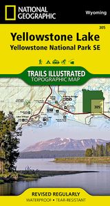
Prachtige geplastificeerde kaart van het nationaal park. Met alle recreatieve voorzieningen als campsites, maar ook met topografische details en wandelroutes ed. Door uitgekiend kleurgebruik zeer prettig in gebruik. Scheur en watervast! National Geographic's Trails Illustrated map of the Yellowstone Lake area of Yellowstone National Park is designed to meet the needs of outdoor enthusiasts with unmatched detail of the south-east section of the national park. Expertly researched and created in partnership with local land management agencies, this map features key points of interest including Yellowstone lake shown with contours and bathe metric shading, Lake Village, Grant Village, East Entrance Station, Heart Lake, Bridger-Teton National Forest, Shoshone National Forest, Teton Wilderness, and North Absaroka Wilderness. With many miles of mapped trails and marked Bear Management Zones the Yellowstone Lake map can guide you off the beaten path and back again. The clearly marked trails include mileages between intersections. The map base includes contour lines and elevations for summits, passes and many lakes. Some of the many recreation features include: visitor centers, campgrounds, boat ramps, trailheads, and interpretive trails. Every Trails Illustrated map is printed on "Backcountry Tough" waterproof, tear-resistant paper. A full UTM grid is printed on the map to aid with GPS navigation. Other features found on this map include: Big Game Ridge, Colter Peak, Eagle Peak, Heart Lake, Lewis Lake, Mount Hancock, Mount Sheridan, North Absaroka Wilderness, Red Mountains, Shoshone National Forest, Teton National Forest, Teton Wilderness, Thorofare Plateau, Washakie Wilderness, Yellowstone Lake, Yellowstone National Park.

