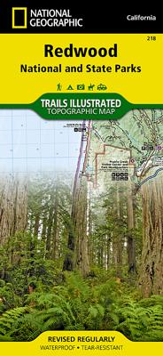
Wandelkaart 218 Redwood National & State Parks | National Geographic

0

Verkopers met dit product

Verkoper
Bezorging
Prijs
DeZwerver.nl logo
DeZwerver.nl
2,95
17,95

Anderen bekeken ook

Wandelkaart - Topografische kaart 205 Sequoia - Kings Canyon National Parks | National Geographic
Prachtige geplastificeerde kaart van het nationaal park. Met alle recreatieve voorzieningen als campsites, maar ook met topografische details en wandelroutes ed. Door uitgekiend kleurgebruik zeer prettig in gebruik. Scheur en watervast! Trails Illustrated maps are the most trusted and popular recreation maps available. Continually setting the standard for accuracy, each map is crafted in conjunction with local land managers, and undergoes rigorous review and enhancement before being printed on waterproof, tear-resistant material. Each Trails Illustrated map contains detailed topographic information, clearly marked and named trails, recreational points of interest, and navigational aids. National Park series maps contain useful details for planning your visit. State series titles cover popular recreation areas, ideal for done-in-a-day activities.  
16,95
Reisgids National Geographic Secrets of the National Parks, 2nd Edition | National Geographic
Discover a side of America's national parks that you've never seen before with more than 500 tips and tricks for getting away from the crowds, exploring little-known hikes, and finding coveted secret spots--along with cool insider tips that will yield a one-of-a-kind vacation experience. The iconic landmarks in America's national parks draw hundreds of millions of visitors every year, from Yosemite's famous Half Dome to Yellowstone's Old Faithful. But beyond these well-known wonders lies a world of hidden treasures--if you know where to look. This exceptional guide reveals these lesser-known gems, along with insider knowledge about the parks' main attractions. With vital tips from rangers, experts, and travelers, readers can have Acadia's massively popular Sand Beach and Jordan pond to themselves, or be one of the 10 percent of Grand Canyon visitors who go beyond the rim. Fully updated and redesigned to include the newest national parks and featuring expert advice from rangers, park …
29,95
Wandelkaart - Topografische kaart 314 Many Glacier - Glacier and Waterton Lakes National Parks | National Geographic
Prachtige geplastificeerde kaart van het bekende nationaal park. Met alle recreatieve voorzieningen als campsites, maar ook met topografische details en wandelroutes ed. Door uitgekiend kleurgebruik zeer prettig in gebruik. Scheur en watervast!   Located just north of Kalispell in Montana's northwest corner, Glacier National contains an abundance of recreational opportunities for outdoor enthusiasts of all interests.   This detailed topographic recreation map contains carefully researched trails, campsites, forest service roads, and points-of-interests, for the Many Glacier section of the park. Two additional maps for the North Fork and the Two Medicine regions of the park along with a comprehensive Glacier National Park Trails Illustrated map are also available. An enhanced scale of 1:50,000, useful UTM and Latitude/Longitude grids, mileage charts, and other navigation features make the North Fork sectional the best map available for the western side of the park.   The North Side of …
14,95
Reisgids Complete National Parks of the United States | National Geographic
Stevig hardcover gids met prachtige kleurenfoto's, gedetailleerde kaarten, historische achtergrondinformatie en praktische details over de locaties van de parken, evenals aanbevelingen voor de beste tijd om te bezoeken en de populairste activiteiten. National Geographic's wide-ranging travel guide to recreation areas, trails, historic sites, nature hikes, seashores, camping, and campgrounds is geared to everyone who loves outdoor recreation. This 544-page reference is the ultimate travel planner for all things national parks, filled with full-color photos, detailed maps, historical background, and practical facts on the location of the park system properties, as well as the best times to visit and top-rated activities.
41,50
Wandelkaart 216 Olympic National Park | National Geographic
Prachtige geplastificeerde kaart van het bekende nationaal park. Met alle recreatieve voorzieningen als campsites, maar ook met topografische details en wandelroutes ed. Door uitgekiend kleurgebruik zeer prettig in gebruik. Scheur en watervast! Within the park, there is detailed coverage of Mount Olympus, Tshletshy Ridge, Hurrican Ridge, Huelsdonk Ridge, Bailey Range, camping areas, facilities, ranger stations, nature trails, waterfalls, boat launches, and much more. Also included are the Mount Skokomish Wilderness, Ozette Lake, Lake Pleasant, Lake Crescent, Lake Mills, and Olympic National Forest.
16,95

Klanten-reviews van Wandelkaart 218 Redwood National & State Parks | National Geographic

Er zijn nog geen beoordelingen voor dit productBen jij de eerste die een review plaatst?

Meer over Wandelkaart 218 Redwood National & State Parks | National Geographic

Verken gerelateerde categorieën

Webshop.nl maakt gebruik van cookies. Ga je verder op onze website, ga dan akkoord met het plaatsen van cookies en de verwerking van deze data door ons en vermelde partners.