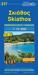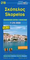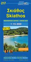
Wandelkaart 217 Skiathos | Road Editions

0
Gedetailleerde wegenkaart met aanduiding van de wandelwegen, lijst van hotels en toeristische informatie. Voor alle doeleinden een zeer geschikte kaart.   The features that make this and every other ROAD island map unique are: *The coastline, hydrography and precision geophysical background based on data provided by the Hellenic Military Geographi...

Verkopers met dit product

Verkoper
Bezorging
Prijs
DeZwerver.nl logo
DeZwerver.nl
2,95
9,95

Anderen bekeken ook

Wegenkaart - landkaart 107 Serifos | Road Editions
Gedetailleerde wegenkaart met aanduiding van de wandelwegen, lijst van hotels en toeristische informatie. Voor alle doeleinden een zeer geschikte kaart. The features that make this and every other ROAD island map unique are: *The coastline, hydrography and precision geophysical background based on data provided by the Hellenic Military Geographic Service and electronically processed by us for clarity and legibility. We have highlighted the mountain masses in shades of brown between the contour lines (at 20m intervals on this map) to outline clearly the relief of the island. *The beaches are indicated by a special symbol next to which we have noted their names, as well as all the roads and footpaths leading to them (since most people primarily visit the islands for the beaches!). We have even included a short text in which the island’s best beaches are concisely referred to, to save you going on a wild goose hunt in search of them. *The road network is mapped out with impressive and ex…
9,95
Wegenkaart - landkaart 109 Sifnos | Road Editions
Gedetailleerde wegenkaart met aanduiding van de wandelwegen, lijst van hotels en toeristische informatie. Voor alle doeleinden een zeer geschikte kaart. The features that make this and every other ROAD island map unique are: *The coastline, hydrography and precision geophysical background based on data provided by the Hellenic Military Geographic Service and electronically processed by us for clarity and legibility. We have highlighted the mountain masses in shades of brown between the contour lines (at 20m intervals on this map) to outline clearly the relief of the island. *The beaches are indicated by a special symbol next to which we have noted their names, as well as all the roads and footpaths leading to them (since most people primarily visit the islands for the beaches!). We have even included a short text in which the island’s best beaches are concisely referred to, to save you going on a wild goose hunt in search of them. *The road network is mapped out with impressive and ex…
9,95
Wegenkaart - landkaart 105 Tzia - Kea | Road Editions
Gedetailleerde wegenkaart met aanduiding van de wandelwegen, lijst van hotels en toeristische informatie. Voor alle doeleinden een zeer geschikte kaart. Scheur- en watervast! The features that make this and every other ROAD island map unique are: *The coastline, hydrography and precision geophysical background based on data provided by the Hellenic Military Geographic Service and electronically processed by us for clarity and legibility. We have highlighted the mountain masses in shades of brown between the contour lines (at 100m intervals on this map) to outline clearly the relief of the island. *The beaches are indicated by a special symbol next to which we have noted their names, as well as all the roads and footpaths leading to them (since most people primarily visit the islands for the beaches!). We have even included a short text in which the island’s best beaches are concisely referred to, to save you going on a wild goose hunt in search of them. *The road network is mapped out…
9,95
Wegenkaart - landkaart 110 Milos Kimolos | Road Editions
Gedetailleerde wegenkaart met aanduiding van de wandelwegen, lijst van hotels en toeristische informatie. Voor alle doeleinden een zeer geschikte kaart. Though not among the top ten most popular destinations in the Aegean, these are two beautiful islands with a unique character, ideal for quiet family holidays, and nature touring, as well as for the young crowd looking for exciting summer fun. This is the best, most updated and easy to read map available of Milos and Kimolos. As all ROAD maps, it was designed following careful and exhaustive onsite research. We used the most advanced technology to precisely map the entire road networks of these two islands, we measured the distances in kilometers from intersection to intersection with precision instruments, marked all country churches, monasteries, archaeological sites and castles on these islands, as we did the beaches and the roads leading to them, the altitudes of mountain peaks, the footpaths we were able to locate and record, the…
9,95
Wandelkaart Tour & Trail Formentera | Discovery Walking Guides
Goede, scheur- en watervaste, wandelkaart van Formentera.   Water-proof, split-proof, tear-proof, adventure-proof. Formentera Tour & Trail Super-Durable Map is simply the toughest, most accurate, easy to read, easy to use map of the island you can buy at any price. David & Ros Brawn surveyed this beautiful island in October 2015 carrying out their 'gps ground survey' pinpointing all the details needed to produce the definitive map of Formentera.   Large, 25k scale, easy to read map sheet includes a wealth of useful details. 20 metre and 100 metre contours combined with altitude shading bring the Formentera landscape to life. All of the legendary Tour & Trail attention to detail is included so that you will find those petrol stations, mirador viewpoints with parking, refreshment stops with parking and accurate road numbering that are so essential when adventuring by hire car; 'watts' new and unique to Formentera we have included the 'Electric hire car' recharging points making sure you…
15,95
Wandelkaart 302 Kythnos | Terrain maps
Erg goede wandelkaart van Kythnos, weerbestendig en volledig. Bezienswaardigheden, campings en andere praktische zaken staan op de kaart aangegeven. GPS toepasbaar.   This is the best map of Kythnos because:   It is waterproof and rip-proof. You can fold and unfold it a thousand times, fold it in irregular ways, dunk it in the sea or leave it out in the rain. This map is indestructible!  It is the first GIS map of the island, meaning that this is the first time Kythnos is mapped with a topographic precision in proportion to the map scale.  It is remarkably detailed, at a scale twice as large as the competition’s, which makes everything crystal clear!  It is the first map depicting the island’s trails with total precision, their length measured in kilometers so you can estimate the duration of your hike, and detailed descriptions of Kythnos’ 13 best trails on the back.  It is the first time the island’s entire coastline is mapped. Cartography was done with TERRAIN’s specially equi…
11,95
Wandelkaart 312 Minor Cyclades | Terrain maps
Gedetailleerde wegenkaart en wandelkaart met alle kleine wegen, wandelpaden, hoogtelijnen en toeristische informatie aangegeven. Alle tekst is tweetalig in Engels en Grieks en de waterproof kaart is geschikt voor gebruik met GPS. Why this is a great map: For one thing, it is the most accurate map of the Minor Cyclades! This is the first GIS precision map on the market for the Minor Cyclades, namely Irakleia, Pano and Kato Koufonisi, Schinousa, Donousa and Keros.  It is waterproof and rip-proof. You can fold and unfold it a thousand times, fold it in irregular ways, dunk it in the sea or leave it out in the rain. This map is indestructible!  It is the first time the island’s entire coastline is mapped. Cartography was done with TERRAIN’s specially equipped and staffed cartographic vessel. This means that you can locate all beaches of the island, down to the tiniest cove! In fact, the special features of every single beach are recorded: whether it is sandy or pebbled, whether it feat…
11,95
Wandelgids Amorgos, Naxos, Paro, Andros & eastern and northern Cycladen | Graf editions
Wandelgids met 56 wandelingen op 12 eilanden. Het boekje beschrijft de mooiste oude wandelroutes. Met gedetaileerde kaartjes, looptijden, GPS points en foto's van standpunten voor een betere orientatie. Met : Amorgós Ándros Antíparos Donoússa Irakliá Koufonísi Mýkonos Náxos Páros Schinoússa Sýros Tínos Van de uitgever This book describes the loveliest old walking trails. With precise descriptions, detailed maps, exact times, GPS points and photos of outstanding places for better orientation. And lots of useful knowledge about the "Islands of Light." It is made for island hoppers who want to drift through the island world by ship and who would also like to hike and swim in this ancient cultural landscape.   For the update of this new edition all the tracks and paths have been newly walked along and rechecked. All extensions, some of them also changed routes, are recorded. And 12 new hikes have been added.   White, cubical houses in front of infinitely blue sea – that is how we know Gre…
19,50
Wandelkaart 329 Psara | Terrain maps
Gedetailleerde wegenkaart en wandelkaart met alle kleine wegen, wandelpaden, hoogtelijnen en toeristische informatie aangegeven. Alle tekst is tweetalig in Engels en Grieks en de waterproof kaart is geschikt voor gebruik met GPS.   This is a great map because: First and foremost, it is the only available map of Psara! So far, no other cartographer had taken interest in this historical but forgotten corner of Greece. It is made with data collected 100% through field survey and comes in the detailed scale of 1:15,000, showing everything very clearly.  For the first time, all the trails of Psara are shown with absolute accuracy. The length of all trails has been measured in kilometres, so you can estimate the duration of your hike. On the back side of the map you ‘ll find detailed descriptions of the 3 best hikes on the island, also labeled on the map itself, so you easily locate them.  The nearby uninhabited island of Antipsara as well as all the surrounding islets are also included,…
11,95
Wandelkaart 337 Kalymnos | Terrain maps
Gedetailleerde wegenkaart en wandelkaart met alle kleine wegen, wandelpaden, hoogtelijnen en toeristische informatie aangegeven. Alle tekst is tweetalig in Engels en Grieks en de waterproof kaart is geschikt voor gebruik met GPS. This is a great map because: It is the only map featuring the climbing crags of Kalymnos completely and accurately. Fabulous cliffs and impeccable organization have made Kalymnos the No 1 rock climbing destination worldwide. This is the first map of Kalymnos to accurately feature all climbing crags on the island, with no omissions or errors, including crags equipped through May of 2009! There are two more maps of Kalymnos in the market, but if you can compare them with the SKAI map of Kalymnos – you will immediately see how far ahead our map is. One of those maps features a few of the climbing crags with symbols on the back side. The other features climbing crags on the actual map but with several errors, inconsistencies and considerable omissions.  It is w…
11,95

Klanten-reviews van Wandelkaart 217 Skiathos | Road Editions

Er zijn nog geen beoordelingen voor dit productBen jij de eerste die een review plaatst?

Meer over Wandelkaart 217 Skiathos | Road Editions

Productomschrijving

Gedetailleerde wegenkaart met aanduiding van de wandelwegen, lijst van hotels en toeristische informatie. Voor alle doeleinden een zeer geschikte kaart.   The features that make this and every other ROAD island map unique are: *The coastline, hydrography and precision geophysical background based on data provided by the Hellenic Military Geographic Service and electronically processed by us for clarity and legibility. We have highlighted the mountain masses in shades of brown between the contour lines (at 20m intervals on this map) to outline clearly the relief of the island. *The beaches are indicated by a special symbol next to which we have noted their names, as well as all the roads and footpaths leading to them (since most people primarily visit the islands for the beaches!). We have even included a short text in which the island’s best beaches are concisely referred to, to save you going on a wild goose hunt in search of them. *The road network is mapped out with impressive and exemplary thoroughness and is updated in each new edition – thoroughness being a trait ROAD is internationally famous for. Even the most insignificant secondary and blind unsurfaced roads are charted (so that you know where not to turn!), with scenic routes specially highlighted in green (telling you where you should turn!) and precision distance measurements from intersection to intersection, to allow you to track your course with greater ease. *The island’s major footpaths are clearly charted. *The monasteries, country churches, archaeological sites, lighthouses, caves and many more places of interest, are marked with great accuracy. *Short texts (in Greek and English) that present the history, the island as it is today, the local products and the most important things to know about the island. *On the back of the map, which is also in colour, there is a complete listing of the accommodations on the island, useful telephone numbers, information about local transport schedules etc., as well as a short tour of the island and many photographs

Verken gerelateerde categorieën

Webshop.nl maakt gebruik van cookies. Ga je verder op onze website, ga dan akkoord met het plaatsen van cookies en de verwerking van deze data door ons en vermelde partners.