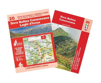
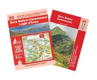
Wandelkaart 20 Dora Baltea Canavesana - Laghi d'Ivrea | L'Escursionista editore

0
Voor weinig gebieden in Italië zijn echt goede wandelkaarten beschikbaar. Dit is gelukkig zo'n serie: voor de noordwestelijke Alpen van Italië, Gran Paradiso, Mont Blanc en Aosta en omgeving.   Met GPS grid uitgeruste detailkaart, schaal 1:25.000 met alle noodzakelijke wandelinformatie als ingetekende routes, Via Ferrata routes, campings, berghutt...

Verkopers met dit product

Verkoper
Bezorging
Prijs
DeZwerver.nl logo
DeZwerver.nl
2,95
15,95

Anderen bekeken ook

Wandelkaart 21 Biellese Nord Ovest - Valli Elvo, Oropa, Cervo | L'Escursionista editore
Voor weinig gebieden in Italië zijn echt goede wandelkaarten beschikbaar. Dit is gelukkig zo'n serie: voor de noordwestelijke Alpen van Italië, Gran Paradiso, Mont Blanc en Aosta en omgeving.     Met GPS grid uitgeruste detailkaart, schaal 1:25.000 met alle noodzakelijke wandelinformatie als ingetekende routes, Via Ferrata routes, campings, berghutten en schuilhutten, dat alles met een kaart die veel topografische details kent.    Hoogtelijnen van 25 m. interval, schaduwtekeningen en goed gebruik van kleur voor bijvoorbeeld gletsjers en bossen. Naast ingetekende routes zijn er ook gewone voetpaden op te vinden.    Bijgeleverd wordt (niet bij elke kaart) een kleine brochure met wandelmogelijkheden in dat bepaalde gebied.   The Biellese district has a remarkable variety of landscapes. It is bounded both by the alpine chain separating it from the Valle d’Aosta and Valsesia, as well as Europe’s largest moraine relief in the southwest. Its rich history embraces herding and gold prospectin…
15,95
Reisgids Marco Polo ENG Lake District | MairDumont
Handige en overzichtelijke, kleine reisgids voor een eerste kennismaking met de vakantiebestemming. Globale uitklapkaart achterin, makkelijk binnenzakformaat. Marco Polo Pocket Guide Lake District: the Travel Guide with Insider Tips Explore the Lake District with this handy, pocket-sized, authoritative guide, packed with Insider Tips. Discover boutique hotels, authentic restaurants, the region's trendiest places, and get tips on shopping and what to do on a limited budget. There are plenty of ideas for travel with kids, and a summary of all the festivals and events that take place. Let Marco Polo show you all this beautiful corner of Britain has to offer... From the highest peaks to the deepest lakes, picture perfect villages, sweeping panoramic views, hilltop walks, literary locations, country pubs and bustling market towns - welcome to the Lake District. England's largest National Park, and now World Heritage Site, the Lake District offers a perfect retreat to the countryside... Thi…
11,50
Wandelgids The Lake District Fells Coniston walking guide | Cicerone
Uitstekende uitgebreide wandelgids van een bepaald deel vsn het Lake District, één van de mooiste wandelgebieden van Engeland. De routes zijn goed beschreven, met prima kaartmateriaal. Zolang je niet van de route afwijkt is deze gids voldoende om de wandelroute te lopen.  Part of the Walking the Lake District Fells series, this guidebook covers a wide range of routes to 24 Lakeland summits that can be climbed from Coniston, Torver, the Duddon valley and the Birker Fell road, with highlights including Coniston Old Man, Swirl How, Wetherlam and Black Combe. Suggestions for longer ridge routes are also included. This guide describes ascents of 24 Lake District fells that can be climbed from Coniston and the Duddon and Eskdale valleys, including Coniston Old Man, Swirl How, Wetherlam and Dow Crag. The Coniston Fells - much loved for their classic ridges and wide-reaching views - need little introduction; however, to the west the less-frequented summits of the Birker and Corney Fell massif…
20,95
Wandelgids - Pelgrimsroute Via Francigena part 2 | Cicerone
Guidebook to the Via Francigena pilgrim route from Lausanne to Lucca. Starting at Lake Geneva (Lac Léman), the 725km route crosses the Alps at historic Great Saint Bernard Pass, descends the Po Valley, then climbs to cross the Cisa Pass into Tuscany. Described in 32 stages, with information on facilities and pilgrim hostels.   Seasons Suitable for walking in spring, summer and autumn. The Great Saint Bernard Pass is fully open to hikers only in August and September.   Centres Lausanne, Martigny, Great Saint Bernard Pass, Aosta, Ivrea, Vercelli, Pavia, Piacenza, Pontremoli, Pietrasanta, Lucca.   Difficulty Each stage is graded for difficulty (1-4). A few mountainous stages include steep and slippery slopes. No special gear is required to walk the Via Francigena in season, but off-season crossings of the Great Saint Bernard Pass require winter mountain gear and careful attention to changing mountain conditions.   Must See Dazzling Lake Geneva, the 1500-year-old Abbey of Sai…
24,95
Wandelgids The Lake District Fells Borrowdale walking guide | Cicerone
Uitstekende uitgebreide wandelgids van een bepaald deel vsn het Lake District, één van de mooiste wandelgebieden van Engeland. De routes zijn goed beschreven, met prima kaartmateriaal. Zolang je niet van de route afwijkt is deze gids voldoende om de wandelroute te lopen.  Part of the Walking the Lake District Fells series, this guidebook covers a wide range of routes to 28 Lakeland summits that can be climbed from the Borrowdale and Thirlmere valleys - both easily accessed from Keswick - with highlights including Catbells, Great Gable and Scafell Pike. Suggestions for longer ridge routes are also included. This guide describes ascents of 28 Lake District fells that can be climbed from Borrowdale and the Newlands and Thirlmere valleys, including Catbells, a perennial favourite, and the mighty Scafell Pike, Great End and Great Gable. Easily accessed from Keswick, Borrowdale is a valley of exquisite natural beauty, with the lower wooded and heather-clad slopes giving way to sweeping moor…
20,95
Fietskaart 10 Cycling guides North York Moors | Goldeneye
Scheur- en watervast foetskaart van de North York Moors  met ingetekende fietsroutes.   Our maps are double-sided, printed on an A2 sheet with a concertina fold. This allows for easy folding and folding, and an ease of access to the mapping. The material is rain and tear-resistant. Our early maps were designed at the scale of 2 miles to 1 inch/1:126,720. The later designs along with digitalisation are 1: 100,000. We were encouraged by the Cycle Touring Club to convert our cartography toward the cycle market (to replace the out-of-print Bartholomew series). As time and the series progressed we have added more data: The National Cycle Network routes, Regional Routes, and Traffic-Free Family Routes, as and when they are developed. These routes are in addition to the Circular Routes Goldeneye Commissioned at the outset of our publishing schedule. We are also adding to new editions; bike shops, cycle hire, and tea rooms, along with the tourist attractions already featured. Our plan is to m…
14,95
Wandelgids 071 Pathfinder Guides The High Fells of Lakeland | Ordnance Survey
Are you planning a holiday to the Lake District? Do you enjoy a hill-walking challenge with impressive mountain-top views? Inside Pathfinder (R) Guide to the High Fells of Lakeland are 20 majestic and challenging fell walks amid the glorious scenery of the Lake District mountains with clear and easy-to-follow route directions compiled from the author's 40 years' experience of Lakeland walking. For adventurous ramblers and walkers wanting a hill-walking challenge, this brand new Pathfinder (R) walking guide features 20 demanding day-walks in the mountains of the Lake District, from Scafell Pike (highest mountain in the Lake District), to Helvellyn, Skiddaw, Great End and Bowfell - all over 900m (nearly 3000 feet) high. Giving a detailed guide to 20 inspiring expeditions on the high fells of Lakeland, Pathfinder (R) Guide to the High Fells of Lakeland explores some of the best fell walking country in the Lake District. With views over to Buttermere, Derwentwater and Grasmere, the Lakela…
18,50
Wandelgids The Lake District Fells Wasdale | Cicerone
Uitstekende wandelgids voor dit uitdagende wandelgebied.   This guide describes ascents of 25 Lake District fells that can be climbed from the valleys of Wasdale, Eskdale and Ennerdale. Quieter and wilder than the eastern side of the national park - though every bit as beautiful - this area is home to many of the region's most celebrated peaks, with highlights including iconic Great Gable, Pillar and Yewbarrow, as well as England's highest mountain, Scafell Pike.   Unlike other guidebooks which describe a single or limited number of routes to a particular destination, the aim of the Walking the Lake District Fells series is to offer all the options. These are presented as numbered sections which can be combined to create infinite possibilities - from simple ascents to longer ridge routes. You'll find the classics and popular routes alongside less traditional alternatives perfect for the wandering spirit. The series gives you both the freedom to devise your own routes and the informati…
20,95
Accommodatiegids - Campergids - Campinggids Botswana Self-Drive Guide | Tracks4Africa
De Self Drive Guide Botswana van Tracks4Africa is een uitgebreide gids met alle informatie voor mensen die zelf met een eigen of gehuurde auto door Botswana willen reizen. De gids bevat informatie over parken en routes, over overnachtingsmogelijkheden en campings, maar ook over de veiligheid, de beste reistijd, de planning, de keuze van welk vervoermiddel en de hulpmiddelen die vereist zijn. Zo vindt u bijvoorbeeld ook informatie over het huren van een 4x4 met tent op het dak en campingspullen, over de techniek van de auto, over voorbereiding, over navigatie, communicatie en vereiste documenten. De gids ziet er aantrekkelijk en overzichtelijk uit en bevat veel kaarten met routes en ook kleurenfoto's. De gids is groot van formaat : A4 !   This guide is specifically aimed at self-drive travellers. If you are a self-drive tourist, there are five things that you need to know when you are on the road:  1. Where to sleep.  2. Where to get fuel.  3. What to see and do.  4. Where to buy suppl…
52,50
Fietskaart Reivers Cycle Routes | Northern Heritage Services
The long-distance Reivers Cycle Routes are two intertwining signed / waymarked bi-directional ‘coast to coast’ cycle routes between the North Sea and the Irish Sea.   The original Reivers Cycle Route was created in 1998 eventually becoming NCN Route 10 with interlinking on-road and off-road sections but this soon morphed into a one-size-fits-all route which never worked well. The regenerated re-launched Reivers Cycle Routes are two intertwining route options – one which is as much off-road as possible suitable for gravel and cross bikes, hybrids and mountain bikes and a version designed for capable road cyclists 100% on tarmac.   The routes are bi-directional and continuously reward the rider with beautiful views of the constantly changing terrain, provide many places of interest to pass by or call in and many lovely villages and quiet hamlets to cycle through or stay the night. Most importantly, there is a supply of excellent on route or close-to-route refreshments stops.   The off-r…
16,50

Klanten-reviews van Wandelkaart 20 Dora Baltea Canavesana - Laghi d'Ivrea | L'Escursionista editore

Er zijn nog geen beoordelingen voor dit productBen jij de eerste die een review plaatst?

Meer over Wandelkaart 20 Dora Baltea Canavesana - Laghi d'Ivrea | L'Escursionista editore

Productomschrijving

Voor weinig gebieden in Italië zijn echt goede wandelkaarten beschikbaar. Dit is gelukkig zo'n serie: voor de noordwestelijke Alpen van Italië, Gran Paradiso, Mont Blanc en Aosta en omgeving.   Met GPS grid uitgeruste detailkaart, schaal 1:25.000 met alle noodzakelijke wandelinformatie als ingetekende routes, Via Ferrata routes, campings, berghutten en schuilhutten, dat alles met een kaart die veel topografische details kent.    Hoogtelijnen van 25 m. interval, schaduwtekeningen en goed gebruik van kleur voor bijvoorbeeld gletsjers en bossen. Naast ingetekende routes zijn er ook gewone voetpaden op te vinden.    Bijgeleverd wordt (niet bij elke kaart) een kleine brochure met wandelmogelijkheden in dat bepaalde gebied.   Only recently has the Dora Baltea Canavese district been discovered by tourists, foreigners for the most part. It has unique landscapes of great interest for visitors. Located at the opening of the Aosta valley, it is geographically distinct. Running along its side and front are some of the most extensive and undoubtedly best preserved moraines in Europe, which make up the so-called Moraine Amphitheatre of Ivrea. The district boasts mountains that soar as high as 2500 metres in the Scalaro basin, while the flanks opposite are dominated by the Mombarone, an especially popular destination for local walkers. This mountain affords superb views that range over the plain and as far as the Ligurian and Central Alps, along with a good part of the crown of peaks in Piedmont. Starting out from the main moraine ridges, a series of minor moraines branch out towards the interior, each home to splendid villages and hamlets surrounded by wooded hills. As the Balteo glacier retreated, it scooped out multiple basins that led to the formation of a number of sizeable bodies of water, the so-called “Lakes of Ivrea”. Walkers will enjoy solitude as they follow majestic stepped stone ways constructed for farming-pastoral purposes and dating back centuries, as well as a dense network of paths at lower altitudes which are well suited to mountain bikers. Cultivated terraces (vineyards for the most part), castles and dairy farms complete the picture. The mountain settlements of Maletto and Scalaro are delightful, as are the villages along the banks of the river Dora Baltea, undiscovered by mass tourism, an added attraction. The best times to visit are spring and autumn; good bases for exploring the area are Settimo Vittone and Quincinetto which boasts a splendid camping ground open year-round, and top quality restaurants and pizzeria.   1 Bec di Nona   2 Mombarone and Punta Tre Vescovi   3 The Via Francigena in the Canavese district   4 A Loop from Montestrutto   5 From Andrate to San Giacomo   6 The Five Lakes on the Serra d'Ivrea   7 The Brosso Mines   8 Monte Cavallaria Circuit   9 Around Cima Battaglia
 

Verken gerelateerde categorieën

Webshop.nl maakt gebruik van cookies. Ga je verder op onze website, ga dan akkoord met het plaatsen van cookies en de verwerking van deze data door ons en vermelde partners.