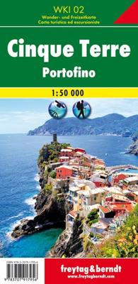
Wandelkaart 2 Cinque Terre - Portofino | Freytag & Berndt

0
Goede wandelkaart van het beroemde Cinque Terre. Fietsroutes, wandelroutes en enkele mountainbike-tochten staan er op ingetekend. GPS - bruikbaar.   Explore the Italian coastline known as Cinque Terre and the fishing village of Portofino with this Freytag & Berndt travel set. Inside the plastic sleeve, you will find a hiking and leisure map; as we...

Verkopers met dit product

Verkoper
Bezorging
Prijs
DeZwerver.nl logo
DeZwerver.nl
2,95
13,95

Anderen bekeken ook

Nieuw
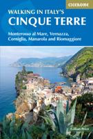
Wandelgids Walking in Italy's Cinque Terre | Cicerone
Uitstekende wandelgids van de Cinque Terre. Goed beschreven met veel praktische informatie om de routes te kunnen lopen, inclusief redelijke kaarten. This guidebook presents 16 graded walks exploring the world-famous Cinque Terre villages of Liguria in Italy. Suitable for beginners and experienced walkers, routes take in the villages of Monterosso, Vernazza, Manarola, Corniglia, Riomaggiore, as well as neighbouring Levanto, Campiglia and Porto Venere. It describes the most popular pathways as well as less trodden routes to hidden gems. Route descriptions and maps for each walk are accompanied by information on how to get around by public transport (train, ferry and bus), with background notes on history, culture, wildlife and flora, and suggestions on where to sleep and what to eat. In short, everything you could possibly need to get the most out of a holiday in this unique corner of the Italian Riviera. One of the best loved places in Italy, the Cinque Terre are UNESCO World Herita…
20,95
Wandelkaart G1 Samos | Freytag & Berndt
Introducing the Samos Hiking and Leisure Map – your essential guide to exploring the stunning landscapes of Samos Island.   Discover detailed information on hiking trails across Samos, allowing you to plan your adventures with ease and learn about key attractions along the way.   Samos beckons hikers with its captivating diversity – from towering peaks like Mount Kerkis and deep gorges such as Kakoperato Gorge, to remote forests waiting to be explored. This Mediterranean hiking paradise boasts picturesque villages, hidden monasteries, ancient city walls, and medieval fortresses.   Key Features of the Samos Hiking and Leisure Map:   Scale 1:35,000 Extensive network of hiking trails Tourist information highlights Includes the Rother App for digital map access Waterproof and tear-resistant Dimensions: 99 x 61 cm Explore confidently with the linked free version of the Rother App, offering a digital map of Samos' complete hiking network and sample tours (free registration required).   Desi…
14,95
Nieuw
Fietskaart - Wandelkaart 076 Nebelstein - Gmünd - Weitra - Gross Gerungs | Freytag & Berndt
The Nebelstein hiking map on a scale of 1:50,000 is the ideal companion for excursions, hikes and bike tours in the Oberes Waldviertel, Waldviertel Mitte and Mühlviertler Alm Freistadt regions Lainsitz, the Castles and Castles Trail, the St. John's Trail and the Life Trail. The hiking trails on the map are easy to follow thanks to the exact cartography by freytag & berndt and the ideal scale. Also for cyclists and mountain bikersthe Nebelstein hiking map is very suitable. In addition to demanding mountain bike routes, the course of the Waldviertel cycle path and parts of the EuroVelo 13 - Iron Curtain Trail can also be followed. Information on the Nebelstein hiking map 1:50,000 Hiking and long-distance hiking trails Cycle paths and mountain bike tours Attractive excursion destinations With info guide GPX Tracks zum Download Waterproof and tear resistant 90 x 61 cm, double-sided Info guide The "short and compact" info guide offers a journey through the regions of the Upper Waldviertel,…
13,95
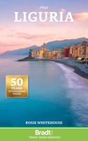
Reisgids Liguria - Ligurië | Bradt Travel Guides
Voor vele landen net zo goed, zo niet beter dan de Planet. Beduidend soberder uitgevoerd, maar ook met veel informatie voor zelfstandige reizigers of backpackers en met veel kaartmateriaal. Een aanrader! This new, thoroughly updated fourth edition of Bradt's award-winning guide to Liguria is the essential companion to getting the most out of a visit to this beguiling Italian region. Author Rosie Whitehouse has spent over thirty years exploring Liguria. In her wide-ranging guide, she introduces you to not just the glitz of the Riviera but also to the charm of the little-known, wild hinterland and mountain valleys, including in-depth coverage of local gastronomic delights - a key element of any Ligurian visit. Liguria is a rugged region of dizzy passes and breathtaking views, where mountains plunge into the sparkling blue waters of the Mediterranean. The coastal strip includes the world-famous Italian Riviera, the great port city of Genoa, the resort of Portofino, the charming Cinque …
27,50
Nieuw
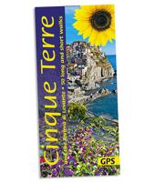
Wandelgids Cinque Terre and Riveira di Levante | Sunflower books
Wandelgids: vele dagtochten worden degelijk beschreven met openbaar vervoer informatie, goede routebeschrijvingen en kaartmateriaal. Tevens enkele autotochten. Deze gids staat goed bekend! Engelstalig Walking guide Cinque Terre includes recommended walks, many of which are circular tours. A detailed introduction provides information on waymarking and maps, what to take, weather and where to stay. Each walk begins with information about distance, difficulty grading, waymarking, how to get there, suggested clothing and equipment, language hints and shorter and alternative routes to the main walk. An appendice provides useful guidance on local transport. Also provided is a map of the area at about 1:400,000 showing where the walks and car tour take place and main roads and town.   The guide explores the best walking and touring possibilities in the region with detailed information about touring by hired car or public transport, helping walkers to navigate and plan day-trips. Shorter stro…
19,50
Nieuw
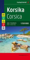
Wegenkaart - landkaart Corsica - Korsika | Freytag & Berndt
Deze bijzonder gedetailleerde Freytag & Berndt Wegenkaart van Corsica is aan één kant geprint en heeft een schaal van 1:150.000. Op deze kaart staan o.a. fietsroutes, lange afstandswandelpaden, toeristische wegen en bezienwaardigheden aangegeven. In de omslag van de kaart is een apart boekje geniet met een korte beschrijving van de TOP 10 van bezienswaardigheden, een uitgebreide index en plattegrondjes van enkele toeristische plaatsen. Explore the Mediterranean island of Corsica with this Freytag & Berndt single-sided road and leisure map. The best way to plan your trip, prepare your itinerary, and to travel independently on this region. As with all Freytag & Berndt maps, the cartography is clear and detailed with the topography shown with relief shading with plenty of spot heights.   This map features a full map of the island. Using Freytag & Berndt's icon system, important tourist information is shown. You will see icons for tourist information such as:   Picturesque towns and panor…
14,95
Nieuw
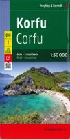
Wegenkaart - landkaart Corfu - Korfoe | Freytag & Berndt
Goede wegenkaart van Corfu, die ook behoorlijk veel detail weergeeft als het gaat om wandelpaden, fietsbare wegen en met veel symbolen voor toeristische bezienswaardigheden. De berijdbare wegen zijn goed weergeven, zowel de hoofdwegen als provinciale en lokale wegen; wegnummers worden vermeld. Afstanden tussen plaatsen zijn in kilometers op de kaart ingetekend, daarnaast worden ook op belangrijke plekken benzinepompen gemarkeerd. In het kaartbeeld wordt door middel van schaduw het reliëf weergegeven en soms enkele punten in het landschap met de daadwerkelijke hoogte. Provinciegrenzen zijn goed terug te vinden, nationale parken en reservaten ook. Met allerhande symbolen worden toeristische bezienswaardigheden weergegeven als monumenten, historisch belangrijke plekken en uitzichtpunten. In bepaalde plaatsen zijn hotels en campings te vinden, luchthavens, treinverbindingen en havens vindt u er ook op! Explore Corfu, the second largest of the Ionian Islands located in Greece; with this Fr…
14,95
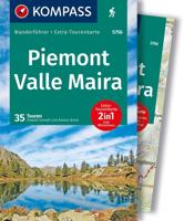
Wandelgids 5756 Kompass Wanderführer Piemont - Valle Maira | Kompass
Goede Duitstalige wandelgids met heldere beschrijvingen van de wandeltochten. Met hoogteprofiel, kaartje en de benodigde praktische informatie als bijvoorbeeld de startlocatie met GPS coordinaten. De wandelingen zijn ingedeeld in zwaarte en dan op verschillende kleuren weergegeven. Beschreven worden eenvoudige wandelingen tot pittige (berg)tochten, voor getrainde en ongetrainde wandelaars, een aantal wandelingen zijn geschikt om met kinderen te doen. Belangrijke toevoeging bij de Kompass wandelgidsen is een bijgevoegde losse wandelkaart van het betreffende gebied waarop de wandelingen uit de gids op de kaart heel duidelijk zijn ingetekend. Schaal 1:35.000   Kompass Hiking Guide Piedmont, Valle Maira Piedmont with the Maira Valley offers majestic Alps, lonely valleys and charming villages. Hikers experience the alpine nature and traditional culture of this northern Italian region.   2-in-1 hiking guide Piedmont, Valle Maira + extra tour card.   Tours hiked by compass experts Eac…
18,50
Nieuw
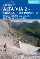
Wandelgids Alta Via 2 - Trekking in the Dolomites | Cicerone
Uitstekende wandelgids van een gerenommeerde Engelse uitgever. De tochten zijn met zorg beschreven en voorzien van allerhande nuttige informatie. Guidebook describing Alta Via 2, a challenging hut-to-hut trek through the Italian Dolomites. Stretching 174km from Bressanone (Brixen) to Feltre, the route involves some aided and exposed sections (although several can be bypassed) calling for a sure foot and a good head for heights. It can be walked in under a fortnight - although it is also possible to walk shorter chunks should you only have limited time, and the guide highlights potential exit routes and transport options. Also included are summaries of Alte Vie 3-6, which are more demanding and include remote terrain and stretches of via ferrata for which climbing experience is essential. On Alte Vie 3-6 some nights will be spent in unmanned bivouac huts, meaning trekkers must carry their own kit, although it is possible to walk shorter hut-to-hut sections. The easiest of the Alta Via …
23,95
Nieuw
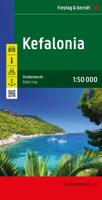
Wandelkaart - Wegenkaart - landkaart Kefallonia - Kefalonia | Freytag & Berndt
Goede wegenkaart van Kefallonia / Kefalonia, waarbij ook de kleinere wegen nog goed te lezen zijn. Gedetailleerde schaal van 1:50.000. Veel toeristische symbolen voor bezienswaardigheden als grotten, tempels, opgravingen maar ook mooie stranden etc. Ook handig is de Nederlandstalige Reisgids van Kefalonia "Ontdek Kefalonia" "Ontdek Kefalonia" Explore Kefallonia, the largest of the Ionian Islands located in Greece; with this Freytag & Berndt single-sided road and leisure map. The map will allow you to travel independently, and plan your journey well.   The map also features full colour photographs of some of the scenery to be found on Kefallonia, as well as an inset showing Kefallonia's position within the nation of Greece. An inset is also provided showing a city plan of the main township on Kefallonia, Argostoli. The topography is clear, with shading showing land gradients.    As with all Freytag & Berndt maps, icons and markings are used to denote tourist information and points of i…
14,95

Klanten-reviews van Wandelkaart 2 Cinque Terre - Portofino | Freytag & Berndt

Er zijn nog geen beoordelingen voor dit productBen jij de eerste die een review plaatst?

Meer over Wandelkaart 2 Cinque Terre - Portofino | Freytag & Berndt

Productomschrijving

Goede wandelkaart van het beroemde Cinque Terre. Fietsroutes, wandelroutes en enkele mountainbike-tochten staan er op ingetekend. GPS - bruikbaar.

  Explore the Italian coastline known as Cinque Terre and the fishing village of Portofino with this Freytag & Berndt travel set. Inside the plastic sleeve, you will find a hiking and leisure map; as well as a guide. The best way to plan your trip, prepare your itinerary, and to travel independently on this region. As with all Freytag & Berndt maps, the cartography is clear and detailed with the topography shown with relief shading with plenty of spot heights.   The hiking and leisure map includes an inset of the village of Portofino. Tourist information is marked clearly using a range of icons and markings. Tourist information displayed includes:   Roadways, footpaths, bridle paths, railway, shipping routes, moutain biking paths and hiking trails Restaurants, churches, and other buildings of interest Camping sites, caves, golf courses, information centres, parking locations, beaches, car ferries, and places for boating   Hiking trails marked are Alta Via dei Monti Linguri, Lunigiana, Alta Via del Golfo, Via Francigena, Alta via delle Cinque Terre and the Verdeazzurro hiking path. Distances between points are shown in kilometres and the legend is in German, Italian, English and French.   Also included is a guide booklet. This is in full colour with photographs; and written in German, Italian, English and French. Within this guide, you will find information on the climate, natural and cultural features, history, regions and walking routes of interest.

Verken gerelateerde categorieën

Webshop.nl maakt gebruik van cookies. Ga je verder op onze website, ga dan akkoord met het plaatsen van cookies en de verwerking van deze data door ons en vermelde partners.