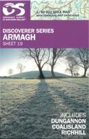
Wandelkaart 19 Discoverer Armagh | Ordnance Survey Northern Ireland

0
Zeer gedetailleerde topografische kaart met een aantal toegevoegde toeristische symbolen voor bijv. Bezienswaardigheden en campings. Met hoogtelijnen, mooi kleurgebruik en ingetekende lange-afstands-wandelroutes. OSNI has replaced the One-Inch maps with a completely new series at 1:50 000 scale. The series is numbered on an all-Ireland basis and O...

Verkopers met dit product

Verkoper
Bezorging
Prijs
DeZwerver.nl logo
DeZwerver.nl
2,95
20,50

Anderen bekeken ook

Wandelkaart 09 Discoverer Larne | Ordnance Survey Northern Ireland
Zeer gedetailleerde topografische kaart met een aantal toegevoegde toeristische symbolen voor bijv. Bezienswaardigheden en campings. Met hoogtelijnen, mooi kleurgebruik en ingetekende lange-afstands-wandelroutes. OSNI has replaced the One-Inch maps with a completely new series at 1:50 000 scale. The series is numbered on an all-Ireland basis and Ordnance Survey of Northern Ireland is responsible for the design and publication of the sheets that cover Northern Ireland and adjoining parts of the Republic of Ireland. The layout incorporates a number of overlaps. This map is derived from the latest large scale material, supplemented by new aerial photographs and ground surveys. It is the country's most detailed small-scale map and as well as showing all the features that were on the One-Inch map.
19,50
Wandelkaart - Topografische kaart OL62 OS Explorer Map Coreen Hills & Glenlivet | Ordnance Survey
Met zijn 4cm voor 1 km (2 ½ cm voor 1 mijl) schaal, is de OS Explorer kaartenserie de ideale en meest gedetailleerde kaartenreeks voor mensen die graag outdoor-activiteiten zoals fietsen, wandelen, paardrijden, klimmen en watersporten. Deze kaart is nog gedetailleerder dan de 'gewone' Landranger maps. Voor- en achterzijde bedrukt! Zeker op de moors en andere natuurgebieden van onschatbare waarden met echt alle aspecten van het landschap op de kaart ingetekend. Zeer goede detailkaart met topografische ondergrond. Hierop zijn toeristische symbolen van bezienswaardigheden ingetekend, daarnaast staan bijvoorbeeld campings en jeugdherbergen vermeld en - voor wandelaars het belangrijkst - alle right of way paden en Lange afstands Wandelpaden zijn er op te vinden. De ideale kaart voor het wandelen in Engeland, Wales of Schotland. Map sheet OL 62 covers Correen Hills and Glenlivet. Highlights include Cairngorms National Park, Gordon Way and Badingair Hill. Also includes Water of Bogie, Rhynie…
19,50
Wandelkaart 14 Discoverer Lough Neagh | Ordnance Survey Northern Ireland
Zeer gedetailleerde topografische kaart met een aantal toegevoegde toeristische symbolen voor bijv. Bezienswaardigheden en campings. Met hoogtelijnen, mooi kleurgebruik en ingetekende lange-afstands-wandelroutes. OSNI has replaced the One-Inch maps with a completely new series at 1:50 000 scale. The series is numbered on an all-Ireland basis and Ordnance Survey of Northern Ireland is responsible for the design and publication of the sheets that cover Northern Ireland and adjoining parts of the Republic of Ireland. The layout incorporates a number of overlaps. This map is derived from the latest large scale material, supplemented by new aerial photographs and ground surveys. It is the country's most detailed small-scale map and as well as showing all the features that were on the One-Inch map.
19,50
Wandelkaart 12 Discoverer Strabane | Ordnance Survey Northern Ireland
Zeer gedetailleerde topografische kaart met een aantal toegevoegde toeristische symbolen voor bijv. Bezienswaardigheden en campings. Met hoogtelijnen, mooi kleurgebruik en ingetekende lange-afstands-wandelroutes.   OSNI has replaced the One-Inch maps with a completely new series at 1:50 000 scale. The series is numbered on an all-Ireland basis and Ordnance Survey of Northern Ireland is responsible for the design and publication of the sheets that cover Northern Ireland and adjoining parts of the Republic of Ireland. The layout incorporates a number of overlaps. This map is derived from the latest large scale material, supplemented by new aerial photographs and ground surveys. It is the country's most detailed small-scale map and as well as showing all the features that were on the One-Inch map.
19,50
Wandelkaart 04 Discoverer Coleraine | Ordnance Survey Northern Ireland
Zeer gedetailleerde topografische kaart met een aantal toegevoegde toeristische symbolen voor bijv. Bezienswaardigheden en campings. Met hoogtelijnen, mooi kleurgebruik en ingetekende lange-afstands-wandelroutes.   OSNI has replaced the One-Inch maps with a completely new series at 1:50 000 scale. The series is numbered on an all-Ireland basis and Ordnance Survey of Northern Ireland is responsible for the design and publication of the sheets that cover Northern Ireland and adjoining parts of the Republic of Ireland. The layout incorporates a number of overlaps. This map is derived from the latest large scale material, supplemented by new aerial photographs and ground surveys. It is the country's most detailed small-scale map and as well as showing all the features that were on the One-Inch map.
19,50
Wandelkaart 18 Discoverer Enniskillen | Ordnance Survey Northern Ireland
Zeer gedetailleerde topografische kaart met een aantal toegevoegde toeristische symbolen voor bijv. Bezienswaardigheden en campings. Met hoogtelijnen, mooi kleurgebruik en ingetekende lange-afstands-wandelroutes.   OSNI has replaced the One-Inch maps with a completely new series at 1:50 000 scale. The series is numbered on an all-Ireland basis and Ordnance Survey of Northern Ireland is responsible for the design and publication of the sheets that cover Northern Ireland and adjoining parts of the Republic of Ireland. The layout incorporates a number of overlaps. This map is derived from the latest large scale material, supplemented by new aerial photographs and ground surveys. It is the country's most detailed small-scale map and as well as showing all the features that were on the One-Inch map.
19,50
Wandelkaart 07 Discoverer Londonderry | Ordnance Survey Northern Ireland
Zeer gedetailleerde topografische kaart met een aantal toegevoegde toeristische symbolen voor bijv. Bezienswaardigheden en campings. Met hoogtelijnen, mooi kleurgebruik en ingetekende lange-afstands-wandelroutes.   OSNI has replaced the One-Inch maps with a completely new series at 1:50 000 scale. The series is numbered on an all-Ireland basis and Ordnance Survey of Northern Ireland is responsible for the design and publication of the sheets that cover Northern Ireland and adjoining parts of the Republic of Ireland. The layout incorporates a number of overlaps. This map is derived from the latest large scale material, supplemented by new aerial photographs and ground surveys. It is the country's most detailed small-scale map and as well as showing all the features that were on the One-Inch map.
19,50
Wandelkaart 17 Discoverer Lower Lough Erne | Ordnance Survey Northern Ireland
  Zeer gedetailleerde topografische kaart met een aantal toegevoegde toeristische symbolen voor bijv. Bezienswaardigheden en campings. Met hoogtelijnen, mooi kleurgebruik en ingetekende lange-afstands-wandelroutes.   OSNI has replaced the One-Inch maps with a completely new series at 1:50 000 scale. The series is numbered on an all-Ireland basis and Ordnance Survey of Northern Ireland is responsible for the design and publication of the sheets that cover Northern Ireland and adjoining parts of the Republic of Ireland. The layout incorporates a number of overlaps. This map is derived from the latest large scale material, supplemented by new aerial photographs and ground surveys. It is the country's most detailed small-scale map and as well as showing all the features that were on the One-Inch map.
19,50
Wandelkaart - Fietskaart - Wegenkaart - landkaart 449 Central Crete - Kreta centraal | Terrain maps
Gedetailleerde wegenkaart en wandelkaart met alle kleine wegen, wandelpaden, hoogtelijnen en toeristische informatie aangegeven. Alle tekst is tweetalig in Engels en Grieks en de waterproof kaart is geschikt voor gebruik met GPS. Terrain’s map of Central Crete provides travelers with everything they need:  Scale of 100.000, which attributes all the information with clarity and in detail.  Map data processed within a GIS environment, resulting in great accuracy.  Double coordinate system, WGS 84 and ΕΓΣΑ 87, completely compatible with GPS.  It is printed on Polyart material, making it totally waterproof and rip-proof. You can fold it and unfold it a hundred times, fold it in irregular ways, dunk it in the sea or leave it out in the rain. This map is indestructible!  Clear symbols, easily readable fonts, rich colors and excellent arrangement of every element make the map extremely friendly to the user.  Unique wealth of information. Every village, every road (including their dista…
12,50
Wegenkaart - landkaart Kosovo | Freytag & Berndt
Uitstekende wegenkaart van Kosovo. Met index, toeristische informatie en afstanden in kilometers. Gedetailleerde, eenzijdige landkaart van Kosovo, prima geschikt voor planning en rondtrekken. De berijdbare wegen zijn goed weergeven, zowel de hoofdwegen als provinciale en lokale wegen; wegnummers worden vermeld. Afstanden tussen plaatsen zijn in kilometers op de kaart ingetekend, daarnaast worden ook op belangrijke plekken benzinepompen gemarkeerd. In het kaartbeeld wordt door middel van schaduw het reliëf weergegeven en soms enkele punten in het landschap met de daadwerkelijke hoogte. Provinciegrenzen zijn goed terug te vinden, nationale parken en reservaten ook. Met allerhande symbolen worden toeristische bezienswaardigheden weergegeven als monumenten, historisch belangrijke plekken en uitzichtpunten. In bepaalde plaatsen zijn hotels en campings te vinden, luchthavens, treinverbindingen en havens vindt u er ook op!   This detailed road map of Kosovo is very suitable for planning and …
14,95

Klanten-reviews van Wandelkaart 19 Discoverer Armagh | Ordnance Survey Northern Ireland

Er zijn nog geen beoordelingen voor dit productBen jij de eerste die een review plaatst?

Meer over Wandelkaart 19 Discoverer Armagh | Ordnance Survey Northern Ireland

Productomschrijving

Zeer gedetailleerde topografische kaart met een aantal toegevoegde toeristische symbolen voor bijv. Bezienswaardigheden en campings. Met hoogtelijnen, mooi kleurgebruik en ingetekende lange-afstands-wandelroutes.

OSNI has replaced the One-Inch maps with a completely new series at 1:50 000 scale. The series is numbered on an all-Ireland basis and Ordnance Survey of Northern Ireland is responsible for the design and publication of the sheets that cover Northern Ireland and adjoining parts of the Republic of Ireland. The layout incorporates a number of overlaps. This map is derived from the latest large scale material, supplemented by new aerial photographs and ground surveys. It is the country's most detailed small-scale map and as well as showing all the features that were on the One-Inch map.

Productinformatie

    Verken gerelateerde categorieën

    Webshop.nl maakt gebruik van cookies. Ga je verder op onze website, ga dan akkoord met het plaatsen van cookies en de verwerking van deze data door ons en vermelde partners.