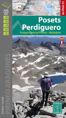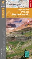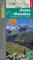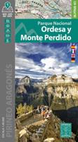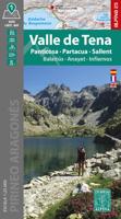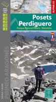
Wandelkaart 14 Posets - Perdiguero | Editorial Alpina

0
Wandelgids -en kaart, GPS compatible. De gids bevat veel nuttige informatie over MTB, rotsklimmen, wandelroutes. Language: Spaans/Frans/Engels Publisher: Alpina Continent: Europa Country: Spanje Region: Spaanse Pyreneeën Scale: 1/25   Dorpen en bergen op de kaart: Gistain-Chisten, Plan, San Juan de Plan / San Chuan de Plan, Sahún, Eriste Grist, A...

Verkopers met dit product

Verkoper
Bezorging
Prijs
DeZwerver.nl logo
DeZwerver.nl
2,95
16,95

Anderen bekeken ook

Wandelkaart A06 Siniscola | Abies
Siniscola area at 1:25,000 in a series of contoured maps from Ed. Abies. Overprint highlights campsites and agriturismo accommodation, climbing sites, wild sheep and bird watching sites and archaeological remains. This title has no UTM grid. Main series at 1:60,000 (Nos. 1 to 12) The maps have contours at 100m intervals and colouring for woodlands and maquis shrubland. Local trails are highlighted, with additional overprint for selected hiking, mountain bike and kayaking routes listed on the reverse of the maps with brief notes and grading for the degree of difficulty. All the maps have a UTM grid for GPS users. Very extensive range of symbols highlight numerous places of interest and tourist facilities, including campsites and caravan parks, beaches, sport and recreational sites, archaeological remains and nuraghi, etc. The maps also indicate places where typical local products can be purchased. On the reverse each title has descriptions of its main places of interest, beaches, etc…
12,95
Nieuw
Wandelkaart 26 Pica d`Estats - Mont-roig E25 | Editorial Alpina
Zeer gedetailleerde wandelkaart van een klein gebied. Met ingetekende wandelroutes en andere informatie. Spaanstalig, maar uitstekende kaart. Coordinaten zijn weergegeven, dus GPS compatible met UTM grid.    Op de topografische wandelkaart worden o.a. berghutten, campings aangeduid en hoogtelijnen, ingetekende wandelroutes en de GR paden (doorgaande langeafstandswandelpaden). De kaart is inclusief een Spaanstalig boekje met extra informatie over aanwezige voorzieningen en enkele routes.   Gebied: Lladorre, Àreu, Alins, Ribera de Cardós, Escaló, l'Artigue, Mounicou, Marc, Quanca, Mont-Roig, Pic dels Tres Comtes, Pica d'Estats, Pica Roja, Monteixo, Pic de Montarenyo.   Language: Spaans/Frans Publisher: Alpina Continent: Europa Country: Spanje Region: Spaanse Pyreneeën Scale: 1/25 Ingetekende GR-wandelroutes GR 11  
19,95
Wandelkaart A15 Sarrabus da Costa Rei a Porto Corallo | Abies
Sarrabus is a territory that is not known by everybody yet. Here lies its charm and this has made possible to keep this environmental area out of big building speculations and also out of history. In fact it preserves little traces of the past, and paradoxically the remains from the prehistoric age are more meaningful than those back to more recent times. We can find traces from the most remote past not far from the State Road SS125, that from Muravera goes to Costa Rei, by visiting the nuraghe Murtas, the nuraghe S’Aqua Secis and the megalithic complexes of Scalas and Cuili Piras. They are about ten menhirs, almost fully intact, arranged in groups and fixed in the ground in the original orthostatic position. They have been put in relation with the position of the sun and the moon, at dawn and at sunset. In fact they were used as a very precise astronomic calendar but also for religious purposes since they represented both the masculine divinity and the fertility according to the wors…
12,95
Wandelgids Wales | Uitgeverij Elmar
De Rother wandelgids Wales beschrijft de 50 mooiste kust- en bergwandelingen in het westen van het Verenigd Koninkrijk - van Pembrokeshire tot Anglesey, van de Ierse Zee tot de grens met Engeland, in de bergachtige regio's, het binnenland en langs de kust.   * Betrouwbare routebeschrijvingen * Gedetailleerde wandelkaarten * Informatieve hoogteprofielen * Downloadbare GPS Tracks   Aanbevolen wandelkaarten bij deze gids:   The Gower + directe omgeving Wandelkaart - Topografische kaart 164 Explorer Gower, Gwyr | Ordnance Survey 1:25.000 Wandelkaart - Topografische kaart 178 Explorer Llanelli, Ammanford, Rhydaman | Ordnance Survey 1:25.000   Pembrokeshire Wandelkaart - Topografische kaart OL35 Explorer Pembrokeshire North - Gogledd Sir Benfro | Ordnance Survey 1:25.000 Wandelkaart - Topografische kaart OL36 Explorer South Pembrokeshire - De Sir Benfro | Ordnance Survey 1:25.000 Wandelkaart - Topografische kaart 198 Explorer Cardigan, New Quay | Ordnance Survey 1:25.000 Wandelkaart - Topog…
19,99
Nieuw
Wandelgids GR 70: The Robert Louis Stevenson Trail van Le Puy tot St-Jean du Gard | Cicerone
Uitstekende wandelgids van een gerenommeerde Engelse uitgever. De tochten zijn met zorg beschreven en voorzien van allerhande nuttige informatie. Met beperkt kaartmateriaal. Aanbevolen wandelkaarten bij deze gids 1:100.000 Wandelkaart GR 70 The Stevenson Trail | IGN - Institut Géographique National Als overzichtskaart Of Wegenkaart 156 Le Puy en Velay - Privas - Mende | IGN - Institut Géographique National Wegenkaart 163 Avignon - Nimes | IGN - Institut Géographique National  of 1:25.000 1. Wandelkaart - Topografische kaart 2835OT Le Puy-en-Velay | IGN - Institut Géographique National 2. Wandelkaart - Topografische kaart 2836OT Gerbier de Jonc | IGN - Institut Géographique National 3. Wandelkaart - Topografische kaart 2736SB Monistrol d'Allier, Solignac-sur-Loire, Cayres | IGN - Institut Géographique National 4. Wandelkaart - Topografische kaart 2737SB Langogne - Grandrieu | IGN - Institut Géographique National 5. Wandelkaart - Topografische kaart 2738SB Le Bleymard | IGN - Institut G…
23,95
Nieuw
Wandkaart Europa - Europe Huge, 170 x 124 cm | Maps International
Fraaie politieke kaart van Europa, waarbij vooral de politieke aspecten heel duidelijk te lezen zijn. Alle landen hebben verschillende kleuren, steden en belangrijke verbindingen zijn goed te vinden. Papieren uitvoering. Let op: deze heeft geen versie in metalen strips, de kaart is simpelweg te groot daarvoor. Wel is er nog een optie met houten stokken  Maps International’s European political wall map is huge! Our European political wall map is the size of a Smart Car and is the largest single sheet map available to buy.  European Map details: Politically coloured wall map of Europe features countries marked in a different colour, with international boundaries shown. All major towns and cities of Europe are featured within our huge map, and the country's capital cities are clearly marked. The map contains hill and sea shading adding to the vibrant overall effect. The wall map also contains a section showing the different flags of countries in Europe. Map uses: As with most of our ma…
47,95
Fietskaart 07 De Sterkste van de Regio Veluwe | Buijten & Schipperheijn
De actueelste Nederlandkaart met fietsknooppunten! Een vrijwel onverwoestbare kaart bovendien, met handige informatie over campings, veerdiensten etc. Regio Veluwe. Duidelijk kaartbeeld met royale letter Compleet netwerk van fietspaden en kleine wegen Alle bewegwijzerde fietsknoppunten Landelijke wandelroutes en streekwandelingen Webadressen van alle bed-and-breakfastlocaties en veerdiensten Precieze locaties van monumenten Groot formaat Groot schaal Compact gevouwen Zeer klein opgevouwen formaat van water- en scheurvast papier. Handig voor op de racefiets! An up-to-date cycle map, with wayfinding points clearly marked. This map is virtually indestructible, waterproof and tear-proof. Complete with useful information about camp sites, ferry locations, and long-distance bike routes, this map is a must-have for long and short distance cycling. Its handy pocket size means that it  can fold easily into a handlebar bag. A complete network of bicycle paths and small roads Bicyc…
12,90
Fietskaart 04 De Sterkste van de Regio Drenthe | Buijten & Schipperheijn
De actueelste Nederlandkaart met fietsknooppunten! Een vrijwel onverwoestbare kaart bovendien, met handige informatie over campings, veerdiensten etc. Regio Drenthe. Duidelijk kaartbeeld met royale letter Compleet netwerk van fietspaden en kleine wegen Alle bewegwijzerde fietsknoppunten Landelijke wandelroutes en streekwandelingen Webadressen van alle bed-and-breakfastlocaties en veerdiensten Precieze locaties van monumenten Groot formaat Groot schaal Compact gevouwen   Zeer klein opgevouwen formaat van water- en scheurvast papier. Handig voor op de racefiets!     An up-to-date cycle map, with wayfinding points clearly marked. This map is virtually indestructible, waterproof and tear-proof. Complete with useful information about camp sites, ferry locations, and long-distance bike routes, this map is a must-have for long and short distance cycling. Its handy pocket size means that it  can fold easily into a handlebar bag. A complete network of bicycle paths and small roads …
12,90
Nieuw
Wegenkaart - landkaart 131 Forêt Noire, Alsace, Vallée du Rhin | Michelin
Speciale toeristische kaart, gemaakt voor een goed bezocht gebied en uitvergroot. Daardoor zeer prettig leesbaar met een hoog nivo wat we van Michelin al veel langer gewend zijn. Alle wegen staan er op, met verschillende kleuren voor de aparte soorten wegen. Verder veel aandacht met symbolen voor de bezienswaardigheden in de regio, de bekende groene stroken naast de mooie wegen en ingetekende doorgaande wandelroutes als grande randonnees. Part of Michelin's Zoom series covering major towns and popular holiday areas throughout France, this map of the Black Forest, Alsace and the Rhine Valley covers both sides of the Rhine Valley, extending from northern Switzerland to Saarland and Heidelberg, with the Black Forest on the German side and the Vosges mountains in France. The map shows road detail from motorways to rough tracks and footpaths, with intermediate road distances shown on most roads, toll and toll-free sections of motorways are indicated and various road obstacles such as stee…
10,95

Klanten-reviews van Wandelkaart 14 Posets - Perdiguero | Editorial Alpina

Er zijn nog geen beoordelingen voor dit productBen jij de eerste die een review plaatst?

Meer over Wandelkaart 14 Posets - Perdiguero | Editorial Alpina

Productomschrijving

Wandelgids -en kaart, GPS compatible. De gids bevat veel nuttige informatie over MTB, rotsklimmen, wandelroutes.


Language: Spaans/Frans/Engels
Publisher: Alpina
Continent: Europa
Country: Spanje
Region: Spaanse Pyreneeën
Scale: 1/25


Dorpen en bergen op de kaart:
Gistain-Chisten, Plan, San Juan de Plan / San Chuan de Plan, Sahún, Eriste Grist, Anciles-Ansils, Benasque-Benas, Cerler-Sarlle, Pic de Cauarere, Pico l'Abeille, Gran Bachimala, Pico de Malpas, Pico de la Madera, Pico de Gourgs Blancs, Pico Perdiguero, Pena Blanca, Senal de Biados, El Monto, Tuca del Dalliu, Pico de Posets o Llardana, Pico d'els Corbets, Picos de Baguenola o de Eriste, El Yerri, Tusal de Bocs

Verken gerelateerde categorieën

Webshop.nl maakt gebruik van cookies. Ga je verder op onze website, ga dan akkoord met het plaatsen van cookies en de verwerking van deze data door ons en vermelde partners.