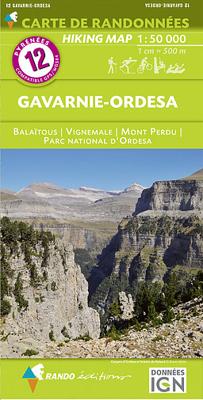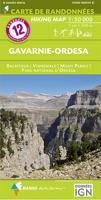
Wandelkaart 12 Gavarnie - Ordesa | Rando Editions

0
Uitstekende wandelkaart met veel toeristische informatie en bijzonder gedetailleerd. Wandelroutes en hutten / campings zijn ingetekend, met hoogtelijnen. GPS Compatible   Met Balaitous, Vignemale, Mont Perdu, Parc National d' Ordesa   IGN based cartography Topography shown by hill shading and contours Hiking and biking routes Refuges and other...

Verkopers met dit product

Verkoper
Bezorging
Prijs
DeZwerver.nl logo
DeZwerver.nl
2,95
16,50

Anderen bekeken ook

Wandelkaart 14 Sierra de Guara | Rando Editions
Uitstekende wandelkaart van Sierra de Guara met veel toeristische informatie en bijzonder gedetailleerd. Wandelroutes en hutten / campings zijn ingetekend, met hoogtelijnen. GPS Compatible   IGN based cartography Topography shown by hill shading and contours Hiking and biking routes Refuges and other accommodation Tourist informations Road network GPS compatible   La carte indispensable pour découvrir la Sierra de Guara et toutes ses activités outdoor : randonnée, canyoning, VTT…   Un cadrage qui assure une couverture intégrale du massif de la Sierra de Guara (Sobrarbe, Somontano, Hoya de Huesca). Une approche routière facilitée depuis Sabinanigo (Port de Monrepos) et Ainsa au nord, depuis Huesca et Abiego au sud, et figurant l'A23 à l'ouest à l'A138 à l'est. Toutes les informations sur les itinéraires d'activités outdoor du moment (canyoning, randonnée, VTT) : • pour le canyoning, sont figurés principaux parkings, accès et sorties des rios (Guatizalema, Formiga, Alcanadre, Masc…
16,50
Wandelkaart 13 Aneto - Posets | Rando Editions
Uitstekende wandelkaart met veel toeristische informatie en bijzonder gedetailleerd. Wandelroute en hutten / campings zijn ingetekend, met hoogtelijnen. Andere dorpen in de Pyreneeën op deze kaart: Port Vieux, Bielsa, Escuain, Pic de Bern, Pont de Prat, PPic Schrader o gran Bachimala, Pic de Postes, Plan, San Juan de Plan, Pic de Céciré, Pico Perdiguero, Eriste, Valle de Benasque, Bossost, Pico de Aneto, Vielha, Port de Rius, Boi, El Pont de Suert, Lasoaules, Castejon de Sos, Campo, Coteilla, Laspuna, Aínsa, Lafortunada Ingetekende Lange Afstandswandelroute GR-10, GR10, GR-11 GR11
16,50
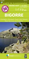
Wandelkaart 4 Bigorre | Rando Editions
Uitstekende wandelkaart met veel toeristische informatie en bijzonder gedetailleerd. Wandelroutes en hutten / campings zijn ingetekend, met hoogtelijnen. Andere dorpen op deze kaart: Loudenvielle - St. Lary Soulan - Piau Engaly - Gavarnie - Pont d' Espangne - Cauterets - Barèges - Arreau (Frankrijk - Pyreneeen)   Bigorre, Parc National des Pyrénées, Parque nacional de Ordesa y Monte Perdido   GPS Compatible   Ingetekende Lange Afstandswandelroute GR-10, GR11.   
16,50
Wandelgids GR 11 Spaanse Pyreneeen - Through the Spanish Pyrenees | Cicerone
Uitstekende wandelgids van dit geweldige gebied. goed beschreven met veel praktische informatie om de route te kunnen lopen, inclusief redelijke kaarten. Beschrijving van de GR 11, het lange afstandswandelpad aan de Spaanse kant van de Pyreneeën. Aanbevolen wandelkaarten Schaal 1:50.000 Wandelkaart Senda Pirenaica GR11 | Editorial Alpina - Set van 21 kaarten Of Wandelkaarten van Rando Pyreneeën - 10 losse kaarten This comprehensive guidebook to the magnificent GR11 trail, which runs 820km from the Atlantic to the Mediterranean, provides everything trekkers will need to take up the challenge - detailed route description, excellent photographs, lots of background information and unique, custom-produced maps. This glorious traverse of the Pyrenees, on the Spanish side, is a serious challenge - passing over a succession of high alpine passes where boulderfields, scree slopes and occasional snowfields may need to be crossed. It is presented in 47 stages of 8-31km.    It is well waymarked a…
23,95
Wandelkaart 43 Iti | Road Editions
Mt Oiti/Iti at 1:50,000 in a series of contoured maps from Road Editions covering popular hiking areas of Greece. All the maps have altitude coloring and spot heights - contour interval varies, as indicated in the descriptions of individual titles. Local footpaths are marked and, for road users the maps show picturesque routes, intermediate driving distances on minor roads, and locations of petrol stations and tyre repairs workshops. Boundaries of national parks and administrative regions are marked, and symbols show campsites, hotels and mountain refuges, and various landmarks and places of interest, e.g. archaeological sites, churches, etc. All place names are in both Greek and Latin alphabet. All the titles have latitude and longitude margin ticks, many also show GPS waypoints. Some maps come with a booklet or notes on the reverse side giving further information about the area and/or descriptions of hiking routes. Map legends include English. In this title: Mount Oiti (Iti) and t…
9,95
Wandelkaart 37 Mount Agrafa | Road Editions
Mt Agrafa at 1:50,000 in a series of contoured maps from Road Editions covering popular hiking areas of Greece. All the maps have altitude coloring and spot heights - contour interval varies, as indicated in the descriptions of individual titles. Local footpaths are marked and, for road users the maps show picturesque routes, intermediate driving distances on minor roads, and locations of petrol stations and tyre repairs workshops. Boundaries of national parks and administrative regions are marked, and symbols show campsites, hotels and mountain refuges, and various landmarks and places of interest, e.g. archaeological sites, churches, etc. All place names are in both Greek and Latin alphabet. All the titles have latitude and longitude margin ticks, many also show GPS waypoints. Some maps come with a booklet or notes on the reverse side giving further information about the area and/or descriptions of hiking routes. Map legends include English. In this title: the Agrafa region, on th…
9,95
Wandelkaart 36 Mount Othris | Road Editions
Mt Othris at 1:50,000 in a series of contoured maps from Road Editions covering popular hiking areas of Greece. All the maps have altitude coloring and spot heights - contour interval varies, as indicated in the descriptions of individual titles. Local footpaths are marked and, for road users the maps show picturesque routes, intermediate driving distances on minor roads, and locations of petrol stations and tyre repairs workshops. Boundaries of national parks and administrative regions are marked, and symbols show campsites, hotels and mountain refuges, and various landmarks and places of interest, e.g. archaeological sites, churches, etc. All place names are in both Greek and Latin alphabet. All the titles have latitude and longitude margin ticks, many also show GPS waypoints. Some maps come with a booklet or notes on the reverse side giving further information about the area and/or descriptions of hiking routes. Map legends include English. In this title: the Othris region in cen…
9,95
Wandelkaart - Topografische kaart OL09 OS Explorer Map Exmoor | Ordnance Survey
Een van de beste detailkaarten die er op de wereld gemaakt worden: zeer gedetailleerd, prachtig helder kleurgebruik, veel topografische aspecten en - zeer belangrijk - allerlei toeristische en recreatieve aspecten zijn ingetekend. De perfecte kaart voor vakantie en vrije tijd: wandelen, fietsen of gewoon de omgeving verkennen. Door de grootte van de kaart, voor- en achterzijde, bestrijkt het een behoorlijk groot gebied! These highly detailed maps show all the administrative boundaries, settlements as small as isolated farms, road network down to unfenced roads and country tracks, and field boundaries (hedges and drystone walls) which make navigation across the countryside much easier. Steep gradients on roads are indicated. Various landmarks, eg. powerlines, archaeological sites, windmills, churches and lighthouses are shown, and additional graphics indicate natural terrain features such as cliffs, scree, mud and vegetation variations. Contour interval is 5 metres in the lower parts o…
19,50
Wandelkaart - Topografische kaart 126 OS Explorer Map Clovelly & Hartland | Ordnance Survey
Met zijn 4cm voor 1 km (2 ½ cm voor 1 mijl) schaal, is de OS Explorer kaartenserie de ideale en meest gedetailleerde kaartenreeks voor mensen die graag outdoor-activiteiten zoals fietsen, wandelen, paardrijden, klimmen en watersporten. Deze kaart is nog gedetailleerder dan de 'gewone' Landranger maps. Voor- en achterzijde bedrukt! Zeker op de moors en andere natuurgebieden van onschatbare waarden met echt alle aspecten van het landschap op de kaart ingetekend. Zeer goede detailkaart met topografische ondergrond. Hierop zijn toeristische symbolen van bezienswaardigheden ingetekend, daarnaast staan bijvoorbeeld campings en jeugdherbergen vermeld en - voor wandelaars het belangrijkst - alle right of way paden en Lange afstands Wandelpaden zijn er op te vinden. De ideale kaart voor het wandelen in Engeland, Wales of Schotland. These highly detailed maps show all the administrative boundaries, settlements as small as isolated farms, the road network down to unfenced roads and country track…
19,50
Wandelkaart - Topografische kaart OL20 OS Explorer Map South Devon | Ordnance Survey
Met zijn 4cm voor 1 km (2 ½ cm voor 1 mijl) schaal, is de OS Explorer kaartenserie de ideale en meest gedetailleerde kaartenreeks voor mensen die graag outdoor-activiteiten zoals fietsen, wandelen, paardrijden, klimmen en watersporten. Deze kaart is nog gedetailleerder dan de 'gewone' Landranger maps. Voor- en achterzijde bedrukt! Zeker op de moors en andere natuurgebieden van onschatbare waarden met echt alle aspecten van het landschap op de kaart ingetekend. Zeer goede detailkaart met topografische ondergrond. Hierop zijn toeristische symbolen van bezienswaardigheden ingetekend, daarnaast staan bijvoorbeeld campings en jeugdherbergen vermeld en - voor wandelaars het belangrijkst - alle right of way paden en Lange afstands Wandelpaden zijn er op te vinden. De ideale kaart voor het wandelen in Engeland, Wales of Schotland.   These highly detailed maps show all the administrative boundaries, settlements as small as isolated farms, the road network down to unfenced roads and country tra…
19,50

Klanten-reviews van Wandelkaart 12 Gavarnie - Ordesa | Rando Editions

Er zijn nog geen beoordelingen voor dit productBen jij de eerste die een review plaatst?

Meer over Wandelkaart 12 Gavarnie - Ordesa | Rando Editions

Productomschrijving

Uitstekende wandelkaart met veel toeristische informatie en bijzonder gedetailleerd. Wandelroutes en hutten / campings zijn ingetekend, met hoogtelijnen. GPS Compatible   Met Balaitous, Vignemale, Mont Perdu, Parc National d' Ordesa   IGN based cartography Topography shown by hill shading and contours Hiking and biking routes Refuges and other accommodation Tourist informations Road network GPS compatible   Ingetekende Lange Afstandswandelroutes GR-10, GR11. 


Productinformatie

    Verken gerelateerde categorieën

    Webshop.nl maakt gebruik van cookies. Ga je verder op onze website, ga dan akkoord met het plaatsen van cookies en de verwerking van deze data door ons en vermelde partners.