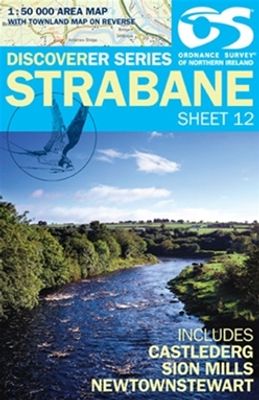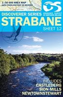
Wandelkaart 12 Discoverer Strabane | Ordnance Survey Northern Ireland

0
Zeer gedetailleerde topografische kaart met een aantal toegevoegde toeristische symbolen voor bijv. Bezienswaardigheden en campings. Met hoogtelijnen, mooi kleurgebruik en ingetekende lange-afstands-wandelroutes.   OSNI has replaced the One-Inch maps with a completely new series at 1:50 000 scale. The series is numbered on an all-Ireland basis and...

Verkopers met dit product

Webshop
Bezorging
Prijs
DeZwerver.nl logo
DeZwerver.nl
niet bekend
19,50

Anderen bekeken ook

Wandelkaart The Mournes | Ordnance Survey Ireland
From the rugged granite peaks of the mountains to the picturesque coastline below, the Mournes region is an Area of Outstanding Natural Beauty. This guide map has information about climbing, rambling or relaxing in the area.   The 1:25,000 scale paper map is for outdoor enthusiasts and provides a detailed guide for many outdoor activities and highlights local amenities and services such as filling stations and bus stops. The map includes Slieve Croob, the Murlough Nature Reserve and Castlewellan Forest Park.   A map for everyone, from the experienced hill walker or rock climber to the casual rambler, from the bird watcher or fisherman to the family out for a picnic.   The Mournes in detail - tracks, cliffs, climbs, the Wall, etc. Contouring at 10 -metre intervals showing clearly the impressive relief of the uplands...sweeping down to the sea via the scenic drives and forests to boating and fishing.   OSNI activity maps are double sided and printed on water resistant paper.   Features:…
14,95
Wandelkaart - Topografische kaart OL39 OS Explorer Map Loch Lomond North | Ordnance Survey
Met zijn 4cm voor 1 km (2 ½ cm voor 1 mijl) schaal, is de OS Explorer kaartenserie de ideale en meest gedetailleerde kaartenreeks voor mensen die graag outdoor-activiteiten zoals fietsen, wandelen, paardrijden, klimmen en watersporten. Deze kaart is nog gedetailleerder dan de 'gewone' Landranger maps. Voor- en achterzijde bedrukt! Zeker op de moors en andere natuurgebieden van onschatbare waarden met echt alle aspecten van het landschap op de kaart ingetekend. Zeer goede detailkaart met topografische ondergrond. Hierop zijn toeristische symbolen van bezienswaardigheden ingetekend, daarnaast staan bijvoorbeeld campings en jeugdherbergen vermeld en - voor wandelaars het belangrijkst - alle right of way paden en Lange afstands Wandelpaden zijn er op te vinden. De ideale kaart voor het wandelen in Engeland, Wales of Schotland.   Map sheet number OL 39 in the OS Explorer series covers the northern area of Loch Lomond, the towns of Tyndrum, Ardlui, Crianlarich and Arrochar. Highlights of th…
19,50
Wandelkaart Tour & Trail La Palma | Discovery Walking Guides
Goede, scheur- en watervaste, wandelkaart van La Palma. Water-proof, split-proof, tear-proof, adventure-proof.  La Palma Tour & Trail Super-Durable Map is simply the toughest, most accurate, easy to read, easy to use map of the island you can buy at any price.  Super-Durable Maps now come with a 2 year adventurous use wear and tear guarantee, see Discovery Walking Guides website for details.    7th Edition of our La Palma Tour & Trail Super-Durable Map is a large 1:40,000 scale map, splitting the island into a North (Landscape view) and South (Portrait view) with a generous overlap, produces double sided map of 840mm by 600mm and folds to 235mm by 120mm. Our legendary 'Tour & Trail' level of detail ranges from major roads to secondary roads to minor roads to streets and camino rural narrow country roads, plus dirt roads and walking trails.  Altitude background colouring is designed to clearly show the altitude range when travelling across the island by car or on foot. 100 metre and 50…
15,95
Wandelkaart Tour & Trail La Gomera & El Hierro | Discovery Walking Guides
Super gedetailleerde kaart van het hele eiland. Met heel veel wandelroutes, al dan niet gemarkeerd. Quite simply La Gomera and El Hierro Tour & Trail Super-Durable Maps are the most detailed, accurate, toughest, easy to read, large scale maps of La Gomera and El Hierro that you can buy. Our map sheet is 840mm by 680mm. On the cover side you get the latest 35k scale 8th edition La Gomera Tour & Trail Super-Durable Map by David Brawn.   On the reverse side is our 35k scale 1st edition El Hierro Tour & Trail Super-Durable Map by Jan Kostura. Both maps are produced to our 'Tour & Trail' level of detail ranging from major roads to secondary roads to minor roads to streets and camino rural narrow country roads, plus dirt roads and walking trails. Walking trails are specially highlighted, GR (Gran Recorido trails in green) and Walk La Gomera (in red), making them easier to identify on the maps and easier to find on the ground.   Altitude background colouring is designed to clearly show …
15,95
Wandelkaart Tour & Trail Azores - Azoren | Discovery Walking Guides
Gedetailleerde kaart van de Azoren. Met heel veel wandelroutes, al dan niet gemarkeerd. For the best adventures, use the best map. Azores Tour & Trail Super-Durable Map is the most detailed, accurate, toughest, large scale map of these 9 islands that you can buy.    1:60,000 scale for each island, Sao Miguel at 70,000 scale, produces a double sided map sheet of 960mm by 694mm; big enough to show masses of detail but compact enough to use in the car or on the trail. Faial, Pico, Santa Maria and Sao Jorge are on the facing sheet of the map with Corvo, Flores, Graciosa, Sao Miguel and Terceira are on the reverse side. Our special concertina map fold means your map is easy to unfold, and more importantly easy to refold back to its pocket size.   You get the most detailed map of the Azores islands that is produced including our 'Tour & Trail' level of detail ranging from major roads to secondary roads to minor roads to streets and narrow country roads, plus dirt roads and walking trails. W…
15,95
Wandelkaart Tour & Trail Corfu - Korfoe | Discovery Walking Guides
Goede wandelkaart van Korfoe. Scheur- en watervast. Corfu Tour & Trail Super-Durable Map is the most detailed, accurate, toughest, large scale map of the island that you can buy. Super-Durable Maps now come with a 2 year adventurous use wear and tear guarantee, see Discovery Walking Guides website for details. Our large 1:40,000 scale produces a double sided map sheet of 840mm by 680mm; big enough to show masses of detail but compact enough to use in the car or on the trail.   Corfu North is on the facing sheet of the map with Corfu South on the reverse side, including a generous overlap between the two sides. Our special concertina map fold means your map is easy to unfold, and more importantly easy to refold back to its pocket size. You get the most detailed map of Corfu that is produced including our 'Tour & Trail' level of detail ranging from major roads to secondary roads to minor roads to streets and narrow country roads, plus dirt roads and walking trails.   We have a new metho…
15,95
Wandelkaart - Topografische kaart 179 OS Explorer Map Gloucester, Cheltenham, Stroud | Ordnance Survey
The essential map for outdoor activities in Gloucester, Cheltenham and Stroud. The OS Explorer Map is the Ordnance Survey's most detailed folding map and is recommended for anyone enjoying outdoor activities including walking, horse riding and off-road cycling. This map now comes with a digital version which you can download to your smartphone or tablet.Providing complete GB coverage, the OS Explorer map series details information essential in the great outdoors, including youth hostels, pubs and visitor information. Rights of way, fences, permissive paths and bridleways are clearly shown, ensuring you have the best information to get the most out of your time in the countryside. FeaturesCotswold Way Severn Way Gloucestershire Way Macmillan Way Wysis WayCotswold Way (National Trail) GloucesterCheltenhamGloucester Stroud1:25 000 scale (4 cm to 1 km - 2.5 inches to 1 mile) Met zijn 4cm voor 1 km (2 ½ cm voor 1 mijl) schaal, is de OS Explorer kaartenserie de ideale en meest gedetailleerd…
19,50
Wandelkaart - Topografische kaart 181 OS Explorer Map Chiltern Hills North | Ordnance Survey
The essential map for outdoor activities in Chiltern Hills North. The OS Explorer Map is the Ordnance Survey's most detailed folding map and is recommended for anyone enjoying outdoor activities including walking, horse riding and off-road cycling. This map now comes with a digital version which you can download to your smartphone or tablet.Providing complete GB coverage, the OS Explorer map series details information essential in the great outdoors, including youth hostels, pubs and visitor information. Rights of way, fences, permissive paths and bridleways are clearly shown, ensuring you have the best information to get the most out of your time in the countryside. FeaturesIcknield Way RidgewayNorth Buckinghamshire Way Icknield Way PathSwan's Way Two Ridges Link Aylesbury RingSouth Bucks Way Chess Valley Walk Chiltern Link Thame Valley WalkGrand Union Canal Walk Midshires Way Bledlow Circular Ride Hertfordshire Way Chiltern WayRidgeway (National Trail) Bedfordshire Buckinghamshire H…
19,50
Wandelkaart - Topografische kaart OL33 OS Explorer Map Haslemere & Petersfield | Ordnance Survey
Met zijn 4cm voor 1 km (2 ½ cm voor 1 mijl) schaal, is de OS Explorer kaartenserie de ideale en meest gedetailleerde kaartenreeks voor mensen die graag outdoor-activiteiten zoals fietsen, wandelen, paardrijden, klimmen en watersporten. Deze kaart is nog gedetailleerder dan de 'gewone' Landranger maps. Voor- en achterzijde bedrukt! Zeker op de moors en andere natuurgebieden van onschatbare waarden met echt alle aspecten van het landschap op de kaart ingetekend. Zeer goede detailkaart met topografische ondergrond. Hierop zijn toeristische symbolen van bezienswaardigheden ingetekend, daarnaast staan bijvoorbeeld campings en jeugdherbergen vermeld en - voor wandelaars het belangrijkst - alle right of way paden en Lange afstands Wandelpaden zijn er op te vinden. De ideale kaart voor het wandelen in Engeland, Wales of Schotland.   Map sheet number OL 33 covers Haslemere, Petersfield, Midhurst and Selborne. Highlights include the South Downs National Park, Surrey Hills and the Sussex Border …
19,50
Wandkaart Ireland - Ierland, 76 x 91 cm | National Geographic
National Geographic Maps' new Ireland wall map is one of the most authoritative maps yet published of the Emerald Isle. Of the nearly 1,000 place-names shown on this map, all within the Republic of Ireland adhere to that nation's constitution—that the Irish and English language share official status. Thus, Gaelic (Irish) place-names, along with their English variants in parentheses, are shown within Irish-speaking regions while English place-names, along with their Gaelic variants, are shown outside these areas.   Ireland Classic is ideal for those researching their Irish ancestry, a perfect tool for business reference, and a beautiful addition to any décor. It’s one of the largest and most detailed wall maps specifically for Ireland available today. Shown on the map are over 1,000 named places including primary and secondary towns, counties, political boundaries, infrastructure, and selected historical sites for both Ireland and Northern Ireland.   Place-name Details: Per the Republi…
31,95

Klanten-reviews van Wandelkaart 12 Discoverer Strabane | Ordnance Survey Northern Ireland

Er zijn nog geen beoordelingen voor dit productBen jij de eerste die een review plaatst?

Meer over Wandelkaart 12 Discoverer Strabane | Ordnance Survey Northern Ireland

Productomschrijving

Zeer gedetailleerde topografische kaart met een aantal toegevoegde toeristische symbolen voor bijv. Bezienswaardigheden en campings. Met hoogtelijnen, mooi kleurgebruik en ingetekende lange-afstands-wandelroutes.   OSNI has replaced the One-Inch maps with a completely new series at 1:50 000 scale. The series is numbered on an all-Ireland basis and Ordnance Survey of Northern Ireland is responsible for the design and publication of the sheets that cover Northern Ireland and adjoining parts of the Republic of Ireland. The layout incorporates a number of overlaps. This map is derived from the latest large scale material, supplemented by new aerial photographs and ground surveys. It is the country's most detailed small-scale map and as well as showing all the features that were on the One-Inch map.

Verken gerelateerde categorieën

Webshop.nl maakt gebruik van cookies. Ga je verder op onze website, ga dan akkoord met het plaatsen van cookies en de verwerking van deze data door ons en vermelde partners.