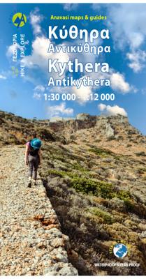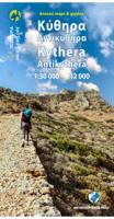
Wandelkaart 10.60 Kythera, Antikythera | Anavasi

0
Compatible card printed on lightweight, waterproof and tear-resistant plastic paper.   Kythera is a unique island in many ways. First of all, she has an interesting body shape. It is a vast plateau bordered by hills cut by deep gorges, some dry and majestic, others filled with water, ending in beaches of exceptional beauty.   Explore this unique t...

Verkopers met dit product

Verkoper
Bezorging
Prijs
DeZwerver.nl logo
DeZwerver.nl
2,95
10,95

Anderen bekeken ook

Wandelkaart Tour & Trail Mallorca - Tramuntana South | Discovery Walking Guides
For your best adventures, use the best map. Water-proof, split-proof, tear-proof, adventure-proof. Mallorca's Tramuntana South Tour & Trail Super-Durable Map is simply the toughest, most accurate, easy-to-read, easy-to-use multi-purpose map that you can get.   Whether you plan to walk, or explore southern Tramuntana by car or the bus, this is the map for you. A large 960mm by 694mm double sided map sheet covers southern half of Serra de Tramuntana at 1:30,000 scale. This 8th edition sees a significant upgrade from the previous Mallorca North & Mountains Tour & Trail Map, as we have split Serra de Tramuntana in two halves to produce TWO much more detailed maps of larger scale, now also including all the popular tourist resorts on the southern coast.   This map covers a continuous area from Tramuntana's southern-most point Cap de Cala Figuera, including all the coastal resorts such as Magaluf, Santa Ponca and Peguera, with Port d'Andratx and Sa Dragonera islet also covered, all the way …
18,95
Spoorwegenkaart - Wegenkaart - landkaart Scotland Far North & Islands Railway & Road | ITMB
Great Britain, by its shape, is difficult to map. The population is dense, the road network intense, and the coastline convoluted. A map of the British Isles shows only the major features. Sectional maps of just England, or Just Wales, make little sense, due to the geographic shape of the island kingdom. Scotland also needs more than one map to show its treasures in sufficient detail. ITMB previously issued Scotland Central and South, and now extends its coverage at 1:300,000 to the sparsely-populated highlands and the isolated Western, Orkney, and Shetland island archipelagos that are usually shrunk to insignificance on most maps, as insets. This double-sided map covers the area from Loch Lochy south of Invergarry to John O’Groats in the north, and from the Western islands of Uist and Lewis to the Moray Firth and Craigellachie in the east. The second side has to duplicate part of the first side in order to extend the artwork further eastward to include Aberdeen and northward to inclu…
13,95
Reisgids Madagascar - Madagaskar | Bradt Travel Guides
Zeer goede gids voor Madagaskar en betrouwbaar alternatief voor de Lonely Planet. Zo mogelijk nog completer! Zelfde soort informatie als de Lonely Planet: vol met praktische feiten en achtegronden. Engels. Bradt Guide A new, thoroughly updated 13th edition of Bradt's Madagascar, the leading and most comprehensive guide to this unique island nation, written by Hilary Bradt, who first visited in 1976 and has returned roughly 35 times, and Daniel Austin, who has visited 12 times and continues to travel there annually. Bradt's Madagascar is by far the most thorough guide to the country in English and is written and updated by established experts whose unparalleled knowledge of Madagascar combines with contributions from over 50 experts in a book which has been the most authoritative guide to the country for three decades. It covers national parks and protected areas and includes itineraries to suit all interests and budgets, plus details of around 1,000 hotels and restaurants. Madagascar …
24,95
Wandelkaart Tour & Trail Mallorca - Tramuntana North | Discovery Walking Guides
Let op: deze kaart dekt het noordelijke deel van Mallorca.   For your best adventures, use the best map. Water-proof, split-proof, tear-proof, adventure-proof. Mallorca's Tramuntana North Tour & Trail Super-Durable Map is simply the toughest, most accurate, easy-to-read, easy-to-use multi-purpose map that you can get.   Whether you plan to walk, or explore northern Tramuntana by car or the bus, this is the map for you. A large 960mm by 694mm double sided map sheet covers northern half of Serra de Tramuntana at 1:30,000 scale. This 8th edition sees a significant upgrade from the previous Mallorca North & Mountains Tour & Trail Map, as we have split Serra de Tramuntana in two halves to produce TWO much more detailed maps of larger scale.   This map covers a continuous area from Tramuntana's northern-most Cap de Formentor, including all the coastal resorts such as Port de Pollenca and Port d'Alcudia, all the way to Soller and Deia at the opposite end of the map (for the area from S…
18,95
Wandelkaart 10.50 Karpathos | Anavasi
Zeer goede kaart van Karpathos. Topografische details zijn goed uitgewerkt, zeer leesbare kaart met ook nog eens alle toeristisch interessante punten. Karpathos, a mountainous island with rugged terrain and magnificent landscapes, is one of the most authentic places in Greece. It has endless sandy beaches in the south and secluded coves with emerald-blue waters in the north. The more developped south of the island is popular to surfers while the north still keeps folkways alive especially in the magical village of Olymbos, perched on a saddle between two mountains and two seas. Off the northern tip of Kárpathos, separated from it by a narrow channel is the uninhabited island of Sariá with old agricultural settlements and remains of medieval houses at Palatia. This new detailed map of Anavasi proposes 12 hiking trails in the north and 6 in the south and presents the major highlights of the island.
9,95
Reisgids Marco Polo ENG Tenerife (Engels) | MairDumont
Let op: Engeltalige versie Het is een handige en overzichtelijke, kleine reisgids voor een  goede kennismaking met de vakantiebestemming. Globale uitklapkaart achterin, makkelijk binnenzakformaat. Toch best veel aandacht voor de toeristische hoogtepunten en leuke tips van en door de schrijvers die er vaker geweest zijn.  Explore Tenerife with this handy, pocket-sized, authoritative guide, packed with Insider Tips. Discover boutique hotels, authentic restaurants, the island's trendiest places, and get tips on shopping and what to do on a limited budget. There are plenty of ideas for travel with kids, and a summary of all the festivals and events that take place. Let Marco Polo show you all the largest of Spain's Canary Islands has to offer... Discover the deep blue Atlantic fringed by fine beaches, rugged coastlines and gorges, dense forests and Badlands, all crowned by the mighty volcano of Mount Teide soaring above its bizarre lava field. This practical, pocket-sized Tenerife guide t…
14,95
Wandelgids 2 Madeira Walks | Discovery Walking Guides
Engelstalige wandelgids Madeira, met uitgebreide beschrijvingen van wandelroutes, routekaartjes en praktische informatie zoals bussen en accommodatie. In dit tweede deel staan de wat uitdagendere routes. As a walker's paradise, Madeira has it all - majestic mountains, rugged coastline, ancient forests, a unique levada network and verdant flora; easy to see why so many walkers return year after year. In 2015 Madeira was voted the "World's Best Island Destination" by the World Travel Awards the final accolade from the previous two years when it was voted "Europe's Leading Island Destination". Quite an achievement, brought about largely by the substantial EU investment over the past decade in the improvement and development of the island's infrastructure and facilities.   One of the initiatives focused on improving and creating new walking trails which has resulted in Madeira now being regarded as one of Europe's top hiking destinations.To date, around thirty routes on Madeira have been …
19,95
Reisgids Marco Polo ENG Gran Canaria (Engels) | MairDumont
Let op : Engelstalige versie Het is een handige en overzichtelijke, kleine reisgids voor een  goede kennismaking met de vakantiebestemming. Globale uitklapkaart achterin, makkelijk binnenzakformaat. Toch best veel aandacht voor de toeristische hoogtepunten en leuke tips van en door de schrijvers die er vaker geweest zijn.  Explore Gran Canaria with this handy, pocket-sized, authoritative guide, packed with Insider Tips. Discover boutique hotels, authentic restaurants, the island's trendiest places, and get tips on shopping and what to do on a limited budget. There are plenty of ideas for travel with kids, and a summary of all the festivals and events that take place. Let Marco Polo show you all this Spanish Canary Island has to offer... Paradise beaches, rugged mountains and immense sand dunes entice the visitor, as does the big city atmosphere of the capital, Las Palmas. Diving, walking, windsurfing, enjoying the nightlife or simply relaxing, with the assurance of year-round sunshine…
14,95
Wegenkaart - landkaart South Pacific Cruising & Samoa | ITMB
Een overzichtskaart van de zuidelijke Stille Oceaan met de cruise routes tussen de verschillende eilanden aangegeven. Op de achterzijde een overzichtskaart van Samoa This is a new venture for ITMB. Cruising is a rapidly-growing segment of the travel industry, experiencing double-digit growth rates annually. Obviously, this is a thriving market. In conjunction with several cruise ship lines, we have prepared a map of the South Pacific Ocean, which extends southwards from Hawai'i to the southern tip of New Zealand and eastwards from central Australia/Papua New Guinea to the Pitcairn Islands. Thus, it does not include the popular South East Asia and China coast routes. We think this has to change at a time when 25,000,000 people are travelling by cruise ships. At the same time, we must keep coverage area relevant for those end users of the artwork. Even at 1:12M, most of the area covered is water, with island countries such as Fiji, Tonga, Kiribati, Tahiti, and the Cook Islands being vis…
13,95
Wandelkaart 6.11 Mt. Olympus | Anavasi
Uitstekende topografische kaarten van een deel van Griekenland: zonder meer hele goede kaarten voor wandeltochten in een onbekend stuk Griekenland! Ze zijn gedrukt op scheurvast en watervast papier op een schaal van 1:25.000 met een UTM grid voor GPS gebruikers. Op de meeste kaarten is geven de hoogtelijnen een interval van 20m. aan. Met schaduwkleuren, punten met hoogtemeters, bronnen, riviertjes en landgebruik geven ze de topografie van het land goed weer. Lokale voetpaden, herbergen en berghutten zijn duidelijk weergegeven. De wegen zijn in gradaties getekend: verhard en onverhard, groot en klein, met afstanden en benzinepompen. Toeristische bezienswaardigheden als kloosters, grotten, kerken etc staan ingetekend. Achterop de kaart worden suggesties gegeven voor wandelroutes met wandeltijd in uren. Hiking map to mount Olympus in a scale 1:30 000 and summit Mitikas in a scale of 1:10 000   Mount Olympus is the highest mountain in Greece with an altitude of 2917m, and in ancient times…
11,95

Klanten-reviews van Wandelkaart 10.60 Kythera, Antikythera | Anavasi

Er zijn nog geen beoordelingen voor dit productBen jij de eerste die een review plaatst?

Meer over Wandelkaart 10.60 Kythera, Antikythera | Anavasi

Productomschrijving

Compatible card printed on lightweight, waterproof and tear-resistant plastic paper.   Kythera is a unique island in many ways. First of all, she has an interesting body shape. It is a vast plateau bordered by hills cut by deep gorges, some dry and majestic, others filled with water, ending in beaches of exceptional beauty.   Explore this unique terrain and traditional villages of Kythira along the ancient trails depicted on the map. Through this landscape, the history of the island takes shape: from mythology to the present day, it has dotted the island with numerous monuments.   Antikythera, due to its geographical position, has always been a springboard between the Peloponnese and Crete, both for sailors and for migratory birds. In modern times, the name has become famous due to the shipwreck and the unique finds. Otherwise, it is a destination of absolute tranquility and abstraction.

Productinformatie

    Verken gerelateerde categorieën

    Webshop.nl maakt gebruik van cookies. Ga je verder op onze website, ga dan akkoord met het plaatsen van cookies en de verwerking van deze data door ons en vermelde partners.