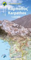
Wandelkaart 10.50 Karpathos | Anavasi

0
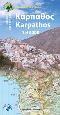
Zeer goede kaart van Karpathos. Topografische details zijn goed uitgewerkt, zeer leesbare kaart met ook nog eens alle toeristisch interessante punten. Karpathos, a mountainous island with rugged terrain and magnificent landscapes, is one of the most authentic places in Greece. It has endless sandy beaches in the south and secluded coves with emera...

Verkopers met dit product

Verkoper
Bezorging
Prijs
DeZwerver.nl logo
DeZwerver.nl
2,95
9,95

Anderen bekeken ook

Wandelkaart 10.50 Karpathos | Anavasi
Zeer goede kaart van Karpathos. Topografische details zijn goed uitgewerkt, zeer leesbare kaart met ook nog eens alle toeristisch interessante punten. Karpathos, a mountainous island with rugged terrain and magnificent landscapes, is one of the most authentic places in Greece. It has endless sandy beaches in the south and secluded coves with emerald-blue waters in the north. The more developped south of the island is popular to surfers while the north still keeps folkways alive especially in the magical village of Olymbos, perched on a saddle between two mountains and two seas. Off the northern tip of Kárpathos, separated from it by a narrow channel is the uninhabited island of Sariá with old agricultural settlements and remains of medieval houses at Palatia. This new detailed map of Anavasi proposes 12 hiking trails in the north and 6 in the south and presents the major highlights of the island.
9,95
Wandelkaart 345 Karpathos - Kasos | Terrain maps
Gedetailleerde wegenkaart en wandelkaart met alle kleine wegen, wandelpaden, hoogtelijnen en toeristische informatie aangegeven. Alle tekst is tweetalig in Engels en Grieks en de waterproof kaart is geschikt voor gebruik met GPS. This is a great map because: • It is the first GIS map of the island, meaning that this is the first time Karpathos and Kasos are mapped with a topographic precision in proportion to the map scale. • It is waterproof and rip-proof. You can fold and unfold it a thousand times, fold it in irregular ways, dunk it in the sea or leave it out in the rain. This map is indestructible! • It features the most complete road network. No matter which corner of the island on the SKAI map of Karpathos you compare with any other map on the market, you will see that it features many more roads –most importantly, they are depicted with accuracy. • It features the trails of Karpathos and Kasos for the first time, with total precision since the cartographers of TERRAIN walked th…
11,95
Wandelgids Rhodos, Karpathos, Kos and southern Dodecanese | Graf editions
Engelstaige wandelgids. Rhodos, Karpathos, Kos en de zuidelijke Dodekanesos. van de uitgever   This book describes the loveliest old walking trails. With precise descriptions and route photos of outstanding points for better orientation. And lots of interesting facts worth knowing about the Dodecanese Islands. It is made for island hoppers who want to drift through the island world by ship and who would also like to hike and swim in this ancient cultural landscape. Ten to twelve islands, among them very small ones, are described in each book, except for Walking on Naxos and Walking on Samos with only one island respectively.   The walks are carefully selected so that places of cultural significance as well as lonesome beaches can be found along the way. Exploring the remaining ancient mule tracks and marble plated roads make the walks especially enjoyable. Each walk is characterized by a precise and plain text as well as a detailed map. Six to four photos of distinctive places a…
19,50
Wegenkaart - landkaart 201 Karpathos - Kassos | Road Editions
Gedetailleerde wegenkaart met aanduiding van de wandelwegen, lijst van hotels en toeristische informatie. Voor alle soorten vakanties, ook als wandel- en fietskaart goed te gebruiken. Easy to read map for Karpathos and Kassos with touristic information churches, monasteries, archaeological sites and castles as well as all the beaches, the altitudes of mountain peaks, the complete network of trails (footpaths), the lighthouses, the airport of course, and much more.
9,95
Wandelkaart 10.27 Amorgos | Anavasi
Zeer goede wandelkaart van Amorgos. Topografische details zijn goed uitgewerkt, zeer leesbare kaart met ook nog eens alle toeristisch interessante punten. Amorgos Hiking map in scale 1:32.000 is updated with all new footpaths, roads, toponyms and even the diving center. Amorgos Trail Challenge, the new mountain running race, is also recorded. Amorgos island is the easternmost island of the Cyclades. Amorgos map shows all the beaches of the island. The Hozoviotissa monastery just below the Amorgos Chora symbolizes man s tribute to the Holy Mother. Built into the face of a cliff, it provides a breathtaking view of the sparkling blue waters of the Aegean Sea. The new edition is printed on synthetic paper (waterproof and rip-proof) is even more lightweight and very easy to carry.
10,95
Wandelkaart 11.20 Gavdos | Anavasi
Wandelkaart op schaal 1:20.000 voor Gavdos. De wandelkaart van Gavdos, met de volledige topografische achtergrond van het eiland, omvat het gehele wegen- en wandelnetwerk. Op de achterkant van de kaart vindt u informatie over de geografie, de natuurlijke omgeving en de geschiedenis van het eiland. Naast de voorgestelde wandelroutes met basisinformatie, is er ook een korte gids voor gratis kamperen, gebaseerd op respect voor de natuurlijke omgeving en een harmonieus samenleven daarmee. De kaart is gedrukt op Polyart-papier, dat scheur- en waterbestendig is.   The 1:20,000 scale Gavdos Island hiking map, with its topographic background, includes the entire road and pedestrian network of the island.   On the back of the map there is information about the geography, natural environment and history of the island.   In addition to the suggested hiking routes with their basic details, there is also a small guide for free camping, based on respect for nature and harmonious cohabitation w…
9,95
Wandelkaart 5 Thraki-Aegan Noord anavasi - Thraki Aegan North | Anavasi
The Thraki-North Aegean map guides us to areas of Greece with a rich history and important ecosystems. On the one side, Eastern Macedonia & Thrace where Ancient, Byzantine and Ottoman monuments coexist with the virgin forests of the Rhodope mountains, precious wetlands and the birds of prey sanctuary of Dadia. On the other side, the islands of the North Aegean, Thassos, Samothraki, Limnos, Lesvos, Chios and the smaller Ai Stratis and Psara complete the wonderful mosaic of nature and culture, as this NE edge of Greece has been through time a bridge between East and the West.  
11,95
Reisgids Karpathos | Michael Müller Verlag
Uitstekende, diepgaande reisgids over dit deel van het land. Met veel achtergrondinformatie en ook praktische zaken als overnachtingen en eet- en drinkgelegenheden. Thematische hoofdstukken over geschiedenis, geologie etc. Let op: Duits! Karpathos zählt zu den schönsten und abwechslungsreichsten Inseln der Ägäis. Urwüchsige, bizarre Landschaften, traumhafte Strände, malerische Dörfer und Traditionen, die man sonst in Griechenland kaum noch findet, machen sie zu einem Erlebnis der besonderen Art. Trotzdem hält sich der Tourismus noch in Grenzen. Größere Hotelanlagen gibt es nur im Süden der Insel, die Mitte und vor allem der Norden sind bis heute sehr ursprünglich geblieben - wie geschaffen für Individualreisende, die sich etwas abseits der großen Touristenströme bewegen wollen.   Der Band präsentiert malerische Fischerdörfer und quirlige Badeorte, führt zu interessanten Ausgrabungsstätten, stellt die schönsten Strände und Badebuchten vor und bietet insgesamt 24 Wanderungen durch die f…
23,50
Wandelkaart - Wegenkaart - landkaart 10.51 Ikaria | Anavasi
The new Anavasi map of Ikaria on a scale of 1:35.000 figures dozens of footpaths, the complete road network and all the beaches of the island, which is also well known for its summer feasts (panigiria) and the longevity of its inhabitants. The island was named after the mythical Icarus, the young man who flew too close to the sun and plunged into the sea, close to Ikaria.   Ikaria has a well-marked network of hiking trails. The island is indeed perfect for days of hiking pleasure with lots of vegetation, deep river valleys with plenty of hidden, refreshingly cold (and clean) water pools, relatively level top plateaus and a ridge line that climbs up to about 900-1000m above sea level with amazing views and nice beaches to end the walks. Printing on waterproof, rip-proof polyart paper
10,95
Wandelkaart 10.60 Kythera, Antikythera | Anavasi
Compatible card printed on lightweight, waterproof and tear-resistant plastic paper.   Kythera is a unique island in many ways. First of all, she has an interesting body shape. It is a vast plateau bordered by hills cut by deep gorges, some dry and majestic, others filled with water, ending in beaches of exceptional beauty.   Explore this unique terrain and traditional villages of Kythira along the ancient trails depicted on the map. Through this landscape, the history of the island takes shape: from mythology to the present day, it has dotted the island with numerous monuments.   Antikythera, due to its geographical position, has always been a springboard between the Peloponnese and Crete, both for sailors and for migratory birds. In modern times, the name has become famous due to the shipwreck and the unique finds. Otherwise, it is a destination of absolute tranquility and abstraction.
10,95

Klanten-reviews van Wandelkaart 10.50 Karpathos | Anavasi

Er zijn nog geen beoordelingen voor dit productBen jij de eerste die een review plaatst?

Meer over Wandelkaart 10.50 Karpathos | Anavasi

Productomschrijving

Zeer goede kaart van Karpathos. Topografische details zijn goed uitgewerkt, zeer leesbare kaart met ook nog eens alle toeristisch interessante punten.

Karpathos, a mountainous island with rugged terrain and magnificent landscapes, is one of the most authentic places in Greece. It has endless sandy beaches in the south and secluded coves with emerald-blue waters in the north. The more developped south of the island is popular to surfers while the north still keeps folkways alive especially in the magical village of Olymbos, perched on a saddle between two mountains and two seas.

Off the northern tip of Kárpathos, separated from it by a narrow channel is the uninhabited island of Sariá with old agricultural settlements and remains of medieval houses at Palatia. This new detailed map of Anavasi proposes 12 hiking trails in the north and 6 in the south and presents the major highlights of the island.

Productinformatie

    Verken gerelateerde categorieën

    Webshop.nl maakt gebruik van cookies. Ga je verder op onze website, ga dan akkoord met het plaatsen van cookies en de verwerking van deze data door ons en vermelde partners.