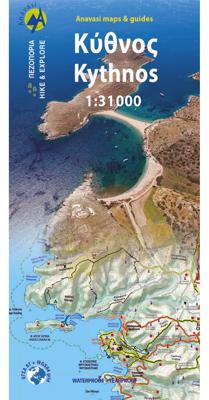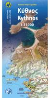
Wandelkaart 10.44 Kythnos | Anavasi

0
Het eiland Kithnos heeft twee charmante nederzettingen, Hora en Dryopida, wat zeker een bezoekje waard is. Ook heeft Kithnos prachtige stranden en een goed bewaard netwerk van paden.   De kaarten van Anavasi zijn zeer gedetailleerd, beschikken over een helder kaartbeeld en zijn uitstekende kaarten voor diverse activiteiten. Ze beschikken over vele...

Verkopers met dit product

Webshop
Bezorging
Prijs
DeZwerver.nl logo
DeZwerver.nl
2,95
9,95

Anderen bekeken ook

Wandelkaart - Topografische kaart 172 OS Explorer Map Chiltern Hills East | Ordnance Survey
Discover the east Chiltern Hills where they meet the Thames Valley, replete with lovely countryside, beautiful views and rich history. Delight in the unrivalled sailing reaches of Maidenhead; the Georgian architecture of High Wycome, the onetime furniture capital of England and the market town of Rickmansworth, set in beautiful country but a stone’s throw from London.    Bathe in natural beauty, from carpets of bluebells in the beech woods to red kites on the chalk grasslands and wildflower meadows where rare butterflies like the Adonis Blue flutter  Discover stately homes and historic houses including the gorgeous Italianate mansion of Clevedon, the charming Tudor manor Chenies and Milton’s Cottage where Paradise Lost was finished  Walk, cycle or hike a wide range of recreational paths including the Chiltern Way, South Bucks Way, Shakespeare’s Way and the Thames Path  Met zijn 4cm voor 1 km (2 ½ cm voor 1 mijl) schaal, is de OS Explorer kaartenserie de ideale en meest gedetailleer…
19,50
Wandelkaart - Topografische kaart 146 OS Explorer Map Dorking, Box Hill, Reigate | Ordnance Survey
Unearth the rich history and pastoral charms of the Surrey Hills, an Area of Outstanding Natural Beauty, and visit the historic market towns of Dorking, Leatherhead, Reigate and Caterham. Climb Box Hill, the world’s favourite cyclist hill climb, for stunning views of the North Downs.    Marvel at the 18th-century landscape park of Painshill, the Edwardian charm of Polesden Lacey and Reigate’s medieval castle  Spot Adonis blue butterflies and bee orchids, picnic by the Stepping Stones or climb Box Hill for its sensational vistas of the North Downs and High Weald  Ramble, hike and cycle along paths including the North Downs Way, Greensand Way and Mole Gap Trail    Met zijn 4cm voor 1 km (2 ½ cm voor 1 mijl) schaal, is de OS Explorer kaartenserie de ideale en meest gedetailleerde kaartenreeks voor mensen die graag outdoor-activiteiten zoals fietsen, wandelen, paardrijden, klimmen en watersporten. Deze kaart is nog gedetailleerder dan de 'gewone' Landranger maps. Voor- en achterzijde b…
19,50
Wandelkaart Tour & Trail Tenerife | Discovery Walking Guides
Uitstekende wandelkaart, met ingetekende wandelroutes, voor specifieke wandelgebieden van Tenerife. Let op: dit is niet een kaart van het hele eiland, maar puur en alleen voor de wandelgebieden > daar is deze kaart de beste in! Our latest hiking research on Tenerife has resulted in new editions of Walk! Tenerife and Tenerife Hikers' Super-Durable Maps. Thanks to Jan Kostura's research we have several new hiking adventures described in detail in Walk! Tenerife. Jan's gps records of his research for new routes and updating of current routes has provided the detailed information to produce our new fourth edition of Tenerife Hiker's Super-Durable Maps. Note that Tenerife Hikers' Super-Durable Maps is a collection of four 30k scale map sections on a double sided sheet of 840mm by 600mm which folds up to 220mm by 120mm. It is not a map of all of Tenerife.  In this edition you will find 30k scale maps covering Valle de Orotava, West, Anaga and Adeje/Arona - Teide printed on a double sided…
17,95
Wandelkaart Suva Planina - Servië | Geokarta
One side topographic marked with footpaths, ski trails, ski lifts, camp sites, picnic sites, mountain huts, also notable features in the landscape. Other side further information, additional words and pics of notable features, mountain huts etc. Suva Mountains with the Gorges of the Jelašnicka River on a detailed contoured map at 1:55,000, plus extensive information on the tourist facilities in the area with colour photos of mountain shelters, notes on fauna and flora, etc. The map has contours at 20m intervals with relief shading and colouring for woodlands. Different levels of protection zones are marked and areas where hunting is allowed are indicated. An overprint highlights waymarked hiking trails including the 130km long-distance trail across the Niš range. Also marked are different types of tourist accommodation including campsites and hunting lodges, paragliding sites, skiing areas, etc. The map has latitude and longitude lines at intervals of 5’. Map legend includes English. …
13,95
Wandelkaart Belasitsa | IT maps - Iskar
Goede duidelijke wandelkaart met een schaal van 1:25.000 van het grensgebied van Bulgarije - Griekeland - Noord Macedonie De kaart is gebaseerd op topografische kaarten met een opdruk van wandelroutes, hutten en andere handige informatie.    Hoogtelijnen (afstand 10 m), bergen, meren en rivieren staan er goed voor navigatie; de beschrijvingen en plaatsnamen zijn in het Latijn en Cyrillisch.   Met coordinaten-aanduiding, de kaart is hierdoor GPS-compatible.  Elke kaart bevat een kaarthoekmeter voor het bepalen van afstanden, de exacte positie en de hellingshoek.   Uitgever: The first, print edition of Belasitsa map is in map scale 1:25000 and contour lines by 10 meters, with many new details on topography, much improved design elements, for convenient and easy to read and all-new, very detailed terrain.   Reflected the boundaries of all protected areas within the area of the map, marked hiking trails, lodges, refuges, information centers, facilities ski areas and all details relevant t…
14,95
Wandelkaart Tour & Trail Gran Canaria | Discovery Walking Guides
Goede, scheur- en watervaste, wandelkaart van Gran Canaria.   Gran Canaria Tour & Trail Super-Durable Map covers the whole island at 50,000 scale  in a double sided map sheet of North and South with a generous overlap common to both North and South map sheets.   For the best adventures, use the best map.  Gran Canaria is a large island of dramatic landscapes. Gran Canaria Tour & Trail Super-Durable Map (50k scale) is a large 960mm by 700mm double sided map sheet which folds to its 235mm by 120mm pocket size. A special concertina map fold makes the map easy to unfold and refold in use.  Super-Durable means water-proof and tear-proof, simply wipe clean with a damp cloth if your map gets dirty. This map has a "2 Year Guarantee" covering adventurous use.   Gran Canaria North is on one side with South on the reverse side, while a generous common overlap minimises your map turning.    Now in its 5th edition Gran Canaria Tour & Trail Super-Durable Map, 50k scale, is the result o…
15,95
Wandelkaart - Topografische kaart OL32 OS Explorer Map Winchester | Ordnance Survey
Met zijn 4cm voor 1 km (2 ½ cm voor 1 mijl) schaal, is de OS Explorer kaartenserie de ideale en meest gedetailleerde kaartenreeks voor mensen die graag outdoor-activiteiten zoals fietsen, wandelen, paardrijden, klimmen en watersporten. Deze kaart is nog gedetailleerder dan de 'gewone' Landranger maps. Voor- en achterzijde bedrukt! Zeker op de moors en andere natuurgebieden van onschatbare waarden met echt alle aspecten van het landschap op de kaart ingetekend. Zeer goede detailkaart met topografische ondergrond. Hierop zijn toeristische symbolen van bezienswaardigheden ingetekend, daarnaast staan bijvoorbeeld campings en jeugdherbergen vermeld en - voor wandelaars het belangrijkst - alle right of way paden en Lange afstands Wandelpaden zijn er op te vinden. De ideale kaart voor het wandelen in Engeland, Wales of Schotland.   Map sheet OL 32 in the OS Explorer map series is the ideal map for days out in the Winchester area. Winchester, capital of England in Saxon times is a beautiful c…
19,50
Wandelkaart A15 Sarrabus da Costa Rei a Porto Corallo | Abies
Sarrabus is a territory that is not known by everybody yet. Here lies its charm and this has made possible to keep this environmental area out of big building speculations and also out of history. In fact it preserves little traces of the past, and paradoxically the remains from the prehistoric age are more meaningful than those back to more recent times. We can find traces from the most remote past not far from the State Road SS125, that from Muravera goes to Costa Rei, by visiting the nuraghe Murtas, the nuraghe S’Aqua Secis and the megalithic complexes of Scalas and Cuili Piras. They are about ten menhirs, almost fully intact, arranged in groups and fixed in the ground in the original orthostatic position. They have been put in relation with the position of the sun and the moon, at dawn and at sunset. In fact they were used as a very precise astronomic calendar but also for religious purposes since they represented both the masculine divinity and the fertility according to the wors…
12,95
Wandelkaart Kefalonia & Ithaca | Discovery Walking Guides
Scheur- en watervaste wandelkaart van Kefalonia en Ithaka met hoogtelijnen en graden. Kefalonia was popularised and made famous by "Captain Corelli's Mandolin". For your best adventures, use the best map. Water-proof, split-proof, tear-proof, adventure-proof.   Kefalonia & Ithaca Tour & Trail Super-Durable Map is simply the toughest, most accurate, easy to read, easy to use map of the island you can buy at any price. A large 960mm by 690mm double sided map sheet has both Kefalonia and Ithaca at 1:40,000 scale with the North-West of Kefalonia on the cover side and the South-East of Kefalonia with neighbouring island Ithaca on the reverse. A generous common overlap of Kefalonia reduces the need to turn the map over when navigating.   Our special concertina map fold makes your map easy to open and easy to refold to its 230mm by 120mm pocket size. Our legendary 'Tour & Trail' level of detail ranges from major roads to secondary roads to minor roads to streets and narrow country roads, plu…
15,95
Wandelkaart - Topografische kaart 150 OS Explorer Map Canterbury, Isle of Thanet | Ordnance Survey
Discover Canterbury, city of saints and kings, ancient heartland of England at the foot of the Kent Downs and the head of the River Stour Valley with its vineyards. Follow the river to the coast to discover unspoiled Deal, artistic Margate and picturesque Whitstable.  Starting in Canterbury, take the Stour Valley Walk to Sandwich and the long sweeping sand and shingle beach of Sandwich Bay  Walk the Long Rock from Whitstable to Herne Bay before taking the Thanet Coastal Path around the Isle of Thanet and its three famous Georgian and Victorian resorts of Margate, Ramsgate and Broadstairs   Take the National Trails of the England Coast Path and North Downs Way or choose from a lattice of other popular recreational paths  Met zijn 4cm voor 1 km (2 ½ cm voor 1 mijl) schaal, is de OS Explorer kaartenserie de ideale en meest gedetailleerde kaartenreeks voor mensen die graag outdoor-activiteiten zoals fietsen, wandelen, paardrijden, klimmen en watersporten. Deze kaart is nog gedetailleer…
19,50

Klanten-reviews van Wandelkaart 10.44 Kythnos | Anavasi

Er zijn nog geen beoordelingen voor dit productBen jij de eerste die een review plaatst?

Meer over Wandelkaart 10.44 Kythnos | Anavasi

Productomschrijving

Het eiland Kithnos heeft twee charmante nederzettingen, Hora en Dryopida, wat zeker een bezoekje waard is. Ook heeft Kithnos prachtige stranden en een goed bewaard netwerk van paden.   De kaarten van Anavasi zijn zeer gedetailleerd, beschikken over een helder kaartbeeld en zijn uitstekende kaarten voor diverse activiteiten. Ze beschikken over vele interessante punten voor wandelaars, fietsers of andere toeristen die het gebied bezichtigen. De wandelkaarten bevatten ook een uitzonderlijke reliefaanwijzing, verschillende vormen van gewassen en andere topografische details.   Kythnos, the second in the series of the islands of the western Cyclades, after Kea, has two charming settlements, Hora and Dryopida, wonderful beaches and a well preserved network of trails, whose maintenance and waymarking has started. The new detailed map of Anavasi depicts as always with precision and detail roads and trails, while professor of archeology  Alexander Mazarakis Ainian and the great connoisseur of the island Adonis Kyrou, have put the finishing touch to the map recording unknown ancient towers and mining facilities

Verken gerelateerde categorieën

Webshop.nl maakt gebruik van cookies. Ga je verder op onze website, ga dan akkoord met het plaatsen van cookies en de verwerking van deze data door ons en vermelde partners.