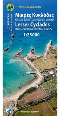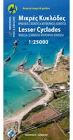
Wandelkaart 10.36 Lesser Cyclades | Anavasi

0
GPS-compatible map of the island of Naxos and 5 small Cyclades (Irakleia, Schinousa, Pano Koufonisi, Kato Koufonisi and Donousa). This map is printed on light, waterproof and tear-resistant laminated paper. The map presents a plan of the most important cities. The suggestions for hiking are indicated. The road network indicates the undeveloped min...

Verkopers met dit product

Verkoper
Bezorging
Prijs
DeZwerver.nl logo
DeZwerver.nl
2,95
10,95

Anderen bekeken ook

Wandelkaart 312 Minor Cyclades | Terrain maps
Gedetailleerde wegenkaart en wandelkaart met alle kleine wegen, wandelpaden, hoogtelijnen en toeristische informatie aangegeven. Alle tekst is tweetalig in Engels en Grieks en de waterproof kaart is geschikt voor gebruik met GPS. Why this is a great map: For one thing, it is the most accurate map of the Minor Cyclades! This is the first GIS precision map on the market for the Minor Cyclades, namely Irakleia, Pano and Kato Koufonisi, Schinousa, Donousa and Keros.  It is waterproof and rip-proof. You can fold and unfold it a thousand times, fold it in irregular ways, dunk it in the sea or leave it out in the rain. This map is indestructible!  It is the first time the island’s entire coastline is mapped. Cartography was done with TERRAIN’s specially equipped and staffed cartographic vessel. This means that you can locate all beaches of the island, down to the tiniest cove! In fact, the special features of every single beach are recorded: whether it is sandy or pebbled, whether it feat…
11,95
Wandelkaart 217 Skiathos | Road Editions
Gedetailleerde wegenkaart met aanduiding van de wandelwegen, lijst van hotels en toeristische informatie. Voor alle doeleinden een zeer geschikte kaart.   The features that make this and every other ROAD island map unique are: *The coastline, hydrography and precision geophysical background based on data provided by the Hellenic Military Geographic Service and electronically processed by us for clarity and legibility. We have highlighted the mountain masses in shades of brown between the contour lines (at 20m intervals on this map) to outline clearly the relief of the island. *The beaches are indicated by a special symbol next to which we have noted their names, as well as all the roads and footpaths leading to them (since most people primarily visit the islands for the beaches!). We have even included a short text in which the island’s best beaches are concisely referred to, to save you going on a wild goose hunt in search of them. *The road network is mapped out with impressive and …
9,95
Wegenkaart - landkaart 1 Cyclades - Argosaronic islands | Anavasi
Gedetailleerde tweetalige (Grieks/Engels) topografische wegenkaart van de Cycladen met relief, gedetailleerd wegennet met wegnummers, campings en hutten.   Cyclades - Argosaronic islands  [R1] is a new map covering the areas of Attica with the Argosaronic islands of Salamina, Aegina, Ydra and Poros and all the Cyclades islands, printed on 2 sides with overlap. A very useful map, especially for island-hoppers, with short text for each island presenting the main monuments, outstanding beaches and hiking trails on each island. Printed on waterproof, polyart paper
11,95
Wandelgids Santorini, Sifnos, Kea - Western and Southern Cyclades | Graf editions
Wandelen op de Griekse Eilanden met deze klein formaat Engelstalige wandelgids Anafi, Folegandros, Ios, Kea, Kimolos, Kithnos, Milos, Santorini, Thirassia, Serifos, Sifnos, Sikinos, bij elke uitgebreid beschreven dagwandeltocht is een gedetailleerde routekaart afgebeeld en foto's ter orientering van de moeilijke, verwarrende trajecten. Van de uitgever This book describes the loveliest old walking trails. With precise descriptions, detailed maps, exact times, GPS points and photos of outstanding places for better orientation. And lots of useful knowledge about the "Islands of Light." It is made for island hoppers who want to drift through the island world by ship and who would also like to hike and swim in this ancient cultural landscape.   The concept „Greek Islands“ conjures up images of white cubical houses twined around with red bougainvillea, unevenly paved alleys below bright blue church domes, dilapidated windmills on top of stormy mountain ridges, shady groves with old gnarl…
19,50
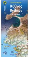
Wandelkaart 10.44 Kythnos | Anavasi
Het eiland Kithnos heeft twee charmante nederzettingen, Hora en Dryopida, wat zeker een bezoekje waard is. Ook heeft Kithnos prachtige stranden en een goed bewaard netwerk van paden.   De kaarten van Anavasi zijn zeer gedetailleerd, beschikken over een helder kaartbeeld en zijn uitstekende kaarten voor diverse activiteiten. Ze beschikken over vele interessante punten voor wandelaars, fietsers of andere toeristen die het gebied bezichtigen. De wandelkaarten bevatten ook een uitzonderlijke reliefaanwijzing, verschillende vormen van gewassen en andere topografische details.   Kythnos, the second in the series of the islands of the western Cyclades, after Kea, has two charming settlements, Hora and Dryopida, wonderful beaches and a well preserved network of trails, whose maintenance and waymarking has started. The new detailed map of Anavasi depicts as always with precision and detail roads and trails, while professor of archeology  Alexander Mazarakis Ainian and the great connoisseur of …
9,95
Wandelkaart - Wegenkaart - landkaart 10.28 Naxos | Anavasi
Zeer goede kaart van Naxos. Topografische details zijn goed uitgewerkt, zeer leesbare kaart met ook nog eens alle toeristisch interessante punten.   The few and relatively recent asphalt roads on Naxos have not been laid over the old network of byways, leaving much of it intact for visitors to use. The footpaths are well - marked and one can travel the whole island on foot.   Many paths are added to this new edition of the very detailed maps of Naxos and the 5 Small Cyclades (Irakleia, Schinousa, Pano Koufonisi, Kato Koufonisi and Donousa). Several proposed hiking routes and the course of Naxos Trail
10,95
Wegenkaart - landkaart 107 Serifos | Road Editions
Gedetailleerde wegenkaart met aanduiding van de wandelwegen, lijst van hotels en toeristische informatie. Voor alle doeleinden een zeer geschikte kaart. The features that make this and every other ROAD island map unique are: *The coastline, hydrography and precision geophysical background based on data provided by the Hellenic Military Geographic Service and electronically processed by us for clarity and legibility. We have highlighted the mountain masses in shades of brown between the contour lines (at 20m intervals on this map) to outline clearly the relief of the island. *The beaches are indicated by a special symbol next to which we have noted their names, as well as all the roads and footpaths leading to them (since most people primarily visit the islands for the beaches!). We have even included a short text in which the island’s best beaches are concisely referred to, to save you going on a wild goose hunt in search of them. *The road network is mapped out with impressive and ex…
9,95
Wegenkaart - landkaart Azoren - Azores | Freytag & Berndt
Uitstekende wegenkaart van de Azoren. Met index, toeristische informatie, Autoveerboten en jachthavens. Elk eiland op een aparte inzet. Gedetailleerde landkaart, ook te gebruiken als wandelkaart of fietskaart van de Azoren (Acores, Portugal) schaal 1:50.000 met uitgebreide legenda en plaatsnamenregister. This large double-sided road map of the Azores, at 1:50,000 from Freytag & Berndt, shows the islands both individually and as a group and comes with an attached index and concise leisure guide booklet.    This map shows main and minor roads, motorways and toll roads, sections under construction or closed to traffic. Conveniently highlighted are scenic routes, gradients on steep roads, driving distances in kilometres, petrol and service stations etc. Railway lines are marked and international and local airports are indicated as well as ferry connections to the other islands.    Relief shading, spot heights and colouring and/or graphics provide a good presentation of the islands topogra…
14,95
Wegenkaart - landkaart 105 Tzia - Kea | Road Editions
Gedetailleerde wegenkaart met aanduiding van de wandelwegen, lijst van hotels en toeristische informatie. Voor alle doeleinden een zeer geschikte kaart. Scheur- en watervast! The features that make this and every other ROAD island map unique are: *The coastline, hydrography and precision geophysical background based on data provided by the Hellenic Military Geographic Service and electronically processed by us for clarity and legibility. We have highlighted the mountain masses in shades of brown between the contour lines (at 100m intervals on this map) to outline clearly the relief of the island. *The beaches are indicated by a special symbol next to which we have noted their names, as well as all the roads and footpaths leading to them (since most people primarily visit the islands for the beaches!). We have even included a short text in which the island’s best beaches are concisely referred to, to save you going on a wild goose hunt in search of them. *The road network is mapped out…
9,95
Wegenkaart - landkaart 109 Sifnos | Road Editions
Gedetailleerde wegenkaart met aanduiding van de wandelwegen, lijst van hotels en toeristische informatie. Voor alle doeleinden een zeer geschikte kaart. The features that make this and every other ROAD island map unique are: *The coastline, hydrography and precision geophysical background based on data provided by the Hellenic Military Geographic Service and electronically processed by us for clarity and legibility. We have highlighted the mountain masses in shades of brown between the contour lines (at 20m intervals on this map) to outline clearly the relief of the island. *The beaches are indicated by a special symbol next to which we have noted their names, as well as all the roads and footpaths leading to them (since most people primarily visit the islands for the beaches!). We have even included a short text in which the island’s best beaches are concisely referred to, to save you going on a wild goose hunt in search of them. *The road network is mapped out with impressive and ex…
9,95

Klanten-reviews van Wandelkaart 10.36 Lesser Cyclades | Anavasi

Er zijn nog geen beoordelingen voor dit productBen jij de eerste die een review plaatst?

Meer over Wandelkaart 10.36 Lesser Cyclades | Anavasi

Productomschrijving

GPS-compatible map of the island of Naxos and 5 small Cyclades (Irakleia, Schinousa, Pano Koufonisi, Kato Koufonisi and Donousa). This map is printed on light, waterproof and tear-resistant laminated paper. The map presents a plan of the most important cities. The suggestions for hiking are indicated. The road network indicates the undeveloped minor routes and the tracks in poor condition The road distances are indicated on the main roads and the locations of the service stations are indicated. A series of symbols highlight the various places of interest, including archaeological sites, beaches, etc. All the names are in Greek and Latin alphabet.   The Lesser or Small Cyclades are made up of more than 30 islands and rocks. The main inhabited islands are Iraklia, Schinousa, Donousa, Pano Koufonisi. The waters around them are very attractive and walking is inevitable as there are few roads. Donoussa has the best combination of paths and beaches, Iraklia is more suitable for hikers, Schinousa has also an interesting climbing site. Pano Koufonisi offers the best beaches while Kato Koufonisi is a favorite spot for wild campers and nudists. (From the publisher)

Verken gerelateerde categorieën

Webshop.nl maakt gebruik van cookies. Ga je verder op onze website, ga dan akkoord met het plaatsen van cookies en de verwerking van deze data door ons en vermelde partners.