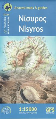
Wandelkaart 10.34 Nisyros | Anavasi

0
Nisyros, a landscape that is out of this world, volcanic earth boiling under your feet, ancient cobbled paths among countless terraces enigmatic chapels and monumental huts. Hiking in Nisyros is an initiation.  ...

Verkopers met dit product

Verkoper
Bezorging
Prijs
DeZwerver.nl logo
DeZwerver.nl
2,95
9,95

Anderen bekeken ook

Nieuw
Wandelkaart - Wegenkaart - landkaart 10.30 Tinos | Anavasi
Goede wandelkaart van Tinos. Tinos island landscape is like a hand made embroidery. Rural huts, dovecotes, churches, terraces and villages are woven into a net of trails. In the first edition of the map, along with my partner Charles Merlin we had recorded several dozens of kilometers of footpaths. From then until the present second edition, Charles made a bet and target to enrich the map in paths, - and put in the game and his friend George Kennedy. Actually the recorded paths, doubled, and plenty of churches, bridges, huts, dovecotes were added beside the paths. Along with the improvements in topographic background and color palette, the map of Tinos has reached very high standards - because we don't like the easy path. On the back side there are several proposed hiking trails with short descriptions and updated information for marking of the paths.
10,95
Nieuw
Wandelkaart 8.1 Mt. Taygetos - Peloponnesos | Anavasi
Uitstekende topografische kaarten van een deel van Griekenland: zonder meer hele goede kaarten voor wandeltochten in een onbekend stuk Griekenland! Ze zijn gedrukt op scheurvast en watervast papier op een schaal van 1:25.000 met een UTM grid voor GPS gebruikers. Op de meeste kaarten is geven de hoogtelijnen een interval van 20m. aan. Met schaduwkleuren, punten met hoogtemeters, bronnen, riviertjes en landgebruik geven ze de topografie van het land goed weer. Lokale voetpaden, herbergen en berghutten zijn duidelijk weergegeven. De wegen zijn in gradaties getekend: verhard en onverhard, groot en klein, met afstanden en benzinepompen. Toeristische bezienswaardigheden als kloosters, grotten, kerken etc staan ingetekend. Achterop de kaart worden suggesties gegeven voor wandelroutes met wandeltijd in uren. This is not just a hiking map, this is a hiking guide AND 1: 25 000 map.   Taygetos extends as 70 km of magnificent massif anchoring the southern tip of Greece. From a dense network of ch…
25,95
Nieuw
Wandelkaart - Wegenkaart - landkaart 10.24 Santorini | Anavasi
As you enter the caldera of Santorini by ferry sheer cliffs rise up dramatically, exposing richly coloured rock strata, crowned by the colored houses of the cliff-top settlements. Equally magnificent is the sunset from the heights of the caldera towards the sea and the remnants of prehistoric rounded island Strogyli, Thirasia, the New and Old Kameni. However, there is more than the visual excitement to discover and if you don’t take the time to walk the island you will have learnt little of Santorini.   The new Anavasi map will take hiking in every corner, beach and hill top of Santorini and Thirassia to discover landscapes with visible signs of the traditional rural culture, with orchards stonewalls, threshing floors, huts, chapels, inland villages with a well preserved medieval core (called Castelo), routes with wonderful vistas, lost beaches quiet even in the heart of summer.   On the reverse side of the map, there is a brief description of the 25 proposed hiking routes and a short…
10,95

Klanten-reviews van Wandelkaart 10.34 Nisyros | Anavasi

Er zijn nog geen beoordelingen voor dit productBen jij de eerste die een review plaatst?

Meer over Wandelkaart 10.34 Nisyros | Anavasi

Productomschrijving

Nisyros, a landscape that is out of this world, volcanic earth boiling under your feet, ancient cobbled paths among countless terraces enigmatic chapels and monumental huts. Hiking in Nisyros is an initiation.  

Verken gerelateerde categorieën

Webshop.nl maakt gebruik van cookies. Ga je verder op onze website, ga dan akkoord met het plaatsen van cookies en de verwerking van deze data door ons en vermelde partners.