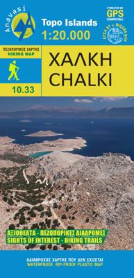
Wandelkaart 10.33 Chalki | Anavasi

0
 wandelkaart schaal 1:20.000 met hoogtelijnen, wandelpaden, toeristische informatie en UTM grid, de kaart is geschikt voor gebruik met GPS. A tiny island though very rich in monuments and ancient remains. More than 50 byzantine chappels, dozens of rock carved cisterns and old agricultural settlements and a well-preserved medieval caslte with a rui...

Verkopers met dit product

Verkoper
Bezorging
Prijs
DeZwerver.nl logo
DeZwerver.nl
2,95
9,95

Anderen bekeken ook

Nieuw
Wandelkaart 10.50 Karpathos | Anavasi
Zeer goede kaart van Karpathos. Topografische details zijn goed uitgewerkt, zeer leesbare kaart met ook nog eens alle toeristisch interessante punten. Karpathos, a mountainous island with rugged terrain and magnificent landscapes, is one of the most authentic places in Greece. It has endless sandy beaches in the south and secluded coves with emerald-blue waters in the north. The more developped south of the island is popular to surfers while the north still keeps folkways alive especially in the magical village of Olymbos, perched on a saddle between two mountains and two seas. Off the northern tip of Kárpathos, separated from it by a narrow channel is the uninhabited island of Sariá with old agricultural settlements and remains of medieval houses at Palatia. This new detailed map of Anavasi proposes 12 hiking trails in the north and 6 in the south and presents the major highlights of the island.
9,95
Nieuw
Wandelkaart - Wegenkaart - landkaart 10.24 Santorini | Anavasi
As you enter the caldera of Santorini by ferry sheer cliffs rise up dramatically, exposing richly coloured rock strata, crowned by the colored houses of the cliff-top settlements. Equally magnificent is the sunset from the heights of the caldera towards the sea and the remnants of prehistoric rounded island Strogyli, Thirasia, the New and Old Kameni. However, there is more than the visual excitement to discover and if you don’t take the time to walk the island you will have learnt little of Santorini.   The new Anavasi map will take hiking in every corner, beach and hill top of Santorini and Thirassia to discover landscapes with visible signs of the traditional rural culture, with orchards stonewalls, threshing floors, huts, chapels, inland villages with a well preserved medieval core (called Castelo), routes with wonderful vistas, lost beaches quiet even in the heart of summer.   On the reverse side of the map, there is a brief description of the 25 proposed hiking routes and a short…
10,95
Nieuw
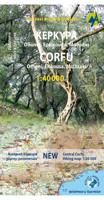
Wandelkaart 9.4 Corfu | Anavasi
Een nieuwe gedetailleerde wandelkaart voor Corfu met informatie over monumenten en stranden. De route van de Corfu Trail, een 220 km lange bewegwijzerde wandelroute langs de mooiste en authentieke plaatsen van het eiland, is op de kaart opgenomen. De kaarten van Anavasi zijn zeer gedetailleerd, beschikken over een helder kaartbeeld en zijn uitstekende kaarten voor diverse activiteiten. Ze beschikken over vele interessante punten voor wandelaars, fietsers of andere toeristen die het gebied bezichtigen. De wandelkaarten bevatten ook een uitzonderlijke reliefaanwijzing, verschillende vormen van gewassen en andere topografische details. A new detailed hiking map for Corfu by Anavasi editions with information on its monuments and beaches. The course of the Corfu Trail, a 220 km long waymarked hiking route passing by the most beautiful and authentic places of the island is recorded on the map. Printed on waterproof and rip-proof polyart paper.  
10,95
Nieuw
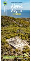
Wandelkaart 10.00 Aigina | Anavasi
Egina eiland ligt heel dicht bij Athene, maar het heeft veel verborgen en wilde kanten. De Anavasi Aigina kaart is de beste manier om deze te ontdekken. De stranden van Egina variëren van zandstranden tot wilde rotsachtige kusten. Maar naast de charmante landschappen en stranden is het een plek die rijk is aan geschiedenis. Deze kaart nodigt u uit om Aigina te ontdekken en rond te lopen in het prachtige landschap. Aan de achterkant van de kaart vindt u voorgestelde wandelroutes en korte beschrijvingen van de belangrijkste bezienswaardigheden. De kaarten van Anavasi zijn zeer gedetailleerd, beschikken over een helder kaartbeeld en zijn uitstekende kaarten voor diverse activiteiten. Ze beschikken over vele interessante punten voor wandelaars, fietsers of andere toeristen die het gebied bezichtigen. De wandelkaarten bevatten ook een uitzonderlijke reliefaanwijzing, verschillende vormen van gewassen en andere topografische details. Aigina island is very close to Athens but it has many hid…
9,95
Nieuw
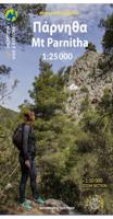
Wandelkaart 1.1 Mt. Parnitha | Anavasi
Parnitha, de hoogste berg in Attika, is een natuurreservaat waar de Atheners in contact komen met de natuur. Het sparrenbos, de ravijnen, het vele kreupelhout, herten en vogels maken dit stukje natuur ontzettend bijzonder. Het is een ideale bestemming om te wandelen, klimmen, mountainbiken, of om zelfs een sneeuwpop te maken. De kaarten van Anavasi zijn zeer gedetailleerd, beschikken over een helder kaartbeeld en zijn uitstekende kaarten voor diverse activiteiten. Ze beschikken over vele interessante punten voor wandelaars, fietsers of andere toeristen die het gebied bezichtigen. De wandelkaarten bevatten ook een uitzonderlijke reliefaanwijzing, verschillende vormen van gewassen en andere topografische details.   A new (7th) edition of Mt Parnitha hiking map. Parnitha, the highest mountain in Attica, is a natural reserve where the Athenians come in contact with nature. The fir forest, the ravines and endless, scrubland, deers and birds are the manifestations of the wildlife we come lo…
11,95
Wandelkaart A15 Sarrabus da Costa Rei a Porto Corallo | Abies
Sarrabus is a territory that is not known by everybody yet. Here lies its charm and this has made possible to keep this environmental area out of big building speculations and also out of history. In fact it preserves little traces of the past, and paradoxically the remains from the prehistoric age are more meaningful than those back to more recent times. We can find traces from the most remote past not far from the State Road SS125, that from Muravera goes to Costa Rei, by visiting the nuraghe Murtas, the nuraghe S’Aqua Secis and the megalithic complexes of Scalas and Cuili Piras. They are about ten menhirs, almost fully intact, arranged in groups and fixed in the ground in the original orthostatic position. They have been put in relation with the position of the sun and the moon, at dawn and at sunset. In fact they were used as a very precise astronomic calendar but also for religious purposes since they represented both the masculine divinity and the fertility according to the wors…
12,95
Nieuw
Wandelgids Naxos and the Small Cyclades | Graf editions
Handig klein formaat engelstalige wandelgids Naxos, Donoussa, Iraklia, Koufonissia, Schinoussa bij elke uitgebreid beschreven dagwandeltocht is een gedetailleerde routekaart afgebeeld en foto's ter orientering van de moeilijke, verwarrende trajecten: Van de uitgever This book describes the loveliest old walking trails. With detailed maps, GPS data and route photos of outstanding points for better orientation. And lots of interesting facts worth knowing about the Islands of Dionysos.   Already when you sail into the harbour, you can sense the island's tremendous cultural diversity. On the left, you peer up at the enormous portal of a classical temple; on the right, you glide past a small Byzantine chapel and, towering above the huddled Cycladic city, a Venetian kástro from the Middle Ages. The city, dating back 5000 years, is one of the oldest inhabited places in the world.   When you penetrate further in to the island, you are surprised by the diversity of the fertile landscapes. An e…
19,50
Nieuw
Wandelkaart 1.3 Mt. Penteli | Anavasi
Deze wandelkaart van berg Penteli door Anavasi nodigt u uit om één van de bergen nabij Athene te ontdekken via wandel- en fietspaden. Oude steengroeven, grotten en monumenten, en de beroemde 'lithagogische weg' zijn in de kaart opgenomen. De kaarten van Anavasi zijn zeer gedetailleerd, beschikken over een helder kaartbeeld en zijn uitstekende kaarten voor diverse activiteiten. Ze beschikken over vele interessante punten voor wandelaars, fietsers of andere toeristen die het gebied bezichtigen. De wandelkaarten bevatten ook een uitzonderlijke reliefaanwijzing, verschillende vormen van gewassen en andere topografische details.   The new hiking map of Mt Penteli [1.3] by Anavasi in a scale 1:16 000 invites you to discover one of the mountains that delimit the Athens plain through hiking and cycling trails. Old quarries, caves and monuments, including the famous "lithagogias road" from where the Parthenon marbles were transported to the Acropolis are recorded on the map The map is printed …
9,95
Nieuw
Reisgids Greece: The Peloponnese - Griekenland: Peloponnesos | Bradt Travel Guides
Voor vele landen net zo goed, zo niet beter dan de Planet. Beduidend soberder uitgevoerd, maar ook met veel informatie voor backpackers en met veel kaartmateriaal. Een aanrader! Engels. This new, thoroughly updated fifth edition of Bradt's Greece: The Peloponnese with Athens, Delphi and Kythira remains the only dedicated guidebook to the southern part of the Greek mainland. It provides more detailed coverage than any other rival guide, making it indispensable for independent and group travellers visiting a fascinating area slightly smaller than Wales. It also incorporates focussed mini-guides to the Greek capital of Athens and the world-famous site of Delphi.   The Peloponnese contains a huge diversity of cultural landscapes, from sleepy, white-washed villages to Byzantine churches, medieval fortresses and ancient archaeological sites such as Olympia and Mycenae. In addition to a long Mediterranean coast lined with classic white sandy beaches, the peninsula incorporates towering mount…
27,50
Nieuw
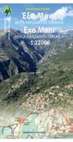
Wandelkaart 08.10 Exo Mani | Anavasi
Uitstekende wandelkaart op scheur- en watervast papier van het wandelgebied rond Kardamyli maar ook nog met Agios Nikolaos. De wandelpaden staan er op ingetekend, zo ook alle bezienswaardigheden als klooster, kastelen en meerdere opgravingen.  Mani is the middle and southernmost peninsula of the Peloponnese and is split between Laconia and Messinia. Exo Mani is the name of the northwestern part, which belongs to the prefecture of Messinia. Exo Mani preserves a treasure trove of Byzantine and post-Byzantine churches and castles in breathtaking landscapes.The new map covers the entire Exo Mani, the are formerly covered by the three older maps "Verga-Kampos", "Kardamyli-Stoupa" and "Agios Nikolaos-Trachila. " The area has wonderful cobbled paths ideal for walking all year round.
11,95

Klanten-reviews van Wandelkaart 10.33 Chalki | Anavasi

Er zijn nog geen beoordelingen voor dit productBen jij de eerste die een review plaatst?

Meer over Wandelkaart 10.33 Chalki | Anavasi

Productomschrijving

 wandelkaart schaal 1:20.000 met hoogtelijnen, wandelpaden, toeristische informatie en UTM grid, de kaart is geschikt voor gebruik met GPS.

A tiny island though very rich in monuments and ancient remains. More than 50 byzantine chappels, dozens of rock carved cisterns and old agricultural settlements and a well-preserved medieval caslte with a ruined medieval settlement at its foot. The new detailed map by ANAVASI will be your precious guide to discover all these little known remains, most of them accessible only by footpaths.

Verken gerelateerde categorieën

Webshop.nl maakt gebruik van cookies. Ga je verder op onze website, ga dan akkoord met het plaatsen van cookies en de verwerking van deze data door ons en vermelde partners.