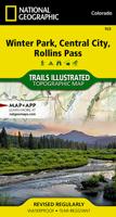
Wandelkaart 103 Winter Park, Central City, Rollins Pass | National Geographic

0

Verkopers met dit product

Verkoper
Bezorging
Prijs
DeZwerver.nl logo
DeZwerver.nl
niet bekend
2,95
17,95

Anderen bekeken ook

Wandelkaart 216 Olympic National Park | National Geographic
Prachtige geplastificeerde kaart van het bekende nationaal park. Met alle recreatieve voorzieningen als campsites, maar ook met topografische details en wandelroutes ed. Door uitgekiend kleurgebruik zeer prettig in gebruik. Scheur en watervast! Within the park, there is detailed coverage of Mount Olympus, Tshletshy Ridge, Hurrican Ridge, Huelsdonk Ridge, Bailey Range, camping areas, facilities, ranger stations, nature trails, waterfalls, boat launches, and much more. Also included are the Mount Skokomish Wilderness, Ozette Lake, Lake Pleasant, Lake Crescent, Lake Mills, and Olympic National Forest.
16,95
Wandelkaart 900 Banff South National Park | National Geographic
Prachtige geplastificeerde kaart van het bekende nationaal park. Met alle recreatieve voorzieningen als campsites, maar ook met topografische details en wandelroutes ed. Door uitgekiend kleurgebruik zeer prettig in gebruik. Scheur en watervast!   Banff & Kootenay National Parks Alberta/British Columbia, Canada Trail distances, Mount Assiniboine Provincial Park, Radium Hot Springs, Lake Minnewanka, Castle Mountain, Bow Valley Parkway Waterproof and tear-resistant Clearly marked trails for hiking, biking, horseback riding, ATV, and more Detailed topography and clearly defined, color-coded boundaries of state parks, national recreation areas, wilderness areas, marine sanctuaries, and wildlife refuges
17,95
Wandelkaart 230 Hawaii Volcanoes National Park | National Geographic
Prachtige geplastificeerde kaart van het bekende nationaal park. Met alle recreatieve voorzieningen als campsites, maar ook met topografische details en wandelroutes ed. Door uitgekiend kleurgebruik zeer prettig in gebruik. Scheur en watervast! Map No. 230, Hawaii Volcanoes National Park, HI, in an extensive series of GPS compatible, contoured hiking maps of USA’s national and state parks or forests and other popular recreational areas. Cartography based on the national topographic survey, with additional tourist information. The map, printed on light, waterproof and tear-resistant plastic paper, covers the whole park at 1:100,000 (contour interval 100 feet), plus its central section shown on the reverse at 1:50,000 (contour interval 50 feet) with the Kïlauea Caldera at 1:25,000 (contour interval 25 feet).
16,95

Klanten-reviews van Wandelkaart 103 Winter Park, Central City, Rollins Pass | National Geographic

Er zijn nog geen beoordelingen voor dit productBen jij de eerste die een review plaatst?

Meer over Wandelkaart 103 Winter Park, Central City, Rollins Pass | National Geographic

Productinformatie

    Verken gerelateerde categorieën

    Webshop.nl maakt gebruik van cookies. Ga je verder op onze website, ga dan akkoord met het plaatsen van cookies en de verwerking van deze data door ons en vermelde partners.