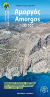
Wandelkaart 10.27 Amorgos | Anavasi

0
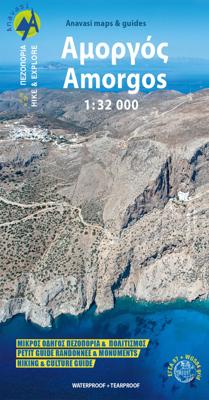
Zeer goede wandelkaart van Amorgos. Topografische details zijn goed uitgewerkt, zeer leesbare kaart met ook nog eens alle toeristisch interessante punten. Amorgos Hiking map in scale 1:32.000 is updated with all new footpaths, roads, toponyms and even the diving center. Amorgos Trail Challenge, the new mountain running race, is also recorded. Amor...

Verkopers met dit product

Verkoper
Bezorging
Prijs
DeZwerver.nl logo
DeZwerver.nl
2,95
10,95

Anderen bekeken ook

Wandelkaart 10.27 Amorgos | Anavasi
Zeer goede wandelkaart van Amorgos. Topografische details zijn goed uitgewerkt, zeer leesbare kaart met ook nog eens alle toeristisch interessante punten. Amorgos Hiking map in scale 1:32.000 is updated with all new footpaths, roads, toponyms and even the diving center. Amorgos Trail Challenge, the new mountain running race, is also recorded. Amorgos island is the easternmost island of the Cyclades. Amorgos map shows all the beaches of the island. The Hozoviotissa monastery just below the Amorgos Chora symbolizes man s tribute to the Holy Mother. Built into the face of a cliff, it provides a breathtaking view of the sparkling blue waters of the Aegean Sea. The new edition is printed on synthetic paper (waterproof and rip-proof) is even more lightweight and very easy to carry.
10,95
Wandelkaart 314 Amorgos | Terrain maps
Gedetailleerde wegenkaart en wandelkaart met alle kleine wegen, wandelpaden, hoogtelijnen en toeristische informatie aangegeven. Alle tekst is tweetalig in Engels en Grieks en de waterproof kaart is geschikt voor gebruik met GPS. This is a great map because: It is waterproof and rip-proof. You can fold and unfold it a thousand times, fold it in irregular ways, dunk it in the sea or leave it out in the rain. This map is indestructible!  It is the first time the island’s entire coastline is mapped. Cartography was done with TERRAIN’s specially equipped and staffed cartographic vessel. This means that you can locate all beaches of the island, down to the tiniest cove! In fact, the special features of every single beach are recorded: whether it is sandy or pebbled, whether it features natural tree shade, water, a beach bar or organized water sports, whether the seabed in front of the beach is sandy or rocky (so that you will know where to anchor).  It indicates the boundaries of NATURA…
11,95
Wandelkaart 10.50 Karpathos | Anavasi
Zeer goede kaart van Karpathos. Topografische details zijn goed uitgewerkt, zeer leesbare kaart met ook nog eens alle toeristisch interessante punten. Karpathos, a mountainous island with rugged terrain and magnificent landscapes, is one of the most authentic places in Greece. It has endless sandy beaches in the south and secluded coves with emerald-blue waters in the north. The more developped south of the island is popular to surfers while the north still keeps folkways alive especially in the magical village of Olymbos, perched on a saddle between two mountains and two seas. Off the northern tip of Kárpathos, separated from it by a narrow channel is the uninhabited island of Sariá with old agricultural settlements and remains of medieval houses at Palatia. This new detailed map of Anavasi proposes 12 hiking trails in the north and 6 in the south and presents the major highlights of the island.
9,95
Wandelkaart - Wegenkaart - landkaart 10.24 Santorini | Anavasi
As you enter the caldera of Santorini by ferry sheer cliffs rise up dramatically, exposing richly coloured rock strata, crowned by the colored houses of the cliff-top settlements. Equally magnificent is the sunset from the heights of the caldera towards the sea and the remnants of prehistoric rounded island Strogyli, Thirasia, the New and Old Kameni. However, there is more than the visual excitement to discover and if you don’t take the time to walk the island you will have learnt little of Santorini.   The new Anavasi map will take hiking in every corner, beach and hill top of Santorini and Thirassia to discover landscapes with visible signs of the traditional rural culture, with orchards stonewalls, threshing floors, huts, chapels, inland villages with a well preserved medieval core (called Castelo), routes with wonderful vistas, lost beaches quiet even in the heart of summer.   On the reverse side of the map, there is a brief description of the 25 proposed hiking routes and a short…
10,95
Wandelkaart 11.20 Gavdos | Anavasi
Wandelkaart op schaal 1:20.000 voor Gavdos. De wandelkaart van Gavdos, met de volledige topografische achtergrond van het eiland, omvat het gehele wegen- en wandelnetwerk. Op de achterkant van de kaart vindt u informatie over de geografie, de natuurlijke omgeving en de geschiedenis van het eiland. Naast de voorgestelde wandelroutes met basisinformatie, is er ook een korte gids voor gratis kamperen, gebaseerd op respect voor de natuurlijke omgeving en een harmonieus samenleven daarmee. De kaart is gedrukt op Polyart-papier, dat scheur- en waterbestendig is.   The 1:20,000 scale Gavdos Island hiking map, with its topographic background, includes the entire road and pedestrian network of the island.   On the back of the map there is information about the geography, natural environment and history of the island.   In addition to the suggested hiking routes with their basic details, there is also a small guide for free camping, based on respect for nature and harmonious cohabitation w…
9,95
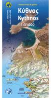
Wandelkaart 10.44 Kythnos | Anavasi
Het eiland Kithnos heeft twee charmante nederzettingen, Hora en Dryopida, wat zeker een bezoekje waard is. Ook heeft Kithnos prachtige stranden en een goed bewaard netwerk van paden.   De kaarten van Anavasi zijn zeer gedetailleerd, beschikken over een helder kaartbeeld en zijn uitstekende kaarten voor diverse activiteiten. Ze beschikken over vele interessante punten voor wandelaars, fietsers of andere toeristen die het gebied bezichtigen. De wandelkaarten bevatten ook een uitzonderlijke reliefaanwijzing, verschillende vormen van gewassen en andere topografische details.   Kythnos, the second in the series of the islands of the western Cyclades, after Kea, has two charming settlements, Hora and Dryopida, wonderful beaches and a well preserved network of trails, whose maintenance and waymarking has started. The new detailed map of Anavasi depicts as always with precision and detail roads and trails, while professor of archeology  Alexander Mazarakis Ainian and the great connoisseur of …
9,95
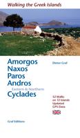
Wandelgids Amorgos, Naxos, Paro, Andros & eastern and northern Cycladen | Graf editions
Wandelgids met 56 wandelingen op 12 eilanden. Het boekje beschrijft de mooiste oude wandelroutes. Met gedetaileerde kaartjes, looptijden, GPS points en foto's van standpunten voor een betere orientatie. Met : Amorgós Ándros Antíparos Donoússa Irakliá Koufonísi Mýkonos Náxos Páros Schinoússa Sýros Tínos Van de uitgever This book describes the loveliest old walking trails. With precise descriptions, detailed maps, exact times, GPS points and photos of outstanding places for better orientation. And lots of useful knowledge about the "Islands of Light." It is made for island hoppers who want to drift through the island world by ship and who would also like to hike and swim in this ancient cultural landscape.   For the update of this new edition all the tracks and paths have been newly walked along and rechecked. All extensions, some of them also changed routes, are recorded. And 12 new hikes have been added.   White, cubical houses in front of infinitely blue sea – that is how we know Gre…
19,50
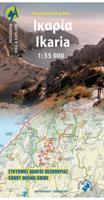
Wandelkaart - Wegenkaart - landkaart 10.51 Ikaria | Anavasi
The new Anavasi map of Ikaria on a scale of 1:35.000 figures dozens of footpaths, the complete road network and all the beaches of the island, which is also well known for its summer feasts (panigiria) and the longevity of its inhabitants. The island was named after the mythical Icarus, the young man who flew too close to the sun and plunged into the sea, close to Ikaria.   Ikaria has a well-marked network of hiking trails. The island is indeed perfect for days of hiking pleasure with lots of vegetation, deep river valleys with plenty of hidden, refreshingly cold (and clean) water pools, relatively level top plateaus and a ridge line that climbs up to about 900-1000m above sea level with amazing views and nice beaches to end the walks. Printing on waterproof, rip-proof polyart paper
10,95
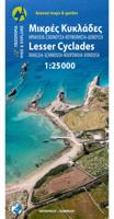
Wandelkaart 10.36 Lesser Cyclades | Anavasi
GPS-compatible map of the island of Naxos and 5 small Cyclades (Irakleia, Schinousa, Pano Koufonisi, Kato Koufonisi and Donousa). This map is printed on light, waterproof and tear-resistant laminated paper. The map presents a plan of the most important cities. The suggestions for hiking are indicated. The road network indicates the undeveloped minor routes and the tracks in poor condition The road distances are indicated on the main roads and the locations of the service stations are indicated. A series of symbols highlight the various places of interest, including archaeological sites, beaches, etc. All the names are in Greek and Latin alphabet.   The Lesser or Small Cyclades are made up of more than 30 islands and rocks. The main inhabited islands are Iraklia, Schinousa, Donousa, Pano Koufonisi. The waters around them are very attractive and walking is inevitable as there are few roads. Donoussa has the best combination of paths and beaches, Iraklia is more suitable for hikers, Schi…
10,95
Wandelkaart 10.26 Sifnos | Anavasi
Deze wandelkaart bevat informatie over het onlangs voltooide netwerk van bewegwijzerende paden op het eiland Sifnos, dat bestaat uit 19 routes. Inclusief luchtfoto's van de eilandlandschappen en korte teksten op de achterkant. De kaarten van Anavasi zijn zeer gedetailleerd, beschikken over een helder kaartbeeld en zijn uitstekende kaarten voor diverse activiteiten. Ze beschikken over vele interessante punten voor wandelaars, fietsers of andere toeristen die het gebied bezichtigen. De wandelkaarten bevatten ook een uitzonderlijke reliefaanwijzing, verschillende vormen van gewassen en andere topografische details.   New edition of the map of Sifnos with the recently completed network of waymarked trails, that comprises 19 routes. Aerial photos of the island landscapes and short texts on the back side.
9,95

Klanten-reviews van Wandelkaart 10.27 Amorgos | Anavasi

Er zijn nog geen beoordelingen voor dit productBen jij de eerste die een review plaatst?

Meer over Wandelkaart 10.27 Amorgos | Anavasi

Productomschrijving

Zeer goede wandelkaart van Amorgos. Topografische details zijn goed uitgewerkt, zeer leesbare kaart met ook nog eens alle toeristisch interessante punten.

Amorgos Hiking map in scale 1:32.000 is updated with all new footpaths, roads, toponyms and even the diving center. Amorgos Trail Challenge, the new mountain running race, is also recorded. Amorgos island is the easternmost island of the Cyclades. Amorgos map shows all the beaches of the island. The Hozoviotissa monastery just below the Amorgos Chora symbolizes man s tribute to the Holy Mother. Built into the face of a cliff, it provides a breathtaking view of the sparkling blue waters of the Aegean Sea. The new edition is printed on synthetic paper (waterproof and rip-proof) is even more lightweight and very easy to carry.

Productinformatie

    Verken gerelateerde categorieën

    Webshop.nl maakt gebruik van cookies. Ga je verder op onze website, ga dan akkoord met het plaatsen van cookies en de verwerking van deze data door ons en vermelde partners.