webshop.nl
Categorieën
  Sluiten

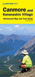
Wandelkaart 06 Canmore & Kananaskis Village | Gem Trek Maps

This map covers some of the most popular terrain for hikers and mountain bikers in Kananaskis Country - Bow Valley Provincial Park, the Canmore area, the Smith-Dorrien/Spray Lakes area south to Mount Shark trailhead, Barrier Lake, and the Kananaskis Village area from Ribbon Creek south to Galatea Lakes trailhead.   Updated trails on this sixth edit...
17,95

Webshops met dit product

Webshop
Bezorging
Prijs

Anderen bekeken ook

Wandelkaart 03 Bow Lake and Saskatchewan Crossing | Gem Trek Maps
This map covers the trails departing from the southern section of the Icefields Parkway from Rampart Creek south to Hector Lake. A 1:100 000-scale inset map on the back of the map increases coverage to the adjoining Mosquito Creek/Fish Lakes area.   The area covered on this map is prime hiking terrain with scenery as superb as the rest of Banff National Park, but with the trails less busy than those in the Banff townsite and Lake Louise areas. Besides spotting marmots in the boulders near Helen Lake, you also have an excellent chance of seeing moose.   On the back of the map are trail descriptions and photos of 16 recommended day hikes, ranging from short and easy to long and strenuous, as well as descriptions of five overnight trips. Classic trails covered include Bow Glacier Falls, Helen Lake, Bow Summit Lookout, Sunset Pass, and Cirque, Chephren and and Glacier Lake trails. All trails are referenced to the front. Contact numbers for parks and info on lodges, campgrounds and hostels …
16,95
Wandelkaart 07 Kananaskis Lakes | Gem Trek Maps
This map covers what some say is the most scenic terrain in all of Kananaskis Country -  the upper Smith-Dorrien-Spray Trail south of Mt. Shark, Peter Lougheed Provincial Park including the network of trails in the Kananaskis Lakes area, and the northern part of Elk Lakes Provincial Park.   Seven snowshoe trails have been added to this new edition, including those at Chester Lake, Hogarth Lakes, Lower Lake, Penstock, Elkwood, Sawmill and Wintour, a 5-km stretch starting at the winter gate on Highway 40. And for those of you who have been asking, the relief shading is back and the map is printed on waterproof material.   Popular day hikes covered on this map include Elbow Lake, Chester Lake, Burstall Pass, Headwall Lakes, Kananaskis Lookout, Upper Kananaskis Lake Circuit, Rawson Lake, Elk Lakes and Ptarmigan Cirque where more than 80 species of wildflowers have been identified by budding botanists.   On the back of the map are trail descriptions and photos of 16 recommended day hikes, t…
16,95
Wandelkaart Banff - Egypt Lake | Gem Trek Maps
Mooie, gedetailleerde kaart uit de serie van Gem Trek Hiking map-guides. Helder kleurgebruik en met de beste / mooiste wandelroutes, hikes en interessante plaatsen erop aangegeven. Gem Trek’s 1:50,000-scale BANFF–EGYPT LAKE MAP covers the most popular hiking trails in the immediate area of the town of Banff in more detail than our Banff & Mount Assiniboine Map.   The Banff–Egypt Lake Map features detailed cartography, accurate hiking trails with distances, and details such as side trips and backcountry campgrounds. For road travellers, it includes viewpoints, picnic areas, and campgrounds.   On the back of the map are trail descriptions of 17 recommended day hikes and four classic multi-day trips, all referenced to the map on the front. Also on the back is a list of trails recommended for early season, birdwatching, wildflowers, waterfalls, expansive views, awe-inspiring scenery, alpine meadows and rainy days. Included are contact numbers for visitor centres and backcountry bookin…
17,95
Wandelkaart 08 Bragg Creek and Sheep Valley | Gem Trek Maps
Gem Trek’s BRAGG CREEK & SHEEP VALLEY MAP is for hikers and outdoor enthusiasts looking to explore Kananaskis Country west and south of Bragg Creek. Whether you are touring along the roads or heading into the backcountry, you’ll find the waterproof and tear-resistant Bragg Creek & Sheep Valley Map to be an invaluable tool.   This map features detailed cartography, accurate hiking trails with distances, and details such as logging roads, campgrounds, equestrian routes, picnic areas, and fire lookouts.   On the back of the Bragg Creek & Sheep Valley Map are detailed descriptions of 20 hiking trails colour-coded by region, eight mountain bike trails, as well details of services such as campgrounds and visitor centres.   Bragg Creek & Sheep Valley Map Coverage The Bragg Creek & Sheep Valley Map covers a large chunk of the eastern portion of Alberta’s Kananaskis Country. The map centres on the Elbow Valley, which is accessed from the village of Bragg Creek, a short drive southwest of Calgar…
17,95
Wandelkaart 09 Highwood & Cataract Creek | Gem Trek Maps
Gedetailleerde kaart van dit prachtige gebied; deze kaart is geplastificeerd, scheur- en watervast. Gem Trek’s Highwood & Cataract Creek map meets the needs of visitors looking to explore the southern portion of Kananaskis Country. Whether you are touring along the roads or heading into the backcountry, you’ll find the waterproof and tear-resistant Highwood & Cataract Creek map to be an invaluable tool.   This map features detailed cartography, accurate hiking trails with distances, and details such as logging roads, campgrounds, equestrian routes, picnic areas, and fire lookouts. On the back are descriptions of the most popular hiking trails, as well details of services such as campgrounds and visitor centres.   The Highwood & Cataract Creek map covers the southern portion of Alberta’s Kananaskis Country, from Sheep River Falls in the north to Plateau Mountain in the south. It extends coverage south where the Bragg Creek & Sheep Valley map leaves off, and east of the Kananaskis Lakes…
16,95
Wandelkaart 10 Kootenay National Park | Gem Trek Maps
This map covers all of Kootenay National Park, from Castle Mountain Junction south through Radium, to Windermere.   All the official hiking and mountain biking trails in Kootenay National Park are shown on the map, ranging from short interpretive walks to full-day jaunts and multi-day backpacking trips. Popular trails on the map include Boom Lake, Twin and Arnica Lakes, Stanley Glacier, Marble Canyon and the Paint Pots, Hawk Creek, Kindersley Pass-Sinclair Creek, plus Floe Lake and the entire Rockwall Trail.   On the back of the map are trail descriptions and photos of 10 short interpretive walks to viewpoints or points of interest, six recommended day hikes, four classic mountain bike rides and four longer, more strenuous dayhikes or overnight trips. Also on the back is an inset map of Radium Hot Springs townsite, as well as contact information for visitor centres and campgrounds.   In addition to the standard features, this map also includes:   contour lines at 100-metre intervals (3…
17,95
Wandelkaart 16 Waterton Lakes NP | Gem Trek Maps
The Waterton Lakes National Park map is one of our most popular trail map-guides for the Canadian Rockies. This map covers all of Waterton Lakes National Park, the eastern end of Akamina-Kishinena Provincial Park, and the Goat Haunt or northern area of Glacier National Park, Montana, at the south end of Upper Waterton Lake. The front of the map covers all of the hiking and biking trails departing from Waterton townsite, Red Rock Parkway, Akamina Parkway, and the Goat Haunt region of Glacier National Park. Popular trails covered include Carthew-Alderson, Crypt Lake, Goat Lake, Twin Lakes, Forum and Wall lakes, and the Tamarack Trail. Also on the front is an inset map (1:35,000) of Waterton townsite, with accommodation and services marked for your convenience. On the back of the map are trail descriptions of more than 20 of the best day hikes in the area, ranging from short interpretive walks to strenuous hikes up to alpine meadows. There are also trail descriptions of four classic bike-…
16,95
Wandelkaart 05 Banff National Park and Mt. Assiniboine | Gem Trek Maps
This map covers the most popular hiking and mountain biking terrain in Banff National Park, from Lake Louise in the north to the south end of Banff National Park, plus all of Mt. Assiniboine Provincial Park. All of the day hikes in and around Banff townsite are covered on this map, such as Tunnel Mountain, Sundance Canyon, Bow Falls to the Hoodoos, Johnston Canyon, Castle Mountain Lookout and the network of trails at Sunshine Village. As well, the popular, multi-day hiking and equestrian loops to Egypt Lake, Shadow Lake and the Sawback Trail up through Mystic Pass are shown in their entirety.   You also get full coverage of the access routes in and out of Mt. Assiniboine Provincial Park via Sunshine Meadows and Citadel Pass, or via Bryant Creek from the Mt. Shark trailhead in Kananaskis Country.   Mountain biking enthusiasts can choose from more than ten trails, ranging from easy pedals around the townsite to longer outings such as Goat Creek Trail, Lake Minnewanka, and the Banff Trail…
17,95
Wandelkaart 01 Jasper National Park & Maligne Lake | Gem Trek Maps
Scheur- en Watervast papier Gem Trek’s JASPER AND MALIGNE LAKE MAP map is designed for outdoor enthusiasts looking to explore the section of Jasper National Park near the town and out to Maligne Lake. Whether you are touring along the roads or heading into the backcountry, you’ll find the waterproof and tear-resistant Jasper & Maligne Lake Map to be an invaluable tool.   This map features detailed cartography, accurate hiking trails with distances, and details such as campgrounds, equestrian routes, picnic areas, and fire lookouts. On the back of the map are trail descriptions and photos of 18 recommended day hikes, four overnight or multi-day trips, and six classic mountain bike rides. Each of these described trails is referenced and colour-coded to the map on the front. Also on the back is contact information for Jasper National Park, as well for as the three backcountry lodges located in the Tonquin Valley and on the Skyline Trail.   Jasper & Maligne Lake Map Coverage The Jasp…
16,95
Wandelkaart 11 Banff Up-Close | Gem Trek Maps
  Gem Trek Map-Guides Banff Up-Close (11) - This map-and-guide-in-one is designed for people who are only going to be in Banff for one to three days, and want to know what the highlights are and how to find them.On the front is a detailed relief-shaded topographic map of the Banff townsite area, from the Sundance and Sulphur Mountain areas in the south, north to Mt. Brewster and east to Lake Minnewanka.All the hiking and biking trails are labeled and distances are marked. Popular trails covered on the map include Tunnel Mountain, Sundance Canyon, Cory and Edith Passes and Cascade Amphitheatre.   On the back of the map are descriptions of the sights, museums and scenic drives in Banff, with hours of operation and admission fees noted to make it easier to plan your day. We've also included a hand-picked list of the best seven walks and day hikes in the area. The highlights of each trail are noted, as well as distance, elevation gain and directions to the trailhead.   Ten color photos acc…
13,50

Klanten-reviews van Wandelkaart 06 Canmore & Kananaskis Village | Gem Trek Maps

Er zijn nog geen beoordelingen voor dit productBen jij de eerste die een review plaatst?

Meer over Wandelkaart 06 Canmore & Kananaskis Village | Gem Trek Maps

Productomschrijving

This map covers some of the most popular terrain for hikers and mountain bikers in Kananaskis Country - Bow Valley Provincial Park, the Canmore area, the Smith-Dorrien/Spray Lakes area south to Mount Shark trailhead, Barrier Lake, and the Kananaskis Village area from Ribbon Creek south to Galatea Lakes trailhead.   Updated trails on this sixth edition include those on both sides of the Bow Valley, including the Highline Trail and its connectors on the south side of Highway 1, and the Benchlands trails on the north side of Highway 1. The new snowshoe trails in the Ribbon Creek area have also been added. And for those of you who have been asking, the relief shading is back, and the map is printed on waterproof material.   Other classic trails covered on this map include Grassi Lakes, Yamnuska, Ha Ling, Lady Macdonald, Barrier Lake Lookout, Mt. Allen via Centennial Ridge (the highest maintained trail in the Canadian Rockies), Ribbon Falls and Ribbon Lake, Lillian and Galatea lakes, Karst Spring and Buller Pass.   On the back of the map are trail descriptions and photos of 14 highly recommended day hikes, three overnight trips and eight classic mountain bike rides, as well as three areas recommended for cross-country skiing. Also on the back is a 1:25 000-scale inset map of the Kananaskis Village-Ribbon Creek area, as well as contact information for visitor centres, campgrounds, hotels and lodges.   In addition to the standard features, this map also includes:   contour lines at 25-metre (82-ft.) intervals   relief shading full color on both sides printed on waterproof materia
Webshop.nl maakt gebruik van cookies. Ga je verder op onze website, ga dan akkoord met het plaatsen van cookies en de verwerking van deze data door ons en vermelde partners.