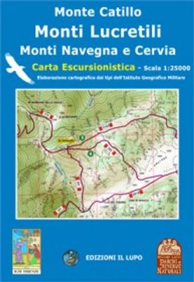
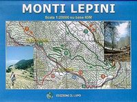
Wandelkaart 05 Monte Catillo - Monti Lucretili - Monte Navegna - Cervia | Edizione il Lupo

0
Topografische wandelkaart met wandelroutes en mountainbike routes ingetekend van het park Monti Lucretili in Lazio. The first map that understands the whole territory from Tivoli up to the Lake of the Turano and to the Navegna Mountain Dimensions 116 x 85 cm - Basic IGM - wooded Coverage Map forehead-back with official trails of the Parks and tour...

Verkopers met dit product

Verkoper
Bezorging
Prijs
DeZwerver.nl logo
DeZwerver.nl
2,95
14,25

Anderen bekeken ook

Wandelgids Walking in the Thames Valley | Cicerone
Walking in the Thames Valley offers 25 challenging circular walks around the River Thames and River Kennet in the south of England, taking in the Southern Chilterns, the Berkshire and North Hampshire Downs, Southern Oxfordshire and the eastern edge of Wiltshire. All routes are within easy reach of Reading, Newbury, Abingdon and London. While some walks visit Iron Age hill forts, others pass more modern features such as Wilton Windmill and the Kennet and Avon Canal. Some follow sections of the Ridgeway, while others meander along the banks of the Thames. What they all have in common is that they take the keen rambler to some of the best parts of the Thames Valley – a patchwork of open chalk grassland, broadleaved woodland and farmland and home to two Areas of Outstanding Natural Beauty. • walks from 10 to 18 miles, including one 2-day route • shorter, less strenuous alternatives for many of the walks • detailed route descriptions with information on local points of interest, OS mapping…
18,50
Wandelkaart A15 Sarrabus da Costa Rei a Porto Corallo | Abies
Sarrabus is a territory that is not known by everybody yet. Here lies its charm and this has made possible to keep this environmental area out of big building speculations and also out of history. In fact it preserves little traces of the past, and paradoxically the remains from the prehistoric age are more meaningful than those back to more recent times. We can find traces from the most remote past not far from the State Road SS125, that from Muravera goes to Costa Rei, by visiting the nuraghe Murtas, the nuraghe S’Aqua Secis and the megalithic complexes of Scalas and Cuili Piras. They are about ten menhirs, almost fully intact, arranged in groups and fixed in the ground in the original orthostatic position. They have been put in relation with the position of the sun and the moon, at dawn and at sunset. In fact they were used as a very precise astronomic calendar but also for religious purposes since they represented both the masculine divinity and the fertility according to the wors…
12,95
Wandelkaart - Topografische kaart 16 Gruppo dei Monti Ernici | Edizione il Lupo
Wandelkaart, gebaseerd op de tpografische kaarten. Met ingetekende wandelroutes. Cartina a scala 1:25000 - Dimensioni 136 x 96 cm Base IGM - Copertura boschiva  Cartina fronte-retro con tutta la sentieristica curata dai CAI di Alatri - Frosinone e Sora Tutti i sentieri sono stati rilevati con il GPS a cura delle 3 sezioni CAI coinvolte. Sul retro descrizione storico-culturale dei paesi della zona e info turistiche
15,95
Wegenkaart - landkaart 3501 Adventure Map Australia - Australië | National Geographic
Wegenkaart van Australië met vermelding van veel bezienswaardigheden, nationale parken en attrakties. Watervast en scheurvast. Juist door deze vermeldingen onderscheidt de kaart zich van andere wegenkaarten. National Geographic's Australia Adventure Map is designed to meet the unique needs of adventure travelers with its durability and detailed, accurate information. The map includes the locations of thousands of cities and towns with a user-friendly index, plus a clearly marked road network complete with distances and designations for major highways, main roads, and tracks and trails for those seeking to explore more remote regions.   The Australia Adventure Map differs from a traditional road map because it includes hundreds of points of interest that highlight diverse and unique destinations within the country. National parks, World Heritage sites, caves, archeological sites, aboriginal settlements, and protected lands are included, making it an invaluable resource to travelers …
17,50
Wegenkaart - landkaart New Orleans - Mississippi River Basin | ITMB
New Orleans stadsplattegrond met schaal 1:15.000, bijzonder uitgebreid. ITMB is pleased to continue its detailed coverage of the USA with its first-ever map of the historic City of New Orleans. The urban area was settled by the French, and was the capital of the vast Louisiana Territory for many years. Napoleon, needing money to fight his many wars, sold the colony to the USA, in 1803, doubling the size of the new American nation overnight. The French Quarter, with buildings dating back 300 years, is the heart of the city and home to dozens of jazz emporiums. The British expulsion of the Acadians from what is now the Canadian provinces of Nova Scotia and New Brunswick, added a vibrant component to the city, creating the concept of the Cajuns. The oldest cathedral in the USA, St Louis, has dominated the city's skyline since 1794, opened just as the French Revolution was at its height. The city offers much more than just music, however, The Louisiana State Museum is where the agreement …
13,95
Reisgids City Guide Rome | Lonely Planet
De perfecte reisgids voor zowel de georganiseerde als de zelfstandige reiziger. Naast een algemene inleiding van de stad vol met praktische informatie over hoe je er het beste kunt reizen: slapen, eten, vervoer, excursies ... alles kun je er in vinden. Engelstalig. Lonely Planet A heady mix of haunting ruins, awe-inspiring art and vibrant street life, Italy’s hot-blooded capital is one of the world’s most romantic and inspiring cities. Lonely Planet will get you to the heart of Rome, with amazing travel experiences and the best planning advice.   Lonely Planet Rome is your passport to the most relevant, up-to-date advice on what to see and skip, and what hidden discoveries await you.   Channel your inner gladiator at the Colosseum, spend hours wandering the vast Vatican Museums, or toss a coin and make a wish at Trevi Fountain; all with your trusted travel companion. Get to the heart of Rome and begin your journey now!   Inside Lonely Planet Rome Travel Guide:   Full-colour maps and i…
24,95
Wegenkaart - landkaart 3203 Adventure Map Morocco - Marokko | National Geographic
Wegenkaart van Marokko met vermelding van veel bezienswaardigheden, nationale parken en attrakties. Watervast en scheurvast. Juist door deze vermeldingen onderscheidt de kaart zich van andere wegenkaarten. National Geographic's Morocco Adventure Map is designed to meet the unique needs of adventure travelers—detailed, durable, and accurate. Morocco includes the locations of thousands of cities and towns with an index for easily locating them, plus a clearly marked road network complete with distances and designations for motorways, dual carriageways, major roadways, and more. Transportation within and beyond the country is made easier with the location of airports, airfields, railroads, ferry routes, river crossings, lighthouses, harbors, border crossings, and petrol stations. What sets National Geographic Adventure Maps apart from traditional road maps are the hundreds of points of interest that highlight the diverse, unique, and exotic destinations within Morocco. In addition to typ…
17,50
Wegenkaart - landkaart South Pacific Cruising & Samoa | ITMB
Een overzichtskaart van de zuidelijke Stille Oceaan met de cruise routes tussen de verschillende eilanden aangegeven. Op de achterzijde een overzichtskaart van Samoa This is a new venture for ITMB. Cruising is a rapidly-growing segment of the travel industry, experiencing double-digit growth rates annually. Obviously, this is a thriving market. In conjunction with several cruise ship lines, we have prepared a map of the South Pacific Ocean, which extends southwards from Hawai'i to the southern tip of New Zealand and eastwards from central Australia/Papua New Guinea to the Pitcairn Islands. Thus, it does not include the popular South East Asia and China coast routes. We think this has to change at a time when 25,000,000 people are travelling by cruise ships. At the same time, we must keep coverage area relevant for those end users of the artwork. Even at 1:12M, most of the area covered is water, with island countries such as Fiji, Tonga, Kiribati, Tahiti, and the Cook Islands being vis…
13,95

Klanten-reviews van Wandelkaart 05 Monte Catillo - Monti Lucretili - Monte Navegna - Cervia | Edizione il Lupo

Er zijn nog geen beoordelingen voor dit productBen jij de eerste die een review plaatst?

Meer over Wandelkaart 05 Monte Catillo - Monti Lucretili - Monte Navegna - Cervia | Edizione il Lupo

Productomschrijving

Topografische wandelkaart met wandelroutes en mountainbike routes ingetekend van het park Monti Lucretili in Lazio.

The first map that understands the whole territory from Tivoli up to the Lake of the Turano and to the Navegna Mountain Dimensions 116 x 85 cm - Basic IGM - wooded Coverage Map forehead-back with official trails of the Parks and tourist itineraries

Productinformatie

    Verken gerelateerde categorieën

    Webshop.nl maakt gebruik van cookies. Ga je verder op onze website, ga dan akkoord met het plaatsen van cookies en de verwerking van deze data door ons en vermelde partners.