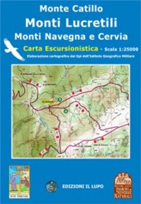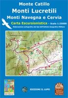
Wandelkaart 05 Monte Catillo - Monti Lucretili - Monte Navegna - Cervia | Edizione il Lupo

0
Topografische wandelkaart met wandelroutes en mountainbike routes ingetekend van het park Monti Lucretili in Lazio. The first map that understands the whole territory from Tivoli up to the Lake of the Turano and to the Navegna Mountain Dimensions 116 x 85 cm - Basic IGM - wooded Coverage Map forehead-back with official trails of the Parks and tour...

Verkopers met dit product

Verkoper
Bezorging
Prijs
DeZwerver.nl logo
DeZwerver.nl
2,95
14,25

Anderen bekeken ook

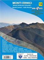
Wandelkaart - Topografische kaart 16 Gruppo dei Monti Ernici | Edizione il Lupo
Wandelkaart, gebaseerd op de tpografische kaarten. Met ingetekende wandelroutes. Cartina a scala 1:25000 - Dimensioni 136 x 96 cm Base IGM - Copertura boschiva  Cartina fronte-retro con tutta la sentieristica curata dai CAI di Alatri - Frosinone e Sora Tutti i sentieri sono stati rilevati con il GPS a cura delle 3 sezioni CAI coinvolte. Sul retro descrizione storico-culturale dei paesi della zona e info turistiche
15,95
Wandelkaart Tour of Monte Rosa Trekking Map | Knife Edge Outdoor
The best sheet map for the Tour of Monte Rosa. Displays the entire route and variants on a single sheet: perfect for planning and navigation.   1:40,000 - larger scale and more detail than any other map.   Made specifically for the Tour of Monte Rosa by Knife Edge Outdoor Guidebooks:   English/French/German map key 1:40,000 Numerous variants Includes free GPX downloads for the trail GPS compatible Tougher than traditional maps: try to tear it! More water-resistant than traditional maps Lighter than traditional maps Huts/accommodation marked on the map   The Tour of Monte Rosa is one of the classic Alpine treks. It leads the trekker on an epic circuit around the Monte Rosa massif. The largest group of 4000m peaks in the Alps is on display: the Weisshorn, the Zinalrothorn, the Dom, the Täschhorn, the Breithorn and the Matterhorn, to name a few.   It is the sister trek to the Walker’s Haute Route and crosses unspoilt and remote mountain terrain: amazing glaciers, snow frosted summits, be…
23,95
Wandelkaart Monte Fitz Roy - Cerro Torre - Lago del Desierto | Zagier & Urruty
Wandelkaart van het fascinerende Fitz Roy massif. Ideale kaart voor trekkings in de regio. Fitz Roy en Cerro Torre in schaal 50.000 en Lago del Desierto in 100.000 Trekking and mountaineering map based on aerophotography. Relief, contours forms, glaciers, woods, camping and trails. Geological chart and landsat image. Includes Lago del Desierto and Route 23 that reaches the zone. Also new trails and shelters. Landscape view of the peaks with their name and height. Afmeting 65 x 95 cm
17,95

Klanten-reviews van Wandelkaart 05 Monte Catillo - Monti Lucretili - Monte Navegna - Cervia | Edizione il Lupo

Er zijn nog geen beoordelingen voor dit productBen jij de eerste die een review plaatst?

Meer over Wandelkaart 05 Monte Catillo - Monti Lucretili - Monte Navegna - Cervia | Edizione il Lupo

Productomschrijving

Topografische wandelkaart met wandelroutes en mountainbike routes ingetekend van het park Monti Lucretili in Lazio.

The first map that understands the whole territory from Tivoli up to the Lake of the Turano and to the Navegna Mountain Dimensions 116 x 85 cm - Basic IGM - wooded Coverage Map forehead-back with official trails of the Parks and tourist itineraries

Productinformatie

    Verken gerelateerde categorieën

    Webshop.nl maakt gebruik van cookies. Ga je verder op onze website, ga dan akkoord met het plaatsen van cookies en de verwerking van deze data door ons en vermelde partners.