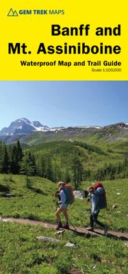
Wandelkaart 05 Banff National Park and Mt. Assiniboine | Gem Trek Maps

0
This map covers the most popular hiking and mountain biking terrain in Banff National Park, from Lake Louise in the north to the south end of Banff National Park, plus all of Mt. Assiniboine Provincial Park. All of the day hikes in and around Banff townsite are covered on this map, such as Tunnel Mountain, Sundance Canyon, Bow Falls to the Hoodoos...

Verkopers met dit product

Verkoper
Bezorging
Prijs
DeZwerver.nl logo
DeZwerver.nl
2,95
17,95

Anderen bekeken ook

Wandelkaart 01 Jasper National Park & Maligne Lake | Gem Trek Maps
Scheur- en Watervast papier Gem Trek’s JASPER AND MALIGNE LAKE MAP map is designed for outdoor enthusiasts looking to explore the section of Jasper National Park near the town and out to Maligne Lake. Whether you are touring along the roads or heading into the backcountry, you’ll find the waterproof and tear-resistant Jasper & Maligne Lake Map to be an invaluable tool.   This map features detailed cartography, accurate hiking trails with distances, and details such as campgrounds, equestrian routes, picnic areas, and fire lookouts. On the back of the map are trail descriptions and photos of 18 recommended day hikes, four overnight or multi-day trips, and six classic mountain bike rides. Each of these described trails is referenced and colour-coded to the map on the front. Also on the back is contact information for Jasper National Park, as well for as the three backcountry lodges located in the Tonquin Valley and on the Skyline Trail.   Jasper & Maligne Lake Map Coverage The Jas…
16,95
Nieuw
Wandelkaart 14 Lake O'Hara | Gem Trek Maps
Mooie, gedetailleerde kaart uit de serie van Gem Trek Hiking map-guides, van het gebied Lake O'Hara.   Gem Trek's Lake O'Hara Map is a hiking and recreation map for the Lake O'Hara region of Yoho National Park in the Canadian Rockies.   Gem Trek's 1:20,000 Lake O'Hara Map is designed for visitors looking to explore one of the finest backcountry destinations in all of the Canadian Rockies. This map features detailed cartography, accurate hiking trails, and all the most significant natural features of the region. On the back are detailed descriptions of the most popular hiking trails with special emphasis given to the Lake O'Hara Alpine Circuit. Reaching Lake O'Hara, in Yoho National Park, requires advance planning and we help you with information needed to get to the destination, as well as lodge and campground details.   Map specs   Edition: 6th Scale: 1:20,000 Folded size: 4.5 x 9.5 inches Flat size: 18 x 24 inches Paper: Regular 80lb stock paper   Map coverage   This map covers the …
9,95
Nieuw
Wandelkaart 06 Canmore & Kananaskis Village | Gem Trek Maps
This map covers some of the most popular terrain for hikers and mountain bikers in Kananaskis Country - Bow Valley Provincial Park, the Canmore area, the Smith-Dorrien/Spray Lakes area south to Mount Shark trailhead, Barrier Lake, and the Kananaskis Village area from Ribbon Creek south to Galatea Lakes trailhead.   Updated trails on this sixth edition include those on both sides of the Bow Valley, including the Highline Trail and its connectors on the south side of Highway 1, and the Benchlands trails on the north side of Highway 1. The new snowshoe trails in the Ribbon Creek area have also been added. And for those of you who have been asking, the relief shading is back, and the map is printed on waterproof material.   Other classic trails covered on this map include Grassi Lakes, Yamnuska, Ha Ling, Lady Macdonald, Barrier Lake Lookout, Mt. Allen via Centennial Ridge (the highest maintained trail in the Canadian Rockies), Ribbon Falls and Ribbon Lake, Lillian and Galatea lakes, Karst…
18,95
Nieuw
Wandelkaart 08 Bragg Creek and Sheep Valley | Gem Trek Maps
Gem Trek’s BRAGG CREEK & SHEEP VALLEY MAP is for hikers and outdoor enthusiasts looking to explore Kananaskis Country west and south of Bragg Creek. Whether you are touring along the roads or heading into the backcountry, you’ll find the waterproof and tear-resistant Bragg Creek & Sheep Valley Map to be an invaluable tool.   This map features detailed cartography, accurate hiking trails with distances, and details such as logging roads, campgrounds, equestrian routes, picnic areas, and fire lookouts.   On the back of the Bragg Creek & Sheep Valley Map are detailed descriptions of 20 hiking trails colour-coded by region, eight mountain bike trails, as well details of services such as campgrounds and visitor centres.   Bragg Creek & Sheep Valley Map Coverage The Bragg Creek & Sheep Valley Map covers a large chunk of the eastern portion of Alberta’s Kananaskis Country. The map centres on the Elbow Valley, which is accessed from the village of Bragg Creek, a short drive southwest of Calga…
18,95
Wegenkaart - landkaart Jasper National Park (Alberta) | Gem Trek Maps
Waterproof and tear-resistant map for Jasper National Park in the Canadian Rockies.   Whether you are a first-time visitor or a long-time local, you’ll find Gem Trek’s Jasper National Park Map to be an invaluable tool. Researched and designed by locals, and printed in Canada, this map features accurate cartography and subtly colored relief that puts the mountainous region in perspective. The map is printed on high-quality synthetic waterproof paper that can be folded and refolded hundreds of times.   The 1:250,000 scale is ideal for discovering the very best of Jasper National Park. Highlights and our recommended hiking trails are marked by numbered stars, then cross-referenced on the reverse side with descriptions. Also included are all mountains and their elevations, along with natural features such as waterfalls, hot springs, and glaciers.   In addition to descriptions for the top highlights and most popular hiking trails, the reverse side has inset maps for the town of Jasp…
16,95
Nieuw
Wandelkaart - Topografische kaart 744 Adirondack Park - Northville - Raquette Lake | National Geographic
Prachtige geplastificeerde kaart van het bekende nationaal park. Met alle recreatieve voorzieningen als campsites, maar ook met topografische details en wandelroutes ed. Door uitgekiend kleurgebruik zeer prettig in gebruik. Scheur en watervast! National Geographic's Trails Illustrated map of Adirondack Park Northville/Raquette Lake is a two-sided, waterproof, topographic trail map designed to meet the needs of outdoor enthusiasts with unmatched durability and detail. This map was created in cooperation with the Adirondack Mountain Club and is loaded with valuable recreation information for boating, hiking, fishing, sailing, cycling, ice fishing, skiing, and snowmobiling. Trails and major roads are clearly distinguished, from the picturesque foothills to the northern peaks and around lakes of all sizes. Campgrounds, climbing areas, marinas, and museums are labeled and easy to find and boundaries for park lands, wilderness, primitive, forest, and protected areas are clearly marked. Disc…
17,95
Nieuw
Wegenkaart - landkaart 04 Icefields Parkway | Gem Trek Maps
Whether you have a day or a week to spend exploring the sights along the spectacular Icefields Parkway highway, Gem Trek's ICEFIELDS PAKRWAY MAP, a combination map and guide, will help you make the most of your time. Like our much-loved hiking maps, our Icefields Parkway map features detailed cartography and is printed on waterproof and tear-resistant paper.   The Icefields Parkway Map shows all viewpoints, picnic areas, trailheads, campgrounds, hostels, lodges and other services along the Icefields Parkway, while the descriptions in the guide point you to the best of these - the best viewpoints of mountains and lakes, the most interesting points of interest and exhibits, and the best bets for spotting wildlife such as moose, bighorn sheep and mountain goats.   Also included are short descriptions of the ten best walks and day hikes along the Icefields Parkway—from the short stroll to Peyto Lake Viewpoint to the rewarding hike through alpine meadows to Helen Lake.   To make it easier …
13,95
Nieuw
Wandelkaart 02 Columbia Icefield | Gem Trek Maps
Waterproof and tear-resistant hiking and recreation map for the Columbia Icefield region of the Canadian Rockies.   Updated with the latest satellite imagery of the icefield extent, Gem Trek's Columbia Icefield Map is designed for visitors looking to explore North America s largest icefield south of Alaska. Located beside the Icefields Parkway in Jasper National Park, the icefield is both spectacular and accessible. Whether you are touring along the parkway and taking an Ice Explorer out onto the Athabasca Glacier or heading off to explore the surrounding wilderness on foot, you'll find the waterproof and tear-resistant Columbia Icefield an invaluable tool for making the most of your visit.   The Columbia Icefield Map features detailed cartography, accurate hiking trails with distances, and details such as glacier flow direction and drainage routes. Campgrounds and highway viewpoints are also marked.   In addition to the map, this product is a user-friendly guide to the Columbia Icefi…
14,95
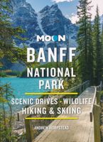
Reisgids Banff National Park | Moon Travel Guides
Uitstekende Amerikaanse reisgids van uitgever Moon. De gids is vergelijkbaar met Lonely Planet en Rough guide en is voor de backpacker - zelfstandige reiziger geschreven; toch is deze door de grote mate van details en achtergronden geschikt voor alle reizigers! De gids onderscheidt zich door gedegen en uitgebreide achtergrondinformatie over bijvoorbeeld natuur en cultuur. Banff sparkles as the crown jewel of Canada's national parks. Explore the best of it with Moon Banff National Park. Inside you'll find: Strategic, flexible itineraries, including the Best of Banff and highlights for a day trip The Best Hikes in Banff: Find the right trek for you with details on length, elevation gains, difficulty levels, and trailheads Experience the Outdoors: Ride over the snow in a horse-drawn sleigh or through the sky in a mountain gondola. Follow the vast network of hiking trails along glacial valleys and discover alpine lakes and spectacular vistas. Soak in a natural hot spring, treat yoursel…
16,50
Nieuw
Wegenkaart - landkaart Banff - Jasper national parks | ITMB
Gedetailleerde wegenkaart van deze 2 bekende nationale parken in Canada. Naast toerischtische informatie zjn de belangrijkste wandelpaden schetsmatig ingetekend en worden de campings weergegeven, hogtelijnen geven een goed beeld van de hoogteverschillen en bergern in het gebied.. Jasper staat op de ene kant en Banff op de andere zijde.  Banff is the first national park declared anywhere in the world, done at a time when the idea of reserving huge tracts of land for the enjoyment of future generations was an admirable, though unheard of, concept. The park in the Rocky Mountains of western Alberta remains as lovely and as enjoyable as it must have seemed to the early CPR railway surveyors searching for a route through the mountains to join the then-colony of British Columbia to Canada. Nowadays, the park is laced with roads and hiking trails, and the town of Banff within the park is severely pressed to maintain a balance between serving the needs of the millions of visitors each year an…
13,95

Klanten-reviews van Wandelkaart 05 Banff National Park and Mt. Assiniboine | Gem Trek Maps

Er zijn nog geen beoordelingen voor dit productBen jij de eerste die een review plaatst?

Meer over Wandelkaart 05 Banff National Park and Mt. Assiniboine | Gem Trek Maps

Productomschrijving

This map covers the most popular hiking and mountain biking terrain in Banff National Park, from Lake Louise in the north to the south end of Banff National Park, plus all of Mt. Assiniboine Provincial Park.

All of the day hikes in and around Banff townsite are covered on this map, such as Tunnel Mountain, Sundance Canyon, Bow Falls to the Hoodoos, Johnston Canyon, Castle Mountain Lookout and the network of trails at Sunshine Village. As well, the popular, multi-day hiking and equestrian loops to Egypt Lake, Shadow Lake and the Sawback Trail up through Mystic Pass are shown in their entirety.   You also get full coverage of the access routes in and out of Mt. Assiniboine Provincial Park via Sunshine Meadows and Citadel Pass, or via Bryant Creek from the Mt. Shark trailhead in Kananaskis Country.   Mountain biking enthusiasts can choose from more than ten trails, ranging from easy pedals around the townsite to longer outings such as Goat Creek Trail, Lake Minnewanka, and the Banff Trail-Rundle Riverside route from Canmore to Banff.   On the back of the map are 1:50 000-scale inset maps of the Mt. Assiniboine and Sunshine Village areas. Also on the back are trail descriptions and photos of 19 recommended day hikes, four classic multi-day trips and six mountain bike rides. Each of these described trails is referenced and color-coded to the map on the front.

Verken gerelateerde categorieën

Webshop.nl maakt gebruik van cookies. Ga je verder op onze website, ga dan akkoord met het plaatsen van cookies en de verwerking van deze data door ons en vermelde partners.