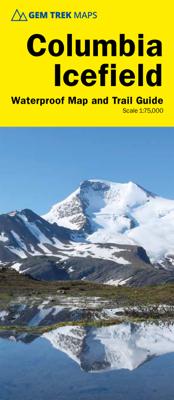
Wandelkaart 02 Columbia Icefield | Gem Trek Maps

0
Waterproof and tear-resistant hiking and recreation map for the Columbia Icefield region of the Canadian Rockies.   Updated with the latest satellite imagery of the icefield extent, Gem Trek's Columbia Icefield Map is designed for visitors looking to explore North America s largest icefield south of Alaska. Located beside the Icefields Parkway in ...

Verkopers met dit product

Verkoper
Bezorging
Prijs
DeZwerver.nl logo
DeZwerver.nl
2,95
14,95

Anderen bekeken ook

Wandelkaart 02 Columbia Icefield | Gem Trek Maps
Waterproof and tear-resistant hiking and recreation map for the Columbia Icefield region of the Canadian Rockies.   Updated with the latest satellite imagery of the icefield extent, Gem Trek's Columbia Icefield Map is designed for visitors looking to explore North America s largest icefield south of Alaska. Located beside the Icefields Parkway in Jasper National Park, the icefield is both spectacular and accessible. Whether you are touring along the parkway and taking an Ice Explorer out onto the Athabasca Glacier or heading off to explore the surrounding wilderness on foot, you'll find the waterproof and tear-resistant Columbia Icefield an invaluable tool for making the most of your visit.   The Columbia Icefield Map features detailed cartography, accurate hiking trails with distances, and details such as glacier flow direction and drainage routes. Campgrounds and highway viewpoints are also marked.   In addition to the map, this product is a user-friendly guide to the Columbia Icefi…
14,95
Wandelkaart 03 Bow Lake / Saskatchewan Crossing | Gem Trek Maps
Waterproof and tear-resistant hiking and recreation map for the Bow Lake and Saskatchewan Crossing region of Banff National Park.   Gem Trek's 1:70,000 Bow Lake and Saskatchewan Crossing Map is designed for outdoor enthusiasts looking to explore the Bow Lake and Saskatchewan Crossing region at the north end of Banff National Park. Whether you are touring along the roads or heading into the backcountry, you’ll find the waterproof and tear-resistant Bow Lake and Saskatchewan Crossing Map to be an invaluable tool. This map features detailed cartography, accurate hiking trails with distances, and details such as logging roads on the British Columbia side of the Continental Divide, campgrounds, picnic areas, and abandoned fire lookouts. On the back are descriptions of 24 recommended hikes, ranging from short walks to overnight treks, as well as details of services such as campgrounds and visitor centres.   Map specs     – Edition: 6th – Map scale: 1:70,000 – Sheet size: 27 x 39 inches – Fo…
18,95
Wandelkaart 07 Kananaskis Lakes | Gem Trek Maps
Waterproof and tear-resistant hiking and recreation map for the Kananaskis Lakes region of the Canadian Rockies   Gem Trek's Kananaskis Lakes Map is designed for hikers and outdoor enthusiasts looking to explore the south-central portion of Kananaskis Country immediately south of our Canmore and Kananaskis Village Map. Whether you are touring along the roads or heading into the backcountry, you'll find the waterproof and tear-resistant Kananaskis Lakes Map to be an invaluable tool.   This map features detailed cartography, accurate hiking trails with distances, and details such as logging roads, campgrounds, equestrian routes, picnic areas, and fire lookouts. On the back are descriptions of the most popular hiking trails, as well details of services such as campgrounds and visitor centres.   – Map scale: 1:50,000 – Sheet size: 27 x 39 inches – Folded size: 4.5 x 9.5 inches   Map Coverage   The Kananaskis Lakes Map covers Peter Lougheed Provincial Park, located off Highway 40 south of …
18,95
Wandelkaart 01 Jasper National Park & Maligne Lake | Gem Trek Maps
Scheur- en Watervast papier Gem Trek’s JASPER AND MALIGNE LAKE MAP map is designed for outdoor enthusiasts looking to explore the section of Jasper National Park near the town and out to Maligne Lake. Whether you are touring along the roads or heading into the backcountry, you’ll find the waterproof and tear-resistant Jasper & Maligne Lake Map to be an invaluable tool.   This map features detailed cartography, accurate hiking trails with distances, and details such as campgrounds, equestrian routes, picnic areas, and fire lookouts. On the back of the map are trail descriptions and photos of 18 recommended day hikes, four overnight or multi-day trips, and six classic mountain bike rides. Each of these described trails is referenced and colour-coded to the map on the front. Also on the back is contact information for Jasper National Park, as well for as the three backcountry lodges located in the Tonquin Valley and on the Skyline Trail.   Jasper & Maligne Lake Map Coverage The Jas…
16,95
Wegenkaart - landkaart 04 Southwest British Columbia & Northern Washington | Gem Trek Maps
Goede wegenkaart van British Columbia met Nationale Parken, Overnachtingsmogelijkheden, Ski gebieden en bezienswaardigheden. Gem Trek’s Southwest British Columbia & Northern Washington map meets the needs of visitors looking to explore the lower mainland of British Columbia and the northern section of Washington state.   All the major highways are shown, as well as national, provincial, and state parks and wilderness areas. The map also shows lesser-known back roads, and pinpoints the location of lodges, campgrounds and hot springs. Mileage charts on the front and back provide distances between major towns and cities.   The Southwest British Columbia & Northern Washington map covers all of Vancouver Island and extends west through the city of Vancouver and the Okanagan Valley to the Kootenays. South of the border, Washington state is covered from the Gulf Islands in the west to Spokane in the east, with coverage as far south as Mount Rainer National Park.   The Southwest British Colu…
9,95
Wegenkaart - landkaart 03 Southwest Alberta & Southeast British Columbia Map | Gem Trek Maps
Goede wegenkaart van Southwest Alberta en Southeast British Columbia met bezienswaardigheden, overnachtingsmogelijkheden en campings. Gem Trek’s Southwest Alberta and Southeast British Columbia Map is designed for visitors looking to explore the regions east and west of the Canadian Rockies, including the Kootenays of British Columbia, the Alberta foothills, and west-central Alberta. All the major highways are shown, as well as national and provincial parks and wilderness areas. The map also shows lesser-known back roads, and pinpoints the location of lodges, campgrounds and hot springs. Mileage charts on the front and back provide distances between major towns and cities.
13,95
Wandelkaart 04 Lake Louise & Yoho | Gem Trek Maps
Gedetailleerde kaart van dit prachtige gebied; deze kaart is geplastificeerd, scheur- en watervast. Gem Trek’s LAKE LOUISE & YOHO MAP is designed for visitors looking to explore one of North America’s premier day hiking destinations. Whether you are new to hiking or experienced in backcountry travel, you’ll find the waterproof and tear-resistant Lake Louise & Yoho Map to be an invaluable tool.   This map features detailed cartography, accurate hiking trails with distances, and details such as campgrounds, lodges, huts, teahouses, and picnic areas. On the reverse side of  the map are photos and trail descriptions of 11 recommended day hikes covered on the main map, ranging from easy lakeshore walks to more demanding hikes into alpine country. Four overnight or multi-day trips are also featured, along with contact information for two backcountry lodges, Skoki Lodge and Twin Falls Chalet.   Lake Louise & Yoho Map Coverage The Lake Louise & Yoho Map centres on Lake Louise, but also…
18,95
Wandelkaart 11 Banff Up-Close | Gem Trek Maps
Waterproof and tear-resistant hiking and recreation map for the town of Banff and surrounds in the Canadian Rockies.   Designed for both locals and visitors, Gem Trek’s 1:35,000 Banff Up-Close Map is a detailed relief-shaded topographic map of the Banff area. All hiking and biking trails are labeled, and distances are marked. Like all Gem Trek maps, the Banff Up-Close Map features detailed cartography and accurate hiking trails with distances, elevation gain, and directions to the trailhead noted. An inset on the back increases coverage of downtown Banff, with museums and all streets marked. Also on the flipside are descriptions of the sights, museums and scenic drives in Banff. We've also included a hand-picked list of the best seven walks and day hikes in the area. The highlights of each trail are noted, as well as distance, elevation gain and directions to the trailhead.   Map specs   Edition: 4th Scale: 1:35,000 Folded size: 4.5 x 9.5 inches Flat size: 18 x 24 inches Paper: Waterp…
13,95
Wandelkaart 15 Canmore Up-Close | Gem Trek Maps
Waterproof and tear-resistant hiking and recreation map for the town of Canmore and surrounds in the Canadian Rockies.   Designed for both locals and visitors, Gem Trek’s 1:35,000 Canmore Up-Close Map is a detailed relief-shaded topographic map of Canmore and the Bow Valley area. This edition has been updated to show all new subdivisions and recent changes to the trail network. On the back of the Canmore Up-Close Map are descriptions of recommended sights and detailed descriptions of the best and most scenic hiking and biking trails, including the highlights of each trail, as well as distance, elevation gain and directions to the trailhead. Also on the back of the map is an inset map of downtown Canmore and colour photos.   Map specs   Edition: 2nd Scale: 1:35,000 Folded size: 4.5 x 9.5 inches Flat size: 18 x 24 inches Paper: Waterproof and tear-resistant   Map coverage   The Canmore Up-Close Map focuses on the town of Canmore in the Canadian Rockies. The map boundary extends along th…
13,95
Wandelkaart 12 Jasper Up-Close | Gem Trek Maps
Water- en scheurvaste wandelkaart van Jasper. Met op de achterzijde een overzicht van de belangrijkste bezienswaardigheden.   Waterproof and tear-resistant hiking and recreation map for the town of Jasper and surrounds in the Canadian Rockies.   Designed for both locals and visitors, Gem Trek’s 1:35,000 Banff Up-Close Map is a detailed relief-shaded topographic map of the Jasper area. On the back of the Jasper Up-Close Map are descriptions of recommended sights, museums and scenic drives to make it easier to plan your day. We’ve also included a hand-picked list of the best six easy walks and day hikes in the area, noting the highlights of each trail, as well as distance, elevation gain and directions to the trailhead. Colour photos and three inset maps, including a town map of Jasper, accompany the descriptions of sights and hikes on the back of the map.   Map specs   Edition: 6th Scale: 1:35,000 Folded size: 4.5 x 9.5 inches Flat size: 18 x 24 inches Paper: Waterproof and tear-resist…
13,95

Klanten-reviews van Wandelkaart 02 Columbia Icefield | Gem Trek Maps

Er zijn nog geen beoordelingen voor dit productBen jij de eerste die een review plaatst?

Meer over Wandelkaart 02 Columbia Icefield | Gem Trek Maps

Productomschrijving

Waterproof and tear-resistant hiking and recreation map for the Columbia Icefield region of the Canadian Rockies.   Updated with the latest satellite imagery of the icefield extent, Gem Trek's Columbia Icefield Map is designed for visitors looking to explore North America s largest icefield south of Alaska. Located beside the Icefields Parkway in Jasper National Park, the icefield is both spectacular and accessible. Whether you are touring along the parkway and taking an Ice Explorer out onto the Athabasca Glacier or heading off to explore the surrounding wilderness on foot, you'll find the waterproof and tear-resistant Columbia Icefield an invaluable tool for making the most of your visit.   The Columbia Icefield Map features detailed cartography, accurate hiking trails with distances, and details such as glacier flow direction and drainage routes. Campgrounds and highway viewpoints are also marked.   In addition to the map, this product is a user-friendly guide to the Columbia Icefield. It includes detailed descriptions of what to see and do at the icefield, recommended hiking trails, a wildlife-viewing guide, answers to frequently asked questions (How big is the Columbia Icefield? How deep is the ice? Why is the glacial ice blue? And many more), and a list of the highest surrounding mountains.   Map coverage:This map covers the entire Columbia Icefield, which lies at the southern end of Jasper National Park, straddling the provincial border dividing Alberta and British Columbia. It also extends north to Beauty Creek and the Brazeau Loop Trail (southern section only) and south to Castleguard Mountain. Popular hiking trails on the Columbia Icefield Map include Stanley Falls, Wilcox Pass, Toe of the Glacier, Parker Ridge, and Nigel Pass.   The Columbia Icefield Map features:   - waterproof and tear-resistant paper - contour lines at 25-metre (80-foot) intervals - relief shading to better show the topography - full colour on both sides - hiking trails with trail names and trail distances marked - hydrology rivers, rapids and waterfalls - mountain names and all available mountain elevations - all campgrounds with a handy chart showing campground details - points of interest and attractions as well as picnic areas and highway viewpoints

Productinformatie

    Verken gerelateerde categorieën

    Webshop.nl maakt gebruik van cookies. Ga je verder op onze website, ga dan akkoord met het plaatsen van cookies en de verwerking van deze data door ons en vermelde partners.