Wandelkaart 01 Jasper National Park & Maligne Lake | Gem Trek Maps

0
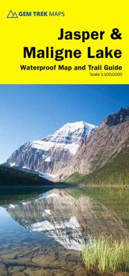
Scheur- en Watervast papier Gem Trek’s JASPER AND MALIGNE LAKE MAP map is designed for outdoor enthusiasts looking to explore the section of Jasper National Park near the town and out to Maligne Lake. Whether you are touring along the roads or heading into the backcountry, you’ll find the waterproof and tear-resistant Jasper & Maligne Lake Map to...

Verkopers met dit product

Webshop
Bezorging
Prijs
DeZwerver.nl logo
DeZwerver.nl
2,95
16,95

Anderen bekeken ook

Wegenkaart - landkaart Jasper National Park (Alberta) | Gem Trek Maps
Waterproof and tear-resistant map for Jasper National Park in the Canadian Rockies.   Whether you are a first-time visitor or a long-time local, you’ll find Gem Trek’s Jasper National Park Map to be an invaluable tool. Researched and designed by locals, and printed in Canada, this map features accurate cartography and subtly colored relief that puts the mountainous region in perspective. The map is printed on high-quality synthetic waterproof paper that can be folded and refolded hundreds of times.   The 1:250,000 scale is ideal for discovering the very best of Jasper National Park. Highlights and our recommended hiking trails are marked by numbered stars, then cross-referenced on the reverse side with descriptions. Also included are all mountains and their elevations, along with natural features such as waterfalls, hot springs, and glaciers.   In addition to descriptions for the top highlights and most popular hiking trails, the reverse side has inset maps for the town of Jasp…
16,95
Fietskaart 01 Cycling guides Cornwall | Goldeneye
Our maps are double-sided, printed on an A2 sheet with a concertina fold. This allows for easy folding and folding, and an ease of access to the mapping. The material is rain and tear-resistant. Our early maps were designed at the scale of 2 miles to 1 inch/1:126,720. The later designs along with digitalisation are 1: 100,000. We were encouraged by the Cycle Touring Club to convert our cartography toward the cycle market (to replace the out-of-print Bartholomew series). As time and the series progressed we have added more data: The National Cycle Network routes, Regional Routes, and Traffic-Free Family Routes, as and when they are developed. These routes are in addition to the Circular Routes Goldeneye Commissioned at the outset of our publishing schedule. We are also adding to new editions; bike shops, cycle hire, and tea rooms, along with the tourist attractions already featured. Our plan is to make available digital versions for cell phones and tablets and to update, on an annual b…
15,95
Nieuw
Wandelkaart - Topografische kaart 201 Trails Illustrated Yellowstone National Park | National Geographic
Prachtige geplastificeerde kaart van het bekende nationaal park. Met alle recreatieve voorzieningen als campsites, maar ook met topografische details en wandelroutes ed. Door uitgekiend kleurgebruik zeer prettig in gebruik. Scheur en watervast! National Geographic's Trails Illustrated map of Yellowstone National Park is designed to meet the needs of outdoor enthusiasts by combining valuable information with unmatched detail of America's first national park. Expertly researched and created in partnership with local land management agencies, this map features key points of interest including Mammoth Hot Springs, Canyon Village, Yellowstone Lake, Yellowstone Falls, Grant Village, and Old Faithful geyser area.   With over 1,000 miles of mapped trails, the Yellowstone National Park map can guide you off the beaten path and back again. The clearly marked trails include mileages between intersections. Trail summaries provide elevation, duration, and difficulty for a variety of suggested hike…
16,95
Wandelkaart Lake District | Harvey Maps
"The best Lake District map I have ever seen. The 1:40,000 scale provides clear, detailed information to one of the most popular hill walking areas in Britain." Sir Chris Bonington, mountaineer. A new generation of tough polyethylene maps. These maps are a leap forward in technical excellence. Tough, durable and 100% waterproof they are compact - not the great bulky package you get with a laminated map - and light to carry. This all weather British Mountain Map for climbers, hill wallkers, mountaineers and mountain bikers is published by HARVEY in co-operation with the British Mountaineering Council. The Lake District's famous mountains and fells on a single map, colour shading for easy identification of hills and valleys and detailed crag information for climbers. The reverse side of the map includes detailed 1:20000 enlargements of Scafell, Gable, Bowfell, Langdale Pikes and Pillar, a Geological map of the Lake District, mountain incident and first aid advice.
31,95
Wandelkaart Tour & Trail Tenerife | Discovery Walking Guides
Uitstekende wandelkaart, met ingetekende wandelroutes, voor specifieke wandelgebieden van Tenerife. Let op: dit is niet een kaart van het hele eiland, maar puur en alleen voor de wandelgebieden > daar is deze kaart de beste in! Our latest hiking research on Tenerife has resulted in new editions of Walk! Tenerife and Tenerife Hikers' Super-Durable Maps. Thanks to Jan Kostura's research we have several new hiking adventures described in detail in Walk! Tenerife. Jan's gps records of his research for new routes and updating of current routes has provided the detailed information to produce our new fourth edition of Tenerife Hiker's Super-Durable Maps. Note that Tenerife Hikers' Super-Durable Maps is a collection of four 30k scale map sections on a double sided sheet of 840mm by 600mm which folds up to 220mm by 120mm. It is not a map of all of Tenerife.  In this edition you will find 30k scale maps covering Valle de Orotava, West, Anaga and Adeje/Arona - Teide printed on a double sided…
17,95
Wandelkaart Tatry Zachodnie | Sygnatura
Goede wandelkaart van het grote westelijke deel van het Tatra gebergte, zowel aan de Poolse als aan de SLowaakse kant. Wandelpaden, campings, hutten, alles staat er op.  Western Tatra Mountains in Poland and Slovakia at 1:25,000 on a contoured and GPS compatible map from CartoMedia highlighting waymarked hiking trails, mountain huts and campsites, places of interest, etc, Coverage extends from Zakopane westwards to Habovka. On the reverse are panels with an overview of the waymarked hiking trails for planning longer routes, a road map showing access to this part of the Tatra Mountains from both sides of the border, a directory of local mountain huts and other useful tourist information, etc.   Maps in the Cartomedia hiking series present topography is by contours at 20m intervals, enhanced by relief shading and, where appropriate, graphic relief for exposed rocky areas. Waymarked hiking trails indicate approximate walking times in both directions and possible danger points. Most title…
9,95
Reisgids Banff, Jasper and Glacier National Park | Lonely Planet
Uitgebreide beschrijving van alle recreatieve mogelijkheden van deze nationale parken. De perfecte reisgids voor zowel de georganiseerde als de zelfstandige reiziger. Naast een algemene inleiding van het land / streek vol met praktische informatie over hoe je er het beste kunt reizen: slapen, eten, vervoer, excursies ... alles kun je er in vinden. Engelstalig. Lonely Planet Lonely Planet's Banff, Jasper and Glacier National Parks is your passport to the most relevant, up-to-date advice on what to see and skip. Hike the Skyline Trail, watch for bears, and ride the rapids; all with your trusted travel companion. Get to the heart of Banff, Jasper and Glacier National Parks and begin your journey now!   Inside the Lonely Planet's Banff, Jasper and Glacier National Parks Travel Guide:   User-friendly highlights and itineraries help you tailor your trip to your personal needs and interests   Insider tips to save time and money and get around like a local, avoiding crowds and troubl…
23,95
Wandelkaart Suva Planina - Servië | Geokarta
One side topographic marked with footpaths, ski trails, ski lifts, camp sites, picnic sites, mountain huts, also notable features in the landscape. Other side further information, additional words and pics of notable features, mountain huts etc. Suva Mountains with the Gorges of the Jelašnicka River on a detailed contoured map at 1:55,000, plus extensive information on the tourist facilities in the area with colour photos of mountain shelters, notes on fauna and flora, etc. The map has contours at 20m intervals with relief shading and colouring for woodlands. Different levels of protection zones are marked and areas where hunting is allowed are indicated. An overprint highlights waymarked hiking trails including the 130km long-distance trail across the Niš range. Also marked are different types of tourist accommodation including campsites and hunting lodges, paragliding sites, skiing areas, etc. The map has latitude and longitude lines at intervals of 5’. Map legend includes English. …
13,95
Reisgids - Fotoboek Epic Hikes of the World | Lonely Planet
With stories of 50 incredible hiking routes in 30 countries, from New Zealand to Peru, plus a further 150 suggestions, Lonely Planet's Epic Hikes of the World will inspire a lifetime of adventure on foot. From one-day jaunts and urban trails to month-long thru-hikes, cultural rambles and mountain expeditions, each journey shares one defining feature: being truly epic. In this follow-up to Epic Bike Rides and Epic Drives, we share our adventures on the world's best treks and trails. Epic Hikes is organised by continent, with each route brought to life by a first-person account, beautiful photographs and charming illustrated maps. Additionally, each hike includes trip planning advice on how to get there, where to stay, what to pack and where to eat, as well as recommendations for three similar hikes in other regions of the world. Hikes featured include: Africa & the Middle East: Cape Town's Three Peaks (South Africa) Kilimanjaro (Tanzania) Camp to Camp in South Luangwa National Park …
21,95
Fotoboek - Reisgids National Parks of America | Lonely Planet
Hardcover fotoboek met reisinformatie van alle 59 nationale parken van Amerika. Perfect ter inspiratie voor de volgende reis. To celebrate America's amazing national parks, Lonely Planet, the world's leading travel publisher, takes you on an informative and gorgeous tour of all 59 parks with our lavishly finished hardcover gift guide packed with detailed itineraries and practical tips on what to do and see in each park to get you started planning your next adventure. America's national parks are full of timeless marvels that still rejuvenate the soul: the world's largest trees in Sequoia; its most spectacular geothermal site in Yellowstone; the grandest canyon. Perhaps the movement's most eloquent description that is still resonates came from national parks advocate John Muir: 'Thousands of tired, nerve-shaken, over-civilized people are beginning to find out that going to the mountains is going home; that wildness is a necessity...' Fortunately for the nerve-shaken, over-civilized peo…
27,95

Klanten-reviews van Wandelkaart 01 Jasper National Park & Maligne Lake | Gem Trek Maps

Er zijn nog geen beoordelingen voor dit productBen jij de eerste die een review plaatst?

Meer over Wandelkaart 01 Jasper National Park & Maligne Lake | Gem Trek Maps

Productomschrijving

Scheur- en Watervast papier

Gem Trek’s JASPER AND MALIGNE LAKE MAP map is designed for outdoor enthusiasts looking to explore the section of Jasper National Park near the town and out to Maligne Lake. Whether you are touring along the roads or heading into the backcountry, you’ll find the waterproof and tear-resistant Jasper & Maligne Lake Map to be an invaluable tool.   This map features detailed cartography, accurate hiking trails with distances, and details such as campgrounds, equestrian routes, picnic areas, and fire lookouts. On the back of the map are trail descriptions and photos of 18 recommended day hikes, four overnight or multi-day trips, and six classic mountain bike rides. Each of these described trails is referenced and colour-coded to the map on the front. Also on the back is contact information for Jasper National Park, as well for as the three backcountry lodges located in the Tonquin Valley and on the Skyline Trail.   Jasper & Maligne Lake Map Coverage The Jasper & Maligne Lake Map covers the section of park around the town of Jasper as well as the entire Maligne Valley, including the extensive hiking and biking trail system that radiates from the town. Coverage extends from Miette Hot Springs in the north to Sunwapta Falls, along the Icefields Parkway, in the south.   Popular day hiking trails on the Jasper & Maligne Lake Map include Bald Hills, Opal Hills, Cavell Meadows, Sulphur Skyline, Devona Lookout, The Palisades, Geraldine Lakes, Maligne Canyon, Jacques Lake, Overlander, and Valley of the Five Lakes. Multi-day hikes such as the Skyline Trail, Tonquin Valley, Astoria River, Fortress Lake, Athabasca Pass, and Fryatt Valley are shown in their entirety on this map.   A 1:50,000-scale inset map on the back increases coverage of the north end of Maligne Lake, while two other insets focus on the town of Jasper and Maligne Canyon.   Jasper & Maligne Lake Map Features The Jasper & Maligne Lake Map includes:  
  • waterproof and tear-resistant paper
  • contour lines at 50-metre (165-foot) intervals
  • relief shading to better show the topography
  • full colour on both sides
  • hiking trails - with trail names and trail distances marked
  • mountain biking trails - with trail names and distances marked
  • hydrology – rivers, rapids, glaciers, wetlands, and waterfalls
  • mountain names and all available mountain elevations
  • all campgrounds
  • points of interest and attractions
  • picnic areas
  • highway viewpoints


Webshop.nl maakt gebruik van cookies. Ga je verder op onze website, ga dan akkoord met het plaatsen van cookies en de verwerking van deze data door ons en vermelde partners.