Wandelgids Zagori | Anavasi

0
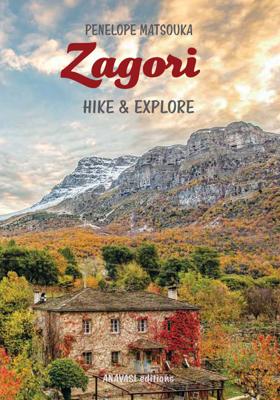
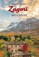
Zagori is not just a guide. It conveys the experiential experience of 40 years in the form of six short personal stories and 39 hiking routes. As a hiking route guide, it is aimed at everyone, mountaineers, experienced hikers and beginners who want to be introduced to hiking. Detailed descriptions, map and photographic material accompany each rout...

Verkopers met dit product

Verkoper
Bezorging
Prijs
DeZwerver.nl logo
DeZwerver.nl
niet bekend
2,95
31,95

Anderen bekeken ook

Wandelgids Zagori | Anavasi
Zagori is not just a guide. It conveys the experiential experience of 40 years in the form of six short personal stories and 39 hiking routes. As a hiking route guide, it is aimed at everyone, mountaineers, experienced hikers and beginners who want to be introduced to hiking. Detailed descriptions, map and photographic material accompany each route. The purpose of the guide is to highlight obvious and hidden beauties of Zagori landscape and to motivate visitors to get to know them by walking. But above all to be introduced to the values of the place, like pilgrims to this sacred monument of nature and culture.   Because Zagori is a place with a geological heritage of outstanding global importance, a valuable ecosystem and refuge for many protected species of flora and fauna and one of the few places where the tangible and intangible cultural heritage still vividly tells the story, in short a unique place.
31,95
Wandelgids Walking and Trekking in the Zagori | Cicerone
Uitstekende wandelgids van Zagori. Goed beschreven met veel praktische informatie om de routes te kunnen lopen, inclusief redelijke kaarten. Zagori in Greece's Northern Pindos National Park is among the last relatively undiscovered and unspoilt hiking destinations in Europe. This guide presents a selection of thirty walks and three short treks showcasing the region's captivating scenery, from dramatic gorges to mystical forests, crystal-clear turquoise rivers, rugged alpine peaks and characterful mountain villages. Routes vary from easy walks on clear paths to strenuous ascents and mountain traverses, meaning that there is something to suit most ambitions and abilities. Clear mapping accompanies the route description, and the introduction to the guide covers all the practicalities, including getting to Zagori, accommodation, equipment, maps and safety. There is also a wealth of information about the region's rich history, architecture, geology, plants and wildlife, as well as fascina…
23,95
Wandelkaart 3.1/6.4 Zagori - Valia Kalda - Metsovo - Pindus | Anavasi
Uitstekende topografische kaarten van een deel van Griekenland: zonder meer hele goede kaarten voor wandeltochten in een onbekend stuk Griekenland! Ze zijn gedrukt op scheurvast en watervast papier op een schaal van 1: 40.000 of 1:50.000 met een UTM grid voor GPS gebruikers. Op de meeste kaarten is geven de hoogtelijnen een interval van 20m. aan. Met schaduwkleuren, punten met hoogtemeters, bronnen, riviertjes en landgebruik geven ze de topografie van het land goed weer. Lokale voetpaden, herbergen en berghutten zijn duidelijk weergegeven. De wegen zijn in gradaties getekend: verhard en onverhard, groot en klein, met afstanden en benzinepompen. Toeristische bezienswaardigheden als kloosters, grotten, kerken etc staan ingetekend. Achterop de kaart worden suggesties gegeven voor wandelroutes met wandeltijd in uren. Van de uitgever Hiking map for Zagori, Valia Kalda and Metsovo in a scale of 1:40 000   Zagori - Metsovo - Valia Kalda 1:40 000 map comprises all recent outdoor activity in t…
11,95
Wandelgids The Cretan Way E4 | Anavasi
De Kretenzische Weg is een 500 km lange wandelroute, die u van oost naar west, over gevarieerde en spectaculaire landschappen van Kreta voert. Het is de ideale manier om de landelijke, bergachtige en kustgebieden van dit ongelooflijke eiland te ontdekken.   Deze gids is de eerste gids voor de route en bevat kaarten, beschrijvingen, een reisverslag, GPS-tracks, accommodatie info en tips om te wandelen op een van de meest opmerkelijke lange afstand routes in de wereld.   The Cretan Way is a 500 km walking route which takes you from east to west across the varied and spectacular landscapes of Crete. It is the ideal way to discover the rural, mountainous and coastal regions of this incredible island.   This guidebook is the first ever guidebook for the route and includes maps, descriptions, a travelogue, GPS tracks, accommodation info and tips for walking one of the most remarkable long-distance routes in the world.
24,95
Wandelkaart 8.1 Mt. Taygetos - Peloponnesos | Anavasi
Uitstekende topografische kaarten van een deel van Griekenland: zonder meer hele goede kaarten voor wandeltochten in een onbekend stuk Griekenland! Ze zijn gedrukt op scheurvast en watervast papier op een schaal van 1:25.000 met een UTM grid voor GPS gebruikers. Op de meeste kaarten is geven de hoogtelijnen een interval van 20m. aan. Met schaduwkleuren, punten met hoogtemeters, bronnen, riviertjes en landgebruik geven ze de topografie van het land goed weer. Lokale voetpaden, herbergen en berghutten zijn duidelijk weergegeven. De wegen zijn in gradaties getekend: verhard en onverhard, groot en klein, met afstanden en benzinepompen. Toeristische bezienswaardigheden als kloosters, grotten, kerken etc staan ingetekend. Achterop de kaart worden suggesties gegeven voor wandelroutes met wandeltijd in uren. This is not just a hiking map, this is a hiking guide AND 1: 25 000 map.   Taygetos extends as 70 km of magnificent massif anchoring the southern tip of Greece. From a dense network of ch…
25,95
Wandelgids Canadian Rockies Trail Guide | Summerthought
The best loved and most detailed Canadian Rockies hiking guidebook is now in full color.   First published in 1971 and now in its 10th edition, the Canadian Rockies Trail Guide was the original guidebook with accurate distances and detailed descriptions to the trails of the Canadian Rockies.   Whether you’re a Canadian Rockies local or a visitor, the Canadian Rockies Trail Guide provides the best resource for hiking in the region, with everything from short interpretive trails to week-long backcountry treks. Now in its 10th edition and known affectionately as the “Bible” by outdoor enthusiasts, the popular tome is the most comprehensive and well-known guidebook to hiking in the region.   Having spent their entire adult lives hiking in the Canadian Rockies and writing about their experiences, authors Brian Patton and Bart Robinson are regarded as the ultimate authority on hiking in the Canadian Rockies. The Canadian Rockies Trail Guide is the only hiking guide to the region recommended…
29,95
Wandelgids Gran Canaria | Rother Bergverlag
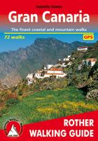
Gran Canary not only enjoys a fabulous reputation as a paradise of sunshine and beaches; it can also be described as one of the most versatile hiking islands of the Canary Archipelago. Connoisseurs praise it as a miniature continent because of its diversity of landscapes: shimmering dunes in contrast with luscious subtropical valleys, deep ravines with palm tree oases and glittering reservoirs, next to which are extensive pine tree forests and green slopes with grazing sheep and goats. To the North West cliffs drop down 800 m deep into the ocean, while in the centre of the island serrated, almost 2000 metre high ridges and bizarre rock monoliths emerge, which the Spanish writer Miguel de Unamuno once interpreted as »fossilised storms of fire and lava.   This Rother walking guide includes excursions to beaches and spectacular cave villages, walks through pine forests and atmospheric ridge paths. Due to the increased significance of hiking tourism, parts of what at times are more than 5…
18,50
Wandelgids 442 Zagoria-Trek Griekenland | Conrad Stein Verlag
Handzaam boekje met de routebeschrijving inclusief een heleboel praktische informatie. De beschrijving is uitstekend, maar kaarten zijn beperkt en schetsmatig aanwezig. Duits. Der Zagoria-Trek zeigt ein Griechenland, das die wenigsten Reisenden kennen: ein bergiges Land mit schroffen Felsmassiven, unzähligen Wasserquellen, weiten Wäldern, frei lebenden Pferden und Kühen und der tiefsten Schlucht der Welt. In bis zu 9 Etappen (bis zu 130 km), die individuell verkürzt oder verlängert werden können, führt der Rundwanderweg durch diese einmalige Landschaft. Der Wanderführer beschreibt mögliche Etappenkombinationen und liefert zu jeder Etappe eine ausführliche Wegbeschreibung mit Übernachtungs- und Einkehrmöglichkeiten, Karten, Höhenprofilen und GPS-Tracks. Als Extra finden Sie zudem eine  Beschreibung für den Aufstieg auf den höchsten Gipfel des Olymps, der ebenfalls im Norden Griechenlands liegt.
14,90
Wandelkaart - Wegenkaart - landkaart 10.24 Santorini | Anavasi
As you enter the caldera of Santorini by ferry sheer cliffs rise up dramatically, exposing richly coloured rock strata, crowned by the colored houses of the cliff-top settlements. Equally magnificent is the sunset from the heights of the caldera towards the sea and the remnants of prehistoric rounded island Strogyli, Thirasia, the New and Old Kameni. However, there is more than the visual excitement to discover and if you don’t take the time to walk the island you will have learnt little of Santorini.   The new Anavasi map will take hiking in every corner, beach and hill top of Santorini and Thirassia to discover landscapes with visible signs of the traditional rural culture, with orchards stonewalls, threshing floors, huts, chapels, inland villages with a well preserved medieval core (called Castelo), routes with wonderful vistas, lost beaches quiet even in the heart of summer.   On the reverse side of the map, there is a brief description of the 25 proposed hiking routes and a short…
10,95
Wandelkaart 4.21 Meteora 3D | Anavasi
Wandelkaart van Meteora en directe omgeving. Op de achterzijde een 3D kaart waarbij het bijgeleverde brilletje tot z'n recht komt.   The hiking map of Meteora in scale 1:10 000 by Anavasi editions is a world first in the printed cartography with its the three-dimensional depiction. We provide the special glasses and we let wander back you back to Meteora even when you are no longer there.   A monument of World Natural and Cultural Heritage of UNESCO, Meteora is a unique landscape of rocky spines and the second largest monastic complex in Greece. With the new map, Anavasi editions invites you to discover the transcendental scenery of Meteora through hiking trails. The map is printed on waterproof "polyart" paper 
9,95

Klanten-reviews van Wandelgids Zagori | Anavasi

Er zijn nog geen beoordelingen voor dit productBen jij de eerste die een review plaatst?

Meer over Wandelgids Zagori | Anavasi

Productomschrijving

Zagori is not just a guide. It conveys the experiential experience of 40 years in the form of six short personal stories and 39 hiking routes. As a hiking route guide, it is aimed at everyone, mountaineers, experienced hikers and beginners who want to be introduced to hiking. Detailed descriptions, map and photographic material accompany each route. The purpose of the guide is to highlight obvious and hidden beauties of Zagori landscape and to motivate visitors to get to know them by walking. But above all to be introduced to the values of the place, like pilgrims to this sacred monument of nature and culture.   Because Zagori is a place with a geological heritage of outstanding global importance, a valuable ecosystem and refuge for many protected species of flora and fauna and one of the few places where the tangible and intangible cultural heritage still vividly tells the story, in short a unique place.

Productinformatie

    Verken gerelateerde categorieën

    Webshop.nl maakt gebruik van cookies. Ga je verder op onze website, ga dan akkoord met het plaatsen van cookies en de verwerking van deze data door ons en vermelde partners.