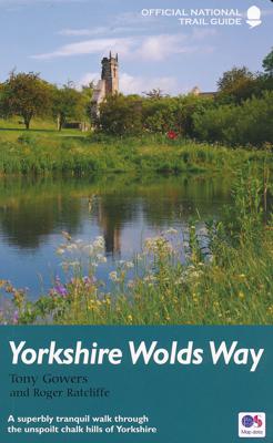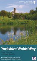
Wandelgids Yorkshire Wolds Way | Aurum Press

0
Een mooie wandelgids met een goede beschrijving en hele duidelijke kaarten met ingetekende route.   The Yorkshire Wolds were brought to international attention in 2012 by David Hockney’s magnificent Royal Academy exhibition of paintings of the region. Now, Tony Gowers’ completely updated, expanded and re-designed National Trail Guide offers the es...

Verkopers met dit product

Webshop
Bezorging
Prijs
DeZwerver.nl logo
DeZwerver.nl
niet bekend
20,95

Anderen bekeken ook

Fietskaart 10 Cycling guides North York Moors | Goldeneye
Scheur- en watervast foetskaart van de North York Moors  met ingetekende fietsroutes.   Our maps are double-sided, printed on an A2 sheet with a concertina fold. This allows for easy folding and folding, and an ease of access to the mapping. The material is rain and tear-resistant. Our early maps were designed at the scale of 2 miles to 1 inch/1:126,720. The later designs along with digitalisation are 1: 100,000. We were encouraged by the Cycle Touring Club to convert our cartography toward the cycle market (to replace the out-of-print Bartholomew series). As time and the series progressed we have added more data: The National Cycle Network routes, Regional Routes, and Traffic-Free Family Routes, as and when they are developed. These routes are in addition to the Circular Routes Goldeneye Commissioned at the outset of our publishing schedule. We are also adding to new editions; bike shops, cycle hire, and tea rooms, along with the tourist attractions already featured. Our plan is to m…
14,95
Reisgids Slow Travel North York Moors - Yorkshire Wolds | Bradt Travel Guides
Een bijzondere serie van Bradt guides, waarin een gedeelte van Engeland of Schotland uitgebreid beschreven wordt. Met veel aandacht voor kleine details die je niet al gauw elders zult vinden. Naast de beschrijvende informatie vind je ook een schat aan praktische informatie als accommodatie-adressen of leuke pubs. Een aanrader! Yorkshire resident, outdoors enthusiast and travel writer Mike Bagshaw has thoroughly updated this new third edition of Bradt’s North York Moors & Yorkshire Wolds, part of Bradt’s award-winning series of Slow travel series of guides to UK regions. It remains the only standalone guide to this region of contrasts. Walkers, cyclists, wildlife-lovers, families, foodies and culture vultures will find everything they need to plan and enjoy time here.   From magnificent cliffs and beaches along Yorkshire’s Heritage Coast and rolling hills in the North York Moors (one of the original nine National Parks of England and Wales) to the Wolds’ tranquil chalk grasslands, t…
22,50
Fietskaart 14 Cycling guides Suffolk | Goldeneye
To be confronted with the variety and complexity of the cycling routes, trails and paths in Suffolk can be a bewildering experience.  For it appears that the Suffolk County Council and the three District Councils are all trying hard to promote their areas. This is indeed encouraging for the growth of cycling, but it can be confusing.  Our purpose is to provide clear, easy to use and easy to follow, cycling maps, and to illustrate these in a comprehensive form.    Suffolk must be one of the most charming of counties to explore by bicycle. When Al Churcher delivered his routes to us at Goldeneye we couldn’t keep him quiet, such was his enthusiasm and wonder at Suffolk’s country lanes and byways. He has cycled all over the UK, Canada, Mallorca, New Zealand and Sicily, but Suffolk remained a firm favourite.    The inland scenery is not spectacular for the county’s main glory lies with its attractive villages; the local architecture jealously preserved from modern depredation. There is an …
15,95
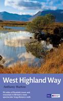
Wandelgids West Highland Way | Aurum Press
Gedegen routegids van het beroemdste pad van Schotland. Uitstekende kaarten, goede achtergronden, helaas wat beperkte praktische informatie. Engels. The 93-mile West Highland Way is indisputably Britain's most spectacular long-distance path. The first section, following the eastern shore of Loch Lomond, offers an idyllic waterside walk, with the full grandeur of the Highlands gradually revealing itself. Then, after crossing the barren wilderness of the Rannoch Moor, the walker climbs the Devil's Staircase above Glencoe and traverses classic Highland landscapes to reach Fort William and, if he or she wishes, a grand finale at the peak of Britain's highest mountain, Ben Nevis. This comprehensive, easy-to-use guide is an authoritative companion, packed with indispensable information. The West Highland Way recreational Path Guide by Anthony Burton is the definitive guide to Britain’s most spectacular long distance walk. This comprehensive, easy-to-use guide contains the entire route split…
20,95
Wandelgids Canadian Rockies Trail Guide | Summerthought
The best loved and most detailed Canadian Rockies hiking guidebook is now in full color.   First published in 1971 and now in its 10th edition, the Canadian Rockies Trail Guide was the original guidebook with accurate distances and detailed descriptions to the trails of the Canadian Rockies.   Whether you’re a Canadian Rockies local or a visitor, the Canadian Rockies Trail Guide provides the best resource for hiking in the region, with everything from short interpretive trails to week-long backcountry treks. Now in its 10th edition and known affectionately as the “Bible” by outdoor enthusiasts, the popular tome is the most comprehensive and well-known guidebook to hiking in the region.   Having spent their entire adult lives hiking in the Canadian Rockies and writing about their experiences, authors Brian Patton and Bart Robinson are regarded as the ultimate authority on hiking in the Canadian Rockies. The Canadian Rockies Trail Guide is the only hiking guide to the region recommended…
29,95
Wandelgids Coast to Coast Walk - van Ierse Zee tot Noordzee | Aurum Press
Goede gids over dit inmiddels beroemde pad. Kaartmateriaal is perfect, alsmede achtergrondinformatie. Praktische info wat minder, maar die is op de ramblerssite op internet te vinden! The Coast to Coast Walk is unique among Britain's long-distance footpaths in that it was the invention of one man, the legendary Alfred Wainwright, and enjoys no official status like, for example, the National trails in England and Wales. Nevertheless, it has become one of Britain's most popular long-distance walks, which is hardly surprising as it traverses some of the finest walking territory in the country. Starting at St Bees on the Cumbrian coast, the route runs for 192 miles (307 km) to Robin Hood's Bay on the North Sea and lies, for the most part, within the boundaries of three of Britain's loveliest National Parks - the Lake District, the Yorkshire Dales and the North York Moors. As well as the main route there are also alternatives available at several points. Martin Wainwright's description of …
20,95
Reisgids Slow Travel Yorkshire Dales | Bradt Travel Guides
Een bijzondere serie van Bradt guides, waarin een gedeelte van Engeland of Schotland uitgebreid beschreven wordt. Met veel aandacht voor kleine details die je niet al gauw elders zult vinden. Naast de beschrijvende informatie vind je ook een schat aan praktische informatie als accommodatie-adressen of leuke pubs. Een aanrader! This new, thoroughly updated third edition of Yorkshire Dales (Slow Travel), part of Bradt’s series of distinctive ‘Slow’ travel guides to local UK regions, remains the most comprehensive guide to the area and covers the whole of the Yorkshire Dales National Park and Nidderdale Area of Outstanding Natural Beauty plus nearby ‘slow’ and historic towns and villages. The Yorkshire Dales could have been invented for modern travel. The region’s cinematic caves, valleys, waterfalls and limestone geology are famous round the world. Within a short walk are filmset-perfect traditional pubs and cafes where you are as likely to chat to shepherds as celebrities.   The Dales …
23,50
Campinggids Under the Stars Camping Australia and New Zealand | Lonely Planet
Featuring over 200 of the best campsites, huts, glamping, and bush camping spots in Australia and New Zealand for the ultimate nature-based escape.   Each of the 9 regional chapters highlight the top locations for camping, glamping, or cabin-style accommodation, as well as essential information on the rules and regulations of free camping, safety considerations, and where to buy camping supplies locally.   Inside Under the Stars Camping Australia and New Zealand:   More than 200 of the best places to spend the night under canvas in Australia and New Zealand Divided into 9 regional chapters and organised by each of Australia's states and territories (the Australian Capital Territory is combined with New South Wales) as well as New Zealand's North and South Islands 12 full-page outdoor activity guides provide a deep-dive of must-try experiences and local highlights in each region including surfing, four wheel driving, aboriginal rock art, indigenous experiences, wine tasting, paddling a…
31,95
Wandelkaart Tour & Trail Costa de Sol - Axarquia | Discovery Walking Guides
Goede wandelkaart van de omgeving Nerja - Competa in het binnenland. For better adventures, use the best map. Costa del Sol (Axarquia) Tour & Trail Super-Durable Map comes with a 2 year adventurous use wear and tear guarantee against splitting or falling apart, see Discovery Walking Guides website for details. From 1 April 2020 a free Custom Map digital edition for Garmin users is available to download from the Discovery Walking Guides website.   Our large 1:40,000 scale, combined with splitting the region into West and East sections with a generous overlap, produces double sided map whose total size is 840mm by 700mm that folds to a pocketable 240mm by 120mm. Costa del Sol (Axarquia) covers the region from Ventas de Zafarraya in the North-West to Almunecar in the South-East; approx 3 42'W to 4 08'W and 36 43'N to 36 58'N. You get the most detailed map of the region that is produced including our 'Tour & Trail' level of detail ranging from major roads to secondary roads to minor ro…
15,95
Wandelkaart - Topografische kaart OL02 OS Explorer Map Yorkshire Dales - Southern & Western Area | Ordnance Survey
Een van de beste detailkaarten die er op de wereld gemaakt worden: zeer gedetailleerd, prachtig helder kleurgebruik, veel topografische aspecten en - zeer belangrijk - allerlei toeristische en recreatieve aspecten zijn ingetekend. De perfecte kaart voor vakantie en vrije tijd: wandelen, fietsen of gewoon de omgeving verkennen. Door de grootte van de kaart, voor- en achterzijde, bestrijkt het een behoorlijk groot gebied! Map sheet number OL2 in the OS Explorer map series is the ideal map to use when exploring the South and West areas of the Yorkshire Dales including Whernside, Ingleborough and Pen-y-ghent. Highlights: The Yorkshire three peaks, The Devils Bridge at Kirkby Lonsdale, Leeds to Liverpool Canal at Skipton, The Pennine Way, Settle, and Old Town. These highly detailed maps show all the administrative boundaries, settlements as small as isolated farms, road network down to unfenced roads and country tracks, and field boundaries (hedges and drystone walls) which make navigation…
19,50

Klanten-reviews van Wandelgids Yorkshire Wolds Way | Aurum Press

Er zijn nog geen beoordelingen voor dit productBen jij de eerste die een review plaatst?

Meer over Wandelgids Yorkshire Wolds Way | Aurum Press

Productomschrijving

Een mooie wandelgids met een goede beschrijving en hele duidelijke kaarten met ingetekende route.   The Yorkshire Wolds were brought to international attention in 2012 by David Hockney’s magnificent Royal Academy exhibition of paintings of the region. Now, Tony Gowers’ completely updated, expanded and re-designed National Trail Guide offers the essential companion to the forgotten but fascinating landscape through which this Trail runs.   The Trail runs from Hessle in the south, by the Humber Bridge, to Filey on the North Yorkshire coast, through the Wolds' secluded and special 'dry valleys', a succession of tranquil villages, and past cel;ebrated locations like Thixendale woods now immortalised in Hockney's vast and dazzling paintings.   As well as comprehensive route descriptions accompanied by OS 1:25,000 maps, the book features a Philip Larkin Trail around Hull, digressions to the handsome town of Beverley with its beautiful Minster, the Holderness region made famous by Winfred Holtby’s South Riding, the seabird colony at RSPB Bempton Cliffs, as well as circular walks to all of the principal locations of Hockney’s Wolds paintings. The result is a n essential purchase, not just for those walking the Trail, but for every visitor to the area.    

Verken gerelateerde categorieën

Webshop.nl maakt gebruik van cookies. Ga je verder op onze website, ga dan akkoord met het plaatsen van cookies en de verwerking van deze data door ons en vermelde partners.