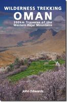
Wandelgids Wilderness Trekking Oman | Gilgamesh

0
The Hajar Mountains rise up from the great central deserts of the Arabian plateau - the so-called Empty Quarter - and then look down to the coastal plain that runs into the waters of the Gulf of Oman. Beautiful and remote, often almost entirely inaccessible, these harsh rocky slopes with their breathtaking views of Oman are largely unexplored. Wi...

Verkopers met dit product

Webshop
Bezorging
Prijs
DeZwerver.nl logo
DeZwerver.nl
niet bekend
16,50

Anderen bekeken ook

Wandelkaart Wilderness Trekking Oman | Gilgamesh
This map is a practical addition to the guide for hiking in the Western Hajar, which is the western portion of the main mountain range in the Sultanate of Oman. The best walking weather in Oman is from mid-November to March. The traverse follows the spine of the mountains in a point-to-point walk taking sixteen days.   It consists of eight one-day walks, two two-day walks and one four-day walk. There is a road intersection with a village or hotel between each of these eleven sections making it practical to walk sections rather than the full traverse. The track climbs to the highest accessible peak in the country at 2999m and finishes in remote dry valleys, called wadis, where impregnable cliffs have precluded road construction and electricity transmission.   This has preserved the Arabian mountain lifestyle that has existed for centuries. This traverse is for hikers who are competent with GPS navigation, as only six of the sixteen day tracks are marked. There are two shorter options, …
19,50
Reisgids Oman | Bradt Travel Guides
Er bestaat geen Lonely Planet van alleen Oman. Voor vele landen net zo goed, zo niet beter dan de Planet. Beduidend soberder uitgevoerd, maar ook met veel informatie voor backpackers en met veel kaartmateriaal. Een aanrader! This new, fully updated fifth edition of Bradt's Oman offers all the information needed to plan a visit to this rapidly developing Arabian nation, written by experts Tony Walsh, a veteran of Oman's travel industry, and Diana Darke, who originally worked for the Omani government in 1980 and has remained acquainted with the country ever since. All parts of the country are covered, including areas not featured by other guides, and Arabic script for town names is detailed to aid on-the-ground navigation and exploration.New for this edition are coverage of the restored medieval walled town of Manah, with its labyrinth of passages and mud-brick houses, developments at the UNESCO site of Ubar at Ash Shisr, and in Muscat the fort at Mutrah, with its panoramic views over t…
26,50
Fietskaart 01 Cycling guides Cornwall | Goldeneye
Our maps are double-sided, printed on an A2 sheet with a concertina fold. This allows for easy folding and folding, and an ease of access to the mapping. The material is rain and tear-resistant. Our early maps were designed at the scale of 2 miles to 1 inch/1:126,720. The later designs along with digitalisation are 1: 100,000. We were encouraged by the Cycle Touring Club to convert our cartography toward the cycle market (to replace the out-of-print Bartholomew series). As time and the series progressed we have added more data: The National Cycle Network routes, Regional Routes, and Traffic-Free Family Routes, as and when they are developed. These routes are in addition to the Circular Routes Goldeneye Commissioned at the outset of our publishing schedule. We are also adding to new editions; bike shops, cycle hire, and tea rooms, along with the tourist attractions already featured. Our plan is to make available digital versions for cell phones and tablets and to update, on an annual b…
15,95
Reisinspiratieboek - Wandelgids Your Trip Starts Here | Lonely Planet
Embark on over 50 of the world's most life-affirming journeys and nurture your path to self-discovery. Packed with beautiful photography and inspiring first-person insights for each trip, from hiking Japan's sacred Shikoku pilgrimage to following the Underground Railroad in the US. This is the perfect book for anyone seeking to travel with purpose.   Each journey features first-hand accounts from travellers with insightful tips on how to begin planning an enlightening travel experience. From cultural explorations to challenging expeditions, travellers can spend a month of reflection on foot through Northern Spain to reach the Cathedral of Santiago de Compostela; connect body and mind as they canoe the wild and remote Yukon River in Canada; embrace the wonders of rail travel aboard Australia's luxurious Ghan; plus so much more. Inside Your Trip Starts Here: - More than 50 life-changing journeys with explanations about how each trip can influence your personal growth- Trips in the book …
34,95
Fietskaart Reivers Cycle Routes | Northern Heritage Services
The long-distance Reivers Cycle Routes are two intertwining signed / waymarked bi-directional ‘coast to coast’ cycle routes between the North Sea and the Irish Sea.   The original Reivers Cycle Route was created in 1998 eventually becoming NCN Route 10 with interlinking on-road and off-road sections but this soon morphed into a one-size-fits-all route which never worked well. The regenerated re-launched Reivers Cycle Routes are two intertwining route options – one which is as much off-road as possible suitable for gravel and cross bikes, hybrids and mountain bikes and a version designed for capable road cyclists 100% on tarmac.   The routes are bi-directional and continuously reward the rider with beautiful views of the constantly changing terrain, provide many places of interest to pass by or call in and many lovely villages and quiet hamlets to cycle through or stay the night. Most importantly, there is a supply of excellent on route or close-to-route refreshments stops.   The off-r…
16,50
Wandelgids Kilimanjaro - A Trekking Guide to Africa's Highest Mountain | Trailblazer Guides
Dat dit boek je met de planning helpt is geen loze kreet. Werkelijk alle facetten van de berg en zijn omgeving komen aan bod. De auteur geeft informatie over hoe je een reis naar de Kili kunt boeken, hoe je er komt, wat je er kunt verwachten en hoe je vervolgens de top kunt bereiken. Maar hij is ook erg duidelijk voor wat betreft het bereiken van die top: doe dat alleen onder begeleiding van een erkende gids en doe het op je gemak. Kilimanjaro is immers niet voor niets de hoogste berg van Afrika en daarmee één van de beruchte 'seven summits'. Practical, best-selling guide to climbing Mount Kilimanjaro, Africa's highest mountain and most popular trek.   Fully updated 6th edition with amendments in 2024.   At 5895m (19,341ft) Kilimanjaro is Africa's highest mountain. Yet with no mountaineering skills necessary to reach the summit, even non-climbers can experience the thrill of climbing one of the world's greatest peaks. Taking you from the dusty plains of East Africa through jungle…
25,95
Fietskaart 14 Cycling guides Suffolk | Goldeneye
To be confronted with the variety and complexity of the cycling routes, trails and paths in Suffolk can be a bewildering experience.  For it appears that the Suffolk County Council and the three District Councils are all trying hard to promote their areas. This is indeed encouraging for the growth of cycling, but it can be confusing.  Our purpose is to provide clear, easy to use and easy to follow, cycling maps, and to illustrate these in a comprehensive form.    Suffolk must be one of the most charming of counties to explore by bicycle. When Al Churcher delivered his routes to us at Goldeneye we couldn’t keep him quiet, such was his enthusiasm and wonder at Suffolk’s country lanes and byways. He has cycled all over the UK, Canada, Mallorca, New Zealand and Sicily, but Suffolk remained a firm favourite.    The inland scenery is not spectacular for the county’s main glory lies with its attractive villages; the local architecture jealously preserved from modern depredation. There is an …
15,95
Fietsgids - Fotoboek Epic Bike Rides of the Americas | Lonely Planet
Een prachtig boek voor de avontuurlijke fietser: meer fotoboek dan echte fietsgids, maar enorm inspirerend. Voor een beetje fietser - of het nu en recreatieve fietser is of een ware fanaticus - het ideale kado!   Get ready to explore America’s most thrilling gravel, road and trail bike routes.   This definitive companion for cycling enthusiasts showcases 200 of North, Central and South America’s best and most celebrated routes, from epic adventures off the beaten path to shorter urban rides. Go bikepacking in Baja, road riding in Colombia, mountain biking in Canada and gravel riding in Pennsylvania.    Each ride is accompanied by stunning photos and a map and toolkit of practical details – where to start and finish, how to get there, where to stay and more – to help you plan the perfect trip. Suggestions for similar rides around the world are also included.   Rides in Canada include:   The Cabot Trail (Nova Scotia) Whistler Bike Park (British Columbia) The Whitehorse Trails (Yukon)…
34,95
Reisgids Tahoe and Reno | Moon Travel Guides
De Amerikaanse uitgever Moon is een vergelijkbare gids met uitgever Lonely Planet > veel praktische informatie met veel diepgang! Het feit dat het een Amerikaanse uitgever is, maken deze gidsen zeer aantrekkelijk voor de staten afzonderlijk. De Lonely Planet haalt dat nivo niet! From the glittering lake and trail-lined mountains to Old West towns and artsy urban centers, experience the best of this adventurous region with Moon Tahoe & Reno. Inside you'll find:*Flexible itineraries, including a week-long Lake Tahoe road trip, long weekends for both winter and summer, and the one-week best of Tahoe and Reno*Strategic advice for hikers, skiers, beach bums, families with kids, foodies and brewery lovers, and more*The best hikes in Tahoe: Find your adventure, from challenging mountain treks to serene meadow walks, with trail descriptions, difficulty ratings, and detailed trail maps*Outdoor adventures for any season: Hit the slopes and get the first tracks through snow-covered pines or spar…
19,95
Wandelkaart A15 Sarrabus da Costa Rei a Porto Corallo | Abies
Sarrabus is a territory that is not known by everybody yet. Here lies its charm and this has made possible to keep this environmental area out of big building speculations and also out of history. In fact it preserves little traces of the past, and paradoxically the remains from the prehistoric age are more meaningful than those back to more recent times. We can find traces from the most remote past not far from the State Road SS125, that from Muravera goes to Costa Rei, by visiting the nuraghe Murtas, the nuraghe S’Aqua Secis and the megalithic complexes of Scalas and Cuili Piras. They are about ten menhirs, almost fully intact, arranged in groups and fixed in the ground in the original orthostatic position. They have been put in relation with the position of the sun and the moon, at dawn and at sunset. In fact they were used as a very precise astronomic calendar but also for religious purposes since they represented both the masculine divinity and the fertility according to the wors…
12,95

Klanten-reviews van Wandelgids Wilderness Trekking Oman | Gilgamesh

Er zijn nog geen beoordelingen voor dit productBen jij de eerste die een review plaatst?

Meer over Wandelgids Wilderness Trekking Oman | Gilgamesh

Productomschrijving

The Hajar Mountains rise up from the great central deserts of the Arabian plateau - the so-called Empty Quarter - and then look down to the coastal plain that runs into the waters of the Gulf of Oman. Beautiful and remote, often almost entirely inaccessible, these harsh rocky slopes with their breathtaking views of Oman are largely unexplored.

Wilderness Trekking in Oman is a practical guide for hiking in the Western Hajar, following some 200km of mountain trails. Meticulously researched and presented with detailed original cartography, this comprehensive guide is the key to discovering a remarkable landscape. The mountain traverse follows the spine of the mountains in a point-to-point walk taking 16 days which can be broken down into eight one-day walks, two two-day walks, and one four-day walk. There is a road intersection with a village or hotel between each of these 11 sections. The traverse climbs to the highest accessible peak in the country at 2999m and finishes in remote dry valleys, called wadis, where impregnable cliffs have precluded road construction and electricity transmission. This has preserved the Arabian mountain lifestyle that has existed for centuries.

This book describes where to go, what to carry, where to sleep, and, most importantly, where to find drinking water. Some hikers may choose to be supported by friends meeting them in a 4WD vehicle at road intersections marking the end of each section. For their benefit, this book includes excursions at eight of these ten rendezvous points. There are other possibilities for resupply at all 10 road intersections. Digital data for download comprises GPS tracks, waypoints, kmz map files, and PDF files of each chapter. Hikers who have completed part or all of this traverse are invited to post reviews on social media accessible from www.hajarhiking.com, where there are historical photographs and video recorded on parts of this traverse in 1992 when there was only one road in the entire mountain range.

Verken gerelateerde categorieën

Webshop.nl maakt gebruik van cookies. Ga je verder op onze website, ga dan akkoord met het plaatsen van cookies en de verwerking van deze data door ons en vermelde partners.