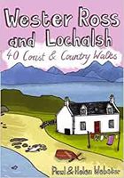
Wandelgids Wester Ross and Lochalsh | Pocket Mountains

0
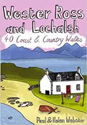
Handige compacte wandelgids met 40 dagwandelingen. Deze gids bevat kleine kaartjes en leuke uitgebreide informatie over wat er langs de route te zien is. Goede wandelkaarten zijn echter we noodzakelijk voor deze tochten: de Ordnance Survey explorer maps of Landanger maps zijn zeer geschikt.     Wester Ross and Lochalsh are amongst the most popul...

Verkopers met dit product

Verkoper
Bezorging
Prijs
DeZwerver.nl logo
DeZwerver.nl
2,95
10,95

Anderen bekeken ook

Wandelgids Wester Ross and Lochalsh | Pocket Mountains
Handige compacte wandelgids met 40 dagwandelingen. Deze gids bevat kleine kaartjes en leuke uitgebreide informatie over wat er langs de route te zien is. Goede wandelkaarten zijn echter we noodzakelijk voor deze tochten: de Ordnance Survey explorer maps of Landanger maps zijn zeer geschikt.     Wester Ross and Lochalsh are amongst the most popular areas for walks in the Scottish Highlands. The Lochalsh peninsula between the shores of Loch Duich and Loch Carron offers varied walking from villages such as Plockton as well as the region's main town at Kyle of Lochalsh. Across the dramatic Mam Ratagan pass is the remote and secluded Glenelg peninsula, a tranquil and peaceful haven far from busy routes.   Further north are Applecross and Lochcarron, with mountains that yield nothing in ruggedness to their more famous counterparts in Torridon, as well as attractive fishing villages and forest walks. Finally around Gairloch is an area that has long been famous for its fine sandy beaches, m…
10,95
Wandelgids Walks Wester Ross Southern Area : Including Kyle of Lochalsh | Hallewell Publications
This guide features walks in the southern part of Wester Ross, in the area between Torridon in the north and Glenelg in the south. Walks range from 0.75 mile to 12 miles (1-19kms) and include high passes through the spectacular hill scenery of Torridon, the signposted routes around Applecross, coastal and moor walks and a number of routes around Kyle of Lochalsh and the pretty village of Plockton.
5,95
Wandelgids Loch Lomond and the Trossachs | Pocket Mountains
Handige compacte wandelgids met 40 dagwandelingen. Deze gids bevat kleine kaartjes en leuke uitgebreide informatie over wat er langs de route te zien is. Goede wandelkaarten zijn echter we noodzakelijk voor deze tochten: de Ordnance Survey explorer maps of Landanger maps zijn zeer geschikt.     The new Loch Lomond National Park has ensured protection for what is not only Britain's largest freshwater lake, but one of its most beautiful, celebrated in ballad and song. West of Loch Lomond are the steep Arrochar Alps towering above Loch Long together with scores of much less visited lower hills stretching down to the seaboard. To the east is the Trossachs - a delightful landscape of forests, lochs and hills that has long been known as Scotland in miniature.   This latest pocket guide features 40 of the best walks in this popular area in an attractive and accessible format.
10,95
Wandelgids Loch Ness, Inverness, Black Isle and Affric | Pocket Mountains
Handige compacte wandelgids met 40 dagwandelingen. Deze gids bevat kleine kaartjes en leuke uitgebreide informatie over wat er langs de route te zien is. Goede wandelkaarten zijn echter we noodzakelijk voor deze tochten: de Ordnance Survey explorer maps of Landanger maps zijn zeer geschikt.   A guide to 40 favourite walks around Loch Ness, Inverness, Black Isle and Glen Affric. Loch Ness, with its legendary monster, is the most famous of all lochs. It holds more water than all the lakes of England and Wales combined and the countryside around it features an equally great variety of walks, with more waymarked trails and easy routes suitable for families than many other parts of the Highlands. Further north lies the magnificent Glen Affric - Scotland's most beautiful glen.   This is a wonderful area of the Highlands for walkers, having the highest mountains north of the Great Glen but also some splendid lower-level and forest walks. To the east is the fertile Black Isle, packed with cha…
10,95
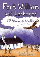
Wandelgids Fort William and Lochaber | Pocket Mountains
Handige compacte wandelgids met 40 dagwandelingen. Deze gids bevat kleine kaartjes en leuke uitgebreide informatie over wat er langs de route te zien is. Goede wandelkaarten zijn echter wel aan te raden voor deze tochten: de Ordnance Survey explorer maps of Landranger maps zijn zeer geschikt. With the historic town of Fort William at its heart, Lochaber boasts some of Scotland's most celebrated mountains and glens, beautiful sea lochs and, on the craggy west coast, dazzling white sandy beaches. Ben Nevis may draw the crowds, but with countless miles of lower-level paths and tracks to explore there is far more than Britain's highest mountain for walkers to enjoy in the region which lays claims to the title of 'The Outdoor Capital of the UK'. This guide features 40 varied walks that take in the very best of Lochaber. From the iconic Glencoe and Glen Nevis to the wild lands of Ardnamurchan and Moidart, there is something for everyone in this diverse selection of routes.
10,95
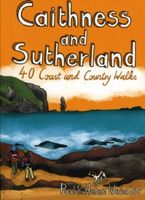
Wandelgids Caithness and Sutherland | Pocket Mountains
Handige compacte wandelgids met 40 dagwandelingen. Deze gids bevat kleine kaartjes en leuke uitgebreide informatie over wat er langs de route te zien is. Goede wandelkaarten zijn echter we noodzakelijk voor deze tochten: de Ordnance Survey explorer maps of Landanger maps zijn zeer geschikt. The county of Ayrshire is located on the Firth of Clyde on the beautiful West Coast of Scotland and is known as one of the most fertile areas of the country, famed for its cattle and crops. Although more industrial to the north, it is in the main a landscape made for walking with an abundance of open countryside and rugged little hills, golden sandy beaches and beautiful sunsets. This guide features 40 mostly moderate walks full of interest which explore all aspects of the region, from craggy cliffs and caves to historic castles, ancient forests to sandy shorelines. Sutherland and Caithness are the most northerly parts of mainland Britain. Northwest Sutherland is a landscape of sandy beaches and …
10,95
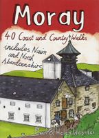
Wandelgids Weekend Walks Moray | Pocket Mountains
The Moray coastline has a string of superb sandy beaches, and towns such as Buckie, Lossiemouth and Nairn (historically part of Morayshire) have long been popular for family holidays.   For the walker there are cliffs, arches and stacks as well as sand and dunes, whilst offshore it may be possible to glimpse the famous Moray Firth dolphins. Set back from the coast are fine stone-built towns such as Forres and the small Cathedral city of Elgin.   From here heading southwards the character of the countryside changes to one of wide, spacious glens and sweeping, purple heather moors and hills. This is Speyside - Malt whisky country par excellence. The main centres here are Keith, Aberlour and attractive Dufftown, as the hills slowly merge into the Cairngorms National Park.   This latest pocket guide features 40 of the best walks in this popular area in an attractive and accessible format.
10,95
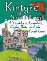
Wandelgids Kintyre and South Argyll | Pocket Mountains
Rugged, wild, sparsely-populated and gouged by misty sea-lochs, South Argyll was once known in Old Gaelic as Airer Goidel, the 'Coast of the Gaels' and remains a place apart. The hills and glens here are steeped in history and littered with standing stones, hillforts and castles, as well as unique wildlife-rich habitats created by the warming Gulf Stream. This book explores the very best of Knapdale, Kintyre and the Cowal coast as well as the Isles of Gigha and Bute with walks to suit all abilities, many of which utilise the long-distance walking trails which criss-cross the area.  
10,95
Wandelgids Aviemore and the Cairngorms | Pocket Mountains
Handige compacte wandelgids met 40 dagwandelingen. Deze gids bevat kleine kaartjes en leuke uitgebreide informatie over wat er langs de route te zien is. Goede wandelkaarten zijn echter we noodzakelijk voor deze tochten: de Ordnance Survey explorer maps of Landanger maps zijn zeer geschikt. 'Aviemore and the Cairngorms' features 40 shorter walks, including many perfect for families, stretching from the ancient region of Badenoch and the uppermost reaches of the Spey Valley, through the outdoor hub of Aviemore to Grantown and Tomintoul, then over Ballater and Royal Deeside to Braemar. Plaatsen in het boekje Abernethy Forest, An Lochan Uaine, Anagach Woods, Aviemore, Badenoch Way, Ballater, Balmoral Estate, Balnagowan Wood, Black Wood, Boat of Garten, Braemar, Bridge of Brown, Burn o’Vat, Cairngorm Club Bridge, Cairngorm Ski Centre, Calder Bridge, Carn Daimh, Carrbridge, Castle Roy, Coire an t-Sneachda, Colonel’s Bed, Coylumbridge, Craigellachie Woods, Craigendarroch, Craigmore Wood, Cr…
10,95
Wandelgids Oban and North Argyll | Pocket Mountains
This guidebook covers a large swathe of Mid and North Argyll, sweeping inland from the fractured western seaboard between Crinan and Appin to Arrochar and Bridge of Orchy on the region’s eastern periphery. Between these four points lies a landscape awash with sea lochs, with Inveraray roughly at the geographical centre. There are no large urban areas here and Oban is the largest settlement. Although the road network and public transport infrastructure are good, many routes feel off the beaten track. This is not only down to the low scattered population but also to the indented coast and its many islands, the sea lochs encroaching deep inland, the elongated freshwater lochs and the mountainous interior – making road travel much more convoluted than direct ‘as-the-crow-flies’ distances would suggest. As well as many great sea lochs, tumbling rivers and iconic mountains, Oban and North Argyll also boasts ancient, wildlife-rich woodlands and several fine gardens. Add to this the Crinan Ca…
10,95

Klanten-reviews van Wandelgids Wester Ross and Lochalsh | Pocket Mountains

Er zijn nog geen beoordelingen voor dit productBen jij de eerste die een review plaatst?

Meer over Wandelgids Wester Ross and Lochalsh | Pocket Mountains

Productomschrijving

Handige compacte wandelgids met 40 dagwandelingen. Deze gids bevat kleine kaartjes en leuke uitgebreide informatie over wat er langs de route te zien is. Goede wandelkaarten zijn echter we noodzakelijk voor deze tochten: de Ordnance Survey explorer maps of Landanger maps zijn zeer geschikt.     Wester Ross and Lochalsh are amongst the most popular areas for walks in the Scottish Highlands. The Lochalsh peninsula between the shores of Loch Duich and Loch Carron offers varied walking from villages such as Plockton as well as the region's main town at Kyle of Lochalsh. Across the dramatic Mam Ratagan pass is the remote and secluded Glenelg peninsula, a tranquil and peaceful haven far from busy routes.   Further north are Applecross and Lochcarron, with mountains that yield nothing in ruggedness to their more famous counterparts in Torridon, as well as attractive fishing villages and forest walks. Finally around Gairloch is an area that has long been famous for its fine sandy beaches, many of them still very quiet. Inland is a vast area of little-visited, rocky peaks known to walkers as 'The Great Wilderness'.   This latest pocket guide features 40 of the best walks in this popular area in an attractive and accessible format.

Productinformatie

    Verken gerelateerde categorieën

    Webshop.nl maakt gebruik van cookies. Ga je verder op onze website, ga dan akkoord met het plaatsen van cookies en de verwerking van deze data door ons en vermelde partners.