webshop.nl
Categorieën
  Sluiten

Meer Pocket Mountains
Meer Pocket Mountains in Literatuur boeken

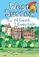
Wandelgids West Sussex | Pocket Mountains

0
From the city of Chichester with its ancient walls and harbour inlets standing sentinel over the English Channel to the northern heights of Black Down on its ridge of greensand above the intervening folds, farms and villages of the western Weald, from the bustling towns of Crawley and Horsham in the lee of the chalk slopes of the South Downs to the...

Webshops met dit product

Webshop
Bezorging
Prijs

Anderen bekeken ook

Wandelgids West Sussex | Pocket Mountains
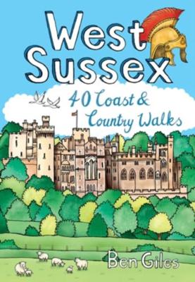
From the city of Chichester with its ancient walls and harbour inlets standing sentinel over the English Channel to the northern heights of Black Down on its ridge of greensand above the intervening folds, farms and villages of the western Weald, from the bustling towns of Crawley and Horsham in the lee of the chalk slopes of the South Downs to the traditional seaside resorts of Littlehampton and Worthing, the 40 circular walks in this guide offer plenty of scope to explore West Sussex’s famed downs, woods, heaths and nature reserves, along with its villages, stately homes and country estates.
10,95
Wandelgids East Sussex | Pocket Mountains
Sitting alongside the English Channel in the southeast corner of England, East Sussex is famed for its rolling hills and magnificent wealdland, Norman battlefields and charming medieval villages, towering chalk cliffs and hip seaside resorts. The county is also traversed by the South Downs Way long distance walking route and is home to England's newest national park, as well as miles of beautiful sandy coastline. From short forays into wildlife-rich wetlands, nature reserves and woodlands to longer riverside meanders and rollercoaster treks along spectacular sea cliffs, the forty varied walks in this guide cover the best walking this glorious county has to offer.
10,95
Reisgids Slow Travel Sussex - South Downs - Weald & Coast | Bradt Trav
Een bijzondere serie van Bradt guides, waarin een gedeelte van Engeland of Schotland uitgebreid beschreven wordt. Met veel aandacht voor kleine details die je niet al gauw elders zult vinden. Naast de beschrijvende informatie vind je ook een schat aan praktische informatie als accommodatie-adressen of leuke pubs. Een aanrader! This new, thoroughly updated third edition of Sussex (Slow Travel), Bradt's much-praised guide, features the South Downs, High Weald and coast, and offers a greater, more personal selection of places to explore than any other guide. Author Tim Locke and updater Emma Gregg, both expert residents, take a leisurely, detailed approach that teases out Sussex's special qualities. The result is highly personal and honest, encouraging you to slow down and gain a deep understanding of what makes this stunning region tick and why it deserves repeat visits. Sussex may be less than 50km from the fringes of London (and easily accessed from the capital), and only minutes from …
23,50
Reisgids Brighton, Sussex & the South Downs | Rough Guides
Een kleinere versie in zakformaat van de grotere versies van de Rough Guides. Als altijd weer vol met goede informatie over cultuur en praktische zaken. Voorin een kaart van de stad. Inspirational and informative pocket guide, shining a spotlight on the best of holidaying at home in the UK through clearly laid-out walking and driving itineraries.   Explore the best of Brighton, Sussex & the South Downs with this unique Rough Guide Staycation to Brighton, Sussex & the South Downs, packed full of insider information and stunning images. From making sure you don’t miss out on must-see attractions like Brighton Pier, Chichester's Novium Museum and grandiose Petworth House to discovering hidden gems, including spotting Sussex wildlife at Arundel Wetland Centre, walking the rambling South Downs Way and mooching down Brighton's The Lanes, the easy-to-follow, ready-made walking and driving routes will save you time, help you plan, and enhance your staycation in Brighton, Sussex & the South Dow…
12,50
Wandelgids Shetland | Pocket Mountains
Handige compacte wandelgids met 40 dagwandelingen. Deze gids bevat kleine kaartjes en leuke uitgebreide informatie over wat er langs de route te zien is. Goede wandelkaarten zijn echter we noodzakelijk voor deze tochten: de Ordnance Survey explorer maps of Landanger maps zijn zeer geschikt. The most northerly of Britain's island groups, Shetland is so far removed from the rest of the UK that it usually appears as an inset on maps. Although relatively little known to those from outside the islands, Shetland is a magnificent terrain for walkers, especially those who love to really explore and get away from the beaten track. The coastal walking here includes some of the finest in the country, with superb cliffs, towering sea stacks, caves and natural arches seemingly around every corner. Added to this is Shetland's better known claim to fame for its spectacular seabird colonies, huge gannetries, moorland packed with arctic and great skuas, arctic terns in the more sheltered spots, and eve…
10,95
Wandelkaart - Topografische kaart OL08 OS Explorer Map Chichester, Sou
Explore the South Downs National Park, follow the South Downs Way up to the picturesque village of South Harting sheltered beneath Harting Down. Discover Chichester Harbour with its delightful fishing villages or range further afield to Selsey at the tip of the Manhood Peninsula.    Seek unspoiled coastlines and countryside on Hayling Island, where windsurfing was invented  Marvel at Chichester’s intact Roman walls and cathedral tower now home to a family of peregrine falcons  Walk or cycle the South Downs Way through gorgeous countryside past South Harting, or explore Chichester Harbour on the Sussex Border Path and Shipwrights Way    Met zijn 4cm voor 1 km (2 ½ cm voor 1 mijl) schaal, is de OS Explorer kaartenserie de ideale en meest gedetailleerde kaartenreeks voor mensen die graag outdoor-activiteiten zoals fietsen, wandelen, paardrijden, klimmen en watersporten. Deze kaart is nog gedetailleerder dan de 'gewone' Landranger maps. Voor- en achterzijde bedrukt! Zeker op de moors en…
19,50
Wandelgids Norfolk | Pocket Mountains
Handige compacte wandelgids met 40 dagwandelingen. Deze gids bevat kleine kaartjes en leuke uitgebreide informatie over wat er langs de route te zien is. Goede wandelkaarten zijn echter we noodzakelijk voor deze tochten: de Ordnance Survey explorer maps of Landanger maps zijn zeer geschikt.   Pinpointing favourite treks, rambles and family trips, these 40 walks visit Norfolk in all its variety. From wild and windswept coast, Fens and Breckland to sheltered inland woods, broads and valleys, they offer geographical impact and a strong sense of history. Treading in the footsteps of warriors, drovers, pilgrims, weavers and reedcutters, this selection links to the county's extensive network of long-distance routes.   You'll find Norfolk at its most photogenic, with swallowtail butterflies and wherry boats, windpumps, seals and sailing boats, round tower churches and medieval architecture. From coast road to historic villages, towns and cities, many of the walks start near public transport.
10,95

Klanten-reviews van Wandelgids West Sussex | Pocket Mountains

Er zijn nog geen beoordelingen voor dit productBen jij de eerste die een review plaatst?

Meer over Wandelgids West Sussex | Pocket Mountains

Productomschrijving

From the city of Chichester with its ancient walls and harbour inlets standing sentinel over the English Channel to the northern heights of Black Down on its ridge of greensand above the intervening folds, farms and villages of the western Weald, from the bustling towns of Crawley and Horsham in the lee of the chalk slopes of the South Downs to the traditional seaside resorts of Littlehampton and Worthing, the 40 circular walks in this guide offer plenty of scope to explore West Sussex’s famed downs, woods, heaths and nature reserves, along with its villages, stately homes and country estates.

Productspecificaties

Artikelnummer(s)
Brand
Pocket Mountains

Verken gerelateerde categorieën

Webshop.nl maakt gebruik van cookies. Ga je verder op onze website, ga dan akkoord met het plaatsen van cookies en de verwerking van deze data door ons en vermelde partners.