webshop.nl
Categorieën
  Sluiten

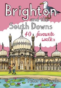
Wandelgids Weekend Walks Brighton and the South Downs | Pocket Mountains

Facing the sea and backed by rolling chalk downland, Brighton is a great place from which to explore one of England's most recognisable and best-loved landscapes. As well as the old chalk grasslands, the South Downs incorporate a variety of habitats, including deciduous, coniferous and mixed woodland, heathland, wetland, shingle beach and saltmarsh...
10,95

Webshops met dit product

Webshop
Bezorging
Prijs

Anderen bekeken ook

Reisgids Brighton, Sussex & the South Downs | Rough Guides
Een kleinere versie in zakformaat van de grotere versies van de Rough Guides. Als altijd weer vol met goede informatie over cultuur en praktische zaken. Voorin een kaart van de stad. Inspirational and informative pocket guide, shining a spotlight on the best of holidaying at home in the UK through clearly laid-out walking and driving itineraries.   Explore the best of Brighton, Sussex & the South Downs with this unique Rough Guide Staycation to Brighton, Sussex & the South Downs, packed full of insider information and stunning images. From making sure you don’t miss out on must-see attractions like Brighton Pier, Chichester's Novium Museum and grandiose Petworth House to discovering hidden gems, including spotting Sussex wildlife at Arundel Wetland Centre, walking the rambling South Downs Way and mooching down Brighton's The Lanes, the easy-to-follow, ready-made walking and driving routes will save you time, help you plan, and enhance your staycation in Brighton, Sussex & the South Dow…
12,50
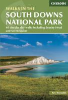
Wandelgids Walking in the South Downs National Park | Cicerone
Goede wandelgids uit de bekende Cicerone serie, dus met mooie foto's en duidelijke routebeschrijvingen en kaartjes. A guidebook to 40 circular day walks in the South Downs National Park. Exploring the beautiful chalk hills between Eastbourne and Winchester, there’s something for beginner and experienced walkers alike.   The walks range in length from 8 to 18km (5–11 miles), each is circular and where possible begins and ends at a place accessible by public transport.   1:50,000 OS maps are included for each walk Detailed information on public transport, accommodation and car parking Highlights include Beachy Head and Seven Sisters Easy access from Brighton and Worthing  
21,95
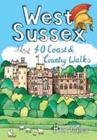
Wandelgids West Sussex | Pocket Mountains
From the city of Chichester with its ancient walls and harbour inlets standing sentinel over the English Channel to the northern heights of Black Down on its ridge of greensand above the intervening folds, farms and villages of the western Weald, from the bustling towns of Crawley and Horsham in the lee of the chalk slopes of the South Downs to the traditional seaside resorts of Littlehampton and Worthing, the 40 circular walks in this guide offer plenty of scope to explore West Sussex’s famed downs, woods, heaths and nature reserves, along with its villages, stately homes and country estates.  
10,95
Wandelgids Walking in the Thames Valley | Cicerone
Walking in the Thames Valley offers 25 challenging circular walks around the River Thames and River Kennet in the south of England, taking in the Southern Chilterns, the Berkshire and North Hampshire Downs, Southern Oxfordshire and the eastern edge of Wiltshire. All routes are within easy reach of Reading, Newbury, Abingdon and London. While some walks visit Iron Age hill forts, others pass more modern features such as Wilton Windmill and the Kennet and Avon Canal. Some follow sections of the Ridgeway, while others meander along the banks of the Thames. What they all have in common is that they take the keen rambler to some of the best parts of the Thames Valley – a patchwork of open chalk grassland, broadleaved woodland and farmland and home to two Areas of Outstanding Natural Beauty. • walks from 10 to 18 miles, including one 2-day route • shorter, less strenuous alternatives for many of the walks • detailed route descriptions with information on local points of interest, OS mapping …
18,50
Wandelgids Weekend Walks The Surrey Hills | Pocket Mountains
Although Surrey is not far from metropolitan London, it famously has more mature woodland than any other county in England and has long been renowned for its rolling hills and valleys, ancient heathlands, beautiful waterways and charming villages.   There is a surprisingly extensive network of local paths and bridleways and, to the south of the North Downs chalk ridge, the hills are intersected by three long-distance walking trails. All these feature in this collection of 40 walks, which explore glorious parklands, country estates, ruined abbeys, impressive castles and wildlife-rich woodlands along the way.
10,95
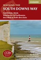
Wandelgids South Downs Way | Cicerone
Uitstekende wandelgids van dit geweldige gebied. goed beschreven met veel praktische informatie om de route te kunnen lopen, inclusief een apart boekje met zeer gedetaileerde kaarten. The South Downs Way National Trail is a 100 mile (160km) walk between Eastbourne and Winchester, staying within the glorious South Downs National Park for its entire length. Presented here in 12 stages of up to 12 miles (19km), the route is described in both east-west and west-east. A waymarked trail with very few stiles, it can be walked at any time of year and makes a good introduction to long-distance walking. Step-by-step route descriptions are illustrated with extracts from OS 1:50,000 mapping for every stage, and a separate, conveniently sized booklet with 1:25,000 maps for the entire route is included. The guide provides detailed practical information on getting to the trail, and facilities and accommodation en route. The South Downs Way offers easy walking on ancient and historical tracks, and sho…
24,95
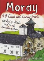
Wandelgids Weekend Walks Moray | Pocket Mountains
The Moray coastline has a string of superb sandy beaches, and towns such as Buckie, Lossiemouth and Nairn (historically part of Morayshire) have long been popular for family holidays.   For the walker there are cliffs, arches and stacks as well as sand and dunes, whilst offshore it may be possible to glimpse the famous Moray Firth dolphins. Set back from the coast are fine stone-built towns such as Forres and the small Cathedral city of Elgin.   From here heading southwards the character of the countryside changes to one of wide, spacious glens and sweeping, purple heather moors and hills. This is Speyside - Malt whisky country par excellence. The main centres here are Keith, Aberlour and attractive Dufftown, as the hills slowly merge into the Cairngorms National Park.   This latest pocket guide features 40 of the best walks in this popular area in an attractive and accessible format.
10,95
Wandelgids South Downs Way | Trailblazer Guides
The South Downs Way is a 100-mile footpath which follows the line of chalk hills stretching from Winchester to Eastbourne. Walking the length of the Downs is the best way to experience this beautiful landscape with its mixture of rolling hills, steep hanging woodland and windswept fields. You'll also pass through picture-postcard villages with welcoming pubs, thatched cottages and country gardens. 1. Unique mapping features - In many walking guides the reader has to read a route description then try to relate it to the map. Our guides are easier to use because walking directions, tricky junctions, places to stay and eat, points of interest and walking times are all written onto the maps themselves in the places to which they apply. With their uncluttered clarity, these are not general-purpose maps but fully-edited maps drawn by walkers for walkers. Downloadable GPS waypoints also included. 2. The largest scale walking maps available - At just under 1:20,000 (8cm or 31/8 inches to 1 mil…
20,95
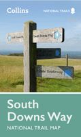
Wandelkaart National Trail Map South Downs Way | Collins
Overzichtskaart op vrij grove schaal van deze LAW Lange Afstands Wandeling in Engeland. Wel met veel informatie op de kaart, goed ingetekend, een route-schema op de achterzijde en een beschrijving van een aantal bezienswaardigheden. ALs je voor lichtgewicht gaat, is dit al vrijwel voldoende om met de bewegwijzering ter plekke de route te kunnen lopen. Perfect guide and map for planning your adventure along the South Downs Way.   Highlights of this Planning Map include:   More than 20 highlighted places of interest with detailed descriptions and attractive photographs, including: Brighton Pier, The Long Man of Wilmington, and Seven Sisters A comprehensive index to more than 800 cities, towns and villages A clear, visible route plotted across a 2 miles to 1 inch ( 1.25 km to 1 cm) scale map Advice on safety and security when travelling along the route, as well as the countryside code and the code of conduct Part of the National Trail network, this long distance footpath covers 100 miles …
11,50
Wandelgids South Downs National Park | Ordnance Survey
Stroll up on the Downs, explore charming villages and wander woodland trails with ten hand-picked leisurely walks suitable for the whole family. Enjoy some of the loveliest and most accessible walks in the South Downs National Park and discover the benefits of being active outside.   South Downs Short Walks Made Easy include:   - Climb the Zig-Zag Path above charming Selborne, made famous by naturalist Gilbert White, for wonderful views - Explore the historic village of Bramber, once an important river port and full of intrigue, and enjoy the beautiful ‘Walk For All’ along the banks of the Adur - See the iconic Devil’s Dyke, offering great views in all directions from the hillfort above the longest and deepest dry valley in the country - Wander the Seven Sisters Country Park, part of the spectacular Sussex coastline between Eastbourne and Seaford - Follow the South Downs Way up Old Winchester Hill to find a hill-fort and barrows, as well as excellent views as far as the Solent and the …
10,95

Klanten-reviews van Wandelgids Weekend Walks Brighton and the South Downs | Pocket Mountains

Er zijn nog geen beoordelingen voor dit productBen jij de eerste die een review plaatst?

Meer over Wandelgids Weekend Walks Brighton and the South Downs | Pocket Mountains

Productomschrijving

Facing the sea and backed by rolling chalk downland, Brighton is a great place from which to explore one of England's most recognisable and best-loved landscapes. As well as the old chalk grasslands, the South Downs incorporate a variety of habitats, including deciduous, coniferous and mixed woodland, heathland, wetland, shingle beach and saltmarsh. The 40 walks in this guidebook cover the area of the Downs around Brighton, extending to Eastbourne in the east and as far as Worthing and the Findon Valley in the west, and from the Channel coast to the foot of the Downs' steep northern escarpment at the edge of the Sussex Weald.  
Webshop.nl maakt gebruik van cookies. Ga je verder op onze website, ga dan akkoord met het plaatsen van cookies en de verwerking van deze data door ons en vermelde partners.