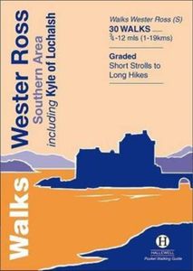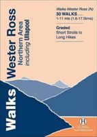
Wandelgids Walks Wester Ross Southern Area : Including Kyle of Lochalsh | Hallewell Publications

0
This guide features walks in the southern part of Wester Ross, in the area between Torridon in the north and Glenelg in the south. Walks range from 0.75 mile to 12 miles (1-19kms) and include high passes through the spectacular hill scenery of Torridon, the signposted routes around Applecross, coastal and moor walks and a number of routes around K...

Verkopers met dit product

Verkoper
Bezorging
Prijs
DeZwerver.nl logo
DeZwerver.nl
2,95
5,95

Anderen bekeken ook

Wandelgids Wester Ross and Lochalsh | Pocket Mountains
Handige compacte wandelgids met 40 dagwandelingen. Deze gids bevat kleine kaartjes en leuke uitgebreide informatie over wat er langs de route te zien is. Goede wandelkaarten zijn echter we noodzakelijk voor deze tochten: de Ordnance Survey explorer maps of Landanger maps zijn zeer geschikt.     Wester Ross and Lochalsh are amongst the most popular areas for walks in the Scottish Highlands. The Lochalsh peninsula between the shores of Loch Duich and Loch Carron offers varied walking from villages such as Plockton as well as the region's main town at Kyle of Lochalsh. Across the dramatic Mam Ratagan pass is the remote and secluded Glenelg peninsula, a tranquil and peaceful haven far from busy routes.   Further north are Applecross and Lochcarron, with mountains that yield nothing in ruggedness to their more famous counterparts in Torridon, as well as attractive fishing villages and forest walks. Finally around Gairloch is an area that has long been famous for its fine sandy beaches, m…
10,95
Wandelgids Walks Aviemore : Including Glenmore & Speyside | Hallewell Publications
This guide covers an upper stretch of the Spey Valley, from Grantown-on-Spey in the north to Newtonmore in the south.  The main walking centres are Aviemore and Glenmore; the bulk of the walking is in the Cairngorm Mountains, the pine woods around Loch Morlich, and the low and rolling Monadhliaths.  Walks range from 1 mile to 21 miles (1.5-34kms).  Routes include: Loch Garten, Cairn Gorm, Loch Morlich to Lairig Ghru, Loch an Eilein and Creag Bheag.  This book was previously published as Walks Speyside, but has been rewalked and revised.  
5,95
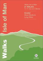
Wandelgids Walks Isle of Man | Hallewell Publications
The Isle of Man is a Crown Dpendency in the Irish Sea, equidistant from the UK and Ireland and is a terrific walking destination. Though the island is only 32 miles/51km long, it contains a wealth of different landscapes and walking types (moorland hills, coastal cliffs, woodland, farmland, sand dunes and beaches). There is a good network of signposted paths including a 102 mile/164km coastal path (Raad ny Foillan) and handsome towns and villages besides. This new guide features walks ranging from 1.5 - 11 miles (2.5 - 18kms) - highlights include the climb up Snaefell and the sea cliffs of Bradda Head and Spanish Head. This guide is part of a popular series of A6 pocket walking guides which describe routes which are suitable for walkers of all abilities and to suit all tastes. Route descriptions are accompanied by 2-colour sketch maps. The guides are illustrated with line illustrations, and will provide walkers with a good introduction to what each area covered has to offer.
5,95
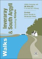
Wandelgids Inveraray & South Argyll : Including Kintyre | Hallewell Publications
Rewalked and updated in 2022, 'Walks Inveraray & South Argyll including Kintyre' covers the stretch of Scotland's west coast from Ardfern in the north to the Mull of Kintyre in the south. This is one of the quieter corners of Scotland, and though it lacks the high peaks of the north and west there are some marvellous and varied walks. Routes featured include the paths around historic Kilmartin and Dunadd, walks by the scenic Crinan Canal, and paths from Campbeltown and the coastal villages of Tayvallich and Inveraray. 28 routes (from 0.5-16kms/0.35-10 miles) are described. The guide is part of a popular series of A6 pocket walking guides describing routes suitable for walkers of all abilities and to suit all tastes. Route descriptions are accompanied by 2-colour sketch maps. The guides are illustrated with line illustrations, and will provide walkers with a good introduction to what each area covered has to offer.  
5,95
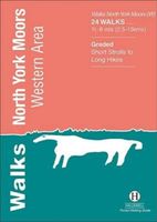
Wandelgids North York Moors: Western Area | Hallewell Publications
Rewalked and updated in 2022, Walks North York Moors (Western Area) features walks in the North York Moors National Park - an area of picturesque moorland intersected by narrow dales, butted up against the coast in the north-east corner of Yorkshire. This guide covers the western half of the area - as far east as the villages of Danby and Rosedale Abbey (for routes around Whitby and the east of the area, see Walks North York Moors (Eastern Area)). The 24 walks in the guide range from 1.5 to 8 miles (2.5 13km). Routes include the ascent of distinctive Roseberry Topping, the path to the famous White Horse near Thirsk, and from Helmsley to the ruin of Rievaulx Abbey. Walks North York Moors (Western Area) is part of a popular series of A6 pocket walking guides which describe routes which are suitable for walkers of all abilities and to suit all tastes. Route descriptions are accompanied by 2-colour sketch maps. The guides are illustrated with line illustrations, and will provide walkers w…
5,95
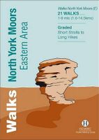
Wandelgids North York Moors: Eastern Area | Hallewell Publications
Rewalked and undated in 2022, this guide features walks in Eastern part of the North York Moors National Park (OS Sheet OL27), including sections of the Cleveland Way along the coast around Whitby and Robin Hood's Bay, and woodland and moorland walks around Eskdale and north of Pickering. Walks range from 1 mile to 9 miles (1.6-14.5kms). Routes include Falling Foss, Robin Hood's Bay to Ravenscar and Hole of Horcum.Part of a popular series of A6 pocket walking guides which describe routes which are suitable for walkers of all abilities and to suit all tastes. Route descriptions are accompanied by 2-colour sketch maps. The guides are illustrated with line illustrations, and will provide walkers with a good introduction to what each area covered has to offer.    
5,95
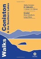
Wandelgids Coniston and the Southern Lakes | Hallewell Publications
Rewalked and revised in 2019, Walks Coniston & the Southern Lakes features walks in The Lake District - the famous area of spectacular peaks and lakes in the north-west of England. This guide covers the south-western part of the area, including walks in the hills around Coniston Water and on the south Cumbrian coast. The 21 walks featured range from 1 mile to 12 miles (1.5-19km). Routes include: The Old Man of Coniston, Grizedale, Dodgson Wood to High Nibthwaite and Grange-over-Sands to Cartmel. Now on its 4th edition, this guide is part of a popular series of A6 pocket walking guides which describe routes which are suitable for walkers of all abilities and to suit all tastes. Route descriptions are accompanied by 2-colour sketch maps. The guides are illustrated with line illustrations, and will provide walkers with a good introduction to what each area covered has to offer.  
5,95

Klanten-reviews van Wandelgids Walks Wester Ross Southern Area : Including Kyle of Lochalsh | Hallewell Publications

Er zijn nog geen beoordelingen voor dit productBen jij de eerste die een review plaatst?

Meer over Wandelgids Walks Wester Ross Southern Area : Including Kyle of Lochalsh | Hallewell Publications

Productomschrijving

This guide features walks in the southern part of Wester Ross, in the area between Torridon in the north and Glenelg in the south. Walks range from 0.75 mile to 12 miles (1-19kms) and include high passes through the spectacular hill scenery of Torridon, the signposted routes around Applecross, coastal and moor walks and a number of routes around Kyle of Lochalsh and the pretty village of Plockton.

Verken gerelateerde categorieën

Webshop.nl maakt gebruik van cookies. Ga je verder op onze website, ga dan akkoord met het plaatsen van cookies en de verwerking van deze data door ons en vermelde partners.