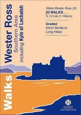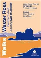
Wandelgids Walks Wester Ross Southern Area : Including Kyle of Lochalsh | Hallewell Publications

0
This guide features walks in the southern part of Wester Ross, in the area between Torridon in the north and Glenelg in the south. Walks range from 0.75 mile to 12 miles (1-19kms) and include high passes through the spectacular hill scenery of Torridon, the signposted routes around Applecross, coastal and moor walks and a number of routes around K...

Verkopers met dit product

Verkoper
Bezorging
Prijs
DeZwerver.nl logo
DeZwerver.nl
2,95
5,95

Anderen bekeken ook

Wandelgids Walks Wester Ross Southern Area : Including Kyle of Lochalsh | Hallewell Publications
This guide features walks in the southern part of Wester Ross, in the area between Torridon in the north and Glenelg in the south. Walks range from 0.75 mile to 12 miles (1-19kms) and include high passes through the spectacular hill scenery of Torridon, the signposted routes around Applecross, coastal and moor walks and a number of routes around Kyle of Lochalsh and the pretty village of Plockton.
5,95
Wandelgids Walks Aviemore : Including Glenmore & Speyside | Hallewell Publications
This guide covers an upper stretch of the Spey Valley, from Grantown-on-Spey in the north to Newtonmore in the south.  The main walking centres are Aviemore and Glenmore; the bulk of the walking is in the Cairngorm Mountains, the pine woods around Loch Morlich, and the low and rolling Monadhliaths.  Walks range from 1 mile to 21 miles (1.5-34kms).  Routes include: Loch Garten, Cairn Gorm, Loch Morlich to Lairig Ghru, Loch an Eilein and Creag Bheag.  This book was previously published as Walks Speyside, but has been rewalked and revised.  
5,95
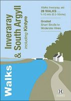
Wandelgids Inveraray & South Argyll : Including Kintyre | Hallewell Publications
Rewalked and updated in 2022, 'Walks Inveraray & South Argyll including Kintyre' covers the stretch of Scotland's west coast from Ardfern in the north to the Mull of Kintyre in the south. This is one of the quieter corners of Scotland, and though it lacks the high peaks of the north and west there are some marvellous and varied walks. Routes featured include the paths around historic Kilmartin and Dunadd, walks by the scenic Crinan Canal, and paths from Campbeltown and the coastal villages of Tayvallich and Inveraray. 28 routes (from 0.5-16kms/0.35-10 miles) are described. The guide is part of a popular series of A6 pocket walking guides describing routes suitable for walkers of all abilities and to suit all tastes. Route descriptions are accompanied by 2-colour sketch maps. The guides are illustrated with line illustrations, and will provide walkers with a good introduction to what each area covered has to offer.  
5,95
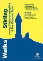
Wandelgids Stirling : Including Clackmannanshire & the Campsie Fells | Hallewell Publications
Rewalked and revised in 2021, Walks Stirling (a new edition of our previous guide to Stirling & District) features 24 walks, and now covers the Campsie Fells as well as the western Ochil Hills and the area around the head of the Forth Estuary. There are some fine hill walks, plus long distance paths and coastal walks. Walks range from 0.5 miles to 12 miles (1.2-20kms). Routes include: Dumyat, Ben Cleuch, Dollar to Auchterardar and Dumgoyne. Rewalked and revised 2010 this is part of a popular series of A6 pocket walking guides which describe routes which are suitable for walkers of all abilities and to suit all tastes. Route descriptions are accompanied by 2-colour sketch maps. The guides are illustrated with line illustrations, and will provide walkers with a good introduction to what each area covered has to offer.  
5,95
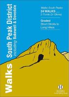
Wandelgids South Peak District : Including Bakewell and Dovedale | Hallewell Publications
Rewalked and updated in 2017/19, Walks South Peak District features walks in the gentler, southern half of the Peak District National Park; an area of low, green hills intersected by narrow valleys. The area's limestone is worked into numerous rock formations notably the famous spires and caves in Dovedale, and the long, low 'edges' above Curbar and Baslow. The main towns in the area are Buxton and Bakewell, but the walks pass numerous picturesque villages, as well as the splendid stately home of Chatsworth House. Walks range from 2 to 7.5 miles (3-12kms). Routes include Curbar Edge, Bakewell to Chatsworth, Thor's Cave & Wetton Hill, Dovedale and Mill Dale and The Roaches. This guide is part of a popular series of A6 pocket walking guides which describe routes which are suitable for walkers of all abilities and to suit all tastes. Route descriptions are accompanied by 2-colour sketch maps. The guides are illustrated with line illustrations, and will provide walkers with a good introdu…
5,95
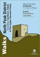
Wandelgids North Peak District : Including Castleton, Edale and the Upper Derwent Valley | Hallewell Publications
Walks North Peak District features walks around Castleton, Edale and the Upper Derwent Valley, in the northern part of the Peak District National Park. Although there are no truly high peaks in the area, there are steep climbs onto Kinder Scout and up the wooded slopes around the reservoirs of the Derwent Valley, and long walks through bleak moorland scattered with tors. Around Castleton the contours are softer, but there are good ridge walks and paths leading to the surrounding caverns. Walks range from 1 to 11 miles (1.5-18kms). Routes include Ladybower, Hayfield to Kinder Scout, Rushup Edge and Stanage Edge. This guide is part of a popular series of A6 pocket walking guides which describe routes which are suitable for walkers of all abilities and to suit all tastes. Route descriptions are accompanied by 2-colour sketch maps. The guides are illustrated with line illustrations, and will provide walkers with a good introduction to what each area covered has to offer.  
5,95

Klanten-reviews van Wandelgids Walks Wester Ross Southern Area : Including Kyle of Lochalsh | Hallewell Publications

Er zijn nog geen beoordelingen voor dit productBen jij de eerste die een review plaatst?

Meer over Wandelgids Walks Wester Ross Southern Area : Including Kyle of Lochalsh | Hallewell Publications

Productomschrijving

This guide features walks in the southern part of Wester Ross, in the area between Torridon in the north and Glenelg in the south. Walks range from 0.75 mile to 12 miles (1-19kms) and include high passes through the spectacular hill scenery of Torridon, the signposted routes around Applecross, coastal and moor walks and a number of routes around Kyle of Lochalsh and the pretty village of Plockton.

Productinformatie

    Verken gerelateerde categorieën

    Webshop.nl maakt gebruik van cookies. Ga je verder op onze website, ga dan akkoord met het plaatsen van cookies en de verwerking van deze data door ons en vermelde partners.